QGIS Resources Hub
QGIS 4 is coming out soon, and I'm super excited!
Also, this is really helpful:
hub.qgis.org
19.01.2026 14:32 — 👍 0 🔁 0 💬 0 📌 0

– rainbowR conference
🌈 The website for the inaugural rainbowR conference is now live! 🎉
🗓️ Save the date: Feb 25th-26th, 2026
📣 Call for submissions is open
👯 We're bringing together LGBTQ+ R users to promote our work and foster connections among community members
conference.rainbowr.org
06.11.2025 15:56 — 👍 31 🔁 19 💬 1 📌 0

GitHub - hadley/genzplyr: dplyr but make it bussin fr fr no cap
dplyr but make it bussin fr fr no cap. Contribute to hadley/genzplyr development by creating an account on GitHub.
Do you teach #rstats? Do your students complain about how lame and old-fashioned dplyr is? Don't worry: I have the solution for you: github.com/hadley/genzp....
genzplyr is dplyr, but bussin fr fr no cap.
06.11.2025 23:25 — 👍 462 🔁 167 💬 42 📌 55

🌈 rainbowR meet-up: Wednesday August 27th, 4pm UTC 🌈
- connect with other LGBTQ+ people who code in #RStats 🏳️🌈
- ask questions about R 🙋
- tell us about an R package you like 📦
- show us something R-related you’ve been working on 💻
➡️ Registration via rainbowr.org/meetups
13.08.2025 10:50 — 👍 23 🔁 13 💬 0 📌 2

A distribution map of the known archaeological sites on the island of Newfoundland. It shows how archaeological research has focused on the heavily populated coast, away from the boreal interior.
13.08.2025 05:06 — 👍 3 🔁 0 💬 1 📌 0
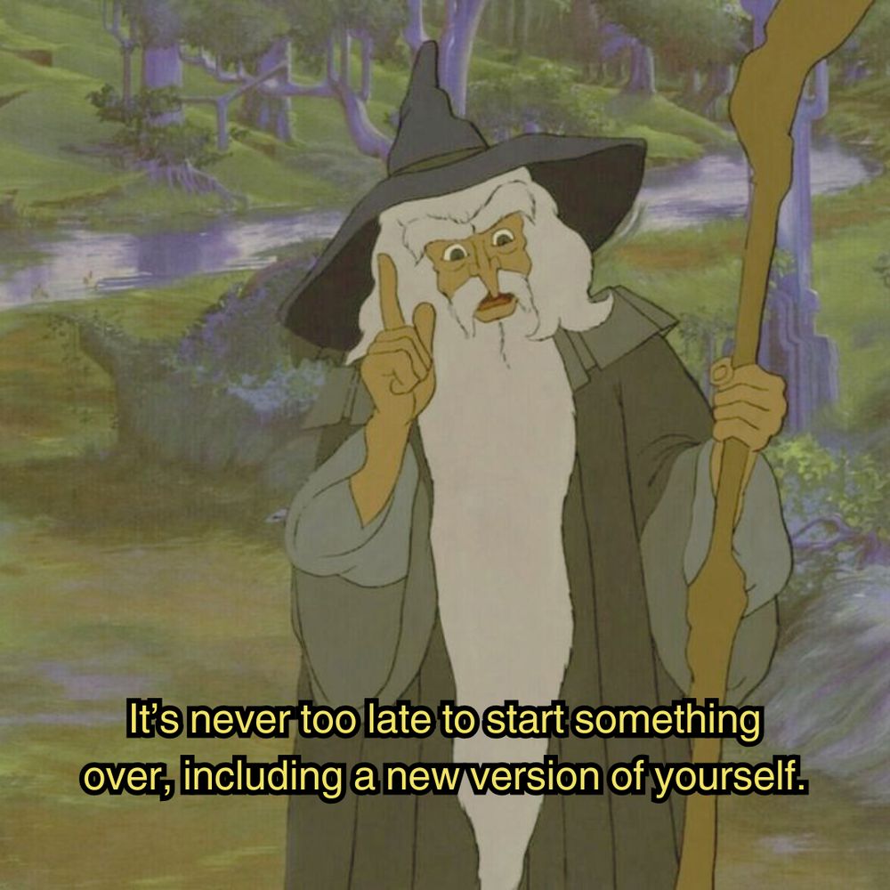
a scene in the animated lord of the rings movie. Gandalf the grey is standing in a lush green forest, wearing grey robes, and a blue pointy wizard's hat while wielding a staff. He's pointing up as if to think of something, and the image is captioned "It's never too late to start something over, including a new version of yourself."
Good morning✌️🍀
25.07.2025 14:27 — 👍 12739 🔁 2064 💬 159 📌 72

A Relative Elevation map for the Churchill River. This is interesting because it shows how the river runs through a rugged area between two different relatively low areas, while going from the Smallwood Reservoir to the shores of Lake Melville.
#Labrador #HVGB #qgis #maps #REM
07.07.2025 00:59 — 👍 7 🔁 1 💬 0 📌 0
The healthiest thing we can do for the internet is get as many regular users as possible running their own websites. You could buy a domain and such, but a super easy starting point is to get a free subdomain of neocities.org, which is like geocities but existing now.
12.11.2024 16:11 — 👍 182 🔁 53 💬 14 📌 9

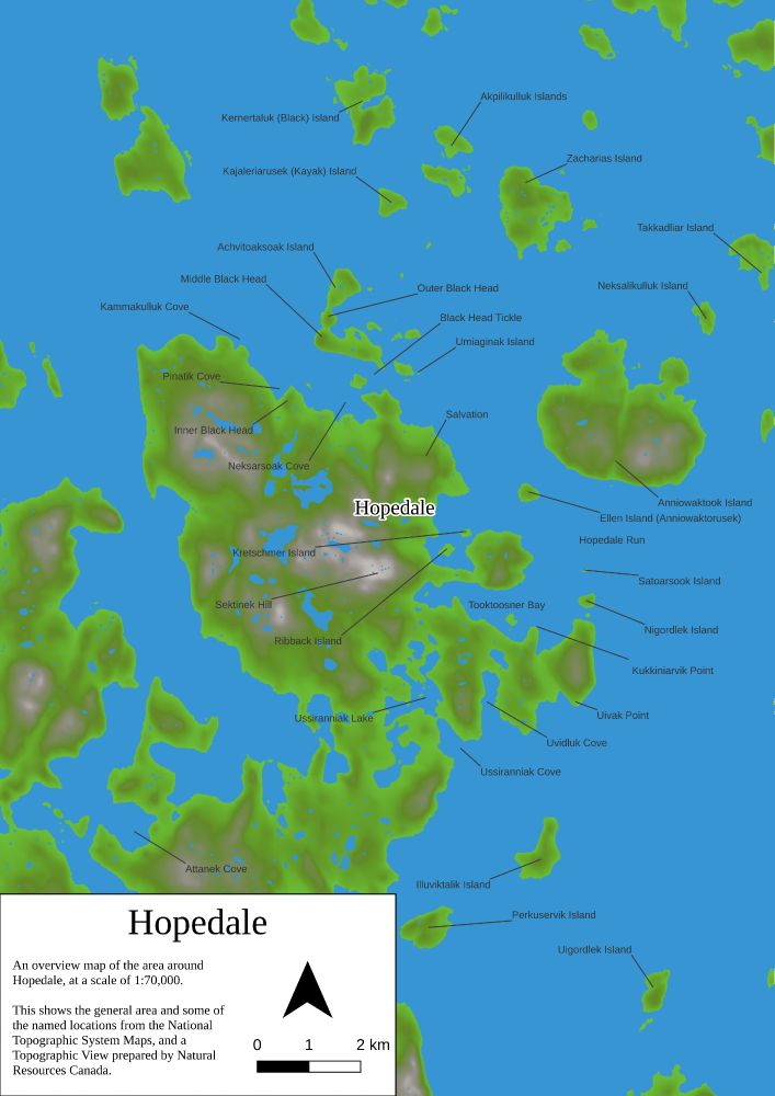
A Tanaka map of the topography around Hopedale, Nunatsiavut, Labrador.
data: NRCAN- NTS
#qgis #maps #topography #visualisation #3d #gis #Nunatsiavut #Labrador
01.07.2025 16:03 — 👍 2 🔁 0 💬 0 📌 0
We're proud to announce that #Finland just launched theit new Topographic Data System built on #QGIS
https://positio-magazine.eu/2025/06/finland-launches-modern-topographic-data-system-built-on-open-source-qgis/
#osgeo #gischat #gis #OpenSource
26.06.2025 16:16 — 👍 21 🔁 7 💬 0 📌 1

Another Photo of Hopedale, Nunatsiavut, Labrador, from a few years ago.
#drones #Hopedale #Nunatsiavut #geospatial
25.06.2025 14:15 — 👍 1 🔁 0 💬 0 📌 0

Cape Spear, Newfoundland
#drones #NL #geospatial
22.06.2025 14:40 — 👍 0 🔁 0 💬 0 📌 0
This was a wonderful event!
22.06.2025 14:32 — 👍 1 🔁 0 💬 1 📌 0

The American Army Base in Hopedale, Nunatsiavut, Labrador
#drones #geospatial #heritage #hopedale #labrador
21.06.2025 21:44 — 👍 0 🔁 0 💬 0 📌 0

A joy plot view of Hopedale, Nunatsiavut, Labrador. With data from the Canadian MRDEM.
19.06.2025 12:45 — 👍 0 🔁 0 💬 0 📌 0

The watercourses of Newfoundland
with data from NRCAN and the NTS
#gis #qgis #spatial #rivers #maps
19.06.2025 00:44 — 👍 2 🔁 0 💬 0 📌 0

The Rivers of Labrador. It's pretty thick with them.
Data from the NTS
#maps #Labrador #QGIS #spatial #gis #nrcan #nts
17.06.2025 01:04 — 👍 0 🔁 0 💬 0 📌 0

A map of the Hexagonal churches of England, prepared for the Month of Maps in 2024.
#England #churches #hexagons #gis #qgis #geospatial #maps
14.06.2025 18:57 — 👍 1 🔁 0 💬 0 📌 0

A map of the National Parks of Canada, with data from NRCAN and Natural Earth.
There is an amazing variation between the parks, in terms of their sizes and purposes.
#parks #canada #maps #geospatial #gis #qgis
14.06.2025 01:02 — 👍 2 🔁 0 💬 1 📌 0

A map of Hopedale, Nunatsiavut in Labrador, Canada.
Data from OSM and NRCAN
#osm #nationaltopographicsystem #nts #Hopedale #Nunatsiavut #gis #qgis #maps
12.06.2025 19:23 — 👍 3 🔁 0 💬 0 📌 0

The roads, trails, ferries and transport paths (and some boundaries) of Auckland, New Zealand in a lightening map.
#qgis #geospatial #osm #gis
12.06.2025 02:00 — 👍 2 🔁 3 💬 0 📌 0

A map of the Mexican Restaurants of North America, with data from OSM and Natural Earth.
Really, I made this because I miss burritos soo much.
#OSM
#QGIS
#NaturalEarth
#MexicanRestaurants
11.06.2025 00:05 — 👍 2 🔁 1 💬 0 📌 0

The watersheds of Labrador from NRCAN and Natural Earth data.
09.06.2025 23:56 — 👍 0 🔁 0 💬 0 📌 0
A map of Hopedale in Nunatsiavut.
08.06.2025 16:00 — 👍 0 🔁 0 💬 0 📌 0

A geological age map of Newfoundland and Labrador. The data used here came from the Department of Natural Resources NL, Natural Earth, and NRCAN
07.06.2025 14:21 — 👍 0 🔁 0 💬 0 📌 0
Data from NRCAN and Natural Earth!
06.06.2025 15:41 — 👍 0 🔁 0 💬 0 📌 0

A topographic relief map of Labrador.
First post! A topographic relief map of Labrador.
06.06.2025 15:27 — 👍 3 🔁 1 💬 1 📌 0
We are a proud specialty group of the American Association of Geographers (AAG) that produces scholarship with protected areas, such as National Parks, National Monuments, National Forests, and beyond. Follow us to see what we are up to!
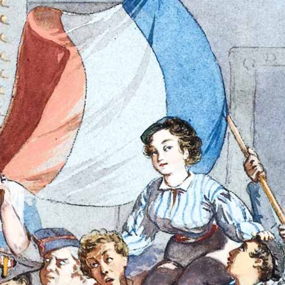
A celebration of the French Republican Calendar.
Posts daily at midnight, Parisian time.
Website is https://sansculottid.es
Ping @worstwizard.online if I'm broken
Sonraí is an Irish data stewardship network.
Our vision is a network of data stewards to promote and support the transition to a FAIR and open research data landscape.
The Irish Reproducibility Network, linking people on the island of Ireland who care about open research
Website: www.irishrn.org
Ruin explorer, fermentation foodie, food gatherer, bike-riding pinko, one of the world's northernmost archaeologists. Secretly a chanterelle.
Researcher in Historical Archaeology at the Svalbard Museum in Longyearbyen.
The Institute of Historical Research is the UK’s national home for history. Supporting historians with digital resources, library, seminars & training
https://www.history.ac.uk/ Part of @sasnews.bsky.social
#python, #rstats, #shiny, #datascience training and consultancy. We help organisations extract the most from their data.
Archaeology student at KU Leuven | Especially interested in paleoanthropology and palaeolithic archaeology | Also active on Instagram as @yourlocalarchaeologist
Led by @suttonprofessor.bsky.social and Deputy Director Professor Paula Reavey, the Centre @stir.ac.uk is a dynamic, collaborative, interdisciplinary research project advancing knowledge in relations between place and memory - placememory.net
Ecologist & Geographer @ ecosystems.psu.edu | Writer | Editor of @briefecology.bsky.social & @rottingleafmag.bsky.social | DSA Organizer
https://www.briefecology.com/
Data Science and Analytics with a LGBTQ+ Focus
https://www.gaytascience.com/
Posts from Scotland’s first industrial eco-museum commemorating and recording mining landscapes through a series of community created cycling and walking routes.
Artist and researcher C18th Highlands / Badenoch / Gaelic / Gàidhlig. Troimh chèile, aobhairean teignigeach.
She/her I/ise
Deputy Director for MassGIS
Geospatial Technology 4 Life.
Geo tech consultant for conservation/ecology. PostGIS, Mapbox, Typescript, React, NestJs, QGIS, DuckDb, AWS/GCP, D3, Angular. Sr Software Engineer
@zevross
Director, Centre for the Sciences of Place & Memory, Stirling Uni, Scotland. Skill, memory, embodied cognition, philosophy, cognitive history, cricket, music, collaboration, wayfinding. Leverhulme International Prof: johnsutton.net & placememory.net
Biostatistician @IDEXX formerly at harvardmed, @BIDMChealth, @nasa. Big data, clinical trials, and medical diagnostics. Mainer. Opinions are my own. he/him
Spatial Data Scientist, Doctoral Researcher #HumanMobility #geospatial @mpidr.bsky.social, @imprs-phds.bsky.social, @upf.edu #rspatial #rstats dev of #rstats github.com/rOpenSpain/spanishoddata 🌐: www.ekotov.pro datasci.social/@EgorKotov
Scientist at British Antarctic Survey, Cambridge and author. Interest include Science, nature, cartography, Polar regions and satellite imagery/ remote sensing.
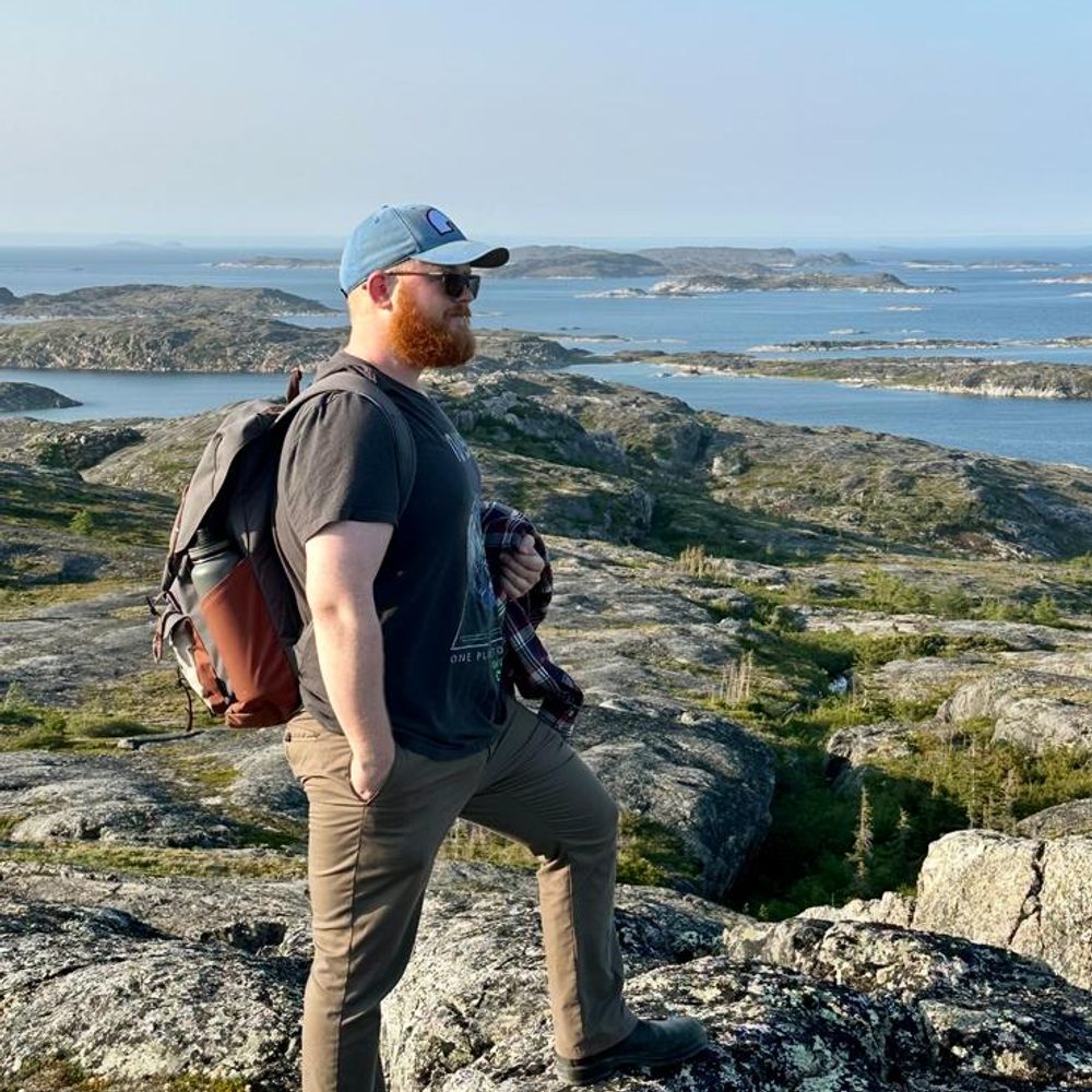
Geography PhD student @uni-graz.at looking into hydrosocial cycle of a river; photographer, radio maker and a storyteller. Croatian, now based in St. John's on the island of Newfoundland.
https://bojanfurstphotography.com
http://www.futurespossible.com/