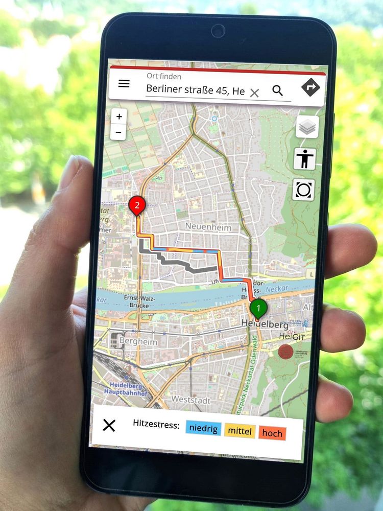
🥵🚶𝗪𝗮𝗹𝗸𝗶𝗻𝗴 𝗶𝗻 𝘁𝗵𝗲 𝗰𝗶𝘁𝘆 𝘂𝗻𝗱𝗲𝗿 𝘁𝗵𝗲 𝗵𝗼𝘁 𝘀𝘂𝗺𝗺𝗲𝗿 𝘀𝘂𝗻?
The 𝗛𝗘𝗔𝗟 𝗮𝗽𝗽 recommends pedestrian routes based on their “coolness”, favoring shadowy, vegetation-rich streets.
The app is available in #Heidelberg and now also in #Worms: worms.heal.openrouteservice.org
Read how it works: heigit.org/a-routing-ap...
11.08.2025 08:15 — 👍 1 🔁 0 💬 0 📌 0
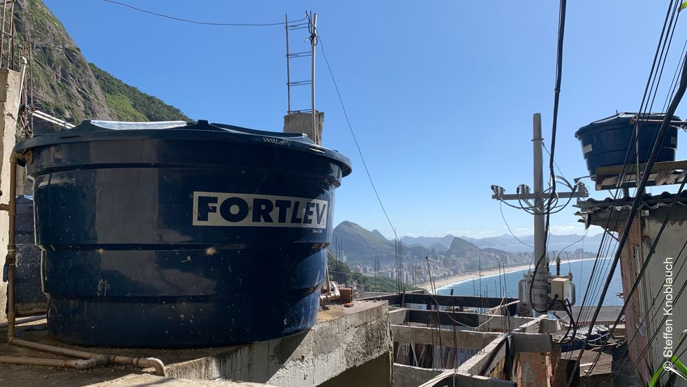
Congratulations to our colleague Steffen Knoblauch, who has won the KlarText prize for science communication with an article on “samba, geodata, and mosquitoes" 👏🎉
Steffen´s article describes his PhD research on how big (geo)data can contribute to the targeted control of dengue in Rio de Janeiro.
07.08.2025 11:20 — 👍 3 🔁 0 💬 0 📌 0
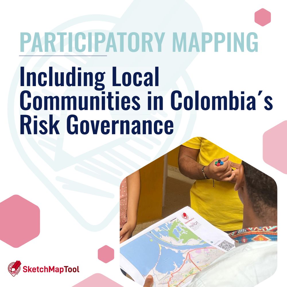
For a fair and effective disaster response, community-driven data is key. Participatory mapping with tools like the 𝗦𝗸𝗲𝘁𝗰𝗵 𝗠𝗮𝗽 𝗧𝗼𝗼𝗹 helps harvest local knowledge.
Read about our fieldwork and collaborations in Colombia to strengthen inclusive risk governance: heigit.org/including-lo...
06.08.2025 12:01 — 👍 0 🔁 0 💬 0 📌 0
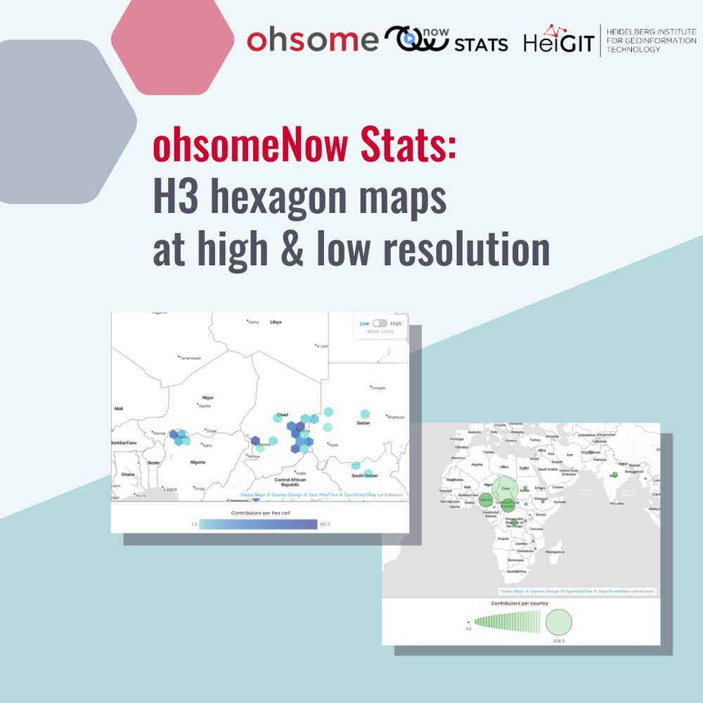
𝗡𝗲𝘄 𝗳𝗲𝗮𝘁𝘂𝗿𝗲 𝗶𝗻 𝗼𝗵𝘀𝗼𝗺𝗲𝗡𝗼𝘄 𝗦𝘁𝗮𝘁𝘀: 𝗛𝟯 𝗵𝗲𝘅𝗮𝗴𝗼𝗻 𝗺𝗮𝗽𝘀 𝗮𝘁 𝗵𝗶𝗴𝗵 & 𝗹𝗼𝘄 𝗿𝗲𝘀𝗼𝗹𝘂𝘁𝗶𝗼𝗻
We have now integrated H3 hexagon grids for a more accurate view of where mapping happens within countries. Another feature is Power Grid Mapping to track electrical infrastructure.
More: heigit.org/another-mile...
04.08.2025 08:36 — 👍 1 🔁 0 💬 0 📌 0
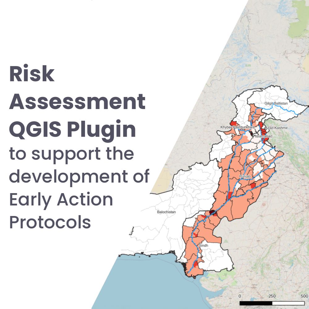
This plugin lets disaster management practitioners run independent, tailored risk assessments in #QGIS.
The 𝗥𝗶𝘀𝗸 𝗔𝘀𝘀𝗲𝘀𝘀𝗺𝗲𝗻𝘁 𝗤𝗚𝗜𝗦 𝗣𝗹𝘂𝗴𝗶𝗻 supports early action in disaster risk management by helping users generate reliable risk scores using local data and custom indicators: heigit.org/risk-assessm...
31.07.2025 14:21 — 👍 1 🔁 0 💬 0 📌 0
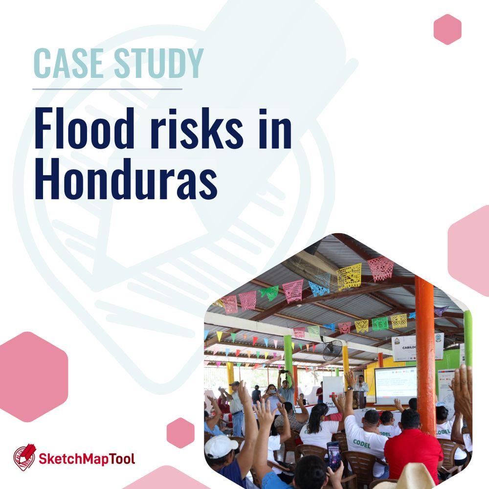
𝗠𝗮𝗽𝗽𝗶𝗻𝗴 𝗙𝗹𝗼𝗼𝗱 𝗥𝗶𝘀𝗸𝘀 𝗶𝗻 𝗛𝗼𝗻𝗱𝘂𝗿𝗮𝘀
In Honduras, we focused on mapping data on flood risk with the Sketch Map Tool. The results enable a more targeted & informed risk assessment, which is beneficial for planning anticipatory actions & improving emergency preparedness.
More: heigit.org/flood-risks-...
29.07.2025 09:17 — 👍 1 🔁 0 💬 0 📌 0
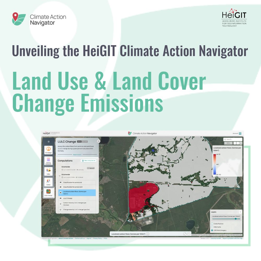
Unveiling the HeiGIT Climate Action Navigator - Land Use and Land Cover Change Emissions. Screenshot of LULC Change Tool in CAN - This example shows Grünheide, Germany
𝗟𝗨𝗟𝗖 𝗖𝗵𝗮𝗻𝗴𝗲: 𝗵𝗼𝘄 𝘁𝗼 𝗰𝗮𝗹𝗰𝘂𝗹𝗮𝘁𝗲 𝗰𝗮𝗿𝗯𝗼𝗻 𝗲𝗺𝗶𝘀𝘀𝗶𝗼𝗻𝘀 𝗳𝗿𝗼𝗺 𝗹𝗮𝗻𝗱 𝘂𝘀𝗲 𝗮𝗻𝗱 𝗹𝗮𝗻𝗱 𝗰𝗼𝘃𝗲𝗿 𝗰𝗵𝗮𝗻𝗴𝗲
The 𝘊𝘭𝘪𝘮𝘢𝘵𝘦 𝘈𝘤𝘵𝘪𝘰𝘯 𝘕𝘢𝘷𝘪𝘨𝘢𝘵𝘰𝘳 shows high-resolution estimates of emissions caused by LULC change, helping to plan locally targeted climate mitigation measures:
heigit.org/unveiling-th...
#EarthOvershootDay
24.07.2025 07:00 — 👍 3 🔁 2 💬 0 📌 0
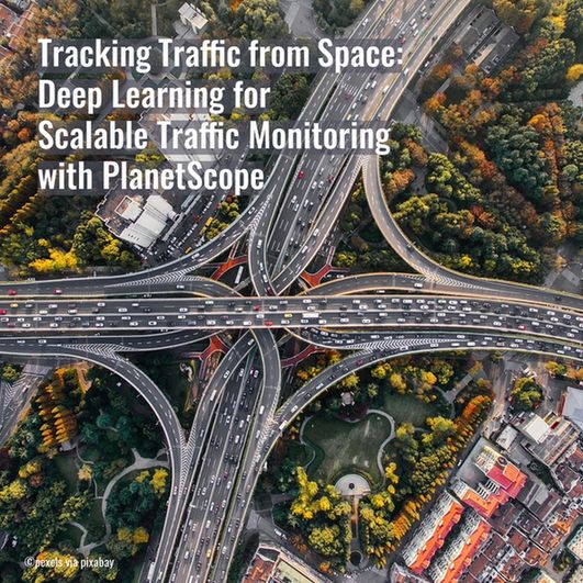
𝗧𝗿𝗮𝗰𝗸𝗶𝗻𝗴 𝗧𝗿𝗮𝗳𝗳𝗶𝗰 𝗳𝗿𝗼𝗺 𝗦𝗽𝗮𝗰𝗲: 𝗗𝗲𝗲𝗽 𝗟𝗲𝗮𝗿𝗻𝗶𝗻𝗴 𝗳𝗼𝗿 𝗦𝗰𝗮𝗹𝗮𝗯𝗹𝗲 𝗧𝗿𝗮𝗳𝗳𝗶𝗰 𝗠𝗼𝗻𝗶𝘁𝗼𝗿𝗶𝗻𝗴 𝘄𝗶𝘁𝗵 𝗣𝗹𝗮𝗻𝗲𝘁𝗦𝗰𝗼𝗽𝗲 🛰️🚗
The study explores how satellite imagery can be used to detect vehicles& estimate their speed. It shows how satellite-based methods can complement traditional traffic monitoring.
heigit.org/new-paper-pl...
23.07.2025 08:15 — 👍 3 🔁 0 💬 0 📌 0
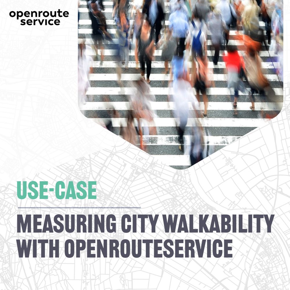
𝗨𝘀𝗲-𝗖𝗮𝘀𝗲: 𝗠𝗲𝗮𝘀𝘂𝗿𝗶𝗻𝗴 𝗰𝗶𝘁𝘆 𝘄𝗮𝗹𝗸𝗮𝗯𝗶𝗹𝗶𝘁𝘆 𝘄𝗶𝘁𝗵 𝗼𝗽𝗲𝗻𝗿𝗼𝘂𝘁𝗲𝘀𝗲𝗿𝘃𝗶𝗰𝗲👣
A recent study by the DC Office of the Chief Technology Officer explores how well residents in Washington, DC can access essential public resources by foot. The isochrones analysis was based openrouteservice.
heigit.org/use-case-mea...
21.07.2025 12:34 — 👍 3 🔁 0 💬 0 📌 0
📱🗺️ 𝗤𝗚𝗜𝗦 users can now integrate 𝗼𝗽𝗲𝗻𝗿𝗼𝘂𝘁𝗲𝘀𝗲𝗿𝘃𝗶𝗰𝗲 also in the mobile app 𝗤𝗙𝗶𝗲𝗹𝗱.
With a new plugin by HeiGIT & OPENGIS.ch, all main functions of openrouteservice can be used in QField to generate routes for different means of transport profiles.
Find the plugin here: github.com/GIScience/qf...
#QGIS
18.07.2025 07:46 — 👍 4 🔁 2 💬 0 📌 0
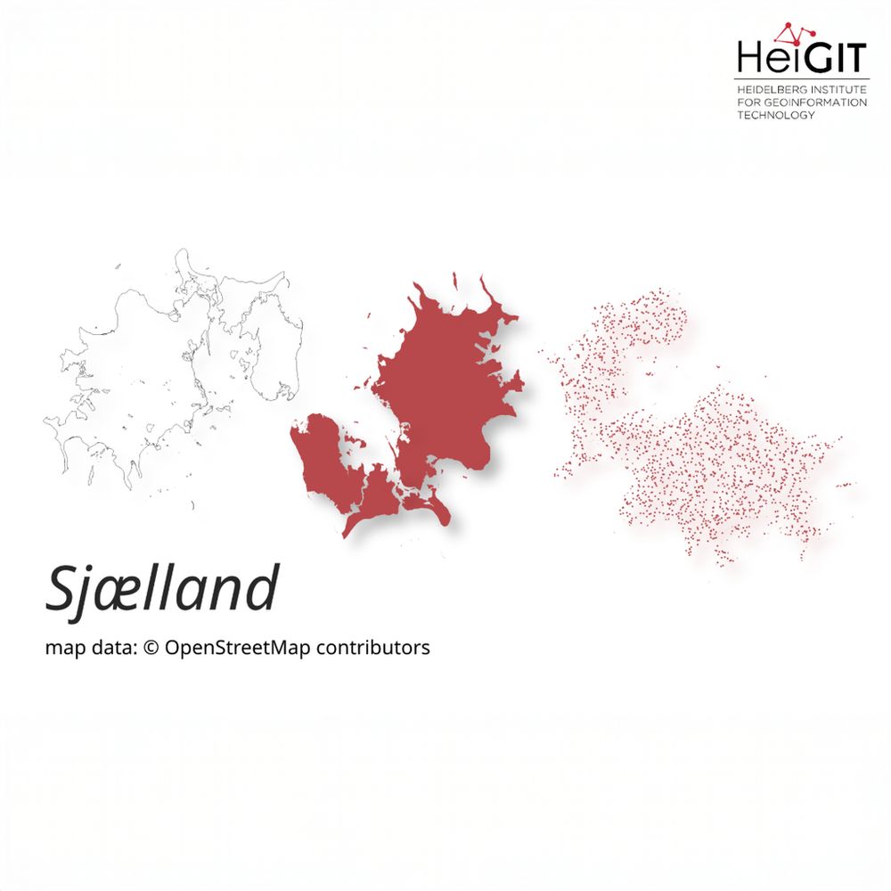
maps of Sjælland, Denmark
𝗡𝗲𝘄 𝗿𝗲𝗹𝗲𝗮𝘀𝗲 𝗼𝗳 𝗼𝗵𝘀𝗼𝗺𝗲-𝗽𝗹𝗮𝗻𝗲𝘁: 𝗘𝘃𝗲𝗻 𝗳𝗮𝘀𝘁𝗲𝗿 𝗽𝗿𝗼𝗰𝗲𝘀𝘀𝗶𝗻𝗴 𝗼𝗳 𝗢𝗦𝗠 𝗵𝗶𝘀𝘁𝗼𝗿𝘆 𝗱𝗮𝘁𝗮 𝗶𝗻 𝗚𝗲𝗼𝗣𝗮𝗿𝗾𝘂𝗲𝘁 𝗳𝗼𝗿𝗺𝗮𝘁🪐🗺️
The tool transforms OpenStreetMap (history) PBF files into into an analysis-ready data format.
More information: heigit.org/new-release-...
Software library on GitHub: github.com/GIScience/oh...
16.07.2025 08:15 — 👍 2 🔁 1 💬 0 📌 0
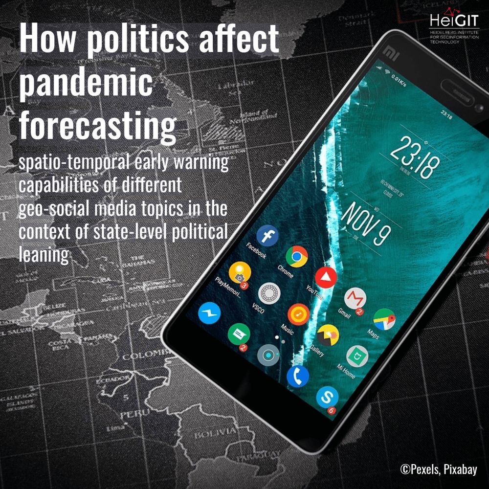
smartphone on a map; "New paper: How politics affect pandemic forecasting: spatio-temporal early warning capabilities of different geo-social media topics in the context of state-level political leaning"
𝗡𝗲𝘄 𝗣𝗮𝗽𝗲𝗿: 𝗛𝗼𝘄 𝗽𝗼𝗹𝗶𝘁𝗶𝗰𝘀 𝗮𝗳𝗳𝗲𝗰𝘁 𝗽𝗮𝗻𝗱𝗲𝗺𝗶𝗰 𝗳𝗼𝗿𝗲𝗰𝗮𝘀𝘁𝗶𝗻𝗴🦠🗺️
Searching for early warning systems during the COVID-19 pandemic, the study explores how digital data sources such as geo-social media could improve the disease’s transmission dynamics.
More info: heigit.org/new-paper-ho...
14.07.2025 08:15 — 👍 1 🔁 0 💬 0 📌 0
@echobit.de Herzlichen Dank für das so positive Feedback. Es freut uns immer sehr zu hören, dass unsere Arbeit bedeutsame Anwendung findet!
14.07.2025 07:43 — 👍 1 🔁 0 💬 0 📌 0
The tiger mosquito can spread infectious diseases like dengue.🦟
Traditional mosquito control methods are expensive for city administrations and often fall short. IRESO shows a different approach, targeting very young people to engage communities.
👉 The project (🇩🇪/🇧🇷): www.ireso.org/tigermuecke-...
10.07.2025 07:45 — 👍 2 🔁 0 💬 0 📌 0
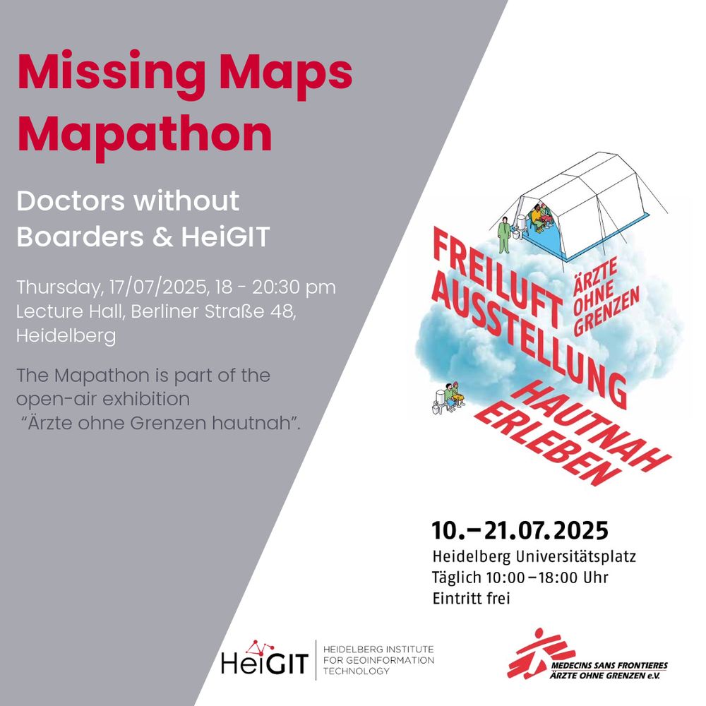
To the #Heidelberg community: Join our next Mapathon and map with us to actively support Doctors without Boarders´ humanitarian work.
📆 17th July 2025, 18:00
📍Lecture Hall, Berliner Straße 48
💡No previous knowledge needed. Bring your own laptop and a computer mouse.
💬Info: heigit.org/events/mapat...
09.07.2025 08:15 — 👍 1 🔁 0 💬 0 📌 0
White text:
Utilizing large language models to simulate parking search:
A new study investigates whether LLMs can simulate human parking choices, from price sensitivity to risk preferences. The models can capture trade-offs involving cost, walking distance, and availability, while also incorporating sociodemographic variables such as income and age.
Background image: two cars parked along a street, viewed from above
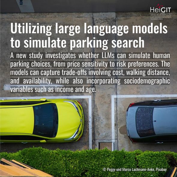
🚗 𝘾𝙖𝙣 𝘼𝙄 𝙧𝙚𝙥𝙡𝙞𝙘𝙖𝙩𝙚 𝙩𝙝𝙚 𝙙𝙚𝙘𝙞𝙨𝙞𝙤𝙣-𝙢𝙖𝙠𝙞𝙣𝙜 𝙤𝙛 𝙖 𝙙𝙧𝙞𝙫𝙚𝙧 𝙨𝙚𝙖𝙧𝙘𝙝𝙞𝙣𝙜 𝙛𝙤𝙧 𝙥𝙖𝙧𝙠𝙞𝙣𝙜?
In this new study by Nir Fulman et al, LLMs were used to simulate human behavior in parking scenarios, including sociodemographic factors and risk attitudes observed in real-world behavior: doi.org/10.1016/j.tr...
07.07.2025 07:31 — 👍 0 🔁 0 💬 0 📌 0
Two people riding bikes on an urban pathway
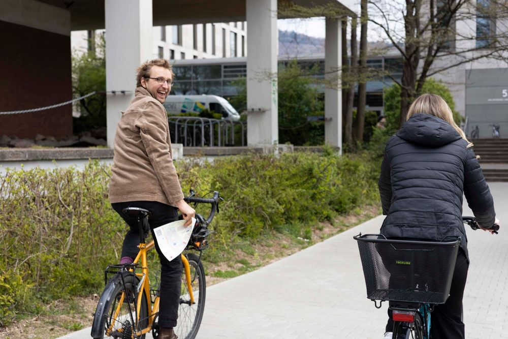
𝗛𝗲𝗶𝗚𝗜𝗧 𝘁𝗮𝗸𝗲𝘀 𝗽𝗮𝗿𝘁 𝗶𝗻 𝗦𝗧𝗔𝗗𝗧𝗥𝗔𝗗𝗘𝗟𝗡🚲🌳
Our team is excited to be participating again in the cycling initiative STADTRADELN, which promotes sustainable mobility and sends a signal to strengthen cycling infrastructure in cities.
Check who is cycling more in Heidelberg: www.stadtradeln.de/heidelberg
03.07.2025 08:15 — 👍 4 🔁 1 💬 0 📌 0
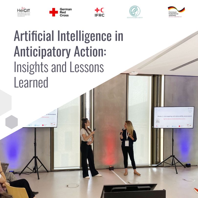
Text: Artificial Intelligence in Anticipatory Action: Insights and Lessons Learned
Photo: Two women giving a presentation in a large room between two screens reading "Theme 2: Risk mapping and vulnerability assessment".
AI is reshaping humanitarian anticipatory action.
Together with humanitarian practitioners & tech experts, we explore how AI can be responsibly and effectively integrated into anticipatory action by improving hazard forecasting, vulnerability mapping and decision support: heigit.org/artificial-i...
02.07.2025 07:40 — 👍 3 🔁 0 💬 0 📌 0
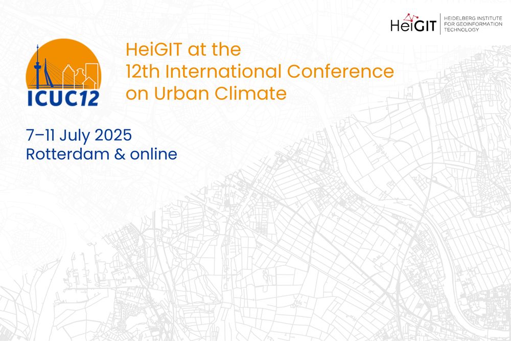
𝗛𝗲𝗶𝗚𝗜𝗧 𝗮𝘁 𝗜𝗖𝗨𝗖
We are looking forward to this year’s ICUC12 (12th International Conference on Urban Climate), in Rotterdam, The Netherlands from 7 - 11 July.
Meet us at our session (08/07/25; 9 am) on monitoring GHG emissions with open data: heigit.org/events/heigi...
30.06.2025 08:04 — 👍 1 🔁 0 💬 0 📌 0
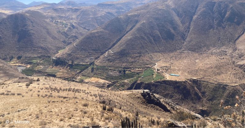
This term's last HGG lecture: Resource Use and Resilience - Pre-Columbian Terrace Agriculture in Southern Peru
📆 08/07/2025, 7:15 p.m; Lecture Hall 2, INF 227 (KIP), Heidelberg
🗣️ Prof. Dr. Julia Meister (Universität Bamberg)
💡 hgg.urz.uni-heidelberg.de/vortraege-so...
27.06.2025 08:15 — 👍 0 🔁 0 💬 0 📌 0
@tobwen.bsky.social it should actually be possible to connect to localhost. Please ask any technical questions in the ORS forum, the openrouteservice team and community will help you solve the issue: ask.openrouteservice.org
25.06.2025 11:58 — 👍 1 🔁 0 💬 0 📌 0
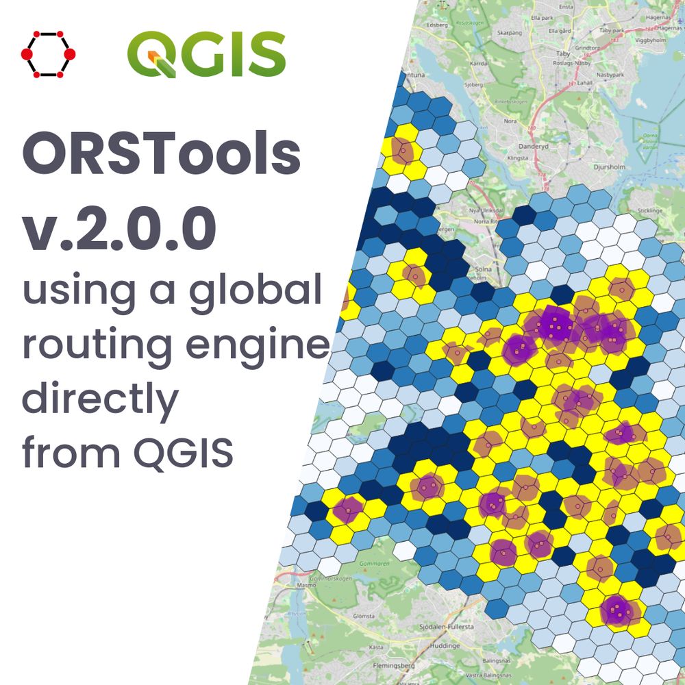
𝗥𝗲𝗹𝗲𝗮𝘀𝗲 𝗼𝗳 𝗤𝗚𝗜𝗦 𝗽𝗹𝘂𝗴𝗶𝗻 𝗢𝗥𝗦𝗧𝗼𝗼𝗹𝘀 𝘃.𝟮.𝟬.𝟬🗺️
ORSTools integrates #openrouteservice directly in #QGIS. This new version brings significant improvements, as full compatibility with new QGIS updates & the possibility to drag-and-drop vertex markers:
heigit.org/release-of-q...
25.06.2025 09:23 — 👍 5 🔁 0 💬 1 📌 0
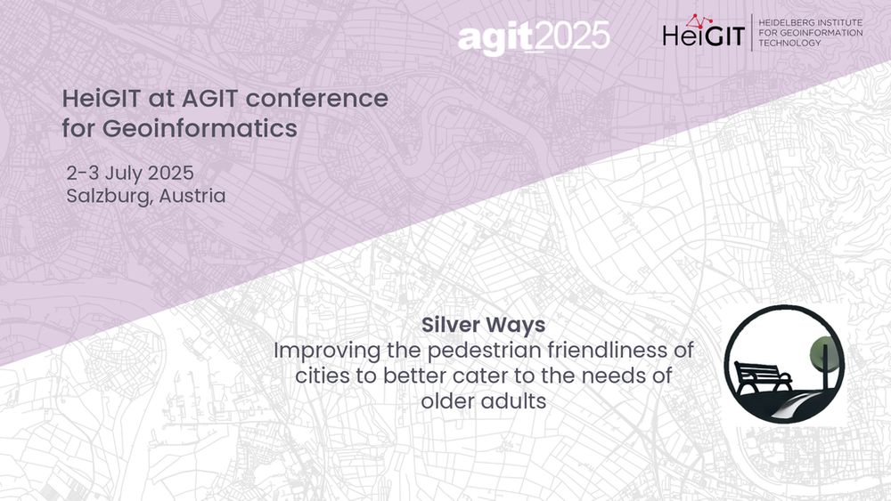
𝗛𝗲𝗶𝗚𝗜𝗧 𝗮𝘁 𝗔𝗚𝗜𝗧 𝗖𝗼𝗻𝗳𝗲𝗿𝗲𝗻𝗰𝗲: 𝘏𝘰𝘸 𝘤𝘢𝘯 𝘤𝘪𝘵𝘪𝘦𝘴 𝘴𝘵𝘢𝘺 𝘸𝘢𝘭𝘬𝘢𝘣𝘭𝘦 𝘧𝘰𝘳 𝘰𝘭𝘥𝘦𝘳 𝘢𝘥𝘶𝘭𝘵𝘴?
We will explore the development of the routing mechanism Silver Ways & show how our findings can help urban policy & planning.
heigit.org/events/heigi...
24.06.2025 08:33 — 👍 2 🔁 0 💬 0 📌 0
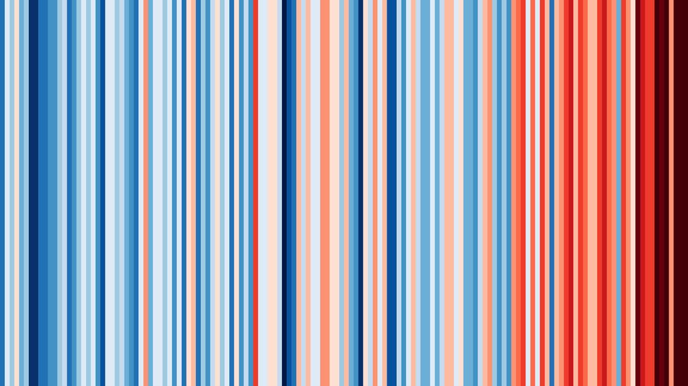
Vertical stripes of different colors ranging from dark blue to light blue, light red and dark red. In the left half there are more blue stripes. In the right half, stripes become increasingly red. The stripes on the right end are mostly dark red.
It’s #showyourstripes day 🌍🌡️
These are the climate stripes for Germany, created via showyourstripes.info.
The climate stripes are a data visualization by Ed Hawkins that shows long-term temperature trends: to us, a vivid reminder of why we need more actionable data and tools for climate action.
21.06.2025 07:01 — 👍 2 🔁 1 💬 0 📌 0
𝗜𝗻𝘀𝗶𝗴𝗵𝘁𝘀 𝗶𝗻𝘁𝗼 𝘁𝗵𝗲 𝗩𝗶𝗲𝘁𝗻𝗮𝗺 𝗲𝘅𝗰𝘂𝗿𝘀𝗶𝗼𝗻
In the next HGG lecture on July 1, Geography students will discuss how Vietnam's diverse geomorphological & geological conditions shape social development & land use:
hgg.urz.uni-heidelberg.de/vortraege-so...
20.06.2025 08:01 — 👍 0 🔁 0 💬 0 📌 0
𝗡𝗲𝘄 𝗶𝗻𝘀𝗶𝗴𝗵𝘁𝘀 𝗶𝗻𝘁𝗼 𝗢𝗦𝗠 𝗴𝗹𝗼𝗯𝗮𝗹 𝗺𝗮𝗽𝗽𝗶𝗻𝗴:
The new version of 𝗼𝗵𝘀𝗼𝗺𝗲𝗡𝗼𝘄 𝗦𝘁𝗮𝘁𝘀 cover all OpenStreetMap data since 2005. You can explore mapping activities in OSM in near real-time and filter by country, hashtag and time period.
More info on our blog: heigit.org/new-insights...
18.06.2025 08:09 — 👍 1 🔁 0 💬 0 📌 0
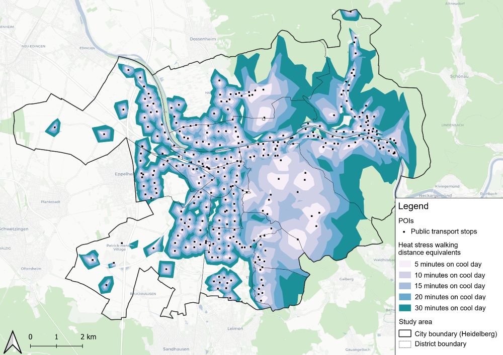
Map of Heidelberg showing "heat stress walking distance equivalents"
🥵🚶How far can we really walk in a heatwave?
According to a new study by Huber et al. on heat stress impact in Heidelberg, nearly one in four citizens loses safe access to essential services during high heat stress.
🔎 Read more: heigit.org/new-paper-ac...
@kathrinfoshag.bsky.social
16.06.2025 14:20 — 👍 5 🔁 2 💬 0 📌 0
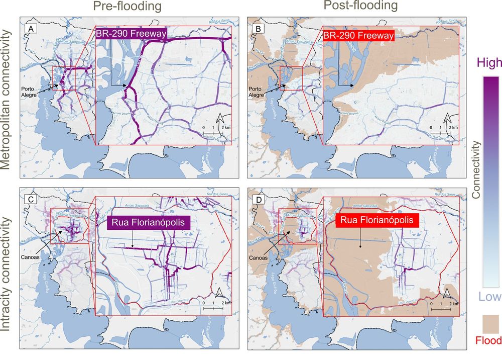
🌍 New study led by Ricardo Ruiz Sánchez on #urban road network resilience after the April 2024 floods in Rio Grande do Sul, Brazil. Using #OpenStreetMap and openrouteservice.org, we analyzed impacts on connectivity and healthcare access.
Presented at #AGILE 2025.
👉 heigit.org/new-paper-ch...
13.06.2025 10:10 — 👍 1 🔁 0 💬 0 📌 0
Climate Action
Big thanks to everyone who joined the CAN launch event last week!
We had great discussions on how the Climate Action Navigator offers actionable data.
🔍 First look at the tool
💬 Loads of good questions
🤝 New collaboration ideas
📖 FAQ coming soon
Check it out: climate-action.heigit.org
@heigit.org
11.06.2025 09:56 — 👍 3 🔁 2 💬 0 📌 0
Frei verfügbare Geodaten für hochauflösende Karten zur gezielten Bekämpfung von Stechmücken: Raumbezogene Big-Data-Methoden ermöglichen die Kartierung von potentiellen Lebensräumen www.uni-heidelberg.de/de/newsroom/...
@heigit.org #universität #heidelberg #uniheidelberg #forschung #heigit #geodaten
06.06.2025 08:09 — 👍 5 🔁 3 💬 2 📌 0
Mobilizing data for people + planet. The Global Partnership for Sustainable Development Data. #Data4SDGs
IT-Analysis, Consulting and Development. Likes simplicity and appreciate sense of humor. CCC since 1998. He/Him. Interfacing: de/en/hr/hu
#TeamDatenschutz #BlueTeam
Other platforms: https://echobit.de
Nehmt Platz. Und lasst uns darüber ins Gespräch kommen, wie wir Klimaschutzlösungen finden.
Journalist, Klimakommunikation und alles von Klimawandel bis Klimakrise, außerdem: Umwelt, Baukultur, Biodiversität
unterwegs in Berlin, in Pankow und im Barnim
works at: klimafakten.de
pro bono: Transparency Deutschland, privat hier
GIScience conference series #giscience2025.
The 13th International Conference on Geographic Information Science, Christchurch, New Zealand August 26-29 2025.
https://giscience2025.org
Die Scientists for Future Österreich halten Euch auf dem Laufenden.
Kontakt: public-relations.at@scientists4future.org
Es posten Anja, Martin & Sophie.
#WissenSchafftKlimaschutz
Spenden > https://www.paypal.com/donate/?hosted_button_id=2T4RWFWTRGVTL
Official account for the Humanitarian OpenStreetMap Team. We use open geospatial data and tech for humanitarian response and community-led development. Find all our key resources and links at https://linktr.ee/hotosm
The GRI (at University of Canterbury, New Zealand) provides a unique opportunity for all branches of the geospatial community to communicate and collaborate. https://geospatial.ac.nz/
Cooperation of @hitsters.bsky.social, @uniheidelberg.bsky.social & @kit.edu on bridging scales from molecules to molecular materials by multiscale simulation & machinelearning
Activities and latest publications of researchers at the Department of Geography @unibonn.bsky.social
Research profile and focuses: http://bit.ly/2JtH4JU
Museum - Veranstaltungen - Tagungen
Grimmaer Straße 25, 04668 Grimma / OT Großbothen
Lernen und Entdecken an einem einzigartigen Ort
Homepage:
https://www.wilhelm-ostwald-park.de/
Datenschutz/Impressum:
https://wilhelm-ostwald-park.de/de/impressum
Researcher Ipea Brazil | Visiting prof @geo_uoft | PhD @TSUOxford | Structured procrastination on Cities, Urban mobility, Accessibility, Equity, Data science, R. About: www.urbandemographics.org/
OpenStreetMap US invites you to chart the course with the mapping community at State of the Map US 2025 on June 19–21 in Boston, Massachusetts.
https://openstreetmap.us/events/state-of-the-map-us/2025/
Landesakademie 🏛️ Baden-Württembergs 🖤💛🐆🐆🐆. Außeruniversitäre Forschungseinrichtung 📚🧪 und Gelehrtengesellschaft 👨🎓👩🔬 für fächerübergreifenden Austausch. http://hadw-bw.de/impressum
Wissenschaft für die Öffentlichkeit: Studium Generale an der FAU Erlangen-Nürnberg
Vortragsreihe
und Führungen durch Sammlungen und Gärten der FAU
Es schreibt: Bernhard Wieser, Veranstaltungsleiter
OpenStreetMap US is a nonprofit organization that supports and grows the OpenStreetMap project in the US.
https://openstreetmap.us/
European Geosciences Union is the leading organisation supporting Earth, planetary & space science researchers in Europe. #EGU25 27 April - 2 May 2025. Online Mon-Fri 10-5 CET.
Socialist. Musician. Philosopher. Scientist. Developer.