It’s hot but breezy out there today, with haze and warmth expected for Mabel day tomorrow. #fyp #pnw #washington #heat #labordayforecast
01.09.2025 00:51 — 👍 0 🔁 0 💬 0 📌 0
Haze is on its way across eastern Washington but could some Sunday rain ramp the flames? #fyp #pnw #washington #smoke #heat
31.08.2025 00:54 — 👍 1 🔁 0 💬 0 📌 0
The haze is moving out for Labor Day as we welcome in warmth and unaltered sunshine! #fyp #laborday #sun #pnw #washington
30.08.2025 02:46 — 👍 0 🔁 0 💬 0 📌 0
Good morning traffic fam! Travel plans this weekend? Check out our travel charts before you go! wsdot.wa.gov/travel/holid...
Other useful reminders:
Pack water
Don't drag chains
Full fuel tanks
KPop Demon Hunters soundtrack on repeat
29.08.2025 13:34 — 👍 5 🔁 2 💬 1 📌 0
It was bright but hazy today more haze is in store tomorrow before we head into a warm and sunny Labor Day weekend
#fyp #laborday #sun #pnw #washington
29.08.2025 04:14 — 👍 3 🔁 0 💬 0 📌 0
We saw a thick cloud deck move into Washington state today hit the chance for thunderstorms lingers tomorrow
#fyp #pnw #washington #thunderstorm #cloud
27.08.2025 03:31 — 👍 2 🔁 0 💬 0 📌 0
The extreme heat warning continues as smoke filters into our region. 🔥💨 #fyp #Washington #fire #heat #smoke
24.08.2025 00:11 — 👍 1 🔁 0 💬 0 📌 0
An extreme heat warning has been issued for our area with triple digits headed our way this weekend! ☀️ #fyp #heatwave #pnw #heat #fire
23.08.2025 01:02 — 👍 0 🔁 0 💬 0 📌 0

* WHAT...Dangerously hot conditions with temperatures up to 98 to
104 degrees expected. This will pose a major to locally extreme
risk of heat-related illness.
* WHERE...Portions of north central and northeast Oregon and
central, south central, and southeast Washington.
* WHEN...From noon Saturday to 9 PM PDT Wednesday.
* IMPACTS...Heat related illnesses increase significantly during
extreme heat events.
* ADDITIONAL DETAILS...An alternative scenario is lingering cloud
cover from possible thunderstorms from southern Oregon may result
in lower than forecast afternoon temperatures or higher than
forecast overnight low temperatures.

* WHAT...Hot conditions with temperatures 95 to 100 degrees
expected. This will pose a moderate to locally major risk of
heat-related illness.
* WHERE...In Oregon, Central Oregon, John Day Basin, and Grande
Ronde Valley. In Washington, Northwest Blue Mountains.
* WHEN...From noon Saturday to 9 PM PDT Wednesday.
* IMPACTS...Hot temperatures may cause heat illnesses.
* ADDITIONAL DETAILS...An alternative scenario is lingering cloud
cover from possible thunderstorms from southern Oregon may result
in lower than forecast afternoon temperatures or higher than
forecast overnight low temperatures.

* WHAT...Hot conditions with temperatures up to 95 degrees expected.
This will pose a moderate risk of heat-related illness.
* WHERE...East Slopes of the Oregon Cascades and Wallowa County.
* WHEN...From noon Saturday to 9 PM PDT Sunday.
* IMPACTS...Hot temperatures may cause heat illnesses.
* ADDITIONAL DETAILS...An alternative scenario is lingering cloud
cover from possible thunderstorms from southern Oregon may result
in lower than forecast afternoon temperatures or higher than
forecast overnight low temperatures.
🚨 Extreme Heat Warning issued August 22 at 12:23PM PDT until August 27 at 9:00PM PDT by NWS Pendleton OR 🚨
Additional Details Here.
22.08.2025 19:30 — 👍 0 🔁 1 💬 0 📌 0
It’s gonna be hot this weekend with temperatures soaring into the triple digits
#fyp #wawx #heat #pnw #heatwave
22.08.2025 02:05 — 👍 1 🔁 1 💬 0 📌 0
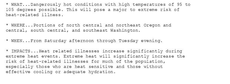
* WHAT...Dangerously hot conditions with high temperatures of 95 to
105 degrees possible. This will pose a major to extreme risk of
heat-related illness.
* WHERE...Portions of north central and northeast Oregon and
central, south central, and southeast Washington.
* WHEN...From Saturday afternoon through Tuesday evening.
* IMPACTS...Heat related illnesses increase significantly during
extreme heat events. Extreme heat will significantly increase the
risk of heat-related illnesses for much of the population,
especially those who are heat sensitive and those without
effective cooling or adequate hydration.
🚨 Extreme Heat Watch issued August 20 at 1:59PM PDT until August 26 at 9:00PM PDT by NWS Pendleton OR 🚨
Additional Details Here.
20.08.2025 21:15 — 👍 0 🔁 1 💬 0 📌 0

...LOCALLY BREEZY WITH LOW RELATIVE HUMIDITY FRIDAY...
.Locally breezy with low relative humidity Friday afternoon and
evening in portions of central and north-central Oregon.
The National Weather Service in Pendleton has issued a Fire
Weather Watch for wind and low relative humidity, which is in
effect from Friday afternoon through Friday evening.
* AFFECTED AREA...Fire Weather Zones 691 Lower Columbia Basin of
Oregon and 703 Warm Springs Reservation.
* TIMING...From Friday afternoon through Friday evening.
* WINDS...Northeast 10 to 15 mph with gusts up to 25 mph.
* RELATIVE HUMIDITY...As low as 10 percent.
* IMPACTS...Any fire that develops will catch and spread
quickly. Outdoor burning is not recommended.
🚨 Fire Weather Watch issued August 20 at 2:10PM PDT until August 22 at 11:00PM PDT by NWS Pendleton OR 🚨
Additional Details Here.
20.08.2025 21:15 — 👍 0 🔁 1 💬 0 📌 0
It’s beautiful outside right now but that’s gonna change this weekend with scorching temperatures in their way 🔥
#fyp #wawx #heatwave #heat #fire
20.08.2025 23:30 — 👍 1 🔁 1 💬 0 📌 0
We’ve got some clouds in store tomorrow and then A warmup next week stay tuned to follow these updates #sun #clouds #heat #warmup #wawx
18.08.2025 00:15 — 👍 2 🔁 1 💬 0 📌 0
Hey folks we saw about a tenth of an inch of rain fall over the past 24 hours across our region with locally higher amounts. Over the next couple of days we’ll see sunshine and 90s return. #rain #wawx #cloud #sun #heat
17.08.2025 00:24 — 👍 1 🔁 1 💬 0 📌 0
We’ve got a rain storm headed our way with likely a tenth to a quarter of an inch of rain in store. The main time of impacts will be between 4 am and noon. Models shown are from the university of Washington and the college of DuPage.
#wawx #rain #storm #atmosphericriver #model
16.08.2025 04:14 — 👍 1 🔁 1 💬 0 📌 0

Significant moisture associated with a passing cold front could
lead to periods of heavy rainfall, especially in and around
thunderstorms through the afternoon and evening. This could lead to
flooding in areas surrounding burn scars associated with the 2024
and 2025 fire seasons.
Flash flooding caused by excessive rainfall is possible. Rain rates
of 1 inch per hour possible within thunderstorms.
🚨 Flash Flood Watch issued August 15 at 1:21PM PDT until August 16 at 11:00PM PDT by NWS Pendleton OR 🚨
Additional Details Here.
15.08.2025 20:30 — 👍 0 🔁 1 💬 0 📌 0
These clouds may not look ominous but they forewarn a storm to come. Stay tuned as tonight I go more in depth on the chance for accumulated precipitation in the middle of August! 🤯 #wawx #storm #rain #cloud #atmosphericriver
15.08.2025 17:58 — 👍 2 🔁 1 💬 0 📌 0
Hey folks here’s a first look at the rain we’re expecting this weekend, I’m not getting too excited about rain totals yet but we will likely see a solid band of rain come in around 9am on Saturday
#wawx #atmosphericriver #rain #drought #storm
15.08.2025 04:38 — 👍 4 🔁 1 💬 0 📌 0
Hey folks it was dry, breezy, and even a bit hazy today across southeastern and central Washington but a bug pattern change is coming as rain is expected Friday night!
#haze #wawx #smoke #wind #fire #redflagwarning #heat
14.08.2025 03:14 — 👍 3 🔁 1 💬 1 📌 0
Hey folks it was dry, breezy, and even a bit hazy today across southeastern and central Washington but a bug pattern change is coming as rain is expected Friday night!
#haze #wawx #smoke #wind #fire #redflagwarning #heat
14.08.2025 03:14 — 👍 1 🔁 1 💬 0 📌 0
I was in ellensburg earlier today where winds were unusually light, the heatwave we’ve experienced the past couple of days has also kept winds down through the Kittitas valley.
Winds are expected to return in force by Wednesday along with a significant cooldown
#wawx #heat #wind #weather #heatwave
12.08.2025 05:47 — 👍 2 🔁 1 💬 0 📌 0
It was a scorcher today with temps rising to 98 degrees in the tri cities, tomorrow will be even warmer at 101!
#wawx #pnw #heatwave #heat #sun #wx #weather #pasco #kennewick #richland
11.08.2025 04:22 — 👍 2 🔁 1 💬 0 📌 0

It’s gonna be a scorcher tomorrow so be sure to drink plenty of water and stay out of the sun if possible. #wawx #heatwave #heat #sun #pnw
10.08.2025 23:57 — 👍 3 🔁 1 💬 0 📌 0

* WHAT...Dangerously hot conditions with temperatures 100 to 103
degrees expected, with the hottest conditions Monday and Tuesday.
This will pose a moderate to major risk of heat-related illness.
* WHERE...Eastern Columbia River Gorge of Oregon and Washington,
Lower Columbia Basin of Oregon and Washington, Foothills of the
Northern Blue Mountains of Oregon, Kittitas Valley, Yakima Valley,
and Foothills of the Blue Mountains of Washington.
* WHEN...Until 10 PM PDT Tuesday.
* IMPACTS...Heat related illnesses increase significantly during
extreme heat events. Extreme heat will significantly increase the
risk of heat-related illnesses for much of the population,
especially those who are heat sensitive and those without
effective cooling or adequate hydration.

* WHAT...Dangerously hot conditions with temperatures 99 to 102
degrees expected. This will pose a moderate to locally major risk
of heat-related illness, especially on Monday.
* WHERE...In Oregon, Central Oregon, John Day Basin, Foothills of
the Southern Blue Mountains of Oregon, and North Central Oregon.
In Washington, Simcoe Highlands.
* WHEN...Until 10 PM PDT Tuesday.
* IMPACTS...Heat related illnesses increase significantly during
extreme heat events.
🚨 Extreme Heat Warning issued August 10 at 1:11PM PDT until August 12 at 10:00PM PDT by NWS Pendleton OR 🚨
Additional Details Here.
10.08.2025 20:15 — 👍 0 🔁 1 💬 0 📌 1
Hey folks we’ve got some triple digits coming Monday.
Stay tuned as I follow the heat coming to the Tri cities. #wawx #sun #heat #tricities #heatwave #heatwarning
10.08.2025 03:00 — 👍 2 🔁 1 💬 0 📌 0
Advocacy journalism for better cities.👩🦽👨🦯🚶🚴♀️ 🚎 ⛴️ 🚊 🚆 🏙️
Based in the Seattle metro area.
Read our coverage on theurbanist.org. 📰
Official WSDOT Bluesky account for traffic in King & Snohomish counties, including Seattle. Monitored 6 a.m.-6 p.m. Mon-Fri. Call 911 to report road hazards.
Official Washington State Department of Transportation Bluesky account. For road hazards and emergencies, please call 911.
Non-partisan political activism group, made up of people in our community coming together to fight for our democracy. Join us!
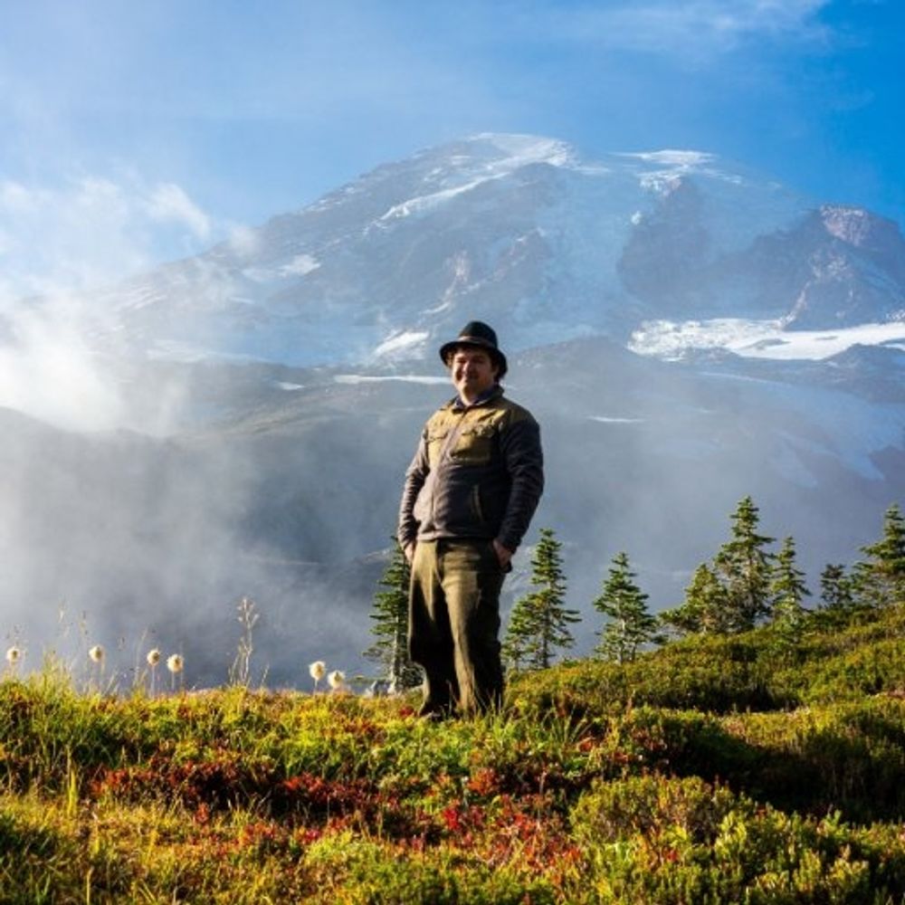
Photographer, writer, environmentalist, geek
I live in the shadow of Mt. St. Helens where I write about cameras and other tech, create YouTube videos, and spend a lot of time out in nature photographing wildlife and the places they live.
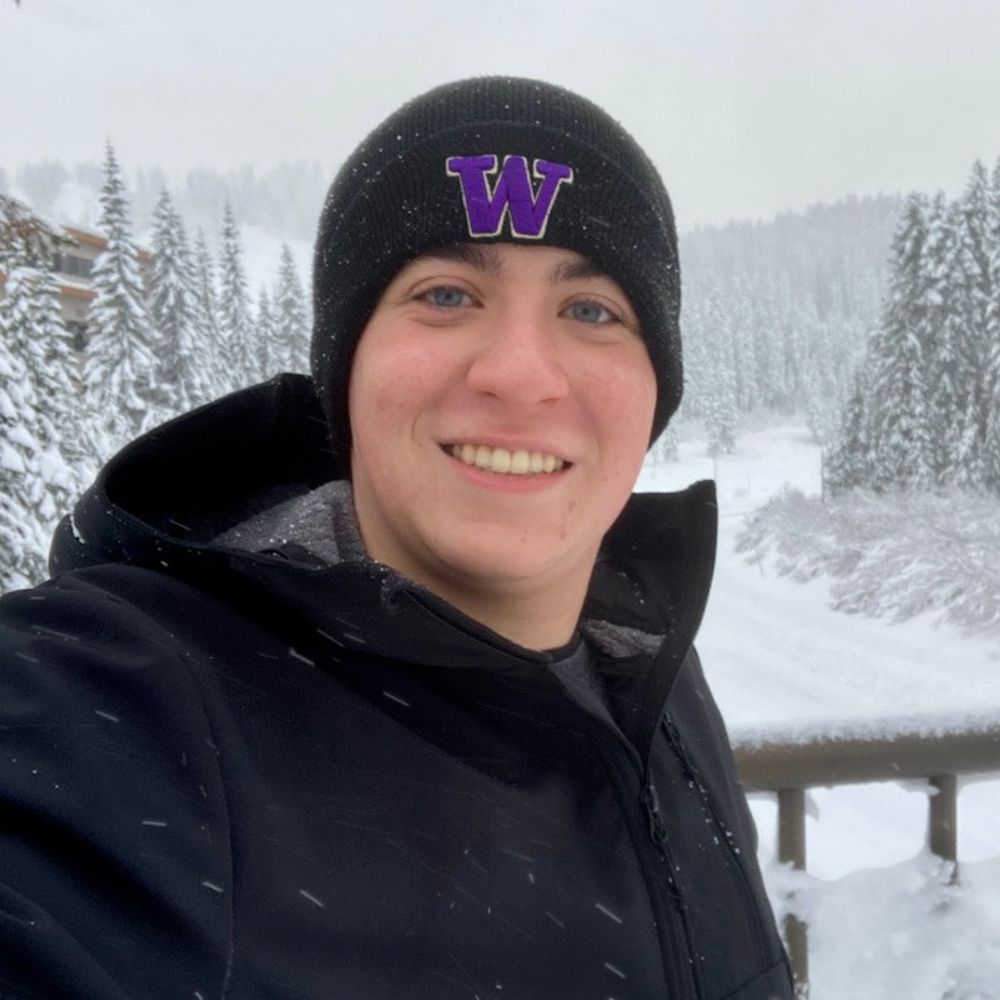
Aspiring meteorologist, freelance with Live Storms Media, host of Western Washington Weather on YouTube, amateur landscape photographer. Posts about weather in the Pacific Northwest & around the US. #wawx
NOAA provides science, service and stewardship to protect life, property & Earth's natural resources. An agency of the Department of Commerce. Join us on Instagram & Facebook. Official NOAA account.
Unofficial bot sharing alerts from NWS Pendleton OR.
This account is not monitored. Contact @wandrme.paxex.aero if needed.
official Bluesky account (check username👆)
Bugs, feature requests, feedback: support@bsky.app