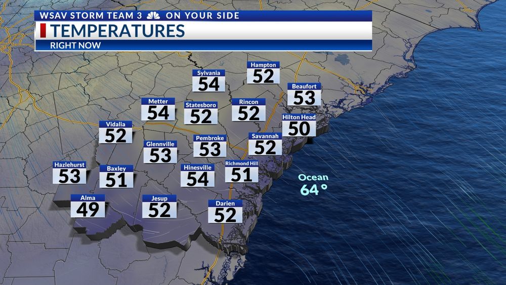
WEEKEND FORECAST --
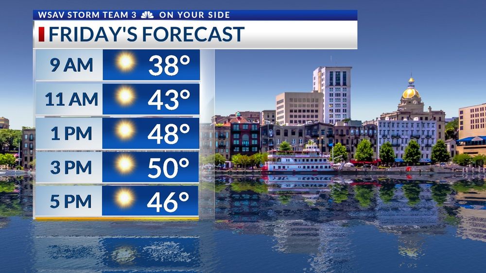
After a sunny and cool Friday, the weekend will be even chillier. Morning lows will be in the lower 30s and highs will be in the low to mid 50s. Have the heavy jackets ready to go!
#gawx #scwx

@wsavscottr.bsky.social
Chief meteorologist for WSAV News 3 - Savannah, Ga.
WEEKEND FORECAST --
After a sunny and cool Friday, the weekend will be even chillier. Morning lows will be in the lower 30s and highs will be in the low to mid 50s. Have the heavy jackets ready to go!
#gawx #scwx
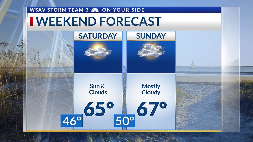
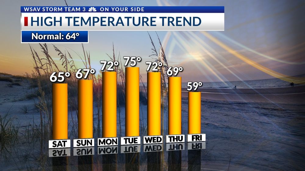
WARMER DAYS AHEAD --
The warming trend will continue into the weekend and beyond. Highs early next week will be in the mid 70s. Showers and a cool down will be here by Thursday. Next weekend will be much colder again.
#gawx #scwx #savannahGA
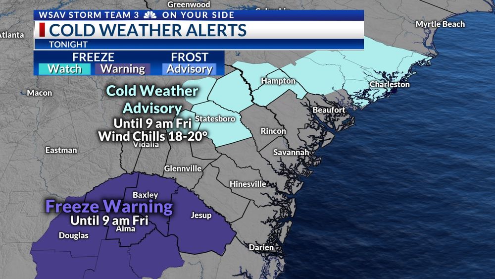
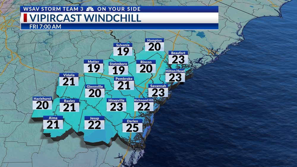
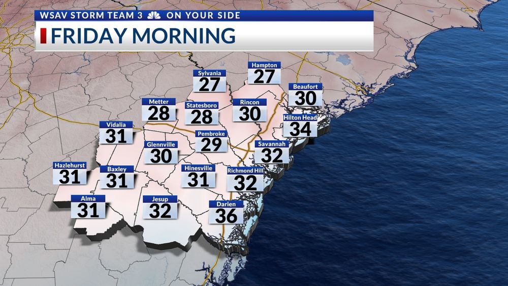
COLD FRIDAY!!
Low temperatures Friday morning will be below freezing for most of the area. A light breeze will make conditions feel even colder with wind chills below 20°F for our northwestern counties. Stay warm!
@wsav.bsky.social
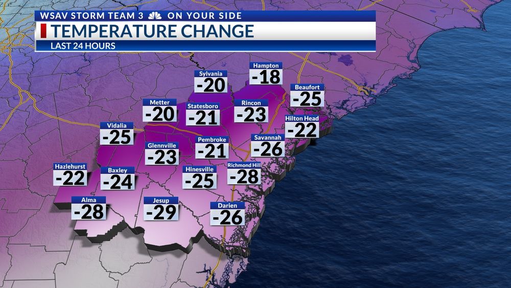
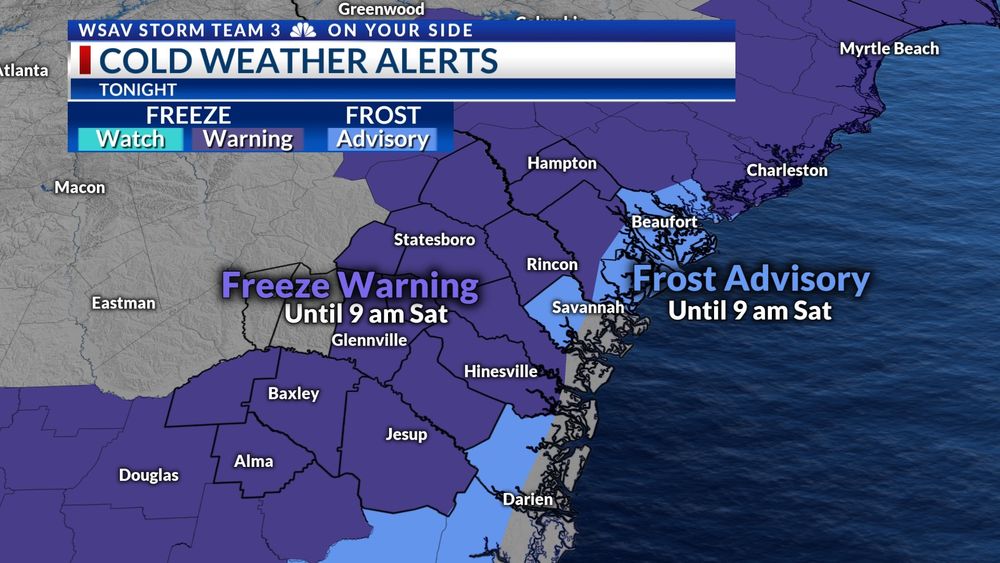
COLD NIGHT
After a warm stretch of weather, much colder air is moving into the SE tonight. Overnight lows will be near or below freezing by Sat AM. Frost and freeze alerts have been issued. It is a good idea to protect sensitive plants. Don't forget your pets too!
#gawx #scwx
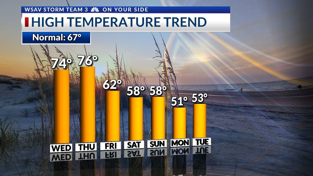
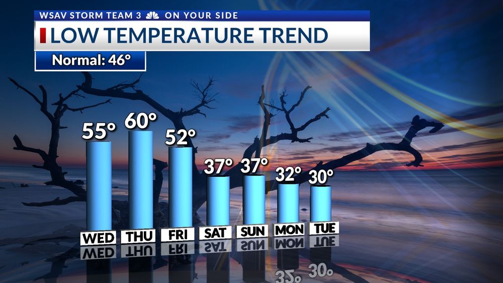
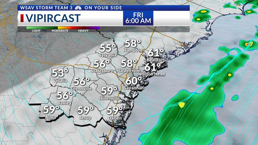
The next couple of days will remain mild in the mornings and highs will be in the 70s. After a strong front moves through on Thanksgiving, much colder air will funnel in southward. There is a good chance that many places west of I-95 will be in the mid-upper 20s Mon & Tue AM.
27.11.2024 02:24 — 👍 1 🔁 0 💬 0 📌 0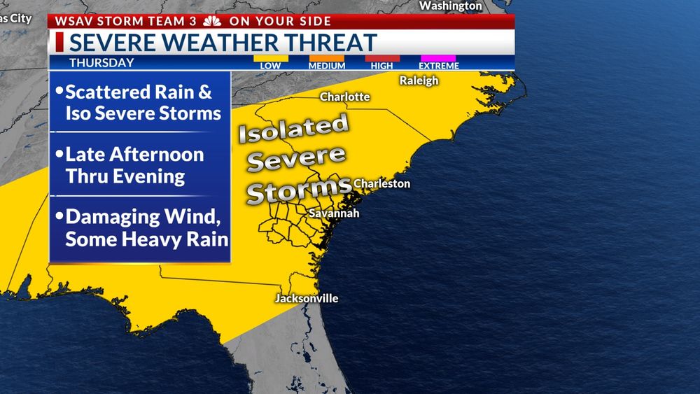
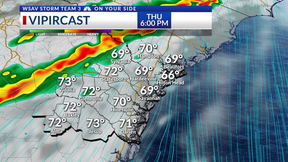
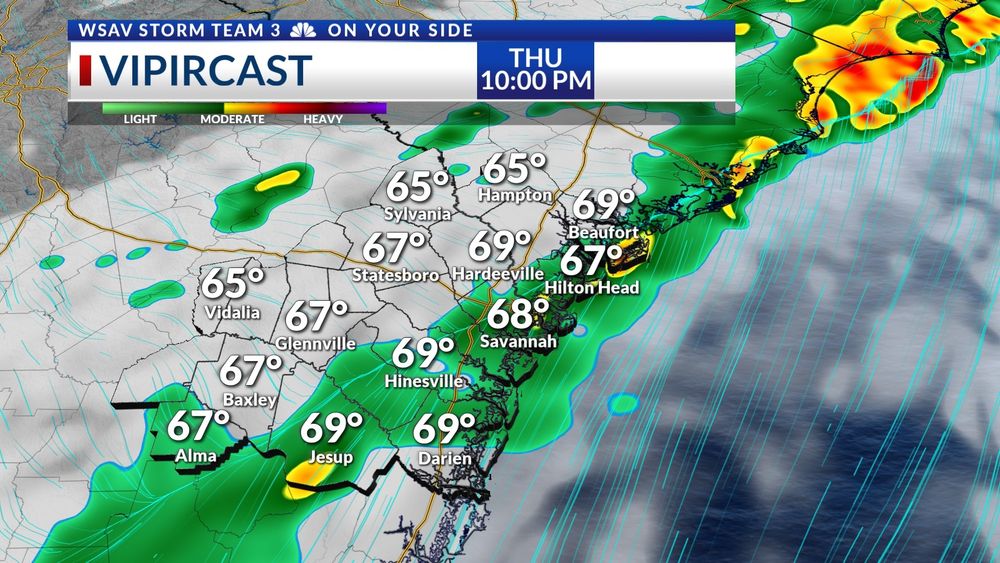
THANKSGIVING STORMS--
Showers and storms are expected late in the afternoon and into the evening Thanksgiving Day. A few storms have potential to become strong or severe. The overall risk for severe storms is low. Damaging wind gusts are the main concern.
#gawx #scwx
Its a great place! Come by anytime.
27.11.2024 02:13 — 👍 1 🔁 0 💬 0 📌 0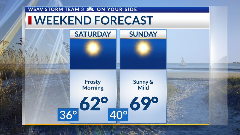
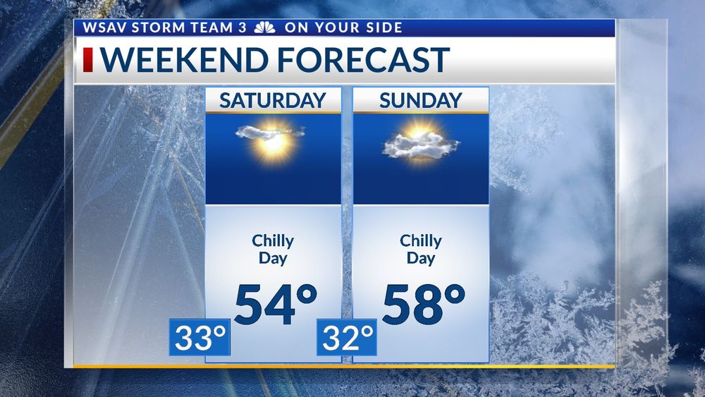
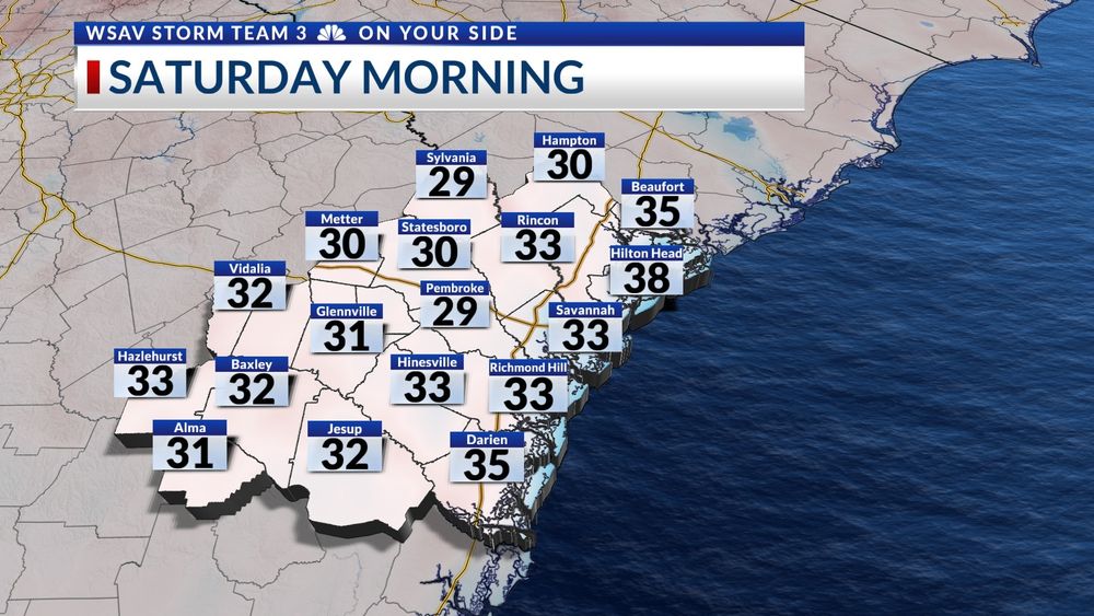
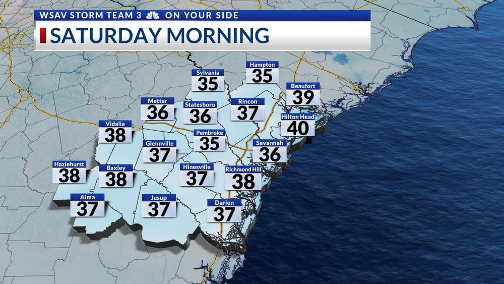
WEEKEND FORECAST --
Saturday will start out with the colder temperatures so far for the season with lows in the 30s. The afternoon will remain chilly even with a sunny sky. Sunday looks to be a little milder.
#gawx #scwx
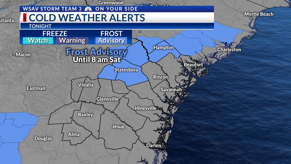
FROSTY NIGHT --
A Frost Advisory has been issued for portions of the Coastal Empire and Lowcountry. Lows in the mid 30s are cold enough for some patchy frost to form. It is a good idea to protect sensitive plants by covering or brining them indoors if you can.
#gawx #scwx
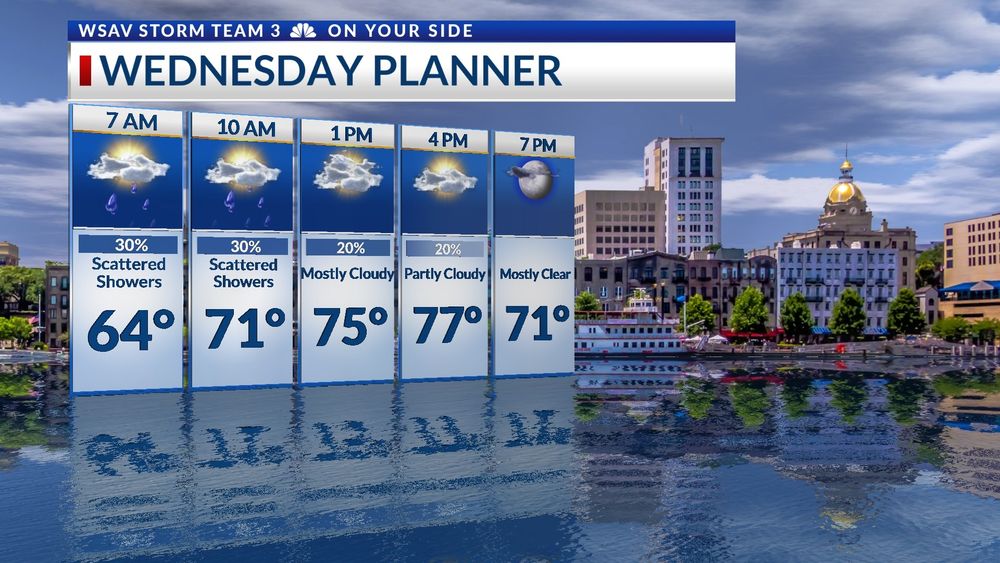
Hi - Wednesday will start out with some showers across the region, but conditions will dry out after lunchtime. Temps will still warm into the low to mid 70s, even with a cold front will move through in the later part of the day. Much cooler air will move in for Thu through Sat.
#gawx #scwx