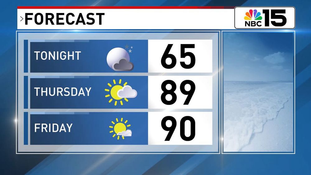
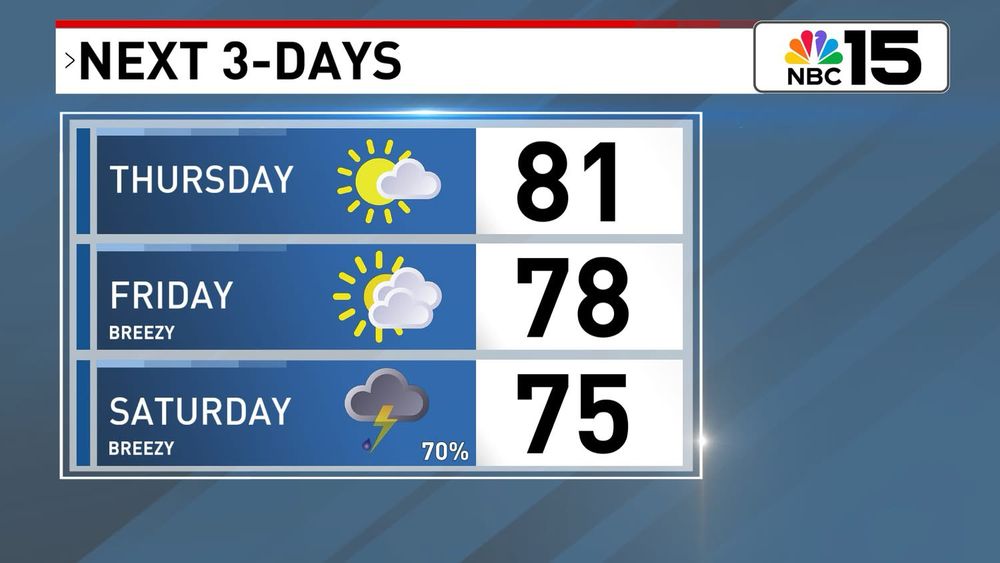
We warm up even more tomorrow, but it’s ahead of a quick midweek cool down. Temps will rebound by the weekend. Here’s a quick overview! @mynbc15.bsky.social
03.02.2026 03:41 — 👍 0 🔁 0 💬 0 📌 0
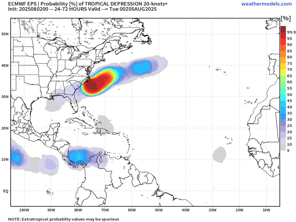
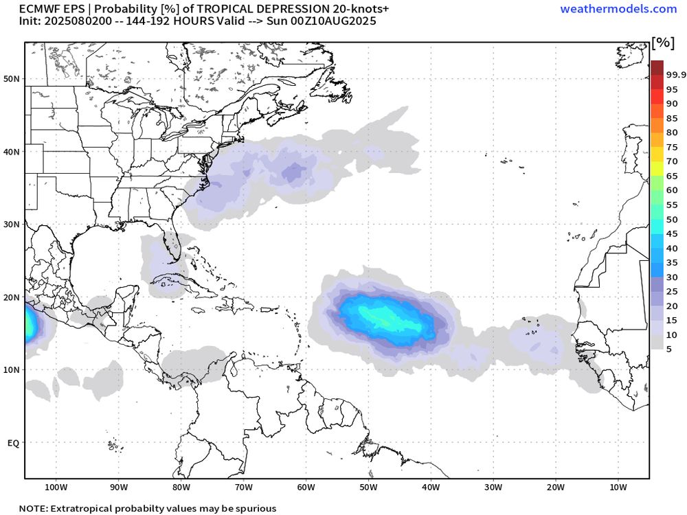
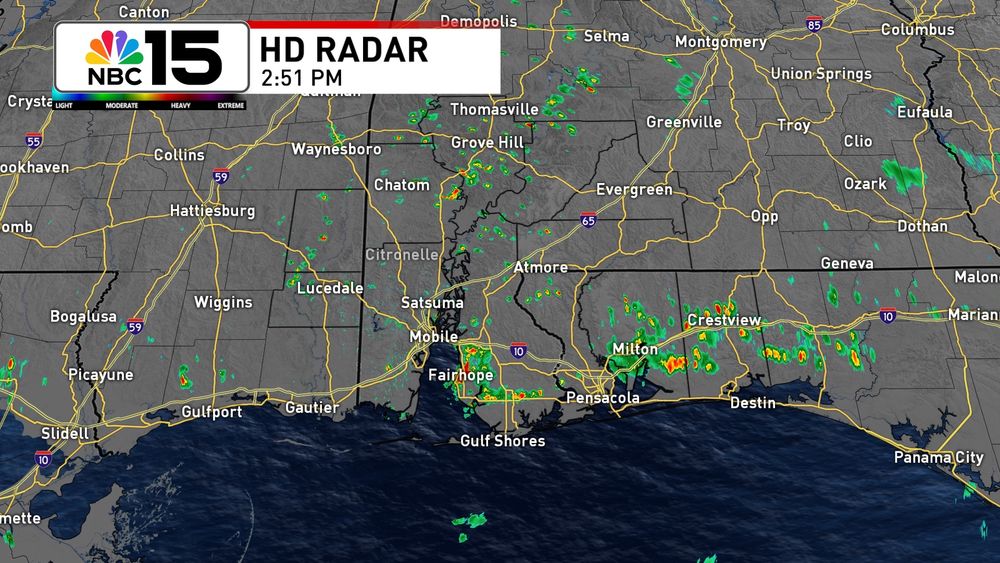
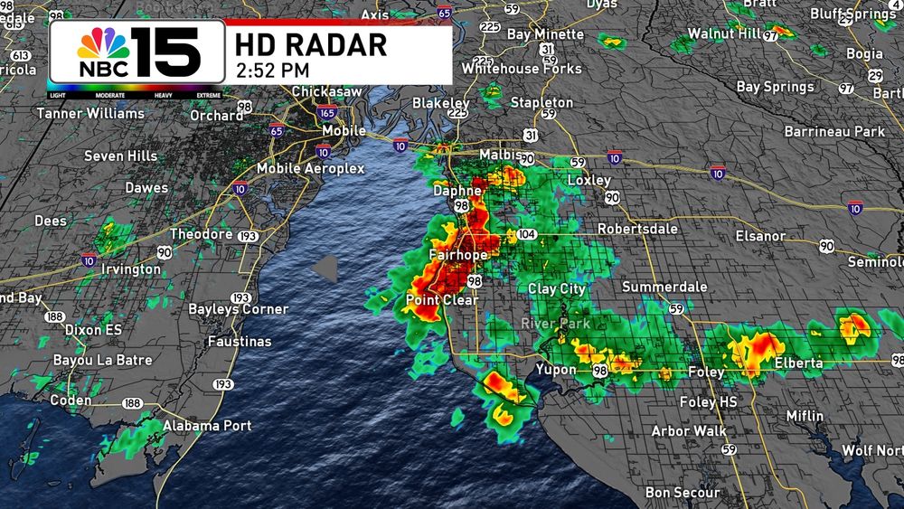
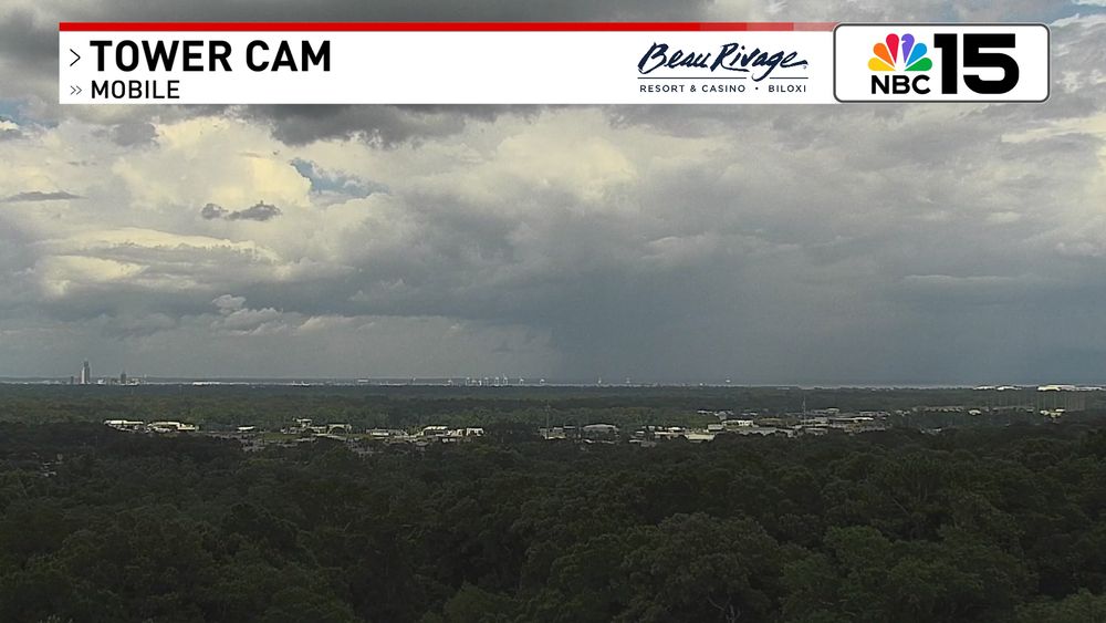
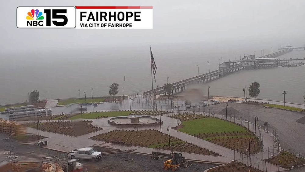
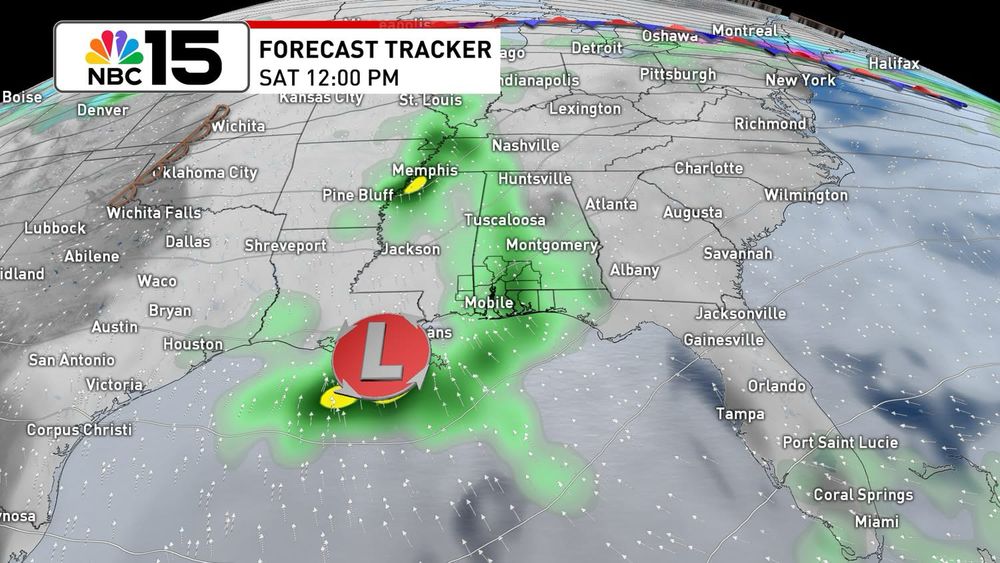
Tracking Gabrielle and a couple of disturbances, but still so far so good in the tropics concerning the Gulf. At home it’s more of the same in the coming days, just with a small uptick in moisture. Next week still looking decent for better rain chances.
18.09.2025 00:06 — 👍 0 🔁 0 💬 0 📌 0
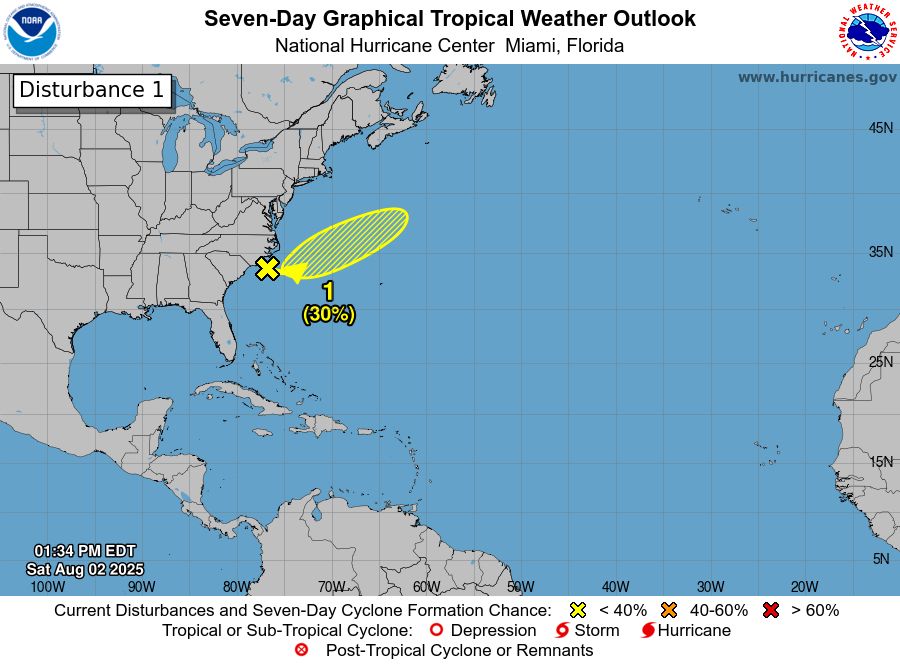
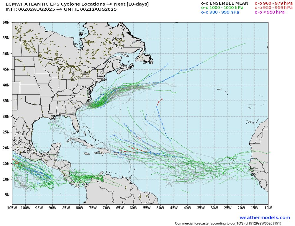
In the tropics, there’s a high chance the disturbance in the east Atlantic develops by this weekend. We’ll watch, but there are no foreseeable tropical threats to the Gulf through the next 7-days. At home it’s a summer pattern with low rain chances for now.
04.09.2025 00:23 — 👍 0 🔁 0 💬 0 📌 0
The pleasant weather hangs on for now, but by the end of this week there will be even more of a summer feel. In the tropics we’re watching a disturbance with a high chance of developing but there’s plenty of time to watch. @mynbc15.bsky.social
02.09.2025 23:59 — 👍 1 🔁 0 💬 0 📌 0
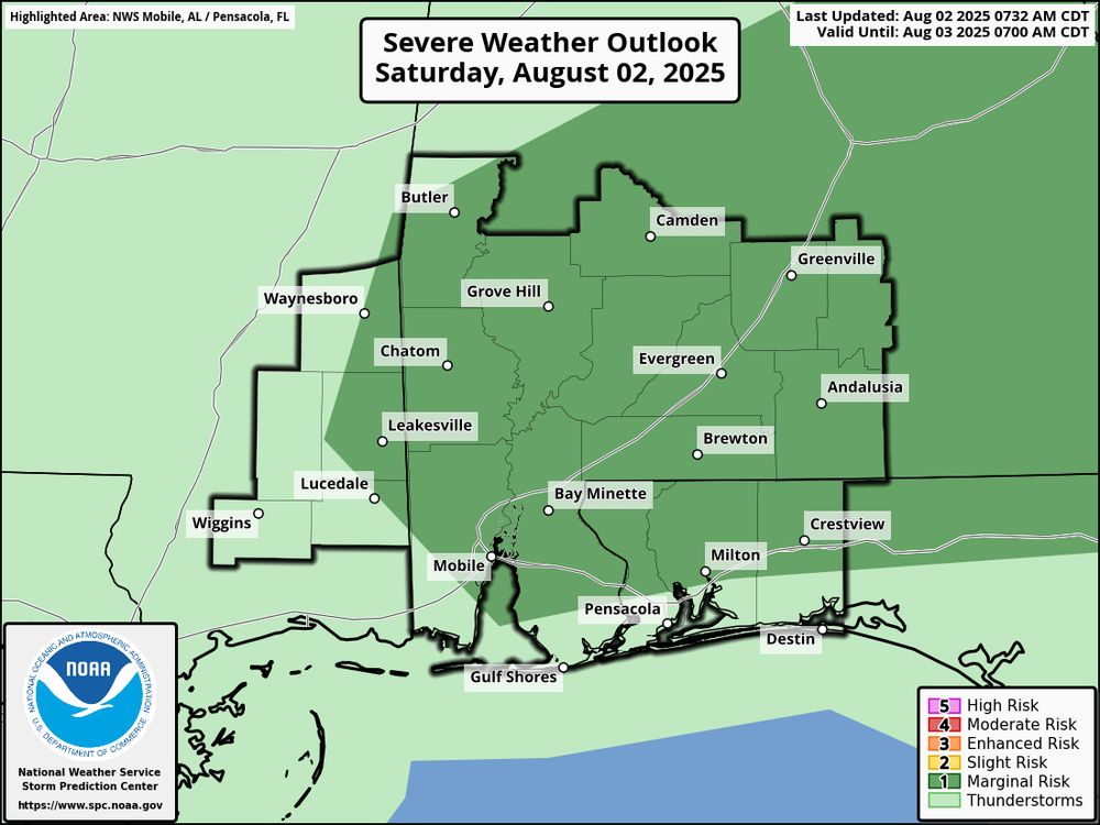
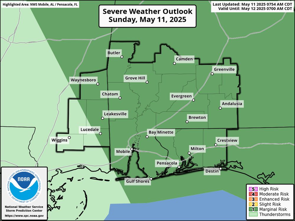
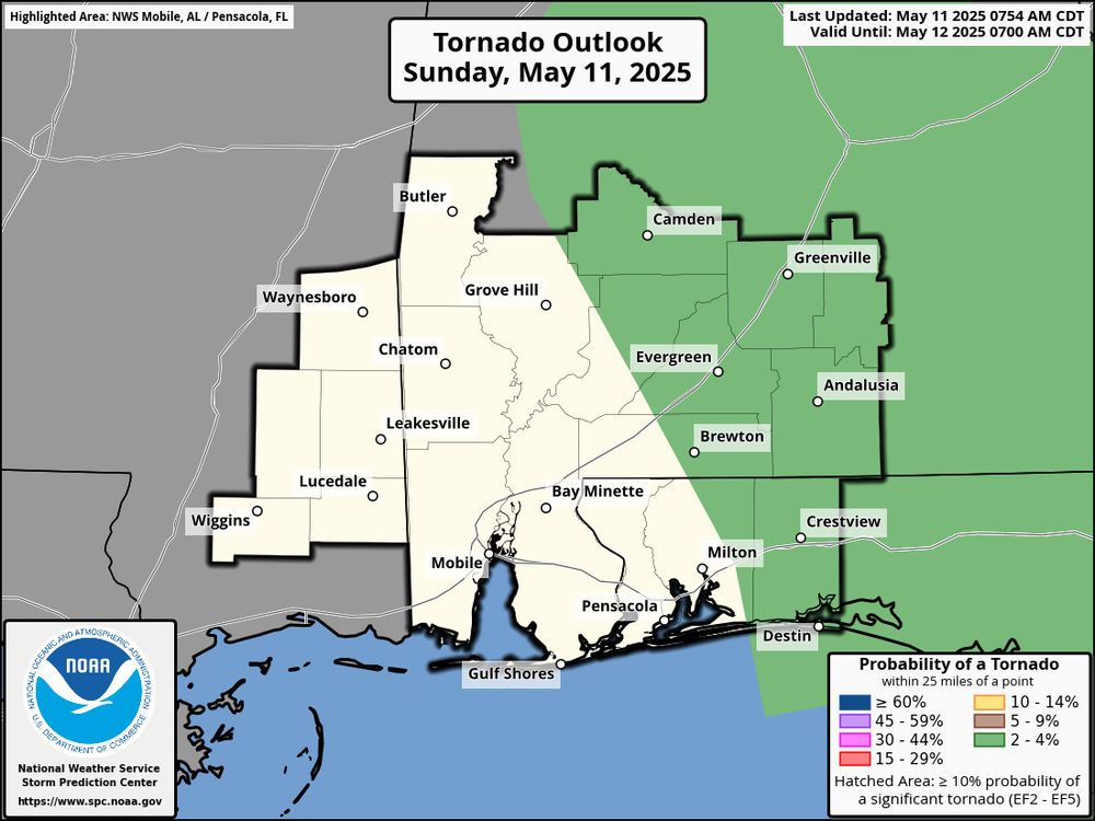
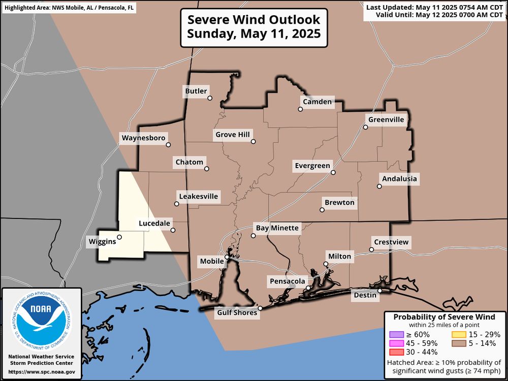
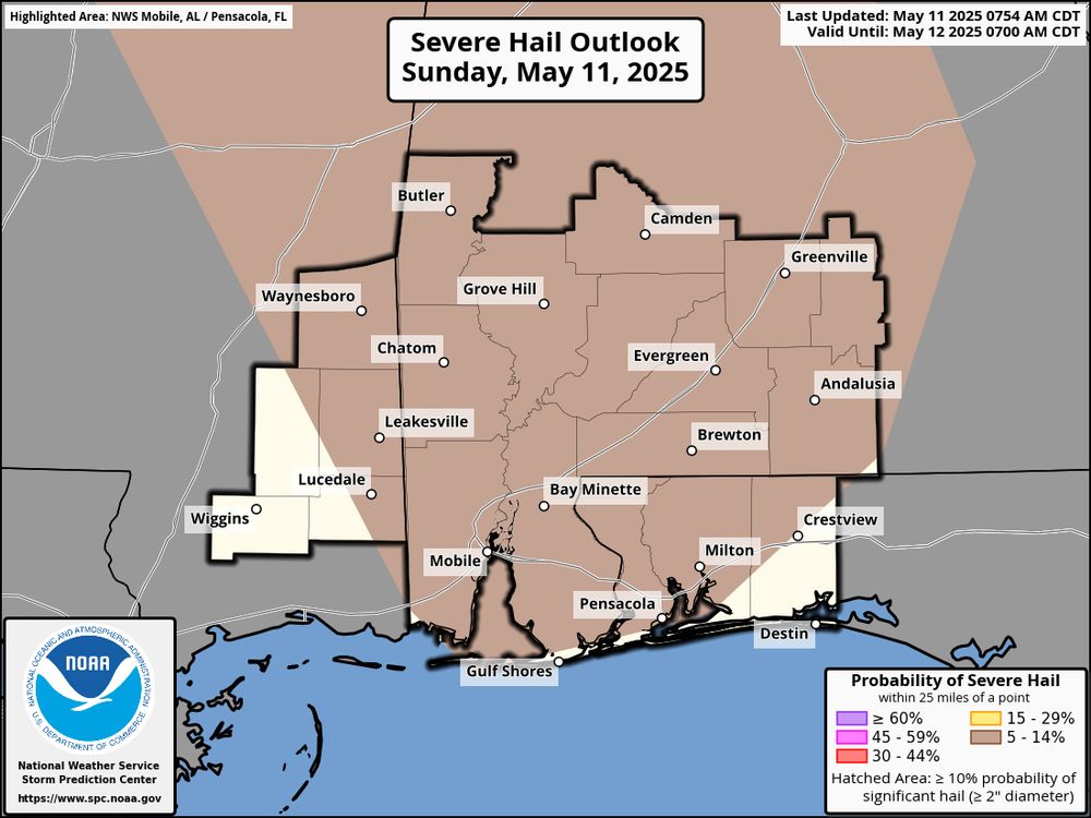
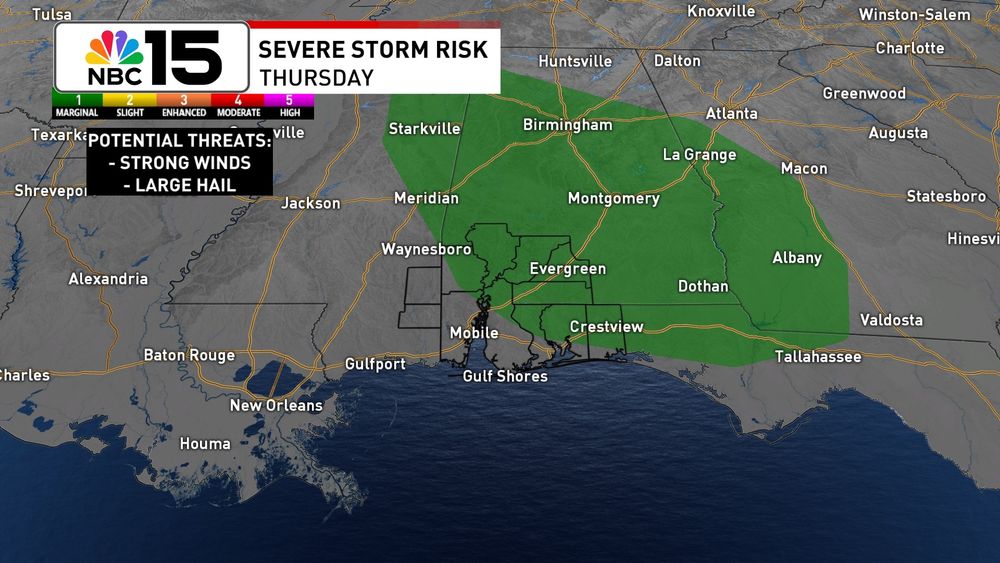
A marginal severe risk has been added to most of our area today. Storms will be capable of strong wind gusts.
02.08.2025 14:41 — 👍 2 🔁 0 💬 0 📌 0
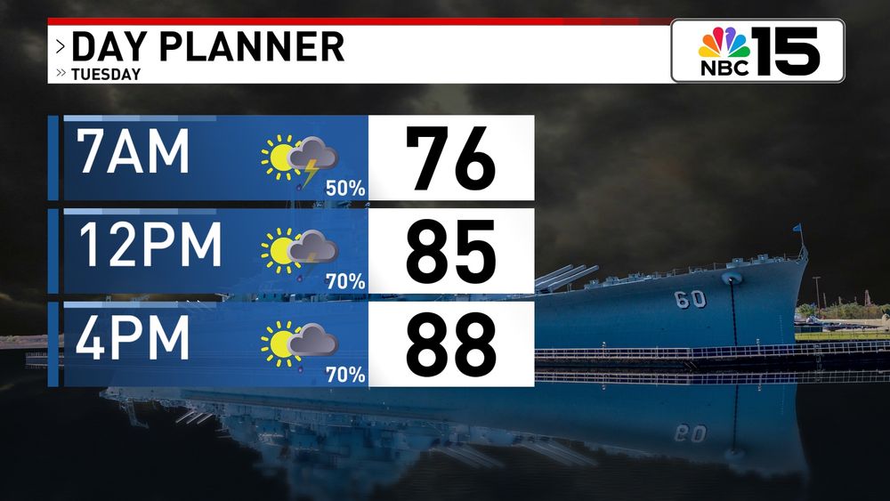
Tomorrow won't bring non-stop rain, but some spots could see multiple rounds. Outside of any wet weather skies will be partly sunny with upper 80s for highs. Thanks to the humidity, it will feel closer to 100° with the heat index. @mynbc15.bsky.social
10.06.2025 03:53 — 👍 1 🔁 0 💬 0 📌 0
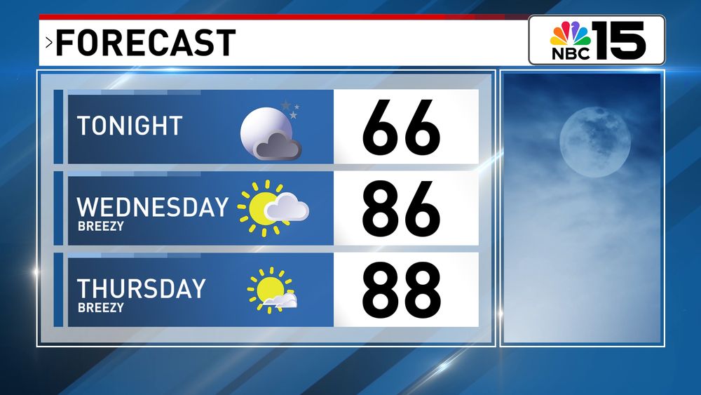
Comfortable tonight, then warm and breezy for the second half of the workweek with mostly dry skies! @mynbc15.bsky.social
14.05.2025 03:12 — 👍 1 🔁 0 💬 0 📌 0
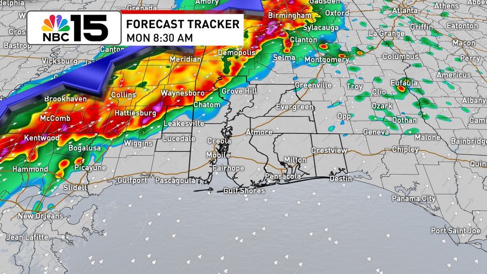
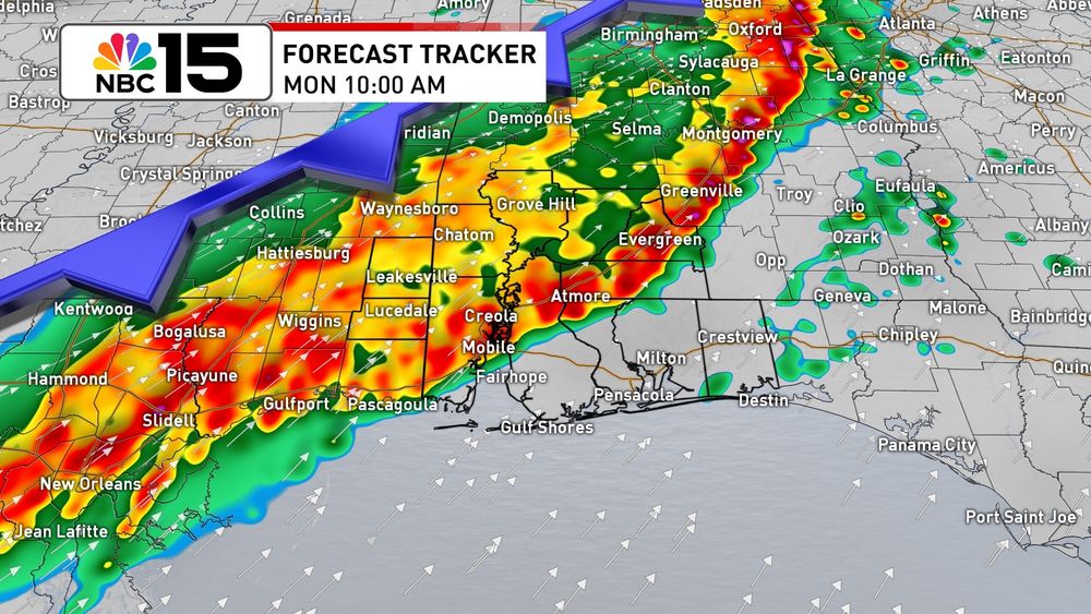
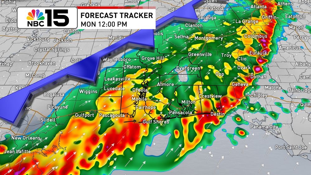
All modes of severe weather remain possible today ahead of the cold front. Even after the front passes, showers will persist into Monday. There's a slight risk of excessive rainfall for our area today & tonight. Here’s a quick update. @mynbc15.bsky.social
06.04.2025 17:18 — 👍 0 🔁 0 💬 0 📌 0
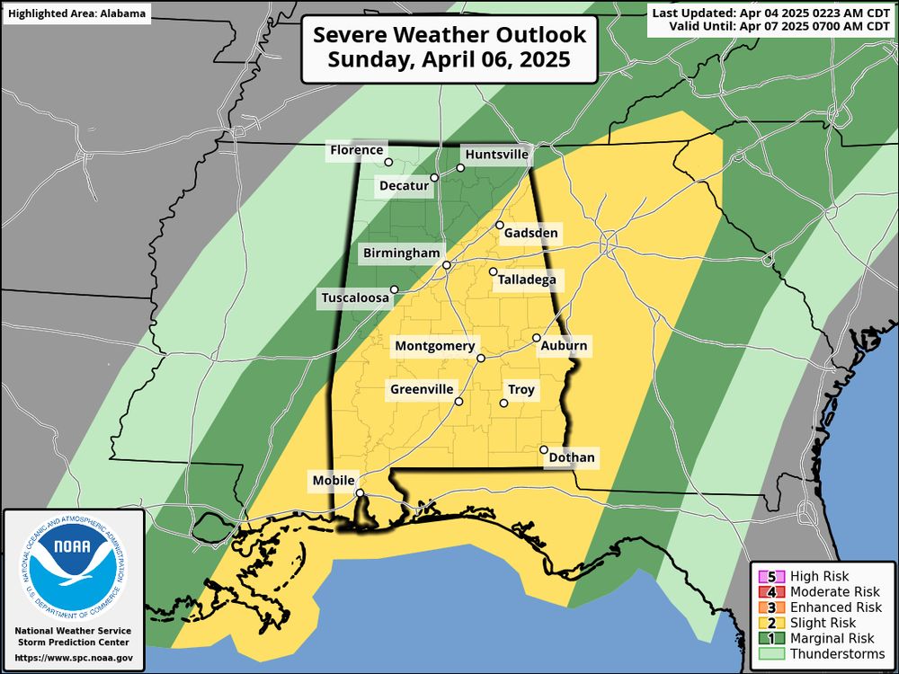
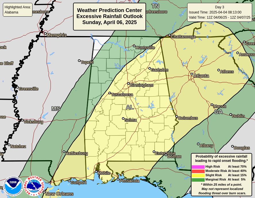
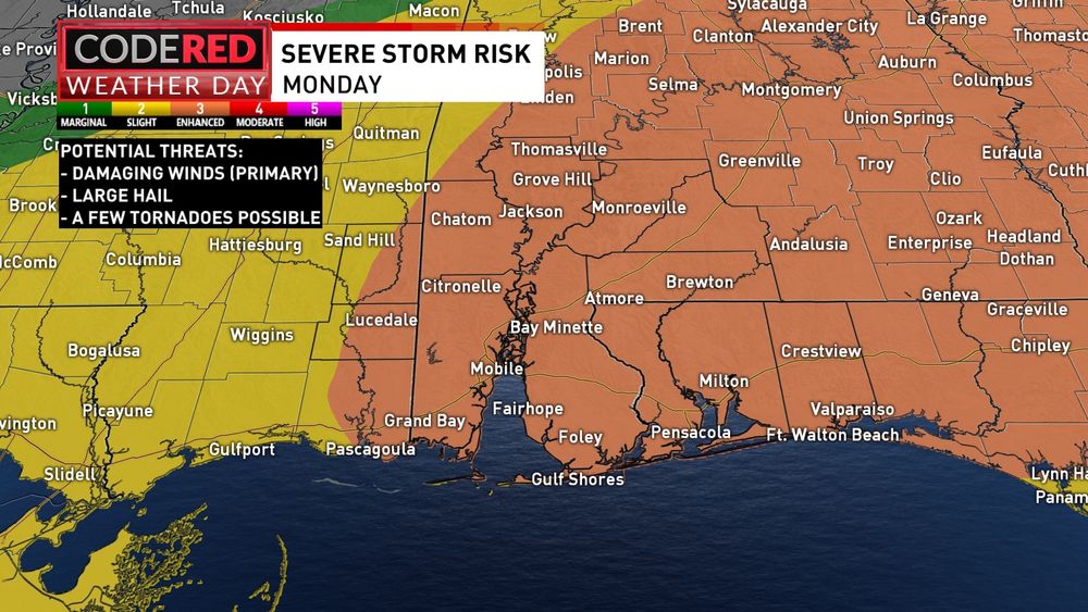
Our Weathermaker on Sunday will bring a level 2 slight risk of severe weather and excessive rainfall. If we see severe weather, winds will be the primary concern, but an isolated tornado threat can’t be completely ruled out.
04.04.2025 18:25 — 👍 1 🔁 1 💬 0 📌 0
Our next weathermaker moves in late tonight into tomorrow morning. We'll see scattered showers and storms, mainly through the first half of Monday. While the severe risk is low, it's not zero. By Tuesday we're back to sunshine as highs warm to the 80s! @mynbc15.bsky.social
24.03.2025 02:54 — 👍 1 🔁 0 💬 0 📌 0
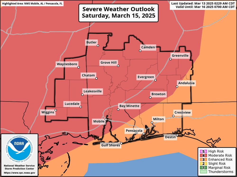
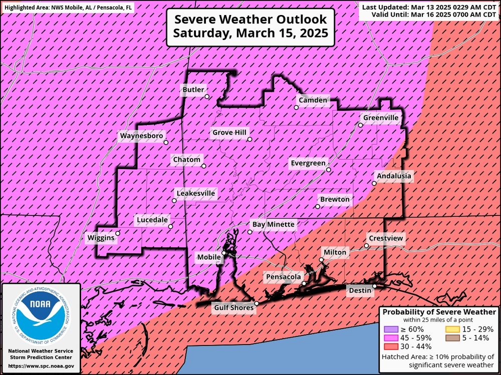
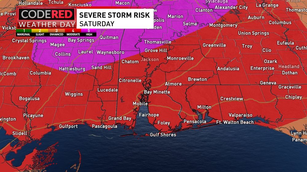
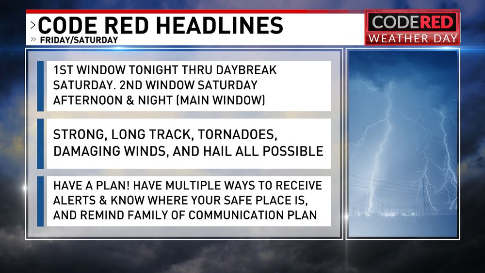
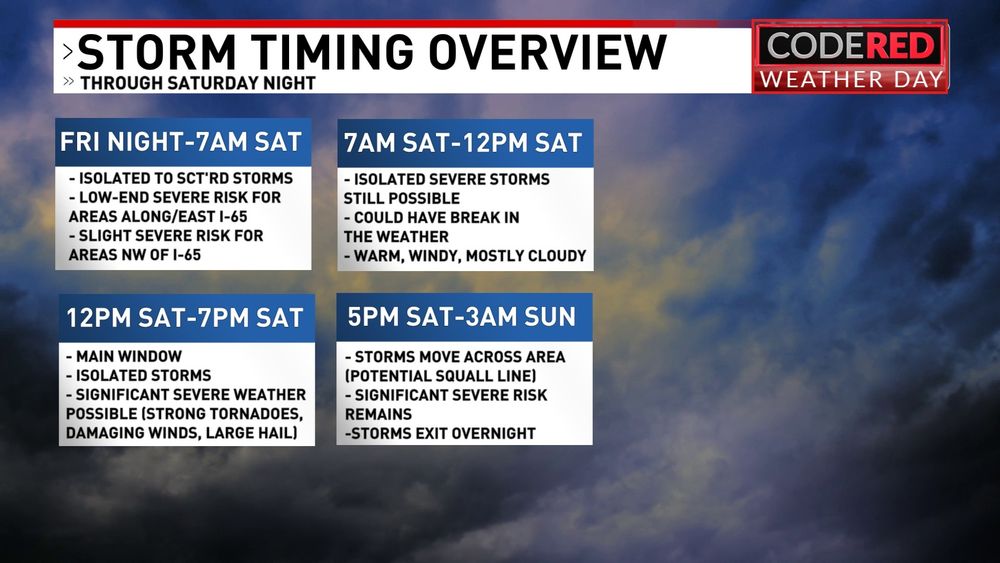
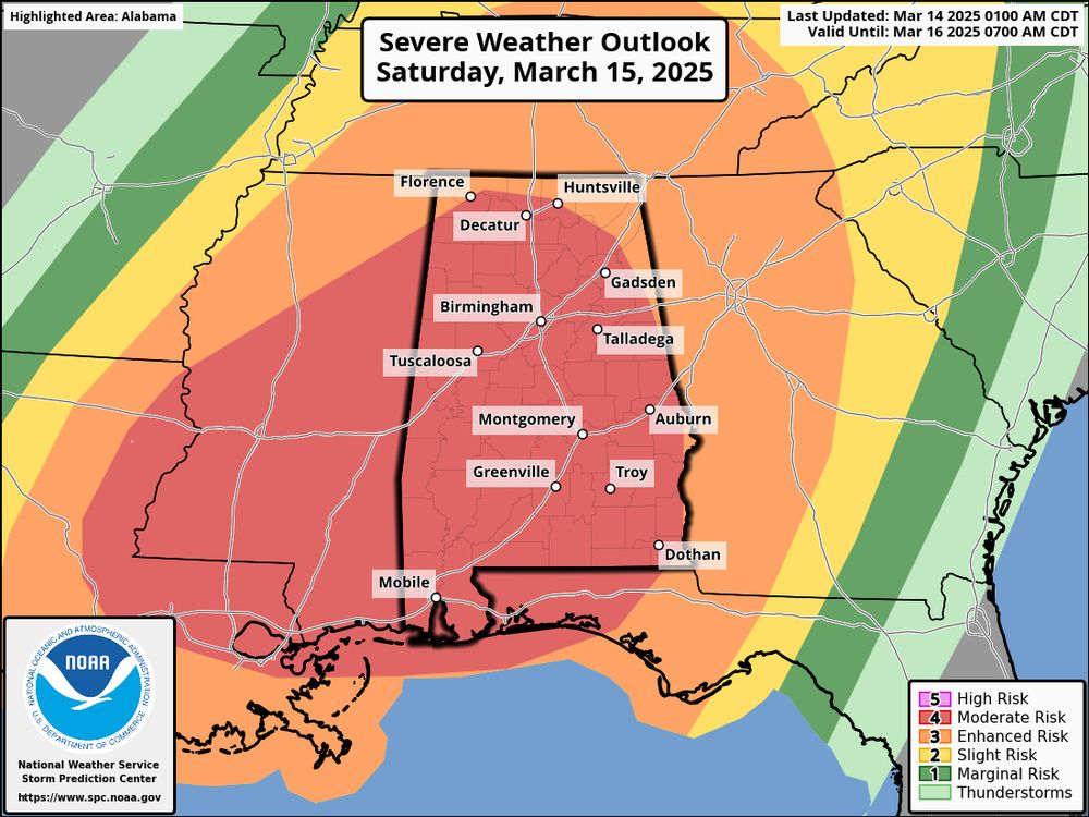
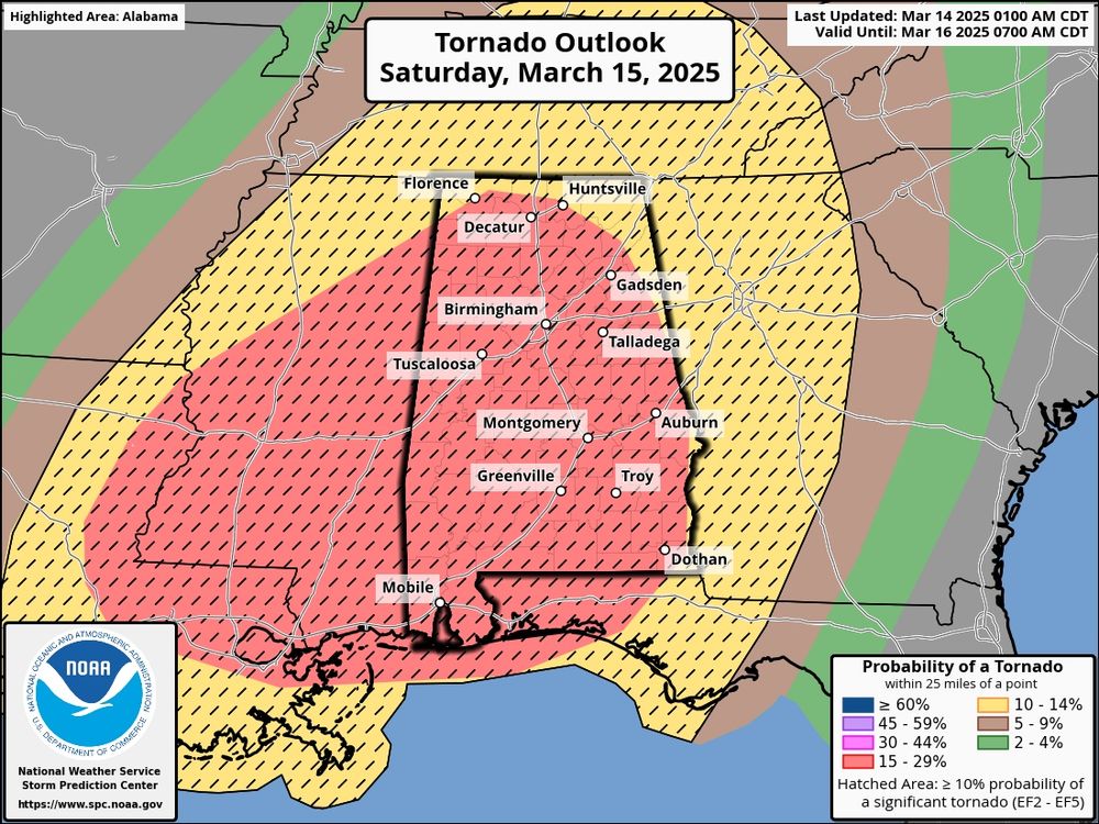
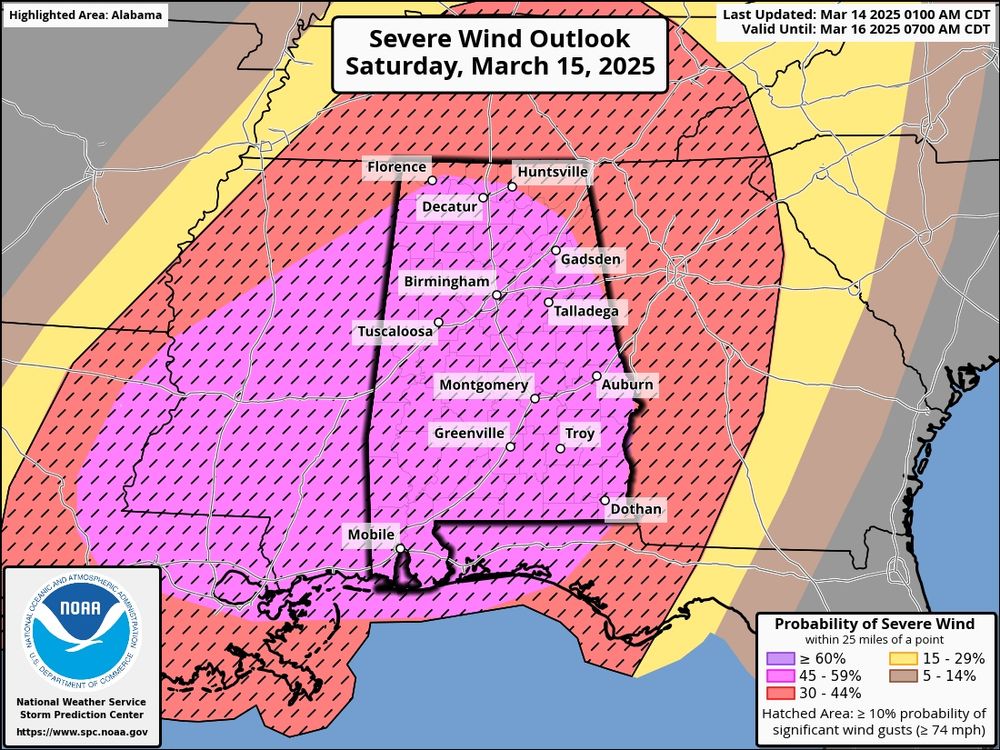
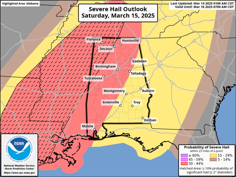
The SPC risk for Saturday had been released and it shows most of the @mynbc15.bsky.social in a level 4 MODERATE RISK. That means scattered to numerous severe storms are expected. Make sure you’re prepared before we get to Saturday. Have a plan and multiple ways to receive alerts!
13.03.2025 07:52 — 👍 1 🔁 0 💬 0 📌 0
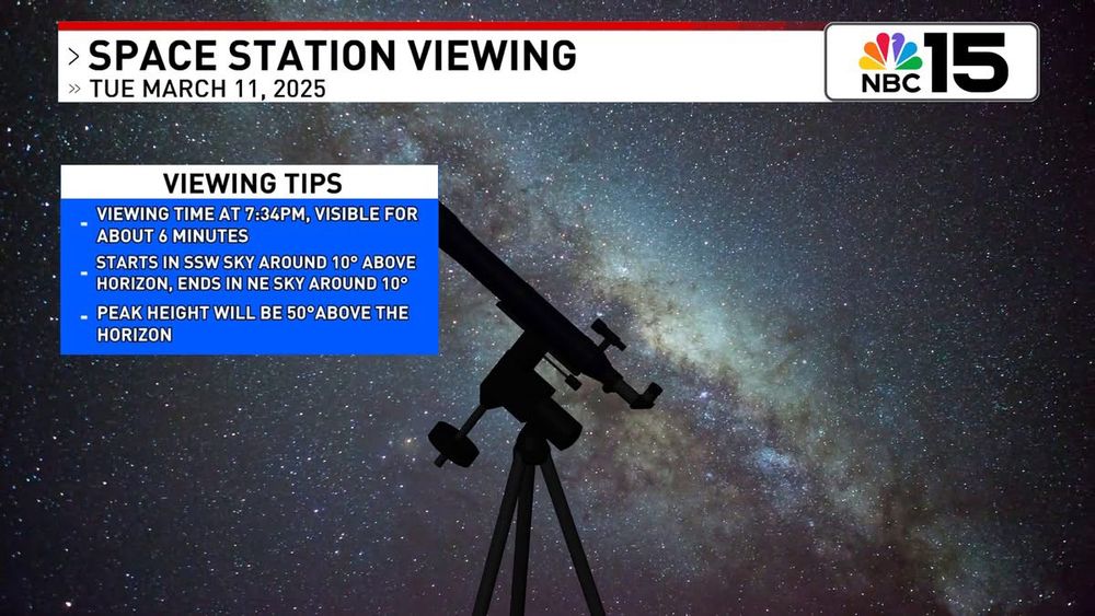
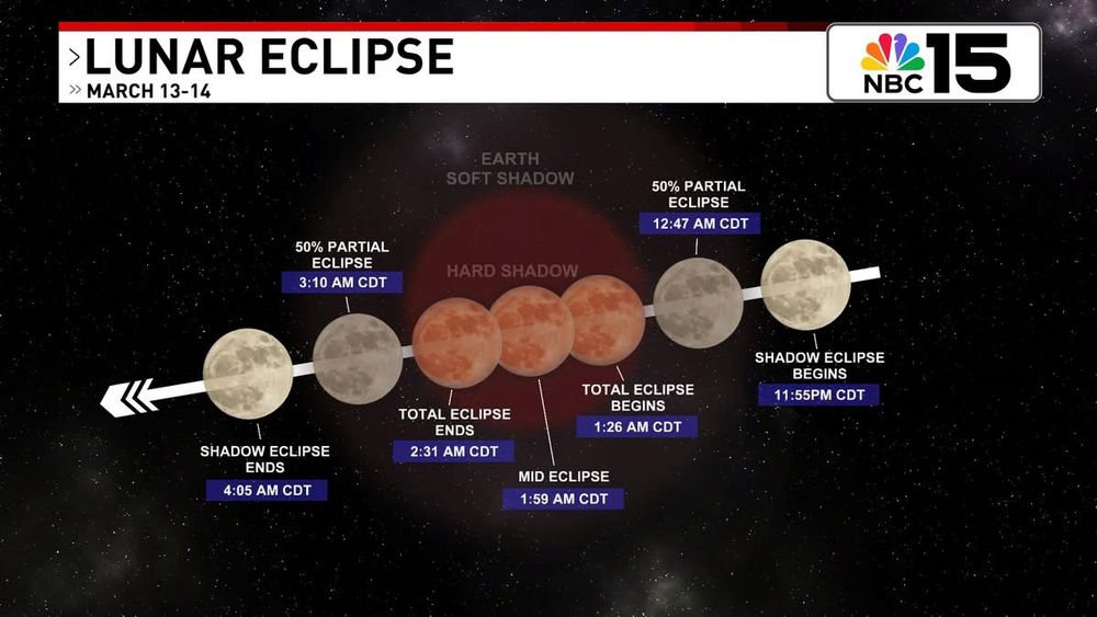
LOOK UP! We get another chance to see the International Space Station again tonight around 7:30PM! Also, don't forget, Thursday night into Friday is the total Lunar Eclipse! @mynbc15.bsky.social @natwxdesk.bsky.social
11.03.2025 23:45 — 👍 2 🔁 0 💬 0 📌 0
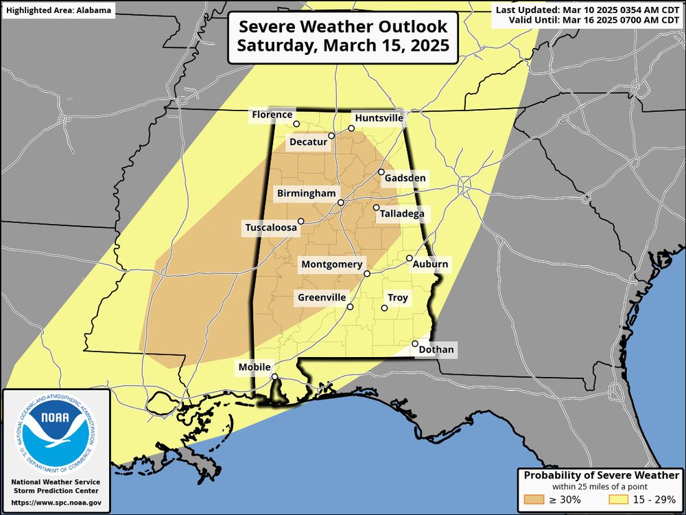
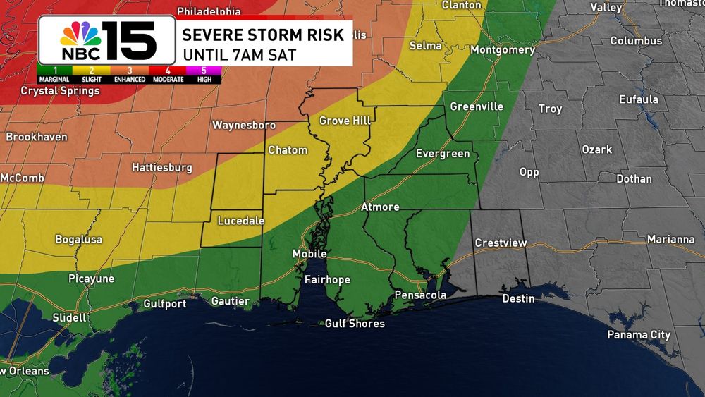
SATURDAY SEVERE RISK - The northwestern part our area has been placed in what would equate to a level 3 enhanced risk meaning numerous severe storms are possible. Most of our area remains in the slight risk. Stay tuned.
10.03.2025 15:42 — 👍 0 🔁 0 💬 0 📌 0
Meteorologist | @NWSColumbia - NC State Alum - SC HS BBall Official - Girl Dad x2
Come join me and enjoy my adventures
Professional photographer
Sports Photographer
Canon EOS R7
Engineer and meteorologist. Alumni of Auburn, NC State, and Mississippi State Universities. US Navy veteran.
Chief Meteorologist. BILLS MAFIA. Dad. Hunter. Fisherman. Not necessarily in order.
He/him. Meteorologist at WPDE. Opinions are my own. Reposts (or whatever they're called here) are not endorsements. I like talking about hurricanes and snow. FSU Alum.
Meteorologist🌤️⛈️❄️🌬️ RU Alum🔴⚪️
The official Bsky account for NBC 15 WPMI - covering the greater Mobile-Pensacola area
UDP ENVIRONMENTAL CHAIR https://www.facebook.com/utahenvironmentalcaucus
I buy , fix and sell old oddball cars and trucks .
https://secure.actblue.com/donate/kane-county-democratic-party--ut--1 switch to preview form to left and ActBlue Express
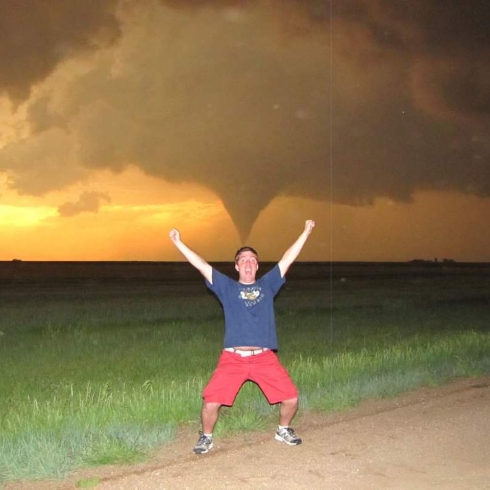
Sometimes stormchaser, Movie Theater Snob, Annoying Pinball Nerd. Iowa State Meteorology B.S. '14/M.S. '16. 🏳️🌈 n' stuff. MN -> IA -> RMI -> OK -> NM.
Offizieller Kanal des SV #Werder Bremen
Englisch: @en.werder.de | Spanisch: @es.werder.de
Dortmund journalist ✍️
Daily content and updates 🚨🗞️
News and rumours 🟡⚫️
The Bundesliga Rundown is a podcast owned by Bavarian Football Works that deep dives into the wonderful world of German football after each Bundesliga match day.
Auf gehts! 🇩🇪⚽️
Instagram: TheBundesligaRundown
Royalty plays here 👑
2026 Season Tix: bit.ly/URFCSeasonTickets26
Claret-and-Cobalt since 2005
Florida Meteorologist | Penn State Meteorology | Husband & Father | Hurricane Irma, Hurricane Ian | Florida Born & Raised
Chief Meteorologist for KPIX-TV, 10x Emmy winner. Also on CBS News 24/7 Prime/Time, occasional contributor to CBS Evening News. Amateur sports analyst, nerd omnivore, Texas A&M Aggie, Denver Pioneer, friend to all dogs.
Spectrum News Meteorologist
UNC CHARLOTTE Alum
Rays and Panthers Fan
Twitch Show about German Soccer, #AlwaysWatchFridayGames, Unbiased. It's Gumbo Time. The Eric Andre Show of Soccer "Podcasts".
#DerekRaeAiYaiYaiTracker
Jake and BFLEM
https://linktr.ee/50PlusDoner
Promoting Meteorology, Weather & Photography since 2015
Use #StormHour and #PhotoHour so we can spot you!
stormhour.com
Support us at ~ https://ko-fi.com/stormhour ☕
Based in Macclesfield, UK