MetOp SG-A1 3MI @ 09:33UTC X-band
Animation from 3MI instrument, 22 wavelength channels
11.11.2025 15:12 — 👍 4 🔁 0 💬 0 📌 0

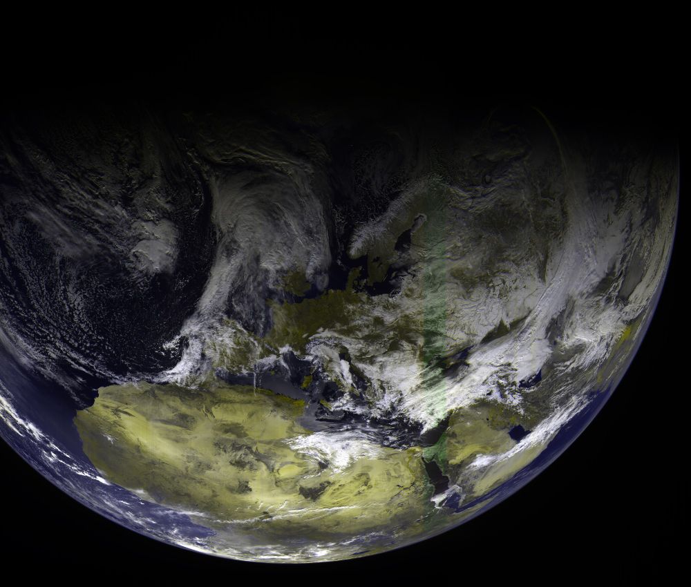
MetOp-SG-A1 METImage @ 09:25UTC X-band @ 100Msps
First METImage instrument images from new MetOp sat. True color composite.
07.11.2025 10:47 — 👍 3 🔁 0 💬 0 📌 0


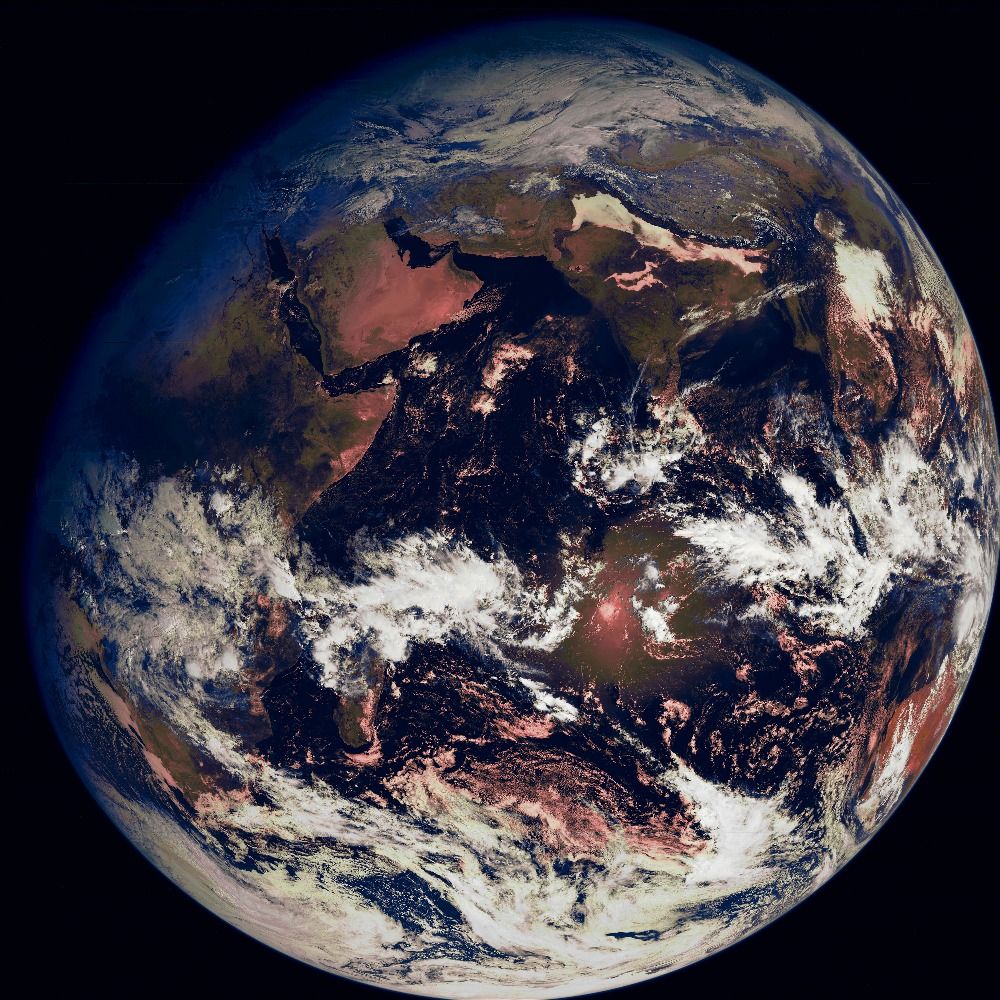
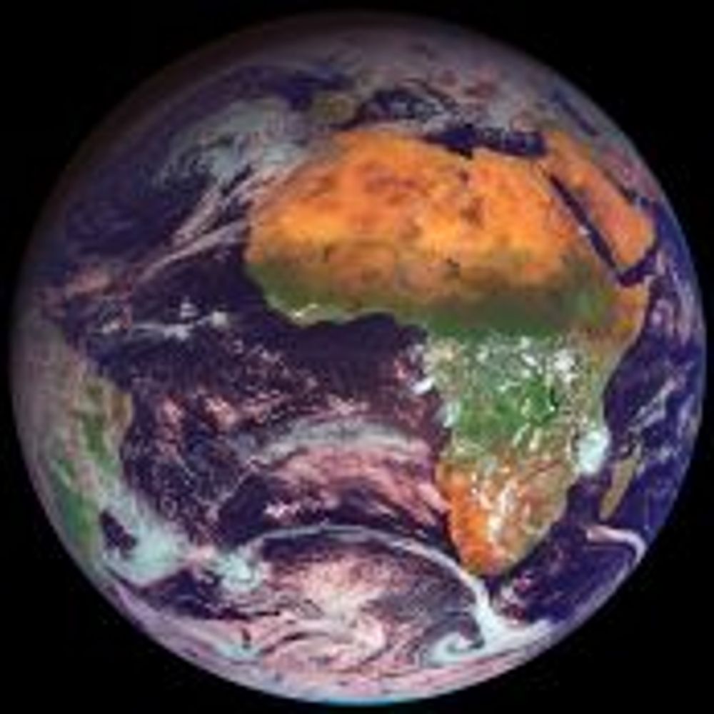
ARKTIKA-M2 RDAS @ 19:15UTC
View on North Hemispehere from Polar region monitoring satellite. Crop on Cat.2 hurricane Gabrielle over Atlantic Ocean
24.09.2025 20:10 — 👍 2 🔁 0 💬 0 📌 0


ARKTIKA-MN2 RDAS @ 20:15UTC
Only channel 2 partially usable, it looks like imagers are shifted
03.09.2025 21:28 — 👍 3 🔁 0 💬 0 📌 0

FY-3D MERSI @ 14:20UTC X-band
West pass at max 25deg, RFNM+Satdump
03.09.2025 15:27 — 👍 3 🔁 0 💬 0 📌 0

MetOp-SGA1 MWS @ 10:20UTC X-band
First image decoded from new MetOp sat. RFNM + Satdump verywip
02.09.2025 14:07 — 👍 4 🔁 0 💬 0 📌 0

AQUA MODIS @ 11:32UTC X-band
Max elev 26deg, RFNM + Satdump
01.09.2025 14:23 — 👍 3 🔁 0 💬 0 📌 0

First test from MetOp SGA-1 X-band
31.08.2025 10:22 — 👍 5 🔁 0 💬 0 📌 0
Im affraid its pointed on GS - M2 probably Moscow, M1 somewhere deeper into russia. The beam is pretty narrow so its impossible to get the signal when you are far from the GS
20.03.2025 21:58 — 👍 1 🔁 0 💬 1 📌 0


NOAA-20/SUOMI NPP VIIRS @ 12:10/10:10UTC X-band
True color composite, east and west pass
20.03.2025 13:02 — 👍 3 🔁 0 💬 0 📌 0

SUOMI NPP VIIRS @ 12:15UTC X-band
True color composite
08.03.2025 13:03 — 👍 2 🔁 0 💬 0 📌 0


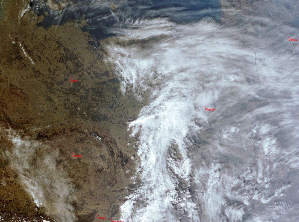
MTG-I1 FCI @ 12:00UTC Ku-band Eumetcast HVS
true color composite + crop on Poland #satdump
07.03.2025 14:31 — 👍 2 🔁 0 💬 0 📌 0


EWS-G2 GVAR @ 12:14UTC L-band
Full disk + crop on EU
05.03.2025 13:03 — 👍 2 🔁 0 💬 0 📌 0

FY-3D MERSI @ 11:45UTC X-band
221 composite, east pass
04.03.2025 15:41 — 👍 2 🔁 0 💬 0 📌 0


EWS-G2 GVAR @ 12:14UTC L-band
Full disk with view on two tropical storms Garance and Honde near Madagaskar. Crop on storm Garance with wind ~110km/h, heading Reunion Island where its predicted it will became tropical cyclone
26.02.2025 12:57 — 👍 3 🔁 0 💬 0 📌 0

NOAA-21 VIIRS @ 12:10UTC X-band
Long pass from Egypt to Iceland, true color composite
19.02.2025 14:17 — 👍 2 🔁 0 💬 0 📌 0
ARKTIKA-M2 RDAS @ 10:30UTC X-band
221 composite using latest satdump wip, strong signal ~15dB snr
18.02.2025 11:47 — 👍 4 🔁 0 💬 1 📌 0


ELEKTRO-L3 RDAS @ 08:30UTC X-band
221 composite with zoom on tropical storm Taliah
17.02.2025 10:37 — 👍 3 🔁 0 💬 0 📌 0


NOAA-21 DNB @ 01:37/23:55UTC X-band
Day Night band view on west and east pass, max elev 40 deg
16.02.2025 02:09 — 👍 3 🔁 0 💬 0 📌 0

AQUA MODIS @ 13:15UTC X-band
True color composite, max elev 30 deg
30.01.2025 13:48 — 👍 3 🔁 0 💬 0 📌 0

EWS-G2 GVAR @ 12:15UTC L-band
30.01.2025 12:49 — 👍 3 🔁 1 💬 0 📌 0


ARKTIKA-M2/FY-3D @ 11:30/14:00UTC X-band
View on storm Eowyn over Ireland, Scotland and UK
24.01.2025 15:20 — 👍 2 🔁 0 💬 0 📌 0

ARKTIKA-M2 RDAS @ 11:15UTC X-band
View on massive storm Eowyn heading Ireland and UK from polar region monitoring satellite
23.01.2025 23:24 — 👍 12 🔁 2 💬 0 📌 0

NOAA-21 VIIRS @ 12:15UTC X-band
321 composite, max elev 32 deg
Full res : ibb.co/k8FgSWN
23.01.2025 14:43 — 👍 2 🔁 0 💬 0 📌 0


NOAA-20 VIIRS @ 12:00/10:20UTC X-band
West and east pass @ 40 deg elev, true color
21.01.2025 13:07 — 👍 2 🔁 0 💬 0 📌 0


AQUA MODIS @ 13:15/11:40UTC X-band
West and east pass in true color
Full res : ibb.co/rMy2V9R
20.01.2025 18:26 — 👍 3 🔁 0 💬 0 📌 0
Associate professor of astronomy at Palomar College, user of smart telescopes. 🔭 Blog: http://visiblesuns.blogspot.com/
New space photos whenever the sky is dark, clear, the equipment is working, and I have time and energy. :P
#astrophotography #astronomy #space #stars #nightsky #milkyway #universe #astro #astrophoto #cosmos #telescope #nebula #deepsky #stargazing
THE CURE FORMED IN CRAWLEY, SUSSEX, ENGLAND. PLAYED ITS FIRST SHOW IN 1978.
Official account for The Cure / @robert.thecure.com
Author of Club Log, a web-based application that analyses log files from a global community of radio amateurs.
https://status.clublog.org
Professor of Criminal Justice
Amateur Radio Enthusiast, W8JJ
HF Contester | CW | SSB | Digital
https://www.qrz.com/db/w8jj
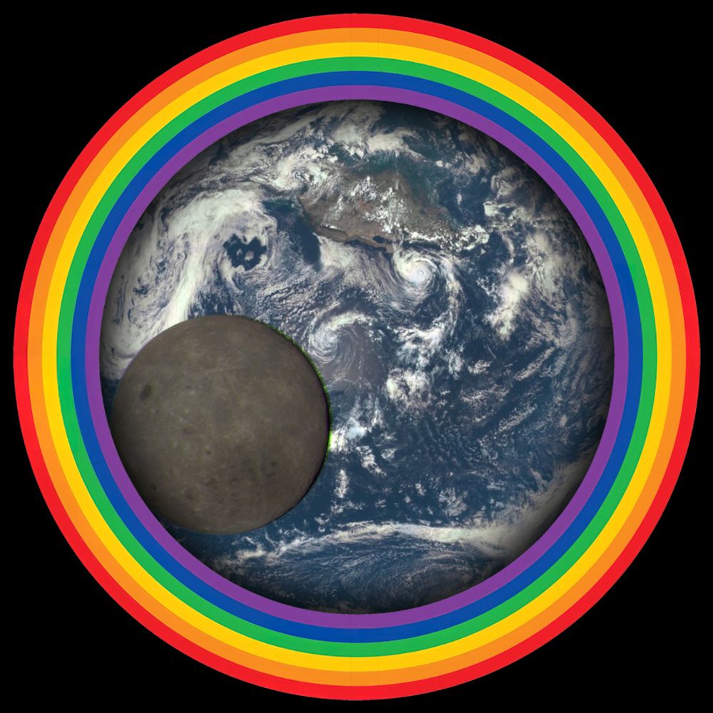
A feed of photos of the Earth from NASA's DSCOVR EPIC camera. Note that this is not an official NASA account.
For more DSCOVR:EPIC information, see epic.gsfc.nasa.gov
Managed by 🔴 @redshift.pics
The European Southern Observatory designs, builds & operates world-class observatories on the ground for the benefit of society. More info on eso.org
Spacecraft systems engineer, amateur astrophotographer, general space nerd
Climate scientist, juggler. Bikes etc. Blogging at https://www.realclimate.org - data visualization, explainers, and debunking.
I work at the European Space Agency as the mission scientist for the Sentinel-2 and Sentinel-3 next generation missions.
I mainly post nice pictures of the Earth from space!
Note: Not an official ESA account, opinions are my own and mine alone!
Coordinator Radio Observers Werkgroep Kunstmanen,
Radio amateur PE1PSJ, Microwave experimenter.
Location:Netherlands near Rotterdam
kunstmanen.net
Interactive weather map and hurricane tracker.
Get our app 👉 https://zoom.earth/app
A random 21yo interested in satellites and other stuff :-)
Probably mostly known as SatDump's author.
http://ko-fi.com/aang23
Radioamateur, interested in satellites, and microwave electronics. 21M
HAM Radio operator. Enthusiast of technology, and Open Source. Nature beauty admirer. Likes to travel. Destination is not a goal but adventure is.
QTH: nr Warsaw, Poland; Member: #SP5POT #SP5MASR
#hamradio #linux #freebsd #sysadmin #retrocomputing
Started with #art & #photography when life became different due to illness. So now I have found a great new creative path to walk on, discovering new artsy things along the way......
Just a dude with a dish and dangerously easy access to a compiler.