We are so looking forward to this! Please join us tomorrow from 7pm.
26.01.2026 12:16 — 👍 9 🔁 6 💬 0 📌 0

Townscape and Architecture in History
Discovery Course 2
Want to learn more about how we look at townscapes as a tool to understand urban & human histories of place?
Join us on 4-6 March with expert guidance on a range of themes, exploring sources, what statutory protection means and how it works and access to the resources of @ihrlibrary.bsky.social. 🗃️
20.01.2026 12:04 — 👍 12 🔁 10 💬 0 📌 2

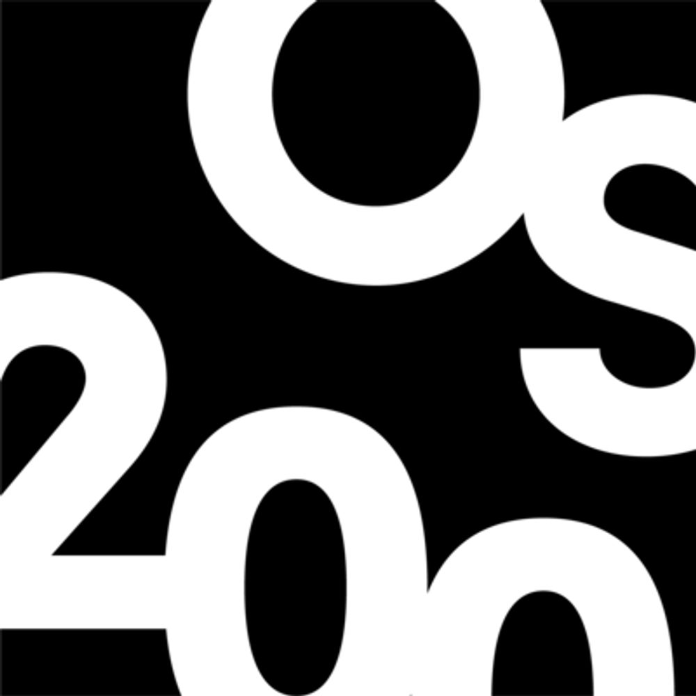
Speakers at the seminar on OS200 in the UL Co-Lab space

It was great to attend the @irelandmapped.bsky.social 'OS200: the world behind the maps' in @ullibrary.bsky.social
The OS is a source with endless research possibilities that was highlighted by the speakers throughout the day & facilitated by @niamhroisin.bsky.social
OS200: dri.ie/os200/spotli...
23.01.2026 16:00 — 👍 4 🔁 2 💬 0 📌 0

Traffic map from The Dublin civic survey report (Liverpool, 1925). Reproduced in IHTA Dublin suburbs no. 1 Clontarf, private collection.

Palace Skating Rink, 1909-13, Rathmines Rd Lower. Reproduced in IHTA Dublin suburbs, no. 2 Rathmines, private collection

Royal Charter School, Clontarf, looking east, 1794 by William Ashford. Reproduced courtesy of the National Gallery of Ireland, 577.
There are c. 150 maps, views and photographs, an essay describing the development of each suburb and histories of over 2000 sites from streets to oyster beds from earliest times to c. 1970
Clontarf by Colm Lennon www.ria.ie/irish-histor...
Rathmines by Séamas Ó Maitiú www.ria.ie/irish-histor...
21.01.2026 13:19 — 👍 3 🔁 3 💬 0 📌 1

Cover image of the Clontarf atlas by Colm Lennon. Turquoise map outline

Cover image of the Rathmines atlas by Seamas O Maitiu. Yellow map outline
Do you like maps? Have you an interest in suburban history?
We are excited to share that for the first time, the atlases of Clontarf and Rathmines are now fully and freely available to download. Originally published by @ria.ie with @dubcitycouncil.bsky.social
Read more: www.ria.ie/2026/01/09/i...
21.01.2026 13:19 — 👍 48 🔁 19 💬 2 📌 2

Map of Ireland showing the towns published and in progress for the Irish Historic Towns Atlas
Our latest town published was Ballyshannon/Béal Átha Seanaidh by Angela Byrne in October 2025. Below are all 32 atlases published along with those that are in progress.
You can browse more here: www.ria.ie/research-pro...
16.01.2026 16:00 — 👍 7 🔁 3 💬 0 📌 0

Irish Historic Towns Atlas - Royal Irish Academy
The Irish Historic Towns Atlas (IHTA) was established with the aim to record the topographical development of a selection of Irish towns both large and small. Each town is published separately as a fa...
These atlases are available to be purchased/browsed via www.ria.ie/research-pro....
The IHTA is part of a European scheme where c. 620 atlases are published following similar guidelines.
Be sure to follow our page to further explore Irish history and keep up to date with the IHTA 🧭🤠
16.01.2026 15:48 — 👍 10 🔁 1 💬 0 📌 0

Excerpt from John Speed's map of Cork city in 1610 showing the line of rivers, walls, houses, bridges, churches etc from a birds eye view on a green background
Hello and welcome to the Irish Historic Towns Atlas BlueSky page! The IHTA is a long-term research programme housed by @ria.ie with the aim to record the topographical development and history of towns across the island of Ireland. To date, 32 atlases have been produced with many more in the works.
16.01.2026 15:48 — 👍 92 🔁 45 💬 3 📌 8
The British Association for Local History is the national charity which promotes local history and serving local historians throughout the UK #WeAreLocalHistory
The Wohl Library of the @ihr.bsky.social is a national resource for everyone researching or writing history. Membership is free to everyone and we are an open access, reference library holding over 200,000 books and journals.
Begun in 1899, the Victoria County History is an encyclopaedic record of England’s places & people.
https://www.history.ac.uk/research/victoria-county-history
The Society for the Study of Nineteenth-Century Ireland promotes an inter-disciplinary approach to Irish studies.
ssnci.org
Tailte Éireann is an independent Government agency providing a property registration system, property valuation service, and national mapping and surveying infrastructure for the State.
Geographer & Head of Subject @ULGeog.bsky.social | FHEA | IRC PI 'OS200' @IrelandMapped.bsky.social | Heritage Council PI 'Locating Bench Marks, Preserving Heritage' | Historical Geography | Digital | GIS | DH | Spatial | Early Maps & Texts
Official account of Queen's University Belfast.
One of the Russell Group’s leading research-intensive universities.
We provide world-class education & research.
RT≠Endorsement.
More: www.qub.ac.uk
House Rules: ow.ly/WFgu50MY7by
The official account for Geography, School of History and Geography, University of Limerick. Follow us for news, events, student info and staff research. https://www.ul.ie/artsoc/history-geography
@irishresearch @ahrcpress joint funded. Digitally Remapping Ireland's Ordnance Survey Heritage. @UniOfLimerick.bsky.social @QUBelfastOfficial.bsky.social @ULGeog.bsky.social @QUBGeography
Implementing the Strategic Heritage Plan 2024-29 @dubcitycouncil.
Proud to be part of the @heritagecouncil.ie's Heritage Officer Network.
Email: heritage@dublincity.ie
Historian of Urban 19-20th c. Ireland/UK.
Director @VirtualTreasury
Views are all my own.
Community Radio for Northside Dublin. The official account for Near FM 90.3. Reposts are not an endorsement. nearfm.ie/livestream RCN: 20205453
An Taisce — the National Trust for Ireland
Heritage | Nature | Climate
www.AnTaisce.org
Donations: https://www.antaisce.org/donate
Membership: https://membership.antaisce.org
Registered Charity: 20006358
Dedicated to empowering Ireland to value and care for its national heritage. Advisor to government on heritage policy. Grant giving body. Operates and collaborates on programmes that raise awareness, educate and conserve heritage for future generations.
Cartographic editor @ihtaria.bsky.social
Maps, towns, music and making things
Historian of Ireland, cities, folklore, photographs, bicycles, raindrops and other ephemera. Associate Prof Modern History at University of Bristol. I blog about weather and urbanization here: https://rainandtheirishcity.com/
Historical researcher into Dublin Corporation and the Irish revolutionary generation 1898-1923. See ‘Dublin City Council and the 1916 Rising’ (Four Courts Press, 2016)
- Nothing here represents views of any employer or organisation, past or present -
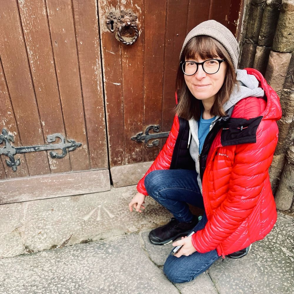
Academic geographer on a long journey. Coventry kid, washed up on Ireland's shore. Interests in bench marks, industrial archaeology, maps and mapping, new towns, landscape histories, medieval stuff, pottering about on my bike, being outdoors 🚵
A @dubcitycouncil.bsky.social initiative to imagine, trial and establish solutions that improve living in the city. www.dccbeta.ie
You can see the status of the various BETA Projects here https://trello.com/b/8jXnfMIO/beta-project-pipeline