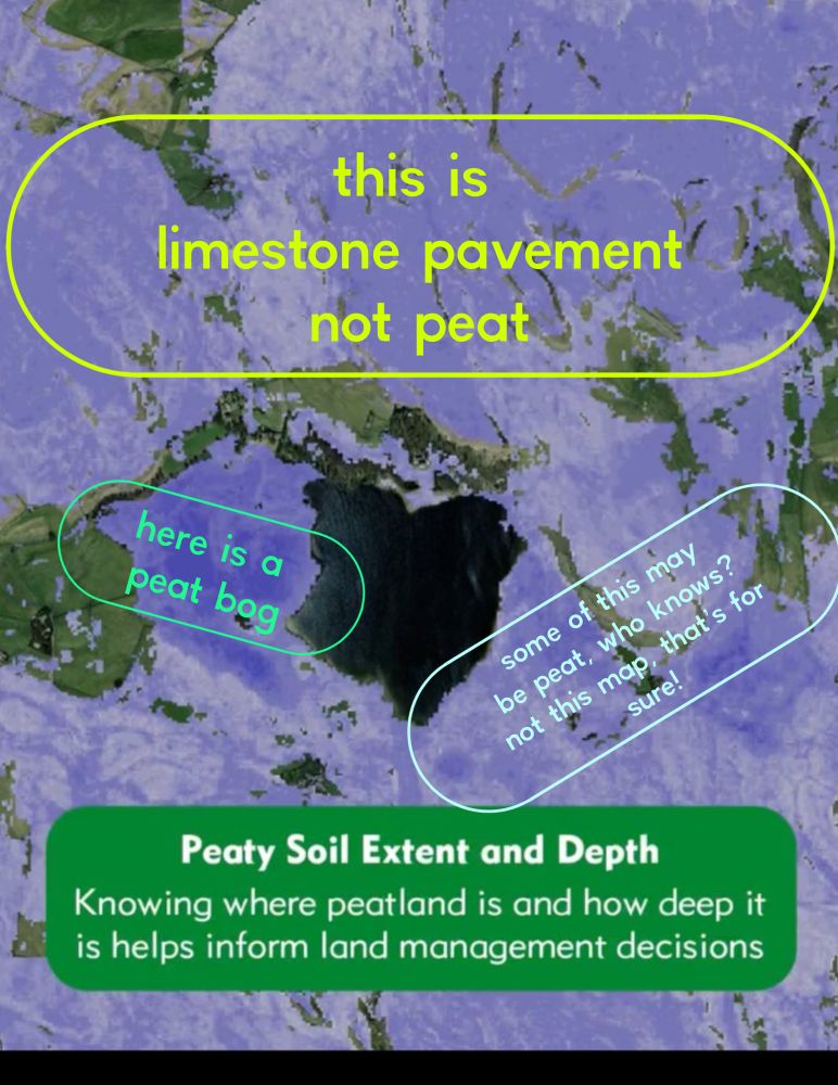
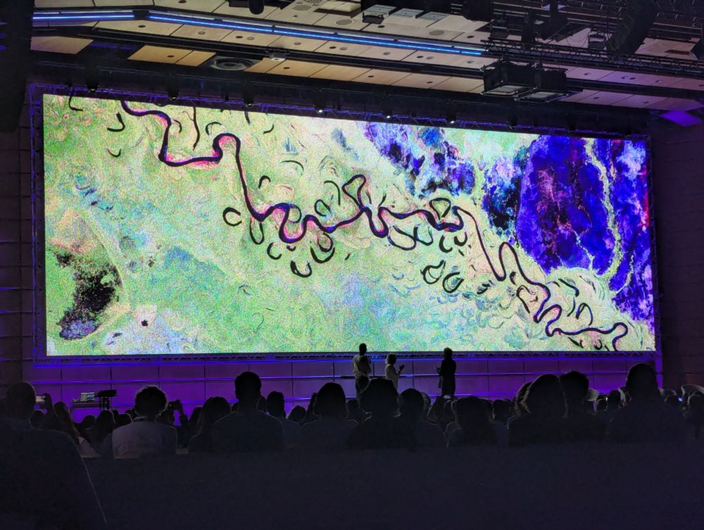
The screen shot of the peat map launch material showing that it’s mapping limestone as peat while claiming to be great!
Look, I know asking for any organisation to say ‘oops we seem to have made a number of sizeable mistakes here’ is a big ask, let alone a big government organisation like @naturalengland.bsky.social
however…
The new natural England peat map is chaos on an epic scale and should go away! Please.
28.07.2025 11:42 — 👍 5 🔁 2 💬 0 📌 0
Watch @oliviablakemp.bsky.social’s brutal takedown of driven grouse shooting in just 90 seconds from last weeks debate in Parliament.
@wildjustice.bsky.social
06.07.2025 11:18 — 👍 2492 🔁 654 💬 53 📌 31
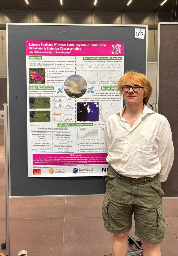
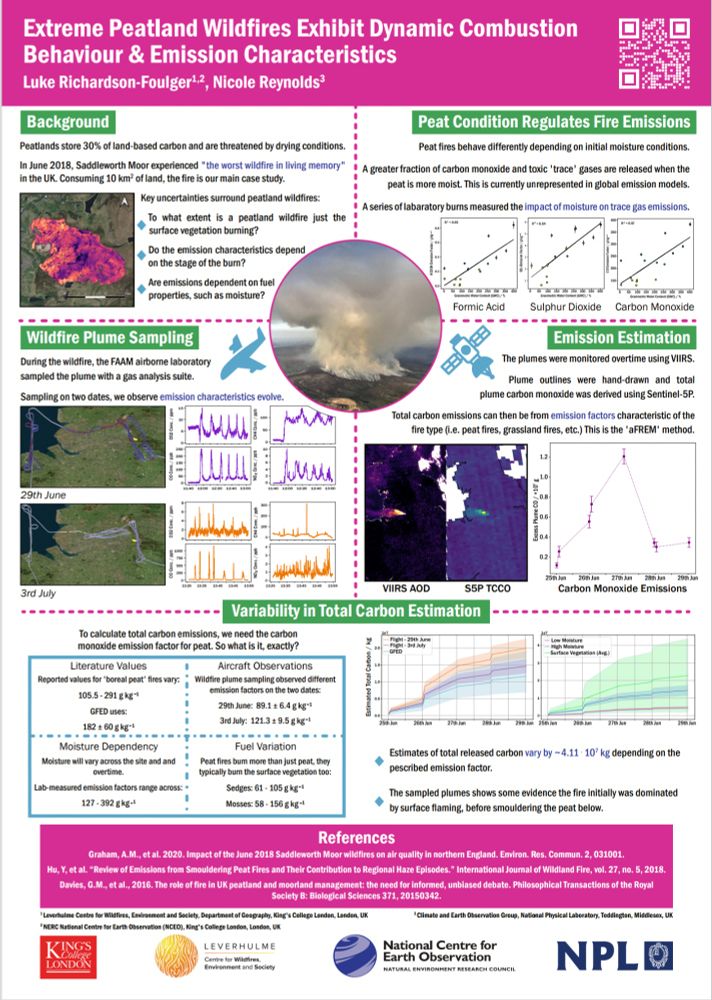
Peatland wildfire emissions dynamically evolve according to its stage and condition - with potential consequences for global fire emissions models. #LPS25 #peatlands
27.06.2025 07:57 — 👍 4 🔁 0 💬 0 📌 0
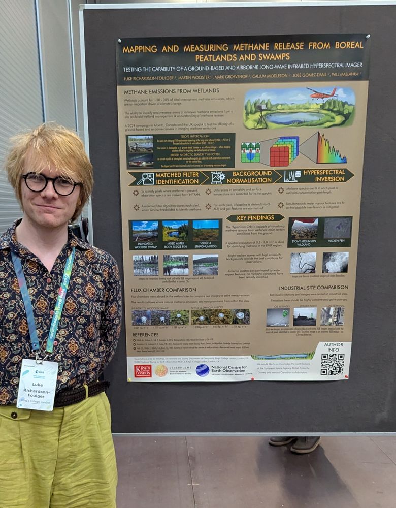
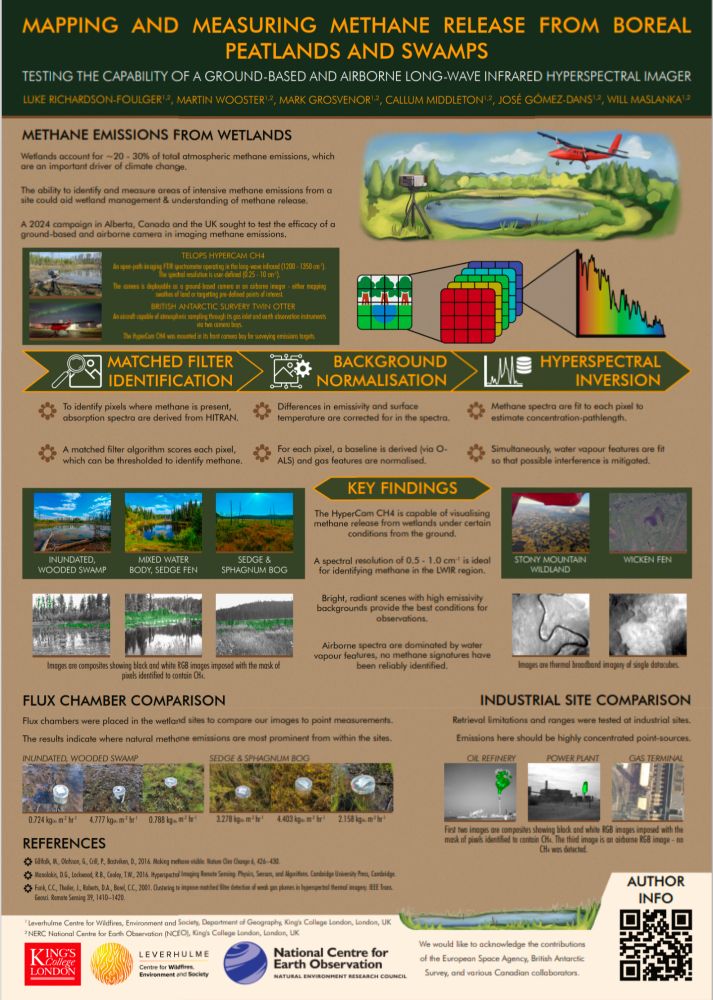
Hyperspectral imaging of disperse methane emissions from #peatlands! Presented yesterday at the Living Planet Symposium...
25.06.2025 12:02 — 👍 2 🔁 0 💬 0 📌 0
First day of the Living Planet Symposium #LPS25 in Vienna! Debut image from the Biomass mission was fantastic to see. Exciting times ahead...
24.06.2025 10:57 — 👍 4 🔁 0 💬 0 📌 0
Excellent swamp 💚
18.06.2025 16:35 — 👍 1 🔁 0 💬 0 📌 0
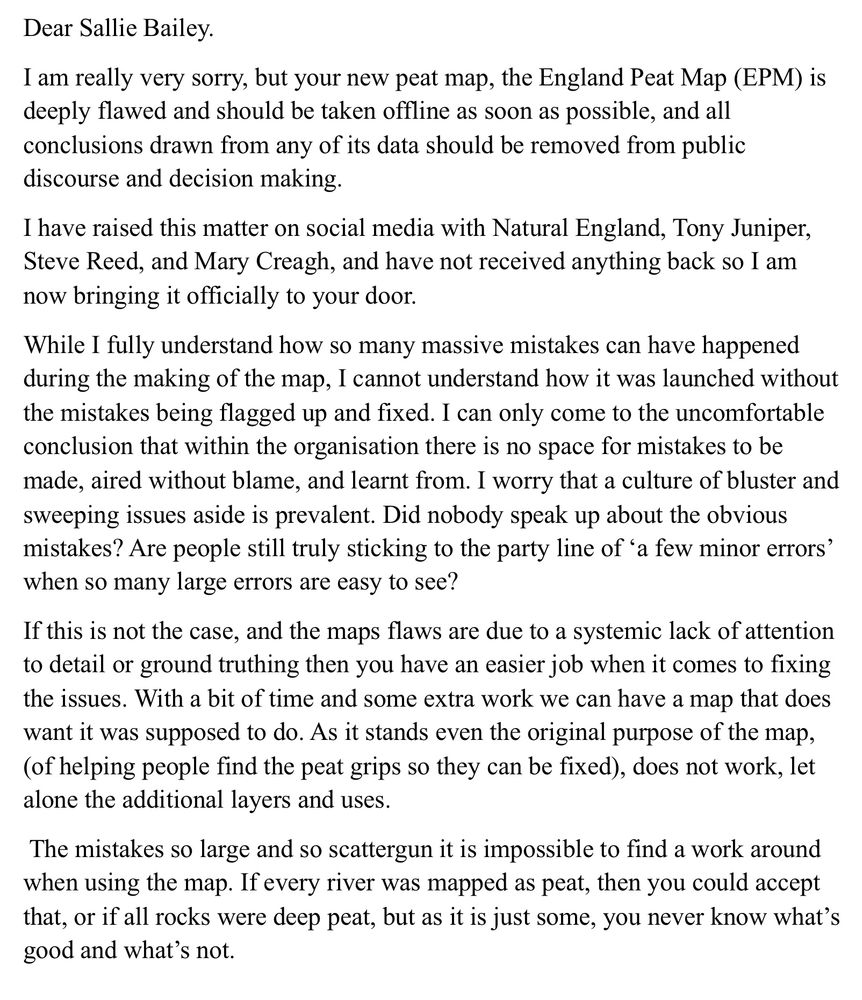
My letter screenshot. Dear Sallie Bailey.
I am really very sorry, but your new peat map, the England Peat Map (EPM) is deeply flawed and should be taken offline as soon as possible, and all conclusions drawn from any of its data should be removed from public discourse and decision making.
I have raised this matter on social media with Natural England, Tony Juniper, Steve Reed, and Mary Creagh, and have not received anything back so I am now bringing it officially to your door.
While I fully understand how so many massive mistakes can have happened during the making of the map, I cannot understand how it was launched without the mistakes being flagged up and fixed. I can only come to the uncomfortable conclusion that within the organisation there is no space for mistakes to be made, aired without blame, and learnt from. I worry that a culture of bluster and sweeping issues aside is prevalent. Did nobody speak up about the obvious mistakes? Are people still truly sticking to the party line of 'a few minor errors' when so many large errors are easy to see?
If this is not the case, and the maps flaws are due to a systemic lack of attention to detail or ground truthing then you have an easier job when it comes to fixing the issues. With a bit of time and some extra work we can have a map that does want it was supposed to do. As it stands even the original purpose of the map, (of helping people find the peat grips so they can be fixed), does not work, let alone the additional layers and uses.
The mistakes so large and so scattergun it is impossible to find a work around when using the map. If every river was mapped as peat, then you could accept that, or if all rocks were deep peat, but as it is just some, you never know what's good and what's not.
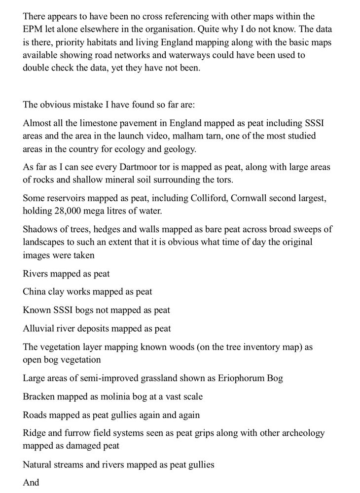
There appears to have been no cross referencing with other maps within the
EPM let alone elsewhere in the organisation. Quite why I do not know. The data is there, priority habitats and living England mapping along with the basic maps available showing road networks and waterways could have been used to double check the data, yet they have not been.
The obvious mistake I have found so far are:
Almost all the limestone pavement in England mapped as peat including SSSI areas and the area in the launch video, malham tarn, one of the most studied areas in the country for ecology and geology.
As far as I can see every Dartmoor tor is mapped as peat, along with large areas of rocks and shallow mineral soil surrounding the tors.
Some reservoirs mapped as peat, including Colliford, Cornwall second largest, holding 28,000 mega litres of water.
Shadows of trees, hedges and walls mapped as bare peat across broad sweeps of landscapes to such an extent that it is obvious what time of day the original images were taken
Rivers mapped as peat
China clay works mapped as peat
Known SSSI bogs not mapped as peat
Alluvial river deposits mapped as peat
The vegetation layer mapping known woods (on the tree inventory map) as open bog vegetation
Large areas of semi-improved grassland shown as Eriophorum Bog
Bracken mapped as molinia bog at a vast scale
Roads mapped as peat gullies again and again
Ridge and furrow field systems seen as peat grips along with other archeology mapped as damaged peat
Natural streams and rivers mapped as peat gullies
And
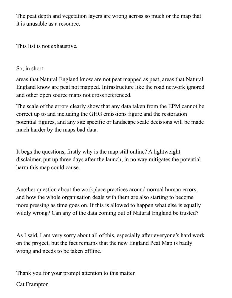
The peat depth and vegetation layers are wrong across so much or the map that it is unusable as a resource.
This list is not exhaustive.
So, in short:
areas that Natural England know are not peat mapped as peat, areas that Natural England know are peat not mapped. Infrastructure like the road network ignored and other open source maps not cross referenced.
The scale of the errors clearly show that any data taken from the EPM cannot be correct up to and including the GHG emissions figure and the restoration potential figures, and any site specific or landscape scale decisions will be made much harder by the maps bad data.
It begs the questions, firstly why is the map still online? A lightweight disclaimer, put up three days after the launch, in no way mitigates the potential harm this map could cause.
Another question about the workplace practices around normal human errors, and how the whole organisation deals with them are also starting to become more pressing as time goes on. If this is allowed to happen what else is equally wildly wrong? Can any of the data coming out of Natural England be trusted?
As I said, 1 am very sorry about all of this, especially after everyone's hard work on the project, but the fact remains that the new England Peat Map is badly wrong and needs to be taken offline.
Thank you for your prompt attention to this matter
It’s been a whole month since the peat map of England was launched!
It’s still very wrong
And it’s still online
So I’ve written a open letter to @naturalengland.bsky.social
I am starting to worry that massive mistakes are just a thing with the whole organisation.
What else is wildly wrong?
16.06.2025 07:33 — 👍 32 🔁 20 💬 3 📌 4
Was glad to help review this interesting piece on elusive 'zombie fires'!
26.03.2025 16:50 — 👍 0 🔁 0 💬 0 📌 0
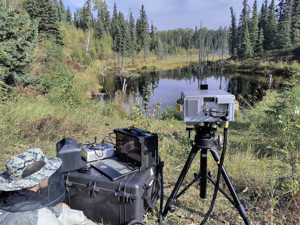
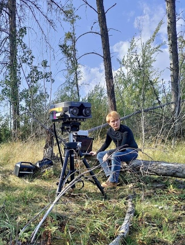
Wetland site with scientific equipment measuring it.
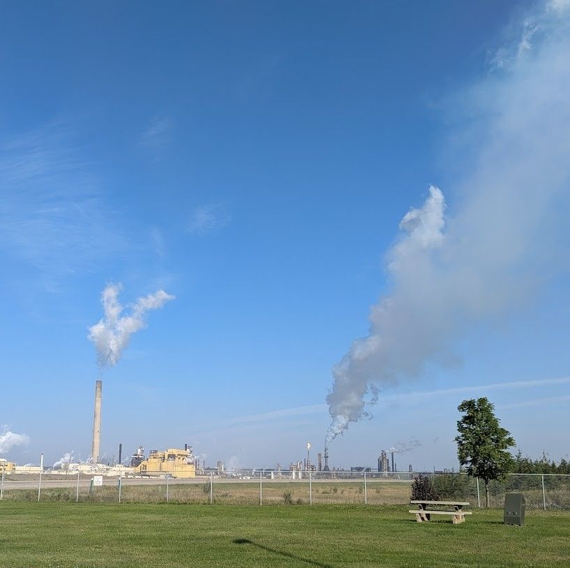
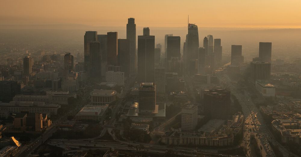
Scene of industry with plumes.
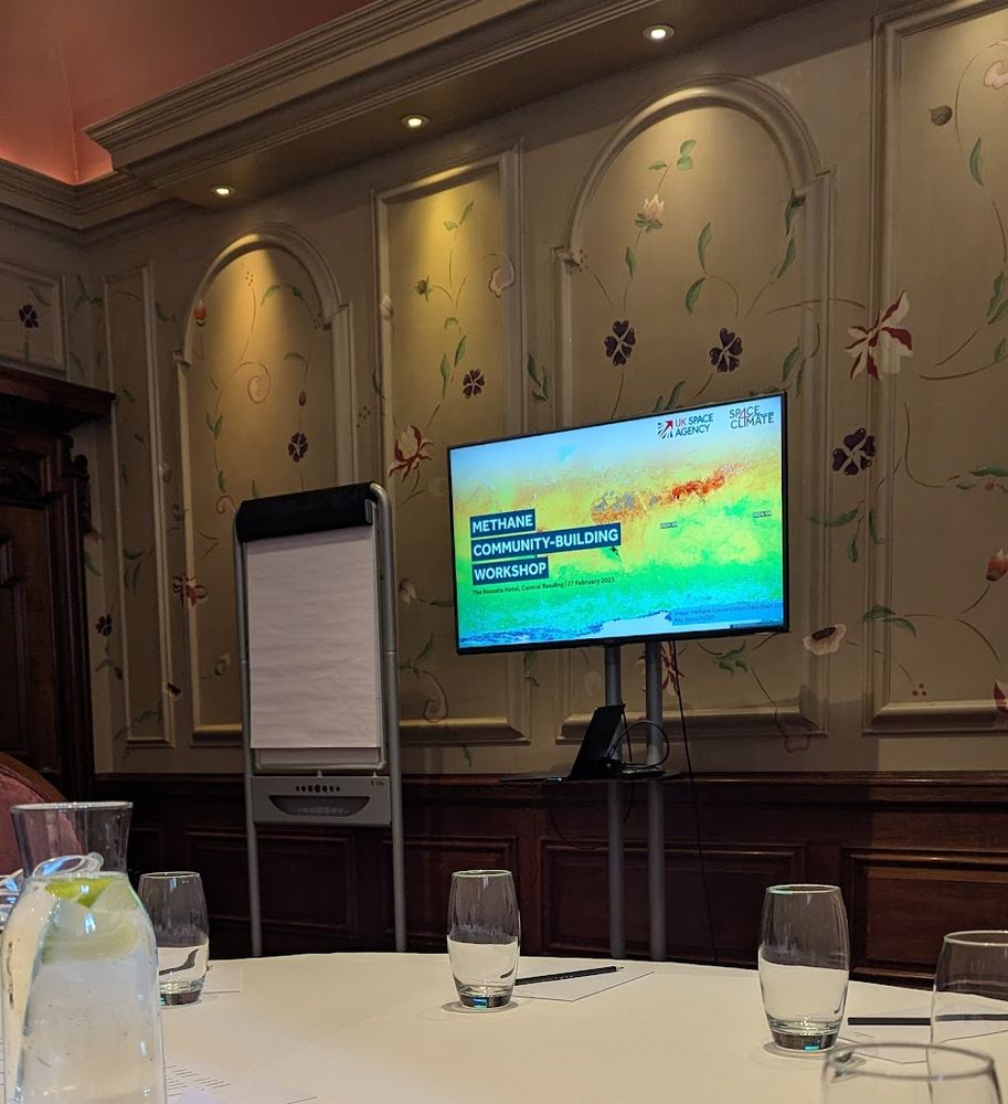
Last month, @space4climate.bsky.social hosted a methane community workshop, uniting UK expertise from academia, industry & government ahead of #COP30.
Methane is a major climate driver—better management of #wetlands, #wildfires & industry can often curb extreme emissions.
Thanks for having me!
13.03.2025 16:48 — 👍 2 🔁 0 💬 0 📌 0
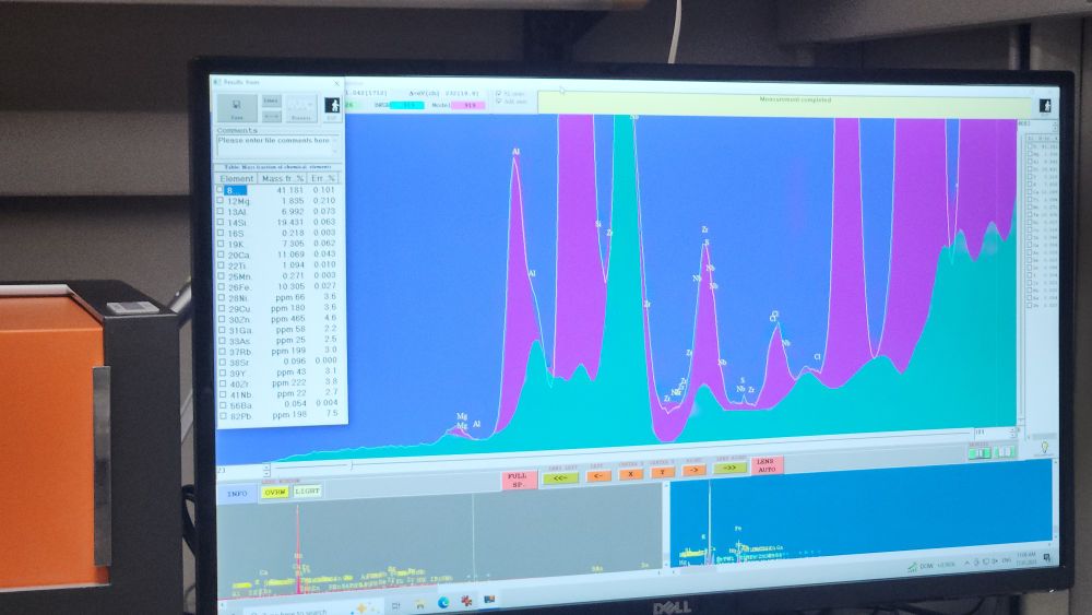
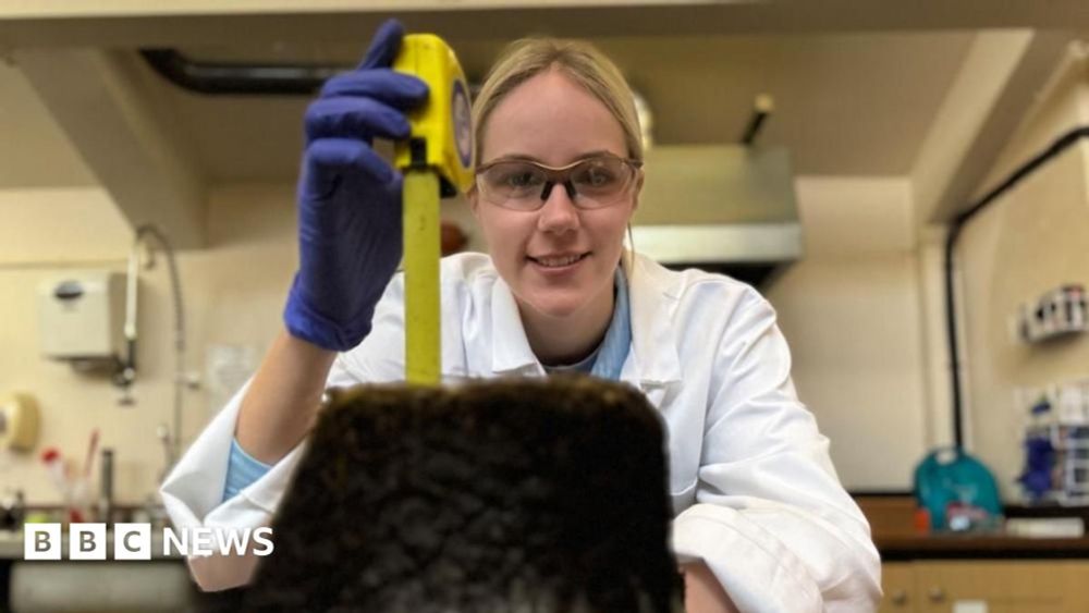
A computer screen with a display showing output from an xray diffraction spectrometer.
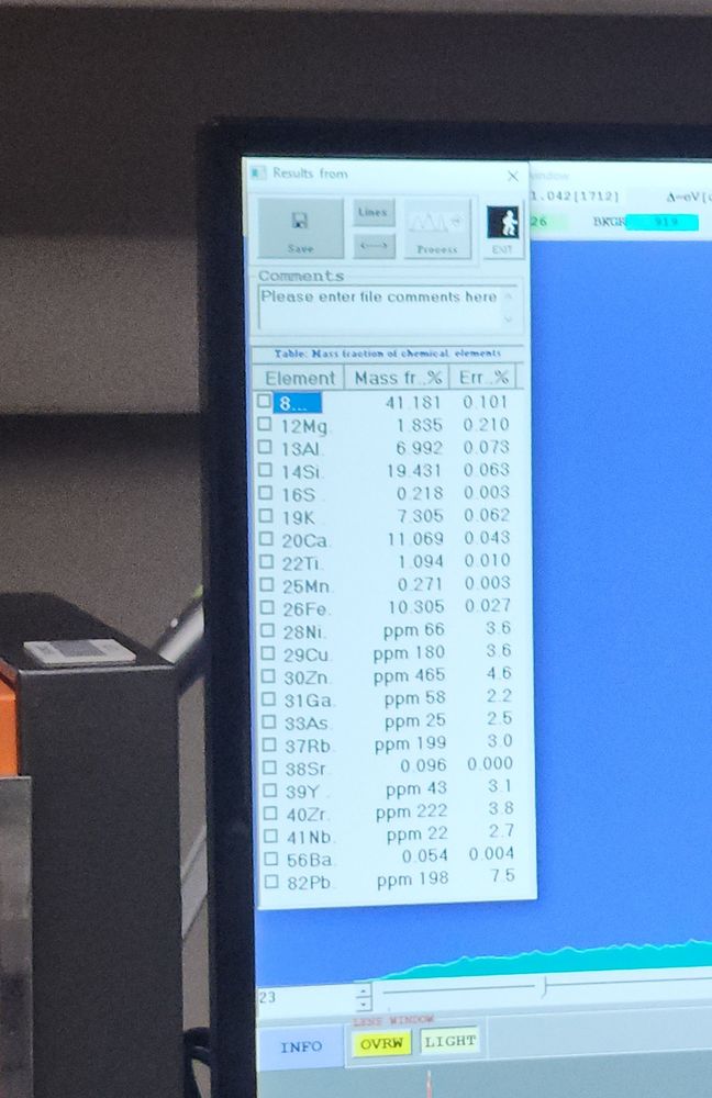
Close up view showing fraction of metals. Fun stuff.
Just had a sample of the Eaton Fire ash that is in my driveway run on the department XRF. Is there titanium (new house paint)? Yup. Lead (old house paint)? You betcha. Heavy metals? Check. Treat that ash like it's toxic folks (because it is)
17.01.2025 19:49 — 👍 4755 🔁 2095 💬 119 📌 144
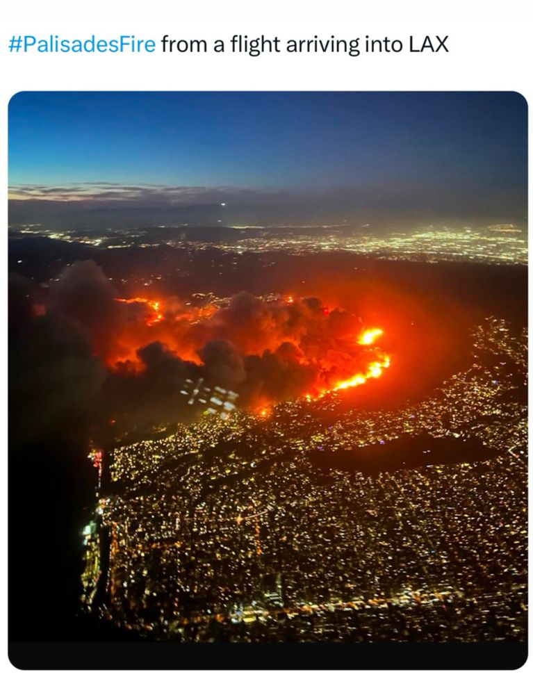
Smoke inhalation — even for seconds - can impair consciousness.
To anyone in the immediate vicinity of this unprecedented fire in the nations most populous county, urgently heed the evacuation orders NOW.
Smoke is as dangerous as the flames behind them.
08.01.2025 04:34 — 👍 11021 🔁 3063 💬 250 📌 165
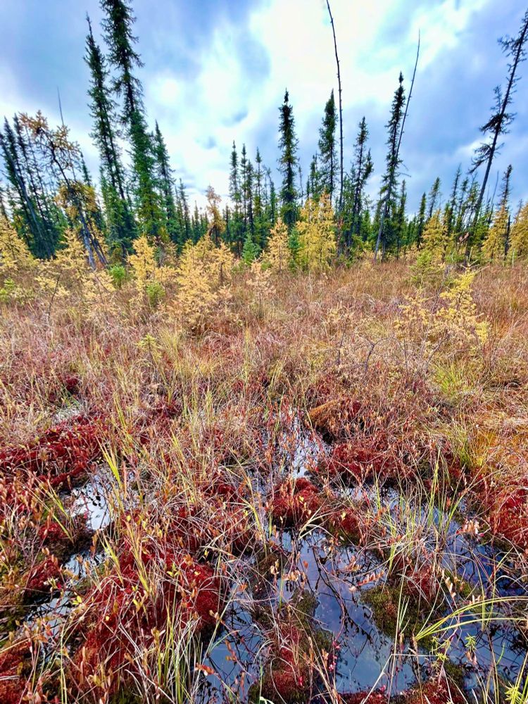
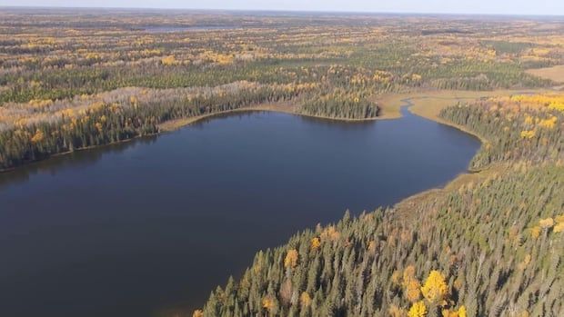
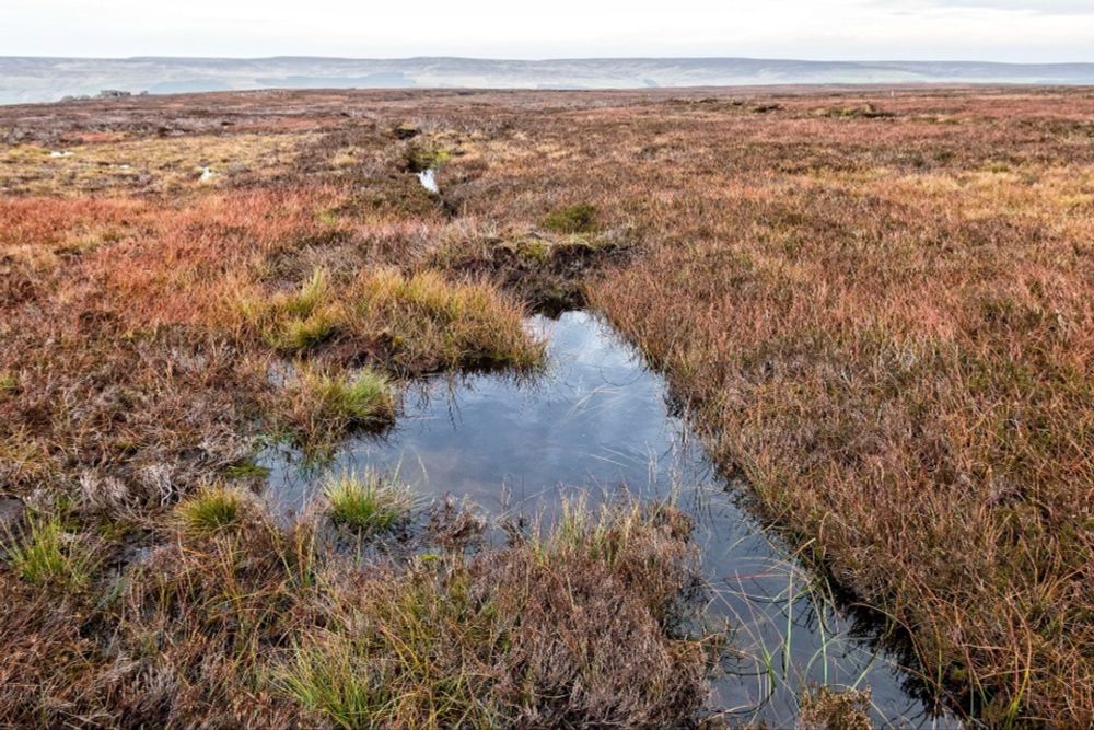
Photo of a very beautiful bog.
Help restore my faith in the world. Who loves a good bog? Make yourselves known! For bogs are - time keepers, death defiers, artifact protectors, carbon trappers, water purifiers, food providers, beautiful mysterious places
17.12.2024 21:37 — 👍 759 🔁 99 💬 62 📌 15
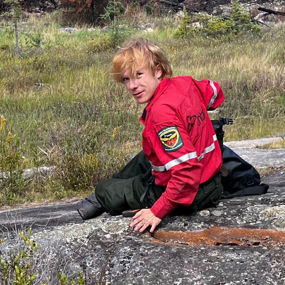
Hello World! I'm Luke, a PhD student at @kingscollegelondon.bsky.social, NCEO, & @centrewildfires.bsky.social studying peatland wildfires 🔥🌿: their emissions, climate impact, and human health effects. My work utilises infrared remote sensing, earth observation, and a lot of soil.
17.12.2024 12:28 — 👍 11 🔁 2 💬 1 📌 0
We believe that avoiding devastating wildfires requires urgent, innovative, and collaborative solutions. Our mission is to bring people together to break down the barriers that currently exist between wildfire-related data, models, and tools.
The GWC facilitates scientific & strategic collaboration among research scientists, national policymakers, local communities, & firefighters to enable wildfire resilience & recovery for human & natural ecosystems.
https://globalwildfirecollective.org/
Professor at the University of Ottawa studying contentious CLIMATE POLITICS. Especially interested in aviation/high-speed rail; nuclear debate; green/de-growth; meat production/consumption; and all things Canada🇨🇦. Co-Host http://EcopoliticsPodcast.ca
Science administrator at CU Boulder. Study air quality and pollution emissions, all things wildfire and open burning. Women in science. Go Buffs!
🔥🛰️🌱 Science, mainly.
🔵Nicer online than in-person.
⚪️Actual real-life Kentucky hillbilly, currently California resident.
🔴Personal account. I do not speak for my employer, all posts mine alone.
Koerner Chair in Wildfire Coexistence @ University of British Columbia in Vancouver, Canada. Interested in forest dynamics, wildfire, cultural burning, disturbance regimes, human impacts & interactions with climate change 🌲🔥🌎
The Best Movie House on Leicester Place.
Please contact us here if you have any questions: boxofficemanager@princecharlescinema.com
https://princecharlescinema.com
https://www.twitch.tv/shaun_vids
https://www.youtube.com/@Shaun_vids
https://www.patreon.com/shaunfromyoutube
Your worlds. Your way. Projects: Grounded 2, Avowed, The Outer Worlds 2, Pentiment, Grounded merch 👉 http://gear.xbox.com
Geographer interested in 🛰️ EarthObservation for 🌿agriculture, 💧water resources, and 🌍 sustainable land management.
F.R.S. FNRS Postdoctoral Fellow 🇪🇺
Earth & Life Institute - UCLouvain 🇧🇪
Earth Observation Lab - HUBerlin 🇩🇪
The Director General of the European Space Agency
Postdoc in KCL dept of geography researching remote sensing of landscape fire and smoke emissions estimation.
Remote sensing of our living environment from space-borne to UAS/UAV, from the tropics to the Arctic -- at @uni-wuerzburg.de, Germany -- https://www.remote-sensing.org http://www.earth-observation.org - managed by Dr Martin Wegmann
Collage Artist, Magic the Gathering Artist, Fiction Cover Artist, Comic Cover Artist, Private Commissions. More at Bad-King.com
European Centre for Medium-Range Weather Forecasts
For press enquiries or for general queries to the Service Desk, please visit http://ecmwf.int/en/about/media-centre
Menswear writer. Editor at Put This On. Words at The New York Times, The Washington Post, The Financial Times, Esquire, and Mr. Porter.
If you have a style question, search:
https://dieworkwear.com/ | https://putthison.com/start-here/
Dartmoor based artist and Farmer who believes land layering is possible - She/her - Team waxcap/dung beetle/nature - it’s always more complicated than that!
We're here to establish thriving #nature for people and planet by building partnerships for nature’s recovery.
Assemblymember. Democratic Nominee for Mayor of NYC. Running to freeze the rent, make buses fast + free, and deliver universal childcare. Democratic Socialist. zohranfornyc.com