Overlooking Pearl River near Bogalusa, LA @vincentledvina.bsky.social
12.11.2025 04:50 — 👍 33 🔁 5 💬 1 📌 0

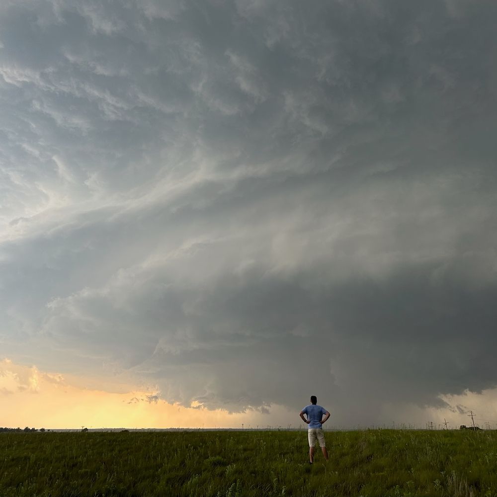
West of Lumberton, MS
12.11.2025 03:21 — 👍 3 🔁 0 💬 0 📌 0
Brief glimpse of aurora on the horizon in Slidell, LA @vincentledvina.bsky.social
12.11.2025 01:58 — 👍 2 🔁 0 💬 0 📌 0

Regarding the sonde from yesterday morning with the 219-kt spot wind, highest dropsonde wind ever seen in a TC, AOML/HRD shared the raw data and I took a look this morning. They’ll have the final call, but I see nothing wrong with the ob and I suspect it’s going to hold up.
29.10.2025 17:54 — 👍 69 🔁 14 💬 2 📌 1
“Everyone wants more warning time, and that’s why we’re working to upgrade the technology that’s been neglected for far too long to make sure families have as much advance notice as possible,” Noem said. The reality: Closing NOAA labs like NSSL, critical for flash flood forecasts & research.
07.07.2025 15:48 — 👍 127 🔁 57 💬 6 📌 1
One of the primary tools we use to predict flash floods is the NSSL's Multi-Radar/Multi-Sensor System. "I’ve zero doubt NWS forecasters were leveraging that tool that evening to issue flash flood warnings. NSSL and associated projects are slated for elimination in NOAA’s proposed 2026 budget."
07.07.2025 14:11 — 👍 69 🔁 27 💬 0 📌 0
This is the most sinking motion (+VP200) observed over Africa in AMJ since 2015.
MJO phase 5-7 has been favored recently which is a mixed bag for subseasonal TC favorability of the Atlantic.
SW Atlantic & subtropics appear to be the hot spots for TCs generally.
Plots: @webberweather.bsky.social
07.07.2025 15:35 — 👍 3 🔁 0 💬 0 📌 0
90-day avg VP200 anomalies since April show how forcing aloft has evolved from spring into summer.
🟢 Rising motion over west Africa has waned
🟤 Sinking motion has increased over West IO (-IOD)
🟢 Rising has increased over maritime continent (-ENSO)
🟤 Sinking has increased over the Amazon
07.07.2025 15:30 — 👍 3 🔁 0 💬 0 📌 1
Deep convection east of the center of #Chantal is causing stronger pressure falls which is elongating and pulling the low-level center NE closer to the tilted mid-level center of the storm.
This is how TCs attempt to remedy the negative effects of wind shear and reorganize.
05.07.2025 16:30 — 👍 6 🔁 2 💬 0 📌 1
TS #Chantal has gradually deepened since the last recon flight yesterday despite being quite lopsided due to SW wind shear.
While the west side is barren, the eastern side will be capable of gusty winds in excess of 50 mph and heavy rainfall as it moves into the Carolinas on Sunday.
05.07.2025 15:52 — 👍 1 🔁 1 💬 0 📌 1
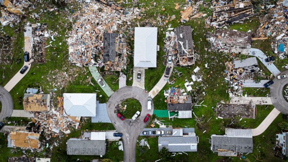
Tragic. Deadliest U.S. flash flood since 39 were killed in Kentucky in July 2022. “A remnant tropical system (Barry), moisture levels in the 99th percentile or higher, forced upward motion due to geography and wind direction, and plentiful instability. That's a recipe for flash flooding.”
05.07.2025 14:30 — 👍 50 🔁 17 💬 0 📌 0
#Invest92L continues to gradually organize and AF recon has identified a closed surface center on the west edge of the deep convection.
A subtropical or tropical cyclone is forming, and some strengthening could occur before SE US landfall this weekend.
Next 🌀 name is Chantal.
04.07.2025 19:36 — 👍 4 🔁 3 💬 0 📌 0
Buckle up for the upcoming peak of the 2025 hurricane season. And possibly for 25 seasons after that. As seen on @nbcmiami.com 📺
#StandUpForScience #ScienceUnderSiege #NOAA #HurricaneSeason #ScienceMatters #TogetherForScience
04.07.2025 11:44 — 👍 112 🔁 45 💬 5 📌 7
Convection continues to become more concentrated and organized on the tail-end of a decaying front, and a broad low is developing as a result.
Despite SW shear, dry air, and limited time over water, a TC could develop over the weekend before impacting the SE US with heavy rain and gusty winds.
04.07.2025 14:45 — 👍 4 🔁 2 💬 0 📌 1
A comprehensive article of what is at stake with the current budget proposed by the DoC ➡️ NOAA.
Nearly every aspect of what we do at NHC has been touched by NOAA Research in one facet or another to our benefit.
#AOML, #CIMSS, #CIRA, #CIMAS all play key roles & losing any of them would be horrific.
03.07.2025 05:43 — 👍 47 🔁 23 💬 0 📌 0
Global models are gradually coming into better agreement that another shorter-lived TC could develop from the tail-end of a stalling front off the SE CONUS this weekend.
Moderate SW wind shear, dry air, and land interaction will be impediments to development/strengthening of a TC.
03.07.2025 15:10 — 👍 1 🔁 0 💬 0 📌 0
In Bay of Campeche fashion, the curvature of the coast is enhancing sfc vorticity & a small low is developing near the coast under the deep convection.
This weak low will rotate up the wave axis, paralleling the Veracruz coast, buying itself time for TCG.
Next 🌀 name is Barry.
28.06.2025 17:46 — 👍 13 🔁 6 💬 0 📌 0
The Atlantic is on the verge of its quietest start since 2014 with 0 storms thus far.
About the only chance for development the next 7 days comes from this lingering trough SE of Bermuda.
Models are latching onto a weak low developing from this convection, but it will struggle to be well-defined.
22.06.2025 04:08 — 👍 3 🔁 0 💬 1 📌 0
It appears the more active East Pacific has won the CAG tug of war with the Caribbean and a TC will consolidate near Central America in the coming days.
📈 There are some hints of rapid intensification being possible if a more compact TC can form before landfall in Mexico.
The next 🌀 name is Erick.
15.06.2025 18:50 — 👍 0 🔁 0 💬 0 📌 0
For years, I've long said that climate.gov's team of remarkable communicators (& their amazing blogs, which were accessible but did not "dumb down" the science!) was NOAA's best (& most cost effective!) public-facing extreme #weather / #climate education effort to date. This will be a huge loss.
11.06.2025 15:18 — 👍 438 🔁 205 💬 7 📌 9
East Pacific tropics have been active in response to upward motion associated with a CCKW.
This CCKW will soon cross into the Caribbean where it will enhance gyre activity near Central America.
Land interaction will likely impede TC formation, but it remains possible a brief TC forms in 5-7 days.
11.06.2025 18:11 — 👍 1 🔁 0 💬 0 📌 1
First you fire the provisional staff, then shove the most experienced out the door, then you try shuffling existing staff into critical vacancies, then you do a new recruitment (for which existing staff will compete, creating new vacancies). Yup, DOGE efficiency at its finest.
02.06.2025 16:50 — 👍 54 🔁 23 💬 1 📌 0


4) With increased stability and cooler east Atlantic, it is reasonable to expect an increased chance for homegrown storms that develop closer to the North American continent.
This is fairly common in the early and late season anyways, but we may see more storms wait to develop until closer to land.
02.06.2025 00:55 — 👍 0 🔁 0 💬 0 📌 0

2) Cooling tropics and 3) warming mid-lats are a negative for TC activity as the Hadley cell stretches into summer.
This reduces vertical instability and intensity of convection over the tropics, inhibiting TC intensity and longevity. This was an important factor in analog year selection.
02.06.2025 00:55 — 👍 1 🔁 0 💬 1 📌 0

The key factors driving the 2025 season:
1) El Niño is unlikely to develop this fall. Cool ENSO neutral conditions are favored.
While this generally helps Atlantic hurricane activity, the lack of ENSO influence will make tracking MJO activity more important during the season.
02.06.2025 00:55 — 👍 0 🔁 0 💬 1 📌 0

June 1st marks the official start of the 2025 #HurricaneSeason in the North Atlantic.
While I no longer am writing seasonal forecast discussions, I do have some thoughts about the upcoming season.
This season is favored to be near the 1991-2020 avg (14 storms, 7 hurricanes, & 3 major hurricanes).
02.06.2025 00:18 — 👍 2 🔁 0 💬 1 📌 0
Literally every single day, United States leadership in scientific research is being tossed in the trash like rotting food and all that power is being ceded to Europe, China, and any other country with a leader that has a brain.
09.05.2025 22:02 — 👍 173 🔁 57 💬 7 📌 5
This is the absolute stupidest, most asinine thing ever. These people are terrible at management. Again, NOAA and the NWS are being gutted for almost no deficit savings while costing the economy and potentially people’s lives significantly.
10.04.2025 22:15 — 👍 94 🔁 22 💬 1 📌 0
⛈️ Meteorologist
🥁 Drummer
Meteorologist & 53 WRS Air Force Reserve Hurricane Hunter. Alum of Naval Postgraduate School (M.S.) & NC State (B.S.) | Views do not represent those of the Air Force or DoD.
Operational forecaster in the private sector | Millersville University Alum | Tortured Saints fan and fan of spinning clouds
🌊 Meteorologist | 🤷🏼♀️ Obnoxiously overuse y'all | 💁🏼♀️ Specialize in sarcasm
NWS Warning Coordination Meteorologist at WFO Norman, OK.
The original Weather Channel stormtracker
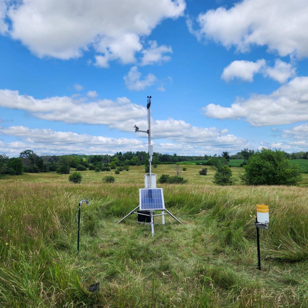
A network of 78 weather and soil monitoring stations in Wisconsin. We're growing with the support of the USDA Rural Partnerships Institute and Wisconsin Alumni Research Foundation.
American Meteorologist
Blixtexperten
Weather Measurements Guy
Award-Winning Communicator
AMS Certified Digital Meteorologist #18
Official Bluesky account of the Oklahoma Mesonet. A joint project of the University of Oklahoma and Oklahoma State University providing 5-minute weather data from 120 stations across Oklahoma.
Forecaster. Storm and sky enthusiast. Occasional adult.
forecast.twodogswx.net
https://github.com/adlyons
For Pics &
Youtube.com/twisterkidmedia
For tornado videos
Bad opinions are my own.
Research Meteorologist/Developer. OU alum (PhD/MS). I study precipitation, microphysics, polarimetric radar, and tropical cyclones. Opinions = my own.
Toward a Climate-Smart Nation. The official NOAA account for Climate.gov hosted by the Climate Program Office. Follow for #climate news, #science, #data, resources, and more!
NOAA provides science, service and stewardship to protect life, property & Earth's natural resources. An agency of the Department of Commerce. Join us on Instagram & Facebook. Official NOAA account.
Personal account, views my own, you know the drill. Techniques Development Meteorologist for the Storm Prediction Center.
See more of my photography:
https://www.instagram.com/keltore
My blog:
https://www.stormscale.io
Official Bluesky account for NOAA's National Weather Service.
35 year meteorologist in warning/forecast provision and research, now CEO of Balanced Weather LLC, Disney/Peanuts fan, golfer, sports fan, TK Little. For more weather info go to https://balancedweather.substack.com/about
On-Camera Meteorologist at The Weather Channel. Also movie fan, Hip-Hop/Music lover & supporter of the back-to-back National Champion Georgia Bulldogs!!!
@weatherchannel Meteorologist 6-10am @amhq M-F & Sat & Sun 1pm-12pm @pattrn