We’re hiring! MARACOOS is seeking a Communications Manager to lead strategy, digital outreach, and storytelling about ocean and coastal observing. Remote or DC-based. Apply by Dec. 1
Details: https://maracoos.org/wp-content/uploads/2025/11/Communications-Manager-Job-Announcement.pdf
19.11.2025 17:06 — 👍 0 🔁 0 💬 0 📌 0
YouTube video by MARACOOS
Tracking Hurricanes Through Sharks: Innovative Ocean Data in Action
🦈🌊 The “Sharks as Ocean Observing Platforms” webinar recording is now live!
Catch Dr. Aaron Carlisle & Caroline Wiernicki as they explain how tagged sharks help strengthen hurricane intensity forecasts.
Watch here: https://youtu.be/X-sQxmjC0pc?si=yf0ccj3SShI3iXlw
18.11.2025 18:36 — 👍 0 🔁 0 💬 0 📌 0
Get Our Newsletter - MARACOOS
This is a success preview text.
From near-real-time ocean data to webinars and workshops to coastal insights, the MARACOOS newsletter keeps you connected to what matters in the Mid-Atlantic.
📩 Subscribe today: https://maracoos.org/get-our-newsletter/
--
#OceanObserving | #IOOS | #MARACOOSUpdates
17.11.2025 17:07 — 👍 0 🔁 0 💬 0 📌 0
Learn more about MARACOOS OceansMap Insights and explore dashboards tailored for the New York & New Jersey area with TetraTech Program Manager, Sheri Schwartz.
Explore all of our Insights: https://maracoos.org/insights/
Have ideas for additional insig...
OceansMap Insights Demo: NY & NJ
#FeatureFriday: See how MARACOOS OceansMap Insights bring coastal data to life for NY & NJ. Tetra Tech’s Sheri Schwartz shares how these dashboards help inform planning, safety & coastal management. 🌊
https://youtu.be/EuIQxLqFaB4?si=h-SHsni4U4cMqcHD
💬 Ideas? info@maracoos.org
14.11.2025 21:13 — 👍 0 🔁 0 💬 0 📌 0
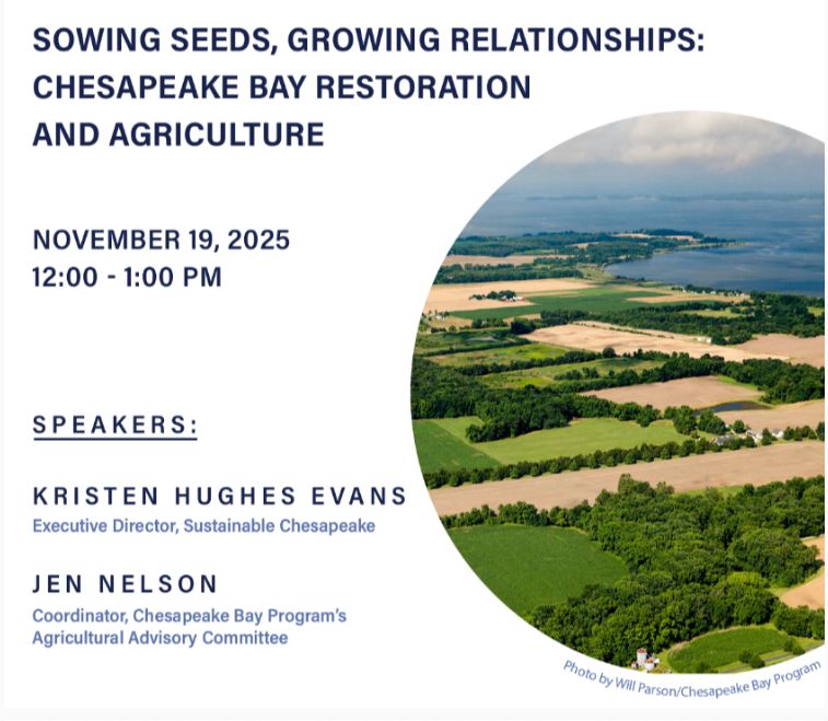
🌾 Join the Chesapeake Research Consortium Nov 19, 12–1 p.m. ET for
“Sowing Seeds, Growing Relationships” — a conversation on the future of sustainable agriculture & Bay restoration.
🔗 Register: https://chesapeake.org/crc-roundtable/
--
#ChesapeakeBay #Sustainability #AgChat
13.11.2025 16:07 — 👍 1 🔁 0 💬 0 📌 0

🌊 📣 MACAN is seeking a contractor to develop a new metric assessing marine species’ vulnerability to acidification across the Mid-Atlantic.
💰 Up to $80K | ⏰ Apply by Dec 5, 2025 | Remote
Details: https://files.constantcontact.com/1d0269c3301/1abccba8-3ce1-42ce-a199-de792c7f8569.pdf?rdr=true
12.11.2025 16:06 — 👍 0 🔁 0 💬 0 📌 0

Webinar advertisement featuring a shark image. Titled "Tracking Hurricanes Through Sharks," hosted by MARACOOS and University of Delaware on November 17, 2025, from 1-2 p.m. Eastern. Invitation to register today for insights on hurricane forecasting using ocean data.
Can sharks help forecast hurricanes? 🦈
Find out in our upcoming webinar with Dr. Aaron Carlisle and Caroline Wiernicki from @UDelaware.
📅 Nov. 17, 2025 | 1-2 p.m. Eastern
🔗 Register: https://us02web.zoom.us/webinar/register/WN_6hvYaabtQyK8ntvCZmufQQ#/registration
10.11.2025 17:46 — 👍 0 🔁 0 💬 0 📌 0
The Regional Associations with IOOS have launched websites and apps where people can go to check beach and coastal conditions. For instance, you can find information about the shores of the Pacific Ocean, in the Great Lakes, the Mid-Atlantic, and elsewh...
Introduction to IOOS Regional Beach and Boating Data Tools
Planning a beach day or heading out to fish? 🌊
Stay safe & prepared with real-time ocean data from the IOOS Regional Associations.
Watch to learn more: https://www.youtube.com/watch?v=QFVZSf24B6Q
--
#IOOS #OceanData #CoastalSafety
28.10.2025 18:47 — 👍 1 🔁 0 💬 0 📌 0

#FeatureFriday: The Mid-Atlantic Coastal Acidification Network (MACAN) has a new website!
Learn how they’re advancing understanding of coastal & ocean acidification across the region.
🔗 Explore: https://www.midacan.org/
24.10.2025 20:48 — 👍 0 🔁 0 💬 0 📌 0

An underwater unmanned vehicle, colored green and blue with the names "LOCAN" and "Redwing" on its body, navigating through deep blue ocean water.
🌊 A world first! Rutgers & Teledyne have launched Redwing—a Slocum Sentinel Glider on a mission to circle the globe, collecting ocean & climate data across 3 oceans over 2 years.
Learn more ➡️ rutgers.edu
#OceanObserving #GliderScience #IOOS
23.10.2025 15:45 — 👍 0 🔁 0 💬 0 📌 0
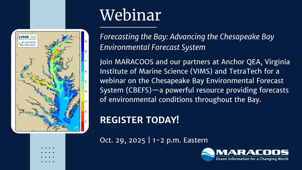
🌊 Join us next Weds, Oct. 29 (1–2 p.m. ET), for a webinar on the Chesapeake Bay Environmental Forecast System (CBEFS)—a tool delivering forecasts for oxygen, salinity, HABs, pathogens & more.
🔗 Register: https://us02web.zoom.us/meeting/register/nXyt_ykOQ8iP7EBQxJcWzA#/registration
22.10.2025 16:28 — 👍 2 🔁 2 💬 1 📌 0

Webinar advertisement featuring a shark image. Titled "Tracking Hurricanes Through Sharks," hosted by MARACOOS and University of Delaware on November 17, 2025, from 1-2 p.m. Eastern. Invitation to register today for insights on hurricane forecasting using ocean data.
Can sharks help forecast hurricanes? 🦈
Find out in our upcoming webinar with Dr. Aaron Carlisle and Caroline Wiernicki from @UDelaware.
📅 Nov. 17, 2025 | 1-2 p.m. Eastern
🔗 Register: https://us02web.zoom.us/webinar/register/WN_6hvYaabtQyK8ntvCZmufQQ#/registration
21.10.2025 18:54 — 👍 0 🔁 0 💬 0 📌 0

Promotional image for the Mid-Atlantic Marine Debris Summit in Dewey Beach, DE on November 12-13, featuring a red lighthouse on the ocean at sunset. Logo of MARCO (Mid-Atlantic Regional Council on the Ocean) displayed at the bottom.
MARACOOS is proud to support our partner, MARCO, for the Mid-Atlantic Marine Debris Summit — uniting the region to tackle storm debris, derelict gear, & microplastics.
🗓️ Nov. 12-13 | Dewey Beach, DE
🔗 https://whova.com/portal/registration/i7bHxvpSuQ5gELIk0prp/
20.10.2025 18:57 — 👍 0 🔁 0 💬 0 📌 0

Three people standing in front of an "IOOS Association" banner. The person in the middle is holding a framed picture of a coastal landscape. All are smiling at the camera.

Group of people posing for a photo in front of a large aquarium, with one individual holding a framed certificate.

A group of five individuals smiling for a photo in front of a large aquarium tank filled with various sea creatures, including fish and a turtle. One child is holding a framed certificate.
#FeatureFriday: Congratulations to Captain Ray Toll, recipient of the 2025 @IOOS_Association Caraid Award! 🌊
Honored for his lifelong leadership advancing ocean observing through @ODU, @MTSociety, and the @VAAquarium.
Learn more ➡️ https://ioosassociation.org/caraid/
17.10.2025 21:07 — 👍 1 🔁 0 💬 0 📌 0

🌊 It’s #OceanAcidificationWeek! Rising CO₂ is making our oceans more acidic, threatening oysters, clams, lobsters & corals. Learn more & join events hosted by @goa_on this week 👉 https://goa-on.org/webinars/OaWeek2025/webinar.php#schedule
#OceanScience #OceanAction
15.10.2025 17:10 — 👍 0 🔁 0 💬 0 📌 0

From near-real-time ocean data to webinars and workshops to coastal insights, the MARACOOS newsletter keeps you connected to what matters in the Mid-Atlantic.
📩 Subscribe today: https://lnkd.in/eFh9YcCd
--
#OceanObserving | #IOOS | #MARACOOSUpdates
14.10.2025 18:45 — 👍 0 🔁 0 💬 0 📌 0

Satellite image of a storm approaching the eastern coast of the United States, covering a large portion of the Atlantic Ocean near the coastline.
🚨 Severe weather alert for the Mid-Atlantic: Expect damaging winds, large hail & possible tornadoes. Stay safe, check weather.gov or NOAA weather radio for updates.
#MidAtlantic #CoastalHazards #WeatherSafety #MARACOOS #OceansMap
10.10.2025 21:07 — 👍 0 🔁 1 💬 0 📌 1
Satellite image of a storm approaching the eastern coast of the United States, covering a large portion of the Atlantic Ocean near the coastline.
🚨 Severe weather alert for the Mid-Atlantic: Expect damaging winds, large hail & possible tornadoes. Review safety plans & check regional conditions in our East Coast Storm Tracker Insight:
#MidAtlantic #CoastalHazards #WeatherSafety #MARACOOS #OceansMap
10.10.2025 21:07 — 👍 0 🔁 0 💬 0 📌 0

Close-up view of a glider on the back of a ship.
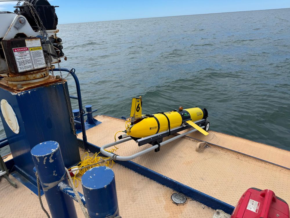
An glider placed on the deck of a boat, ready for deployment in open sea waters.

Image showing a glider being deployed from the rear deck of a boat into the ocean.
#FeatureFriday: MARACOOS06 has joined MARACOOS01 in the Atlantic for nearly a month, flying a W-shaped pattern to monitor the end of hurricane season & the fall transition in the Mid-Atlantic Bight.
🐋 Whale data: robots4whales.whoi.edu
#GliderSeason #OceanObserving
03.10.2025 20:58 — 👍 1 🔁 0 💬 0 📌 0

🌊 Join us Oct. 29 (1–2 p.m. ET) for a webinar on the Chesapeake Bay Environmental Forecast System (CBEFS)—a tool delivering forecasts for oxygen, salinity, HABs, pathogens & more.
🔗 Register: https://us02web.zoom.us/meeting/register/nXyt_ykOQ8iP7EBQxJcWzA#/registration
02.10.2025 18:48 — 👍 1 🔁 1 💬 1 📌 0

Infographic by NOAA about harmful algal bloom observing and forecasting, highlighting affected areas in the U.S. on a map, including Alaska, Hawaii, and the Great Lakes. Indicators on the map show different types of algal impacts like fishery closures and toxin productions. Key points discuss the economic and health impacts caused by these blooms.
National HAB Observing & Forecasting Networks deliver real-time data + predictions to protect health, seafood & coastal economies. 🌐 Learn more:https://cdn.coastalscience.noaa.gov/page-attachments/habs/noaa-operational-hab-services.pdf
01.10.2025 15:47 — 👍 0 🔁 0 💬 0 📌 0
YouTube video by MARACOOS
OceansMap Insights Demo: Virginia
#FeatureFriday: Discover MARACOOS’s new OceansMap Insights for Virginia!
Check out the video: https://www.youtube.com/watch?v=cGIXgb8yHaI
Explore all our regional dashboards here: https://maracoos.org/insights/
Ideas for more data layers? Email us at info@maracoos.org
26.09.2025 20:48 — 👍 0 🔁 0 💬 0 📌 0
YouTube video by MARACOOS
Wave Buoys: New Tools for Smarter Decision-Making During Coastal Flooding
#FeatureFriday 🌊 No time for a full webinar? Catch this clip on Sofar Spotter wave buoys in Delaware Bay—bringing stronger coastal flood monitoring to Delaware communities.
https://youtu.be/70Bar5ORmP4
19.09.2025 20:51 — 👍 0 🔁 0 💬 0 📌 0
YouTube video by MARACOOS
OceansMap in Action: Visualizing New Sensor Data for Smarter Planning and Response in Delaware
🌊 Didn’t catch our webinar? Watch the recording to see how Sofar Spotter Wave buoys + OceansMap are powering the new WWW Network & helping Delaware communities monitor flood risks: https://youtu.be/Jy-4cuYm2C8
#OceanObserving #CoastalResilience #FloodRisk #DecisionSupport #OceanData
17.09.2025 15:48 — 👍 0 🔁 0 💬 0 📌 0
Scientific content aggregator with custom content feeds. Science news, jobs, events and more. Sign up at https://www.scientific.today.
Unifying the University of Maryland’s groundbreaking research with the immediate requirements of Maryland’s decision-makers to address the complexities of climate change as it affects our home.
https://go.umd.edu/essicarticle072125
A global leader in oceanographic instrumentation. Powering science to better understand our oceans. 🌊 Learn more at www.seabird.com.
The coolest oceanographic research institution in the world! We are proudly part of Rutgers University. Jersey roots, global reach!
Free/public GIS mapping & information site focused on ocean areas from New York through Virginia. Browse our collection of 6,000+ interactive maps at https://portal.midatlanticocean.org.
Rutgers University Center for Ocean Observing Leadership - RUCOOL. Researching bio-physical-Chemical processes of coastal waters off New Jersey and around the World.
Seafloor mapper, Chief Scientist of smart mapping company Esri, Oregon State U. GIS/oceans professor, EC50, cyclist, 1st Black submersible diver to Challenger Deep, builds w/LEGO, raised in Hawaii. NAS, NAE, ORCID 0000-0002-2997-7611; She/her; views mine
Official Bluesky account for NOAA's National Weather Service.
News on weather, climate, oceans, fish, satellites, research & more from NOAA Communications. Official NOAA account.
NOAA provides science, service and stewardship to protect life, property & Earth's natural resources. An agency of the Department of Commerce. Join us on Instagram & Facebook. Official NOAA account.
Coastal Science for New York State, supported administratively by NOAA and, in NY, SUNY and Cornell University www.nyseagrant.org
The ACT Network is a community of researchers studying marine and estuarine animal movement.
The University of Delaware's official account. Follow us for the latest news, research and innovations from UD. Go, #BlueHens!
Official Bluesky account for the University of Rhode Island.
Think big. We do.
uri.edu
Woods Hole Oceanographic Institution Sea Grant puts science to work for MA coastal communities through marine research, education and outreach projects. Based @whoi.bsky.social.
We're the world's largest independent non-profit dedicated to ocean research, exploration, and education. Join us!
Research Meteorologist at NOAA’s NCEI. We archive your data and I play with it. On this hell site too along with all the others.
Department of Earth, Marine & Environmental Sciences (EMES) at UNC Chapel Hill. Established July 2021 from the Geological Sciences and Marine Sciences departments and the UNC Institute of Marine Sciences.
https://emes.unc.edu/
AMS is a professional organization that advances the atmospheric and related oceanic and hydrologic sciences in service to society.
https://www.ametsoc.org/