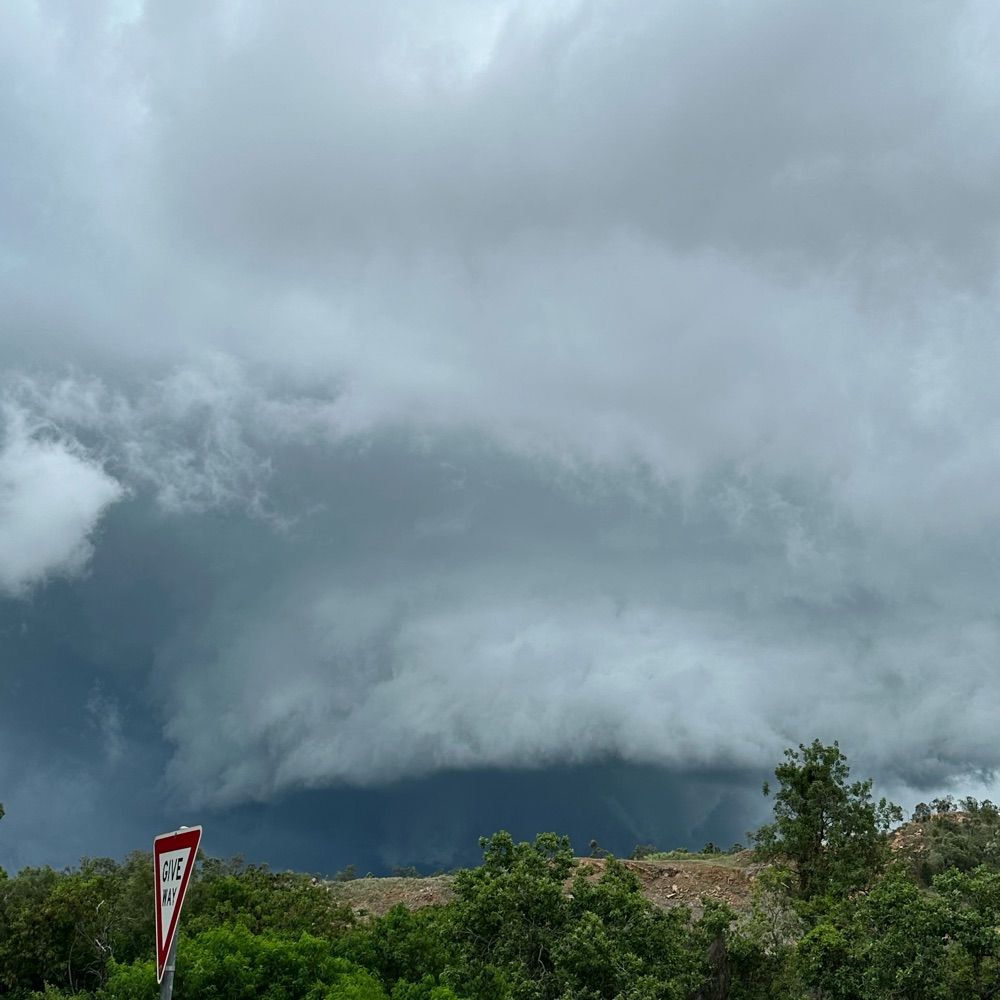
Heed the warnings ahead of this flood watch - this region is completely sodden. It is not going to take very much rain for river levels to rise.
NSW Flood Watch: www.bom.gov.au/nsw/warnings...
SES warnings: www.ses.nsw.gov.au
Hazards Near Me app: www.nsw.gov.au/emergency/ha...
19.08.2025 22:10 — 👍 0 🔁 0 💬 0 📌 0
Flood watch for minor to moderate flooding current. We just sent out a minor warning for Sussex Inlet and a minor-moderate for the Hawkesbury Nepean. This is a dangerous storm. Stay up to date with the latest warnings:
www.bom.gov.au/australia/wa...
www.hazardwatch.gov.au
01.07.2025 10:35 — 👍 1 🔁 1 💬 0 📌 0
Happening NOW! I will be tuning in on night shift 🌖
30.05.2025 07:48 — 👍 0 🔁 0 💬 0 📌 0
There is indeed record flooding occurring in the Manning, and the situation is severe, but this is not the worst flood ever experienced for *the entirety* the Mid North Coast. Many spots aren’t even close to March 2021 levels.
21.05.2025 10:47 — 👍 0 🔁 0 💬 0 📌 0
Forecasts and warnings can change on a dime, so please stay up to date if you are in the affected area, and NEVER DRIVE THROUGH FLOOD WATER. The majority of people who die in floods nowadays die in their cars.
BoM warnings for NSW here: www.bom.gov.au/nsw/warnings/
21.05.2025 10:23 — 👍 0 🔁 0 💬 0 📌 0
Adding to the complexity here is the stalling of the system and the delivery of multiple rounds of rainfall. Renewed rises and multiple peaks make the situation much more complex. It continues to evolve very quickly, with no respite from the rain until at least Saturday
21.05.2025 10:22 — 👍 0 🔁 0 💬 1 📌 0

HazardWatch - Hazard Warnings
View warnings issued by Australian Emergency Services.
Record flooding in the Manning, with records going back to 1929. Stay up to date with the latest warnings - and never underestimate these small coastal NSW troughs
hazardwatch.gov.au
21.05.2025 10:19 — 👍 1 🔁 0 💬 1 📌 0
Another busy week for flooding in Australia. Normally, the kinds of rainfall totals we’re seeing in the international models wouldn’t be *too* concerning, but these catchments are already sodden, so rivers will rise quickly to any new rain.
01.04.2025 05:44 — 👍 0 🔁 0 💬 0 📌 0
This likely to be the largest flood in living memory for many across the Thomson, Barcoo, and Cooper catchments in Queensland. Rivers have already passed or are expected to surpass 2000, 1990, and 1974 flood levels. River levels are still rising; we have yet to see any peaks along the main channels.
27.03.2025 08:56 — 👍 1 🔁 0 💬 0 📌 0
Flood warnings are likely going to continue for several weeks as these floodwaters move slowly downstream
26.03.2025 10:23 — 👍 0 🔁 0 💬 0 📌 0
The Thomson and Barcoo Rivers and Cooper Creeks are experiencing an incredibly significant flood right now. Possibly one of the largest in living memory for this area. Please stay up to date with the latest warnings. There’s another update coming tonight
26.03.2025 10:17 — 👍 0 🔁 0 💬 1 📌 0
Great piece. Three key takeaways that resonate: 1. Getting good code from an LLM is *always* an iterative process; 2. Using LLMs means I code *more* and therefore I learn at an accelerated pace about what works and what doesn’t; and 3. ALWAYS TEST what it produces because it is usually overconfident
12.03.2025 17:34 — 👍 1 🔁 0 💬 0 📌 1
THE TAKEAWAY:
Cyclone tracks and categories don’t always tell the full flood story. Keep an eye on warnings, and don’t let "downgraded" or "weakening" make you complacent about flood risk. Stay safe and stay updated.
06.03.2025 08:27 — 👍 1 🔁 2 💬 0 📌 0
Same with Ex-TC Debbie—it lost cyclone status after crossing the coast near Bowen, but as a tropical low, it kept moving inland, causing major flooding in SE QLD and NE NSW. At Lismore, 1,000 km south of where it initially made landfall and was downgraded, the levee was overtopped.
06.03.2025 08:26 — 👍 1 🔁 0 💬 1 📌 0
Take Cyclone Jasper—it made landfall as a Cat 2 but was quickly downgraded. The problem? It crawled over Cape York Peninsula, dumping most of its rain after being downgraded and causing record flooding in some locations.
06.03.2025 08:26 — 👍 1 🔁 0 💬 1 📌 0
*Cyclone Downgrading
*
Similarly, just because a cyclone is downgraded doesn’t mean we’re out of the woods for flooding. In fact, some of the worst flooding happens after a cyclone is no longer officially at "tropical cyclone strength".
06.03.2025 08:26 — 👍 0 🔁 0 💬 1 📌 0
*Cyclone Category*
We also hear a lot about cyclone category, but that only tells us one thing: mean wind speed.
As a flood forecaster, I care much more about whether a cyclone stalls. How long it lingers over a region makes all the difference when it comes to flood risk.
06.03.2025 08:25 — 👍 1 🔁 0 💬 1 📌 0
Rain impacts often begin days before landfall—and they persist for days afterwards.
06.03.2025 08:24 — 👍 0 🔁 0 💬 1 📌 0
For example, the Dorrigo Ranges on the Mid North Coast have already copped 300 mm—about 350 km away from the cyclone’s center offshore. The Bellinger River is already in minor flood. And Cyclone Alfred still hasn’t made landfall.
06.03.2025 08:24 — 👍 2 🔁 0 💬 1 📌 0
*Cyclone Landfall Location*
There’s always a lot of focus on where a cyclone makes landfall, which makes sense. But rain impacts start well before that.
06.03.2025 08:24 — 👍 0 🔁 0 💬 1 📌 0
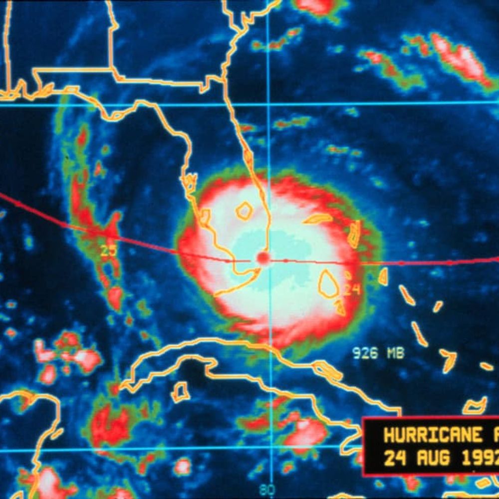
Looking at Cyclone Alfred as a flood forecaster, I want to highlight how flood risk fits into the broader conversation about tropical cyclones. Some key points 🧵
06.03.2025 08:23 — 👍 3 🔁 2 💬 1 📌 0
This video is a nightmare for me to watch as a flood forecaster. The vast majority of people who die in floods die in their cars. The storm surge associated with Alfred is much, much higher than normal for this coastline making it particularly dangerous. Cars are replaceable. Lives are not.
05.03.2025 23:00 — 👍 1 🔁 0 💬 1 📌 0
First flood warning of TC Alfred has been sent - Minor to Major for the Bellinger in NSW.
The modelling has been startlingly consistent over several days indicating moderate to major flooding possible or even likely for many rivers across NE NSW and SE QLD.
www.bom.gov.au/nsw/warnings...
05.03.2025 06:55 — 👍 2 🔁 1 💬 0 📌 0
BoM warnings here: www.bom.gov.au/australia/wa...
NSW SES warnings including links to download Hazards Near Me app: www.ses.nsw.gov.au/northern-riv...
QLD council warnings: www.getready.qld.gov.au/find-your-lo...
QLD councils - Disaster Dashboards: www.qld.gov.au/community/di...
04.03.2025 21:27 — 👍 1 🔁 1 💬 0 📌 0
The story of this cyclone has been full of (literal) twists and turns.
This is a very dangerous storm that has already caused damage to the coast. Stay up to date with the latest warnings and follow the advice of emergency services.
www.bom.gov.au/aviation/?re...
04.03.2025 19:34 — 👍 1 🔁 0 💬 1 📌 0
We’ve got eyes on the Qld North Tropical Coast tonight. The amount of rainfall forecast tonight is nowhere near the totals we’ve seen in recent weeks. However, catchments in the NTC are very wet from recent flooding, and rivers and creeks are very responsive to even small amounts of rainfall.
21.02.2025 04:41 — 👍 0 🔁 0 💬 0 📌 0
Northern Territory Floods: bsky.app/profile/did:...
South Australia Floods: bsky.app/profile/did:...
Tasmania Floods: bsky.app/profile/did:...
New South Wales Floods: bsky.app/profile/did:...
Queensland Floods: bsky.app/profile/did:...
21.02.2025 04:08 — 👍 0 🔁 0 💬 0 📌 0
I've created some feeds for all things flooding in Australia. Please like so that others can find them!
Australia Floods: bsky.app/profile/did:...
Victoria Floods: bsky.app/profile/did:...
ACT Floods: bsky.app/profile/did:...
Western Australia Floods: bsky.app/profile/did:...
21.02.2025 04:07 — 👍 3 🔁 0 💬 1 📌 0
Public prosperity through strategic design, policy and advocacy. Public spaces, public infrastructure, public services, and nature. Co-author: Designing Tomorrow
Wangal country
Interests include: policy, cycling, bonsai, Design
🪴Good stories for a breath of fresh air
📍Brooklyn, New York
📧 jacob@jacobsimonsays.com
👇All story sources, newsletter, actions & more👇
jacobsimonsays.com/bio
Official Bluesky account for NOAA's National Weather Service.
Lead meteorologist with the National Weather Service in Lincoln, IL. Brewers and Packers fan. Long time amateur genealogist. Opinions (not that I usually post any) are my own.
Scientia Prof. of Ocean & Climate Dynamics UNSW Australia | Fellow Australian Academy of Science | CMSI / BEES | Deputy Director ARC Australian Centre for Excellence in Antarctic Science | I study our oceans ice atmosphere and climate 🌊🌎🧊🌍🌤
U.S. Senator from Rhode Island, the Ocean State.
https://linktr.ee/senwhitehouse
CEO of Bluesky, steward of AT Protocol.
dec/acc 🌱 🪴 🌳
The Storm Front Freaks are a team of Meteorologists and Storm Trackers. Join us for our entertaining podcast, LIVE coverage of extreme weather events and more!
Retired NWS meteorologist (formerly WSO Charlotte, NC, WFO Wilmington, NC, and NWS Storm and Weather Prediction Centers). Now living in central Vermont and always watching the sky. I still use the handy Python pickax for data mining from time to time.
Atmospheric scientist // Global model evaluator at the NWS Environmental Modeling Center // Ph.D., M.S., B.S. from UAlbany // Yoga, NY sports, wine // Restaurant Reviewer // Opinions are mine
www.AliciaMBentley.com
📍Washington, DC
Research Meteorologist at NOAA’s NCEI. We archive your data and I play with it. On this hell site too along with all the others.
Your daily dose of historical weather and climate events.
NWS Meteorologist ~ Scott Doering
#weather #history #climate
https://sercc.com/weather-history/
AMS Certified Meteorologist.
#50YearsOfESA: we're the European Space Agency, keeping you posted on European space activities.
Please see our Privacy Notice: https://esa.int/connectwithus
In-depth, independent reporting to better understand the world, now on Bluesky. News tips? Share them here: http://nyti.ms/2FVHq9v
America’s Finest News Source. A @globaltetrahedron.bsky.social subsidiary.
Get the paper delivered to your door: membership.theonion.com
1x winner of the "oh i'm pretty sure that's just jerry spreading misinformation" award 🥇🏆
• Goodfeeds @goodfeeds.co
• Sky․app @getsky.app
thanked by darth july 20, 2023
📍Austin, TX
Earth Sciences · Geodynamics · Modelling
GFZ Potsdam (@gfz.bsky.social)
Uni Potsdam (@geowpotsdam.bsky.social)
https://www.gfz-potsdam.de/en/staff/sascha.brune
Former North, now South QLD’er into Australian weather extremes/records, climate data visualisation, cyclones, and storm chasing.
Cold weather and soccer enjoyer
🟠⚫️ 🟢🟡
Doting grandmother, among other things.