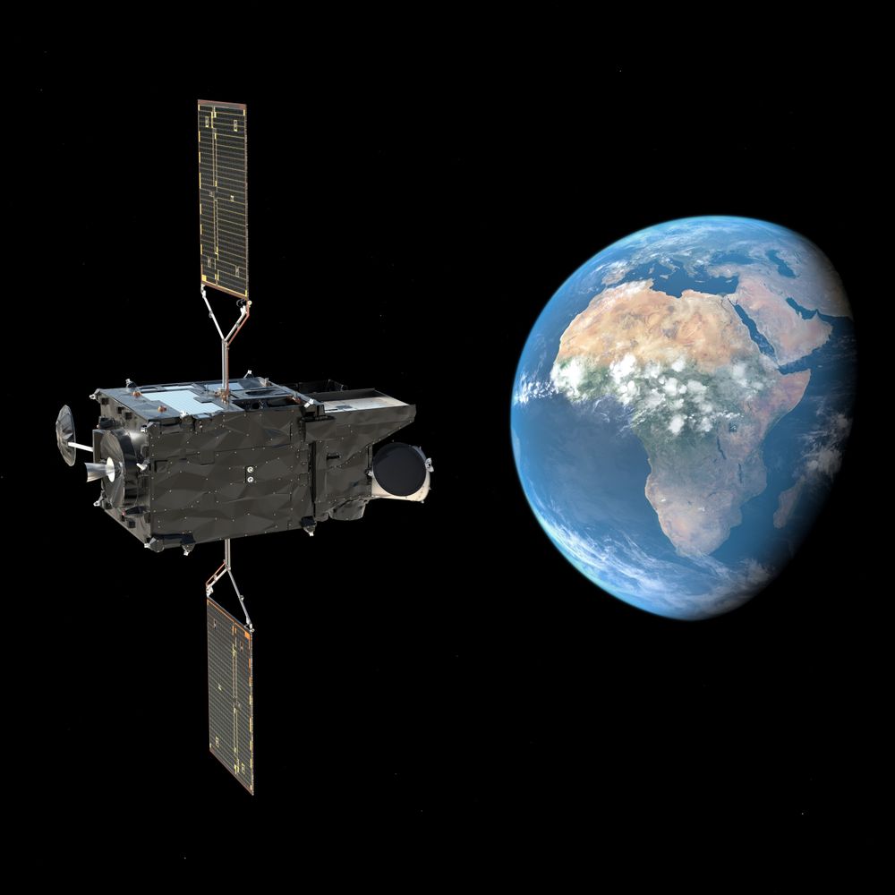
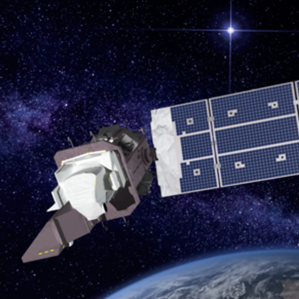
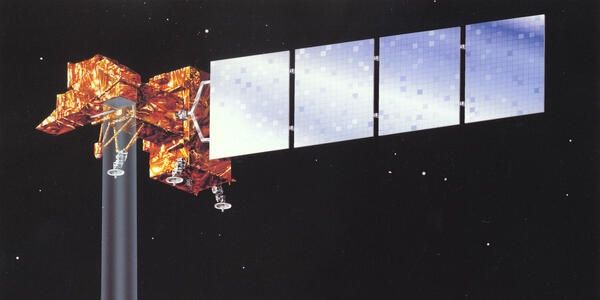
7 days until liftoff! 🚀
On 4 Nov 2025 at 18:03 local (French Guiana) / 21:03 UTC / 22:03 CET, Sentinel-1D launches aboard Ariane 6 — keeping Copernicus radar eyes on Earth, all weather, all the time. 🌍
#Sentinel1D #Copernicus #ESA #Ariane6 #EarthObservation
28.10.2025 12:59 — 👍 3 🔁 1 💬 0 📌 1
That is awesome. Thank you
11.09.2025 11:49 — 👍 0 🔁 0 💬 0 📌 0

Africa on a globe. Photo by James Wiseman on Unsplash
New blog. In Praise of the Digital Earth Africa Sandbox. Its back! A very good place to learn to work with Earth observation data and Python.
www.acgeospatial.co.uk/in-praise-of...
#Earthobervation
#eochat
#opendatacube
11.09.2025 08:55 — 👍 1 🔁 1 💬 1 📌 0
🚀 New Feature in Leafmap – Interactive Time-Series Visualization! 🌍🛰️
Leafmap now supports time sliders for visualizing large collections of remote sensing images.
Try it out
Web App: huggingface.co/spaces/giswq...
Notebook: leafmap.org/maplibre/tim...
#geospatial #leafmap #opensource #mapping
10.08.2025 20:08 — 👍 21 🔁 6 💬 0 📌 0

🚨 Applications are now open!
We are excited to announce that the @geospatialwomen.bsky.social Mentorship Programme is now accepting applications for our 25/26 cohort, open until 7th September!
🔗 Interested? Apply here: lnkd.in/ek7veWdG
#gischat #remotesensing #geospatial #eo #gis #mentorship
11.08.2025 15:16 — 👍 4 🔁 6 💬 0 📌 2
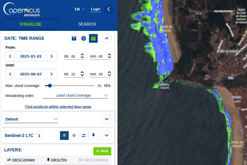
Sentinel Hub Custom Scripts migration from EO Browser to Copernicus Browser
Platform migration and update of my scripts.
🟢 Worth a read if you are using the Copernicus Browser and custom scripts. „Sentinel Hub Custom Scripts migration from EO Browser to Copernicus Browser“ by Mohor Gartner
medium.com/@mohor.gartn...
14.07.2025 04:46 — 👍 6 🔁 4 💬 1 📌 0
Chunks and Chunkability: Tyranny of the Chunk • Element 84
We discuss our attempt to understand chunks and chunking more deeply including where we are today and where we might go from here.
Our latest deep-dive series is live now on the blog! 🗞️💡 Check out Chunks and Chunkability (parts one and two) now.
"It is a truth universally acknowledged in cloud native geospatial that data formats must be chunked."
Part One: element84.com/software-eng...
10.07.2025 21:32 — 👍 0 🔁 1 💬 1 📌 0
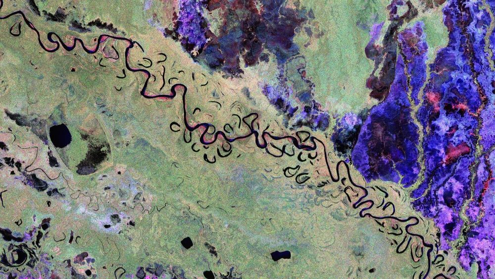
Two #Copernicus #Sentinel-2 images show the massive burn scar of ~100 km2 in northeast #Scotland caused by a fire between 28 June to 2 July. Uplands need better management, including rewilding & rewetting. #eochat @guyshrubsole.bsky.social @chrisgpackham.bsky.social @wildjustice.bsky.social
09.07.2025 15:15 — 👍 12 🔁 5 💬 0 📌 1
maps paper on table from https://unsplash.com/photos/maps-paper-on-table-Uk3t05ndSng
New blog. Now I have a robust way of loading my Garmin tracks and activities into #PostGIS - I connect kepler.gl to it to visualise the data in a Jupyter Lab widget. This is a simple guide.
www.acgeospatial.co.uk/kepler-gl-in...
01.07.2025 08:01 — 👍 2 🔁 0 💬 0 📌 0
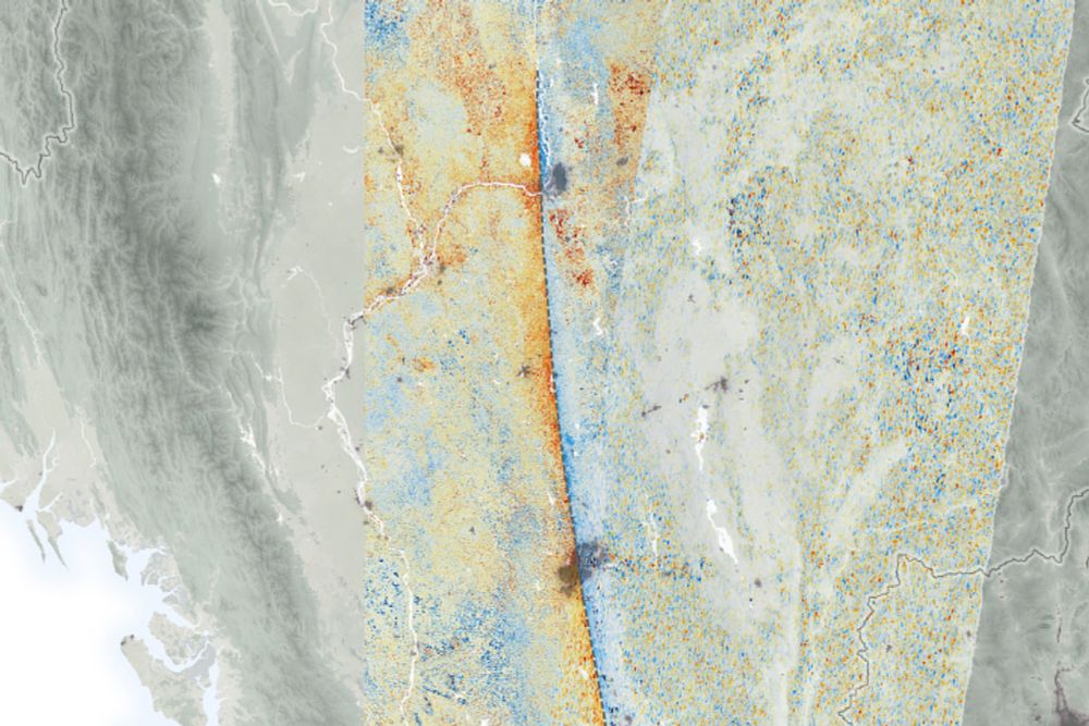
The fantastic first image released by @esa.int Biomass satellite.
In glorious false colour to represent its P-band radar imaging, capable of penetrating even the highest biomass forests in the Amazon and Congo.
23.06.2025 11:37 — 👍 41 🔁 15 💬 1 📌 0
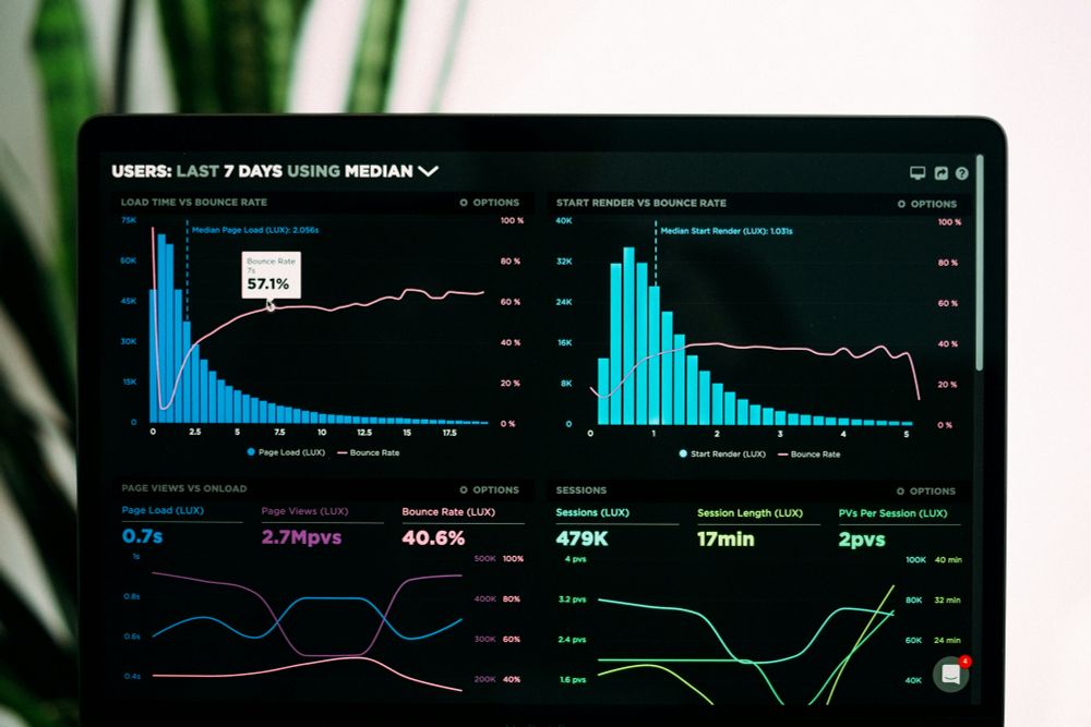
From unsplash - https://unsplash.com/photos/graphs-of-performance-analytics-on-a-laptop-screen-JKUTrJ4vK00 data dashboard
New blog in my Garmin tracks series. This time 'Load activities from Garmin Connect and join to tracks in PostGIS' www.acgeospatial.co.uk/garmin-conne...
#garmin
#PostGIS
code:
github.com/acgeospatial...
23.06.2025 07:16 — 👍 3 🔁 0 💬 0 📌 0
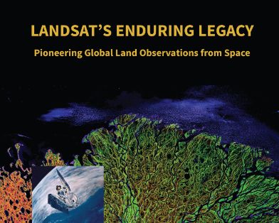
Great idea! While not a paper, a terrific resource is the book Landsat's Enduring Legacy: Pioneering Global Land Observations from Space.
Bit of everything. History of remote sensing. System design. Orbits. Applications. Has it all, AND is #openaccess!
Get a free copy: my.asprs.org/common/Uploa...
17.06.2025 22:12 — 👍 2 🔁 1 💬 1 📌 0

image credit https://unsplash.com/photos/worms-eye-view-photography-of-ceiling-LqKhnDzSF-8 worms eye view of ceiling
New blog. This time handling updates from Garmin Connect to #PostGIS.
www.acgeospatial.co.uk/update-postg...
All the code is on GitHub - github.com/acgeospatial...
#python
#datamanagement
16.06.2025 10:22 — 👍 0 🔁 0 💬 0 📌 0
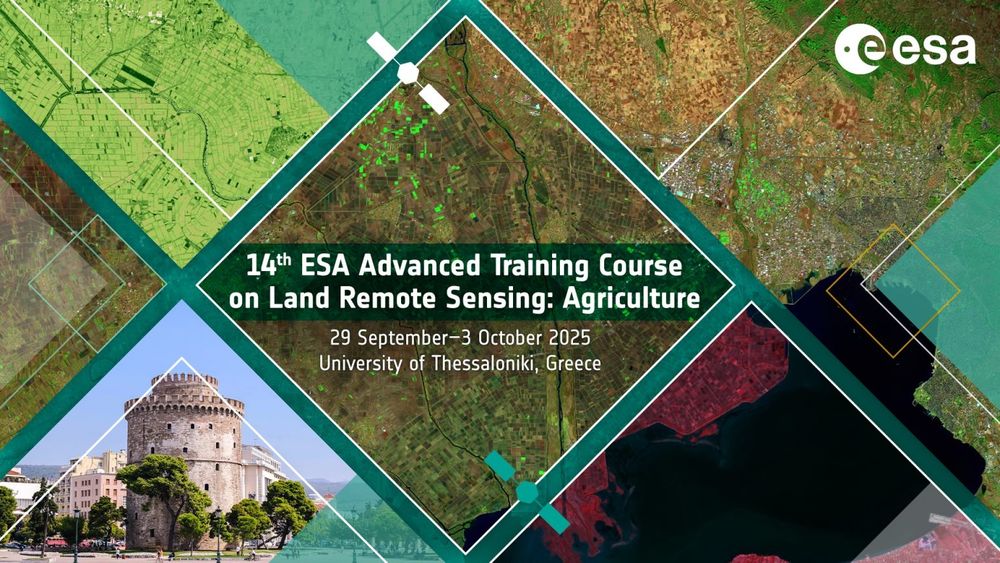
📢 Last 3 days to apply for #ESA 14th Advanced #Training Course on Land #RemoteSensing with a focus on #Agriculture!
📅 When: 29 September - 3 October 2025
📍 Where: Thessaloniki, Greece
👉 Deadline: 12 June 2025
🔗 More info and registration: landtraining2025.esa.int
#GISchat #EOchat #geosky #eo
09.06.2025 06:53 — 👍 3 🔁 3 💬 1 📌 1
Getting tracks from Garmin Connect to PostGIS – acgeospatial
New blog. This time Getting tracks from #Garmin connect to #PostGIS. I present two options with code. www.acgeospatial.co.uk/getting-trac...
Using #geopandas, #sqlalchemy
08.06.2025 14:44 — 👍 4 🔁 1 💬 0 📌 0
End of an Era: Landsat 7 Decommissioned After 25 Years of Earth Observation
After 25 years of capturing Earth's changing landscape, the Landsat 7 satellite received its final transmission from the U.S. Geological Survey and was officially decommissioned June 4, closing a rema...
After 25 years of watching Earth's changes, Landsat 7 has been decommissioned. It helped monitor forests, glaciers, disasters, and coastlines, providing decades of open science data. Its archive will continue to support research and environmental management
🧪⚒️🌊🌋❄️
#Landsat
#RemoteSensing
#GIS
06.06.2025 00:07 — 👍 61 🔁 20 💬 1 📌 1
Getting routes from Garmin Connect to QGIS – acgeospatial
A short blog on getting your tracks / routes from #Garmin Connect into #QGIS. www.acgeospatial.co.uk/getting-rout...
02.06.2025 14:26 — 👍 0 🔁 0 💬 0 📌 0
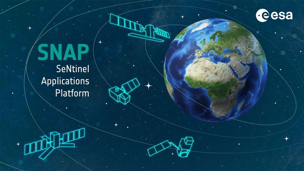
🚀SNAP 12 is here! 🌍
Marking 10 years of ESA's Sentinel App Platform with powerful new features:
🛰️Sentinel-1C support
⚙️JDK 21
🌐ETAD: smarter SLCs, interferograms & auto-download
🌍REACTIV, InSAR, OLCI/SLSTR
📦New vector tools
👉 step.esa.int/main/snap-12...
#EO #RemoteSensing #SentinelData #ESA #SNAP
08.05.2025 12:14 — 👍 14 🔁 8 💬 1 📌 1
This is crazy. 'The economic value of just one year of Landsat data far exceeds the multi-year total cost of building, launching, and managing Landsat satellites and sensors.' www.usgs.gov/news/feature... #eochat
07.05.2025 08:56 — 👍 13 🔁 6 💬 1 📌 0
Cloud Frequency – acgeospatial
New blog post on cloud frequency. www.acgeospatial.co.uk/cloud-freque... asked if a project I was working on was impacted by the distribution of clouds(>in the west?). Answer was not for this project. but I didn't know until I checked. #Python code here github.com/acgeospatial...
#Sentinel2
#eochat
06.05.2025 06:38 — 👍 1 🔁 0 💬 0 📌 0
EXCLUSIVE: UK and New Zealand's space sectors to join forces - UKTN
Prime Minister Keir Starmer hosted New Zealand Prime Minister Christopher Luxon this week.
EXCLUSIVE: UK and New Zealand's space sectors to join forces. 🚀
➡️ www.uktech.news/climate-tech... 🔗
#exclusive #space #climatetech #earthobservation #uktech #newzealand #spacetech #internationalcollaboration #sciencepartnership #startups #UKtech
23.04.2025 13:23 — 👍 1 🔁 1 💬 0 📌 0
Satellite Data Show Motion of Burma Earthquakes
NASA scientists employed a pixel-tracking method to reveal how much the ground shifted during one of the largest documented surface ruptures of its type.
Using satellite data from ESA’s Sentinel-1A & Sentinel-2B/C + NASA JPL’s ARIA, scientists mapped >3 m horizontal land shifts along Myanmar’s Sagaing Fault during the Mar 28, 2025 quakes. #RemoteSensing #Earthquake - earthobservatory.nasa.gov/images/15415...
24.04.2025 12:44 — 👍 1 🔁 1 💬 0 📌 0
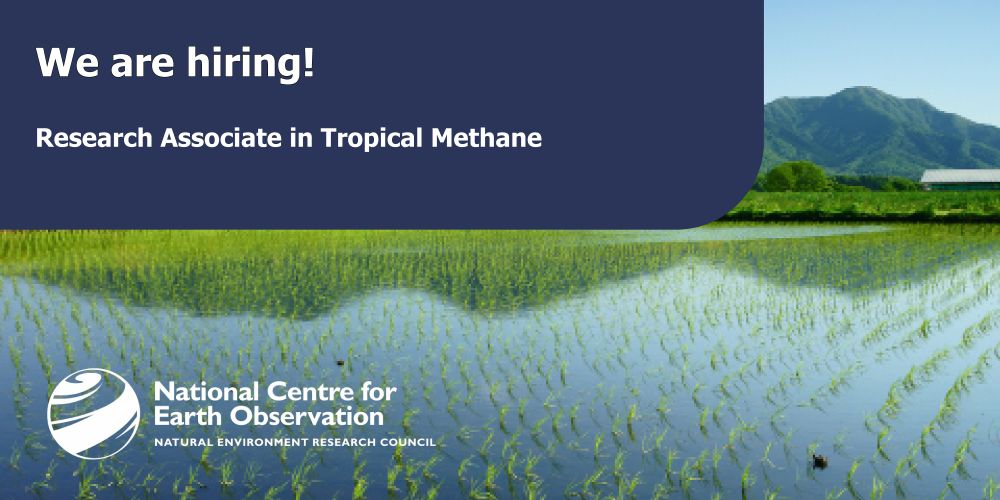
Join us as a Research Associate in Tropical Methane with the EOS group at Uni of Leicester🏛️
You will be working with @drrobparker.bsky.social team on a cutting-edge Environmental Digital Twin to study wetland methane & climate change🌍
📍 Apply by 4 May
🔗 tinyurl.com/mrxzkzya
#ClimateJobs #NCEO
10.04.2025 10:38 — 👍 3 🔁 1 💬 0 📌 0
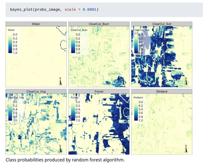

The bayesEO package provides a Bayesian approach to post-processing ML-generated images. It refines class probabilities, removes outliers, and improves labeling for more accurate classification.
🔗 https://github.com/e-sensing/bayesEO/
#rstats #MachineLearning #RemoteSensing #Bayesian #rspatial
30.03.2025 13:00 — 👍 6 🔁 5 💬 1 📌 0

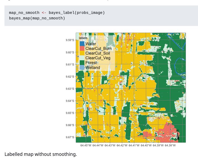
The bayesEO package provides a Bayesian approach to post-processing ML-generated images. It refines class probabilities, removes outliers, and improves labeling for more accurate classification.
🔗 github.com/e-sensing/ba...
#rstats #MachineLearning #RemoteSensing #Bayesian #rspatial
30.03.2025 13:00 — 👍 17 🔁 5 💬 1 📌 0
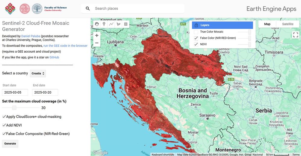
🌍 I have created an interactive #GEE app to generate #Sentinel2 cloud-free mosaics for any country and timeframe, defined by the user.
Generate your mosaics: danielp.users.earthengine.app/view/sentinel2-cloudfree-mosaic-generator
GitHub: github.com/palubad/S2-Mosaic-Generator
#gischat #dataviz
27.03.2025 09:26 — 👍 17 🔁 4 💬 1 📌 1
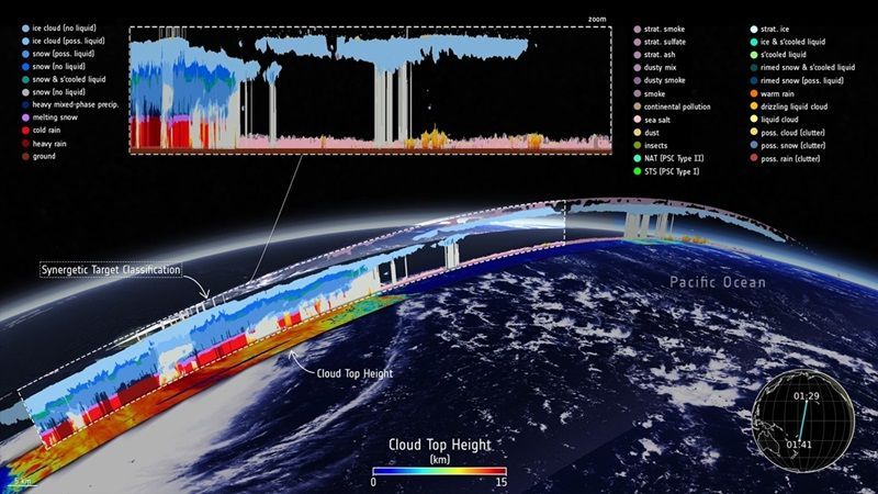
Level-2 data boost EarthCARE's profiling power - Earth Online
EarthCARE’s Level-2 data products are now fully available, offering users more precise and detailed atmospheric profiling data.
Now fully available! 𝗘𝗮𝗿𝘁𝗵𝗖𝗔𝗥𝗘’𝘀 𝗟𝗲𝘃𝗲𝗹-𝟮 data products.
L2A contains data from individual instruments, and L2B provides data from two instruments. Final L2 data will be ready by year-end, integrating information from all four instruments. buff.ly/EAz9ZlZ
#EarhtObs #remotesensing
18.03.2025 07:29 — 👍 2 🔁 2 💬 0 📌 0
Work on open source GIS and sustainability. In my free time I enjoy hanging out with my dogs, camping and running/playing TTRPGs (he/him)
GIS, Interactive & Printed Trail Maps, Data Books, Trip Planners, Snow, Wildfires, Gear Lists, Open Source, GDAL Evangelist. https://www.postholer.com, https://cloudnativemaps.com, https://femafhz.com
Postdoctoral researcher in Earth Observation @ Charles University, Prague, Czechia | SAR | Time Series | 🌳🌲Forests | Machine Learning | 🎓 Capacity Building | 🚴🏼🏐
Remote sensing, Vegetation, fires, agriculture, data assimilation, Bayesian things
[bridged from https://fediscience.org/@jgomezdans on the fediverse by https://fed.brid.gy/ ]
Geographer interested in 🛰️ EarthObservation for 🌿agriculture, 💧water resources, and 🌍 sustainable land management.
F.R.S. FNRS Postdoctoral Fellow 🇪🇺
Earth & Life Institute - UCLouvain 🇧🇪
Earth Observation Lab - HUBerlin 🇩🇪
Humboldt´s Earth Observation Lab focuses on a better understanding of coupled human-environment systems based on remote sensing data and geoinformation.
https://eolab.geographie.hu-berlin.de
Supporting the UK’s world-leading Earth Observation, climate science & climate services community across industry, policy & academia. Find out more at www.Space4Climate.com
Data scientist and modeller understanding ecosystem dynamics and the carbon cycle. Researcher @GFZ_Potsdam. Former @MPI_BGC and @WUR member
https://simonbesnard1.github.io/
he/him; Geospatial, Geology, Geophysics, Software Engineering, Open Source, Open Data, Proj, GDAL, Ocean Mapping, etc. Cofounder of Global Fishing Watch, Whale Alert, NOAA's Environmental Response Management Application (ERMA), NASA Ames Viz&StereoPipe
The Director General of the European Space Agency
NCEO is a Natural Environment Research Council (NERC) research centre which specialises in Earth observation science.
Asoc. Prof. @ClarkUniversity. Director @ClarkCGA. Prev @OurRadiantEarth @MIT @MIT_CEE. Views are my own.
#50YearsOfESA: we're the European Space Agency, keeping you posted on European space activities.
Please see our Privacy Notice: https://esa.int/connectwithus
Environmental data and Earth Observation - tailor-made software solutions, information products and expert advice
https://www.brockmann-consult.de
Husband, father, software engineer, musician, brewer, open source enthusiast, intitiator and some-time completer of diverse projects.
Spatial data science languages, open science, R foundation, upright bass
🌏 humans + environment + urban landscapes 🛰️ | assistant professor @ DePaul geography & GIS | 📍Chicago, IL
🛰️📡 Unofficial mirror/fan account for the Landsat Program, a series of Earth-observing satellites co-managed by USGS & NASA, imaging the Earth since 1972. Posts do not necessarily reflect the views of USGS or NASA.