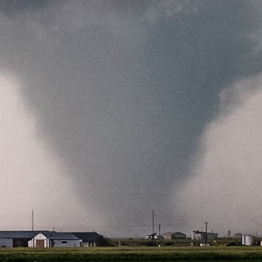
I think the bigger culprit is that the hurricane is temporarily removed from its latent heat engine. When Andrew made landfall it actually intensified as it crossed the Everglades due to an abundance of warm shallow water.
28.10.2025 21:13 — 👍 0 🔁 0 💬 0 📌 0
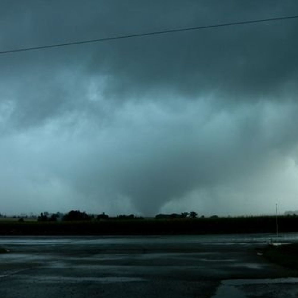
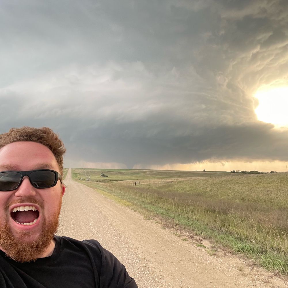
Small area of weak rotation up at the northern end of Georgian Bay, with a 'broken-S' signature showing up on Britt (CASBI) radar. #ONstorm
19.10.2025 18:35 — 👍 6 🔁 3 💬 1 📌 0
Happy #Thanksgiving!
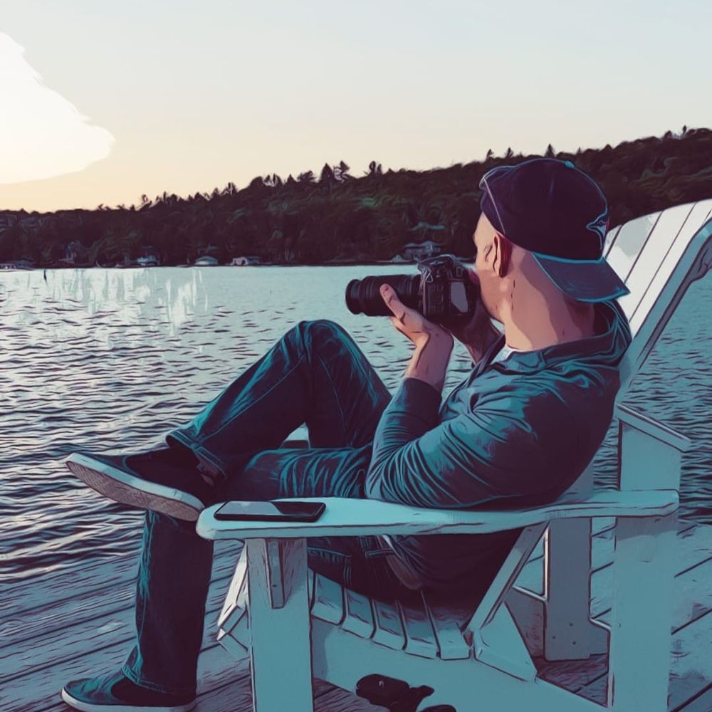
Enjoying the #Woodbridge #Fair today 😀
13.10.2025 21:36 — 👍 2 🔁 0 💬 0 📌 0

Frost risk for #Toronto proper and much of the #GTA again tonight. I’ve temporarily stuffed all the overwintering plants into the greenhouse. I’ll have to organize it in the coming days when I have some time. They should be able to go back outside tomorrow.
#ONweather #weather #frost #greenhouse
09.10.2025 18:44 — 👍 4 🔁 0 💬 0 📌 0
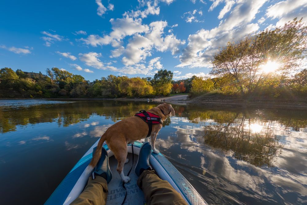
Just a quick video from yesterday on the Credit River... woooosh!
#CreditRiver #Kayaking #PaddleLife #RiverAdventures #Ontario #OutdoorAdventure #Paddling #ExploreOntario
#Beagle #BiscuitTheBeagle #DogsofInstagram #BeagleLife #AdventureDog #DogOnBoard #PaddlerDog
07.10.2025 00:26 — 👍 7 🔁 0 💬 0 📌 0
YouTube video by vaughanweather
Fall Kayaking in Algonquin Park
Had a fantastic 6-hour outing in Algonquin Park on Monday with my dog before the fall colours disappear. We explored two islands and five connected bodies of water. We cheated on lunch and brought McDonald's (the dog got his own fries!). 🍟
#kayak #fall #weather #beagle
youtu.be/DT7iCx4BKYU?...
01.10.2025 19:05 — 👍 2 🔁 0 💬 0 📌 0
What’s going on in your country!
21.09.2025 01:35 — 👍 2 🔁 0 💬 1 📌 0
All with a putter from the club house.
18.09.2025 01:33 — 👍 5 🔁 0 💬 0 📌 0
The application of the 1st amendment is selective at best, that’s the way I’m seeing it.
17.09.2025 23:46 — 👍 1 🔁 0 💬 0 📌 0
Willfully unaware…
There’s strong support at the moment, I fear that for many Americans when they realize what has occurred it may be too late if it gets to that point.
The only motivational factor might be economic hardship, that’ll be the motivation, not any social or political awakening.
17.09.2025 23:44 — 👍 0 🔁 0 💬 0 📌 0
YouTube video by vaughanweather
Sept 11 Kayaking - Humber River
Not directly weather related... but still fun!
youtu.be/T2mIa77f0RA?...
#Toronto #Kayaking #HumberRiver #LakeOntario #TorontoWaterfront #HumberBay #Paddle #Canoeing #Adventure #Travel #OutdoorAdventure #Dog #Beagle #KayakingWithDogs #CitySkyline #TorontoAdventures #Ontario #Canada #SummerVibes
14.09.2025 21:41 — 👍 4 🔁 0 💬 0 📌 0
I'm not a conspiracy theorist at all but... hear me out.
Last time there was a shooting, Trump surged in the polls.
The Epstein thing is still going, and he's underwater, this Charlie Kirk thing is definitely going to pull the spotlight away..
Oh and the shot was not close range...
🤷
10.09.2025 22:30 — 👍 4 🔁 0 💬 1 📌 0

He is dead.
10.09.2025 20:49 — 👍 51 🔁 1 💬 5 📌 0
There are a couple close up videos and it'll be a miracle + science if be survives BUT I think he'll be a paraplegic - looks like serious spinal damage as the bullet passes through his neck.
I actually feel bad for the guy, never thought I'd say that but flat out murder is just wrong.
10.09.2025 20:10 — 👍 0 🔁 0 💬 0 📌 0
I don't know... see the video on Twitter? Definitely severed his spine after going through the artery in his neck. If he survives he'll likely be a paraplegic.
Hate creates more hate but no matter how much someone dislikes/hates him, flat out murder is inexcusable.
10.09.2025 20:04 — 👍 4 🔁 0 💬 1 📌 0
There are now 20+ Russian cruise missiles in Ukraine airspace. Heading across the country at the moment.
10.09.2025 02:55 — 👍 95 🔁 21 💬 1 📌 1
The Operational Command of the Armed Forces is monitoring the current situation, and its forces and resources remain fully prepared for immediate response.
#JoinedForSecurity #JointForSecurity
10.09.2025 01:55 — 👍 2 🔁 0 💬 0 📌 0
weapons were deployed, and operations are underway to locate the downed targets. We emphasize that the military operation is ongoing and we appeal to everyone to stay at home. The most at-risk areas are the Podlaskie, Mazowieckie, and Lublin Voivodeships.
10.09.2025 01:55 — 👍 2 🔁 0 💬 1 📌 0

Please note: During today's attack by the Russian Federation targeting targets located in Ukrainian territory, our airspace was repeatedly violated by drones. An operation is underway to identify and neutralize the targets. At the behest of the Operational Commander of the Armed Forces,
10.09.2025 01:55 — 👍 2 🔁 0 💬 1 📌 0
Yeah wayyyy too early... I'm sure once it's daylight we'll have far more info.
If they were kinetically taking these drones down, they were doing it in unpopulated places. So it'll be a while before the farmers get out there and post photos.
10.09.2025 01:18 — 👍 3 🔁 0 💬 1 📌 0
bsky.app/profile/twmc...
10.09.2025 01:05 — 👍 3 🔁 0 💬 1 📌 0
bsky.app/profile/twmc...
10.09.2025 01:04 — 👍 3 🔁 0 💬 1 📌 0
Social media posts from Poland showing alleged debris in the street that fell from the sky in Cienchanow.
09.09.2025 23:45 — 👍 2 🔁 0 💬 1 📌 0
🤷
The 🇵🇱 military has yet to confirm any engagement but pretty reliable telegram channels are saying SAAB/F35 & F16 fighters have engaged and shot down several.
Also - this time they've gone pretty far into Polish territory if confirmed.
At some point they've got to stop with letters LOL.
09.09.2025 23:42 — 👍 1 🔁 0 💬 1 📌 0
Multiple platforms now report at least 7 known incursions of drones into Polish airspace and possibly several others into Moldovan airspace. Numerous NATO jets up in the air including AWACS and supporting (refueling) aircraft. Unconfirmed reports drones have been engaged by fighter aircraft over Pol
09.09.2025 23:36 — 👍 7 🔁 2 💬 1 📌 0
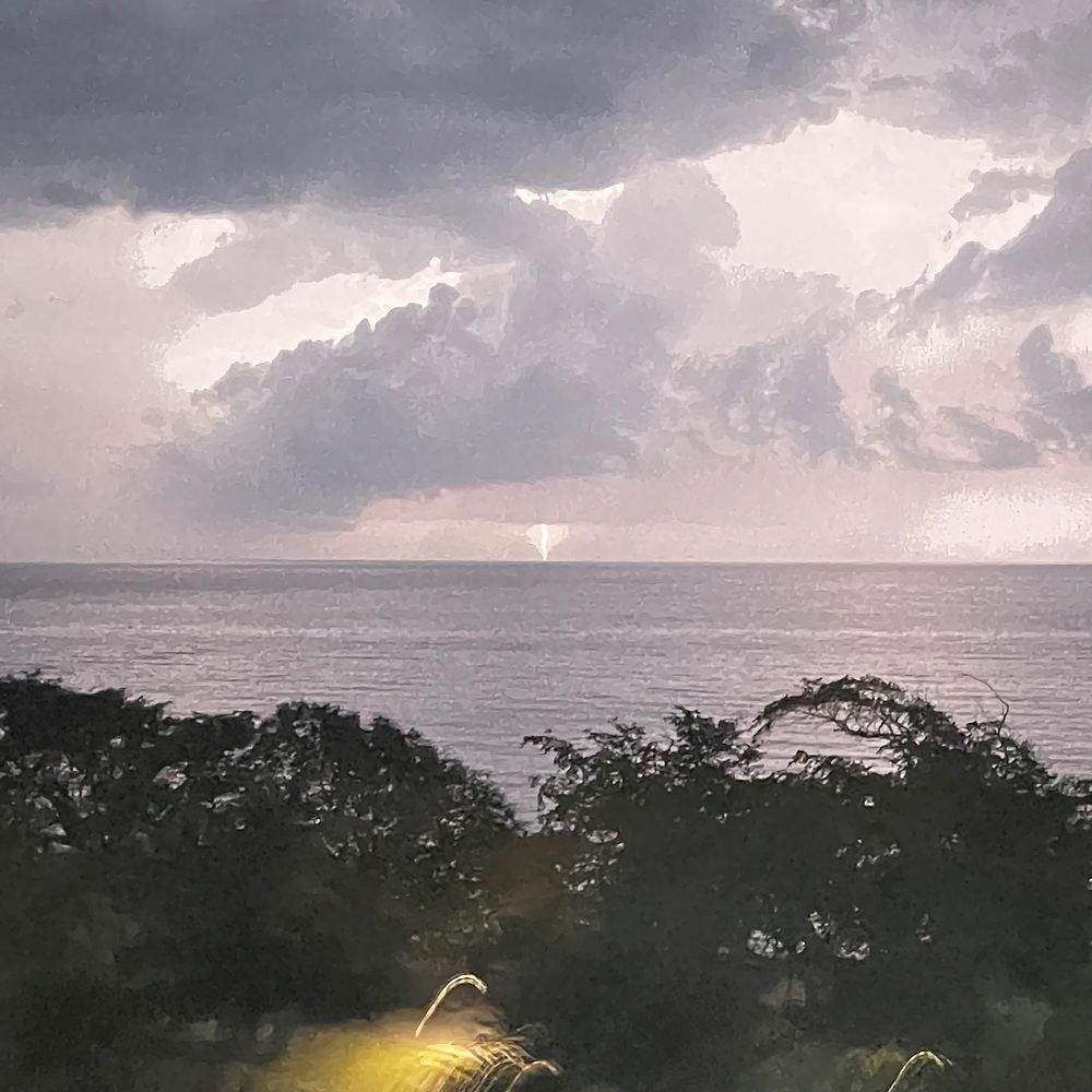
Orphan anvil, cumulonimbus cloud without continuing inflow / convection. Basically one puff up, rain / virga falling down and whatever else went up fanning out at the tropopause forming an anvil cloud. It'll soon just be a blob of cirrus cloud that'll evaporate / sublimate.
02.09.2025 15:38 — 👍 2 🔁 0 💬 0 📌 0
I want to live in a world of equality, justice, & health. Believer in science & nature. Ottawa, ON resident. Sometimes too much Canadian politics & not enough Verin & Tomas. She/her
Profile alt: me. Woman with short hair, glasses, & a green plaid fleece.
I'm just a regular guy who cares
Enjoyer of clouds - Someone once asked if I was a photographer - #BillsMafia - Resident of the Finger Lakes region - 🐦
Husband and Father, amateur storm chaser, amateur photographer, motorcycle rider (two wheel & thunder therapy 🤘😎) animal lover and nature observer
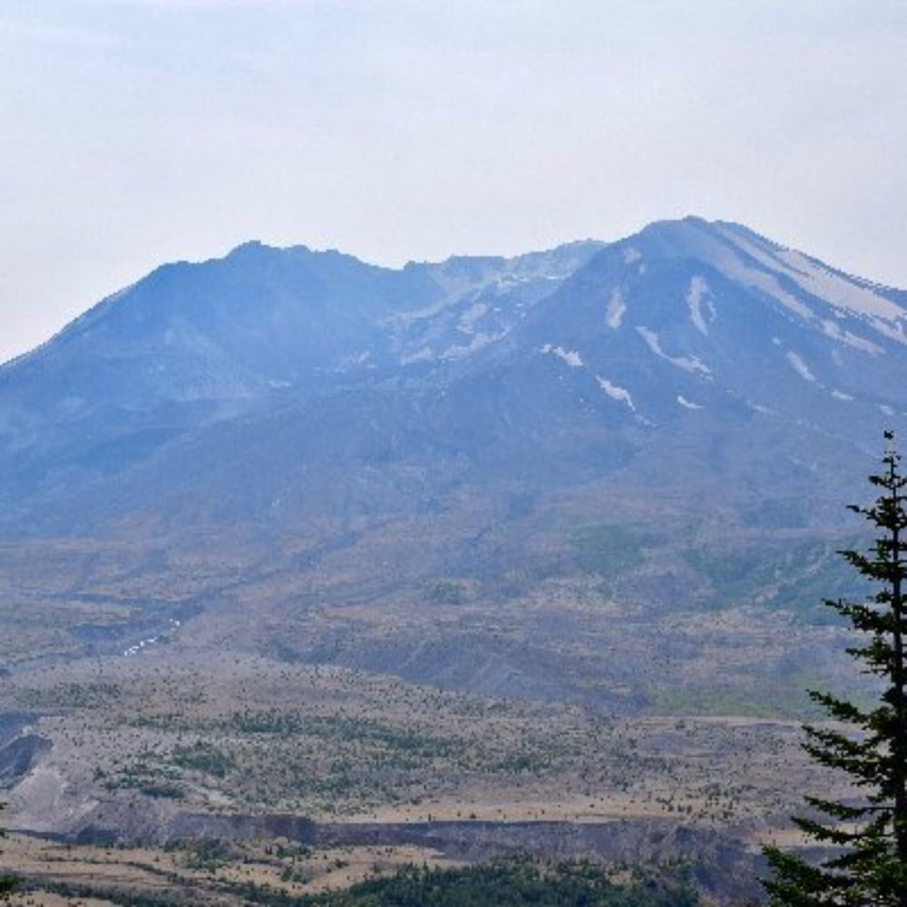
Hi there, I’m Chris—a former SciComms guy talking to you about the 1980 eruption of Mount St. Helens.
About Me: https://bsky.app/profile/mountsthelens1980.bsky.social/post/3lohgbvt4ab2d
Links: https://linktr.ee/sthelensin1980
I'm a wildlife artist, pencil artist and environmentalist.
Atheist and believe in democratic socialism, science, human rights and women's rights.
Please no DMS. YXE
#CanadiansAgainstPoilievre #nevervoteconservative #fucktrump #fuckelon #markcarneyforpm
Gässje un stolz druff
(https://de.wikipedia.org/wiki/Bad_Kreuznach)
__________________
"Some dance to remember, some dance to forget"
"If there was a God, he would stop us"
Meteorologist for CBC in the Maritimes
Tornado chaser 🌪️⚡️⛈️. Except the ones in Alabama. Not those. Orders queso for the table. Taco Bell is my love language
Dad, family, friend, #Paramedic (ACP), #Science (B.Sc.), logic, critical thinking, 🐕, 🐈, centrist, #LGBTQ (🏳️🌈🏳️⚧️he/him), #NAFO 🇺🇦, ☮️. This is my personal account and views expressed here are my own.
I love weather and storms.
Creator of the Universe.
Join God’s newsletter:
https://www.thegodpodcast.com
Storm chaser, YorkU Atmos. Sci. Undergrad, photographer/writer, joyful pessimist. 🏳️🌈
SW Ontario storm chaser, CANWARN spotter, and extremely amateur storm & nature photographer.
Gananoque Ontario Canada, 1000 Islands, Ham Radio, Weather enthusiast, Boater and Dog lover
📷Photographer
🌙Celestial Events Enthusiast
⛈️Weather Enthusiast
🇨🇦Ontario, Canada
Weather & News guy living in Ontario Canada
Meteorologist ⛈️ Forecasting for Oswego County NY!
BC/AB kid in ON. Luddite. Introverted. Profane. Black Lives Matter and Free Palestine. Horror/sci-fi. Shitposting. Politics. Weather. Plants. Fitness. My pup, cat, husband and daughters. LGBTQ stuff. Insufferable Oilers fan. Was same handle on T*itter.