Thank you to @nodgih.com for making me do the NYT crossword today. It was made for me.
29.07.2025 14:37 — 👍 0 🔁 0 💬 0 📌 0
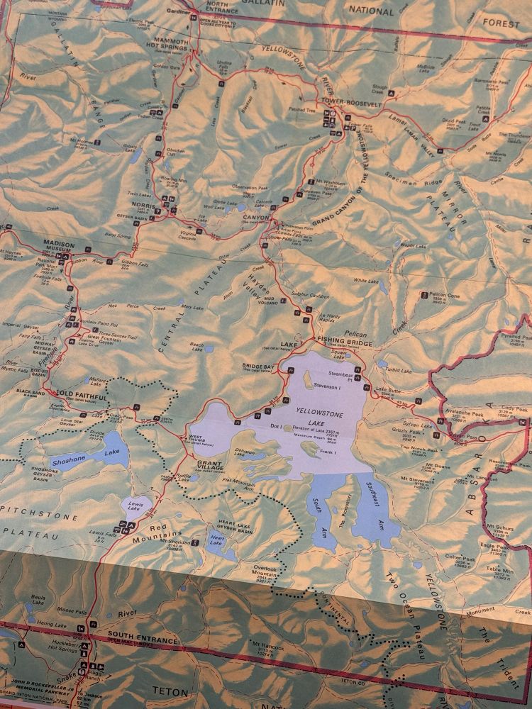
Map of Yellowstone National Park. Green is land, blue is water, red is roads. Yellowstone Lake sits near the center of the image.
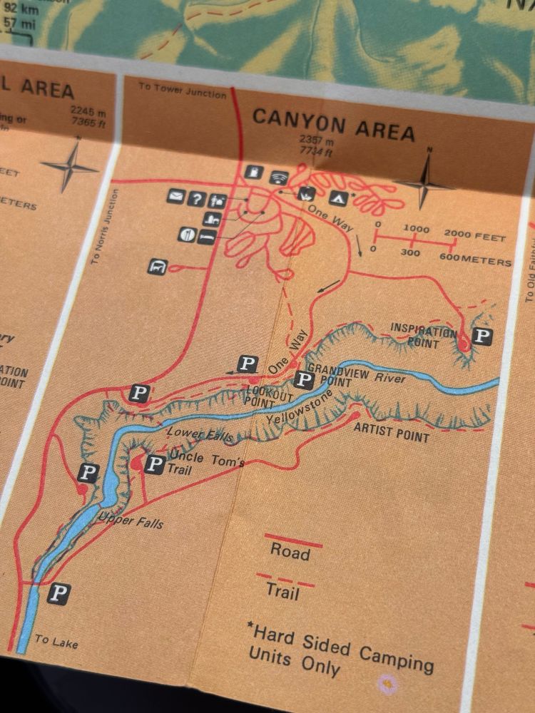
Closeup of the Canyon Area detail map. No shaded relief here.
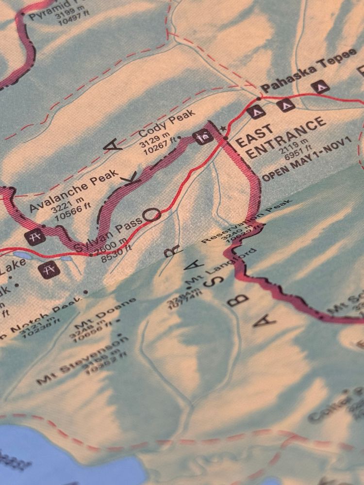
Closeup of the East Entrance.
#Yellowstone brochure map from 1980. Looks a lot different from the modern NPS style, but those colors are great!
24.07.2025 13:25 — 👍 4 🔁 0 💬 0 📌 0
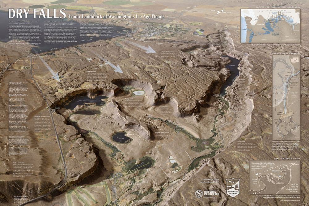
Map of Dry Falls in Washington State's Channeled Scablands
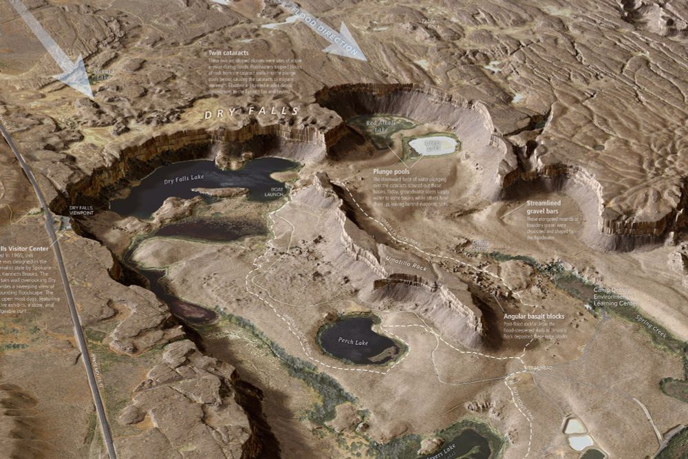
Detailed view of Dry Falls map from Washington State's Channeled Scablands
New, super-detailed Dry Falls interpretive map from the Washington Geological Survey. #iceagefloods #missoulafloods #channeledscablands #geomorphology washingtonstategeology.wordpress.com/2025/07/15/n...
23.07.2025 04:26 — 👍 55 🔁 15 💬 4 📌 3
Thanks to the efforts of @nodgih.com, I now know about this wonderful document of words with a consectuvie triple double, something even the Bitterroots fail to achieve. Let's get some Sheeppoop Mountains on the map somewhere!
21.07.2025 16:45 — 👍 0 🔁 0 💬 0 📌 0
Bitterroot Mountains - Wikipedia
Are there any other mountain ranges with three sets of double letters in their names? Bitterroot always jumps off the page when I see it.
21.07.2025 15:45 — 👍 0 🔁 0 💬 1 📌 0
I know it's named after one of the original park rangers at Glacier. It's still an unfortunate name.
21.07.2025 13:52 — 👍 1 🔁 0 💬 0 📌 0
Working on a map of Minnesota and learning that it's got some great county names based on geography/nature: Big Stone, Otter Tail, Crow Wing. Why name a county after some rando when you could just call it Blue Earth County?
18.07.2025 12:38 — 👍 0 🔁 0 💬 0 📌 0
Reading the Where’s Waldo audiobook and they’re just describing each person individually then try to slip “Waldo” in there real fast but I HEARD IT
16.07.2025 02:20 — 👍 293 🔁 39 💬 2 📌 0
Didn’t know about this app, but I’ve always wanted something that can do pull point forecasts from NWS! Good to know. Enjoy that high sierra weather!
15.07.2025 01:04 — 👍 1 🔁 0 💬 0 📌 0
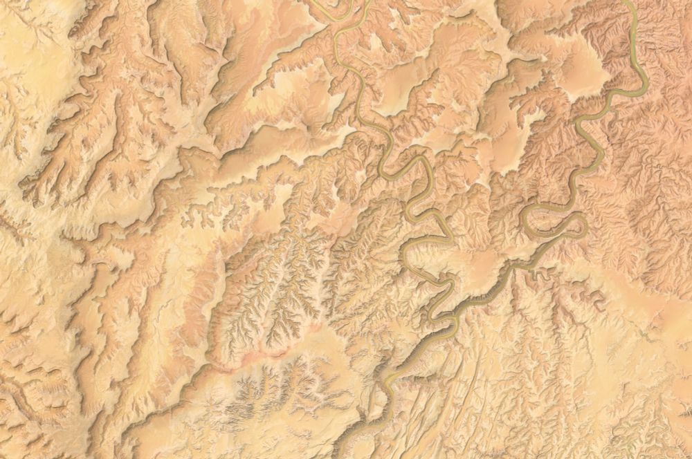
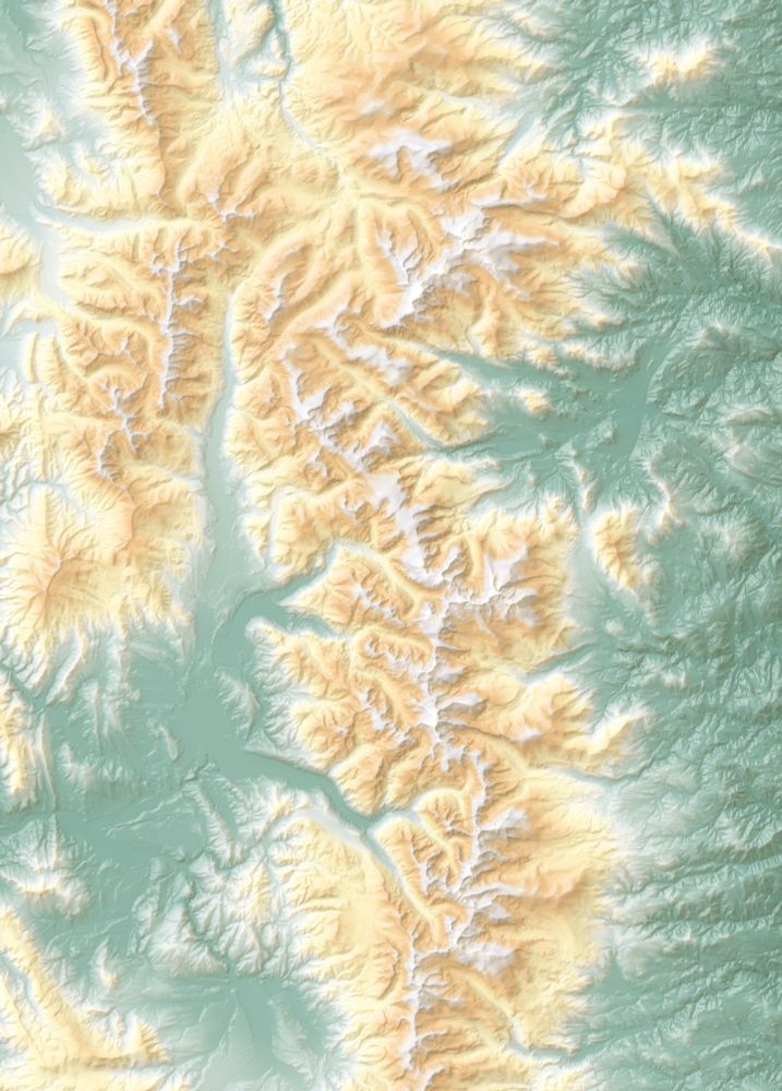
An unlabeled map of canyon country in shades of yellow, orange, and red.
So pretty.
26.06.2025 19:20 — 👍 4 🔁 0 💬 0 📌 0
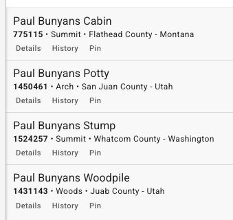
Paul Bunyans Cabin
775115 • Summit • Flathead County - Montana
Details History Pin
Paul Bunyans Potty
1450461 • Arch • San Juan County - Utah
Details History Pin
Paul Bunyans Stump
1524257 • Summit • Whatcom County - Washington
Details History Pin
Paul Bunyans Woodpile
1431143 • Woods • Juab County - Utah
Details History Pin
He's a canonically big dude, so it makes sense that his estate stretches from Washington to Montana to Utah.
24.06.2025 23:13 — 👍 1 🔁 0 💬 0 📌 0
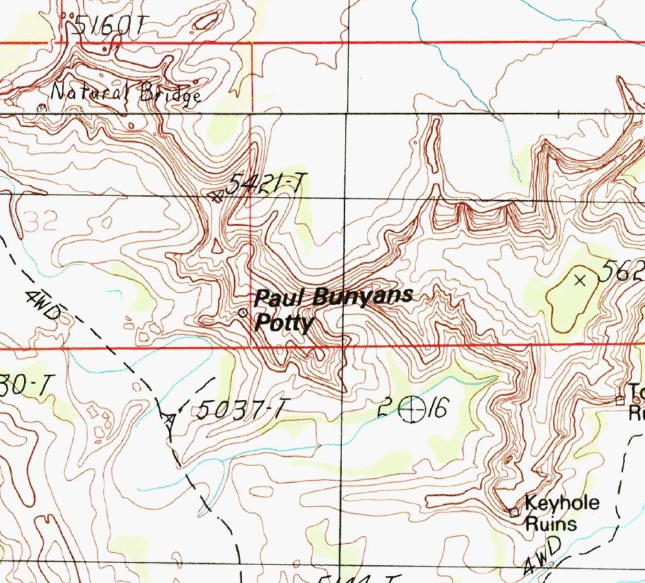
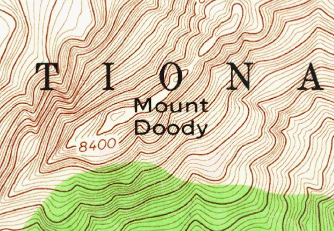
Screenshot of a topo map centered on a feature labeled "Paul Bunyans Potty"
How have I missed this on the maps before?
24.06.2025 22:54 — 👍 1 🔁 0 💬 1 📌 0
Yes! Took me a second to figure it out what was going on, and then I saw it.
23.06.2025 23:51 — 👍 1 🔁 0 💬 0 📌 0
holding my arm up like a falconer any time I see a bird of prey. you never know
20.06.2025 22:19 — 👍 344 🔁 46 💬 2 📌 2
You are 100% correct. Nicely done!
20.06.2025 20:23 — 👍 1 🔁 0 💬 0 📌 0
Shaded relief with hypsometric tinting to show elevation. Green is low, orange is mids, and white is the highest.
Time for a #map quiz: can you identify this landscape just from the shading and elevation tinting?
20.06.2025 20:11 — 👍 2 🔁 0 💬 1 📌 0
Someone in the replies called this doordash for bears and I can't stop laughing
20.06.2025 13:27 — 👍 3412 🔁 1279 💬 26 📌 16
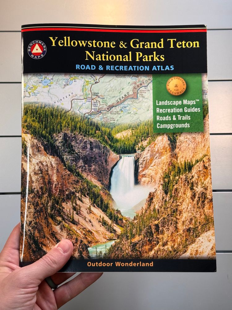
A hand holds an 8.5x11 inch book titled Yellowstone & Grand Teton National Parks Road & Recreation Atlas
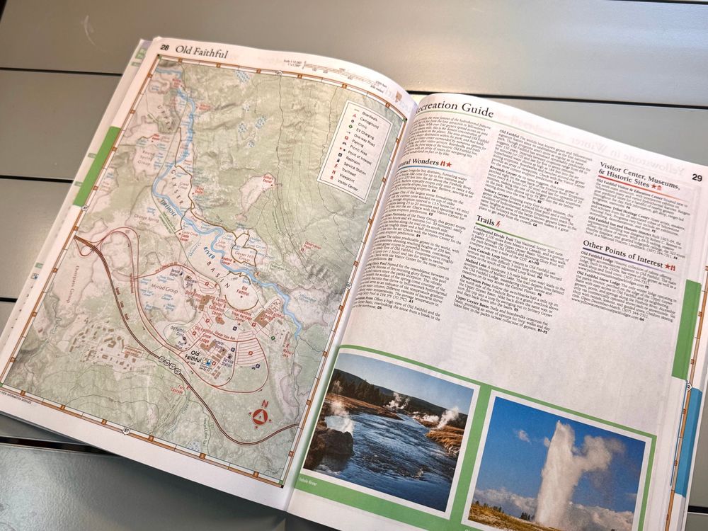
Atlas open on a table. Map of the Old Faithful area on the left, listings and photos on the right. The photos are mine.
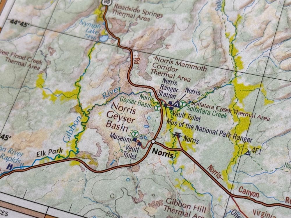
Closeup of the Norris area in Yellowstone, with red type and a red tint showing thermal areas on the landscape.
Stoked to finally get a printed copy of this one: the second edition of our Yellowstone & Grand Teton atlas. More to showcase here, but my favorite new things were the detail maps (like Old Faithful) and the addition of thermal areas on the Landscape Maps.
19.06.2025 17:51 — 👍 2 🔁 0 💬 0 📌 0
One of my favorite bits in the lava tube tours I led in Oregon was talking about how caves like that had preserved some of the oldest evidence of humans in North America. Now I'm looking forward to leading another one at some point and talking about this evidence blowing that out of the water!
19.06.2025 01:22 — 👍 4 🔁 0 💬 0 📌 0
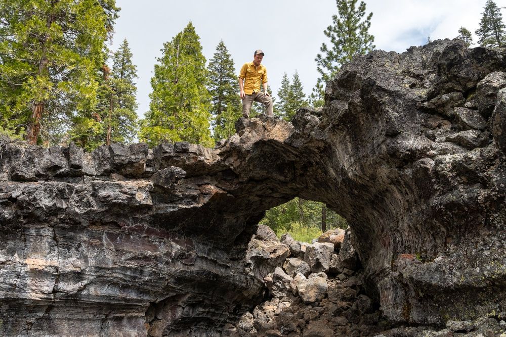
A guy in a yellow shirt (me) stands on a lava arch, leftover from a collapsed lava tube. The rock is dark gray and black. Green conifers rise over the jumble of rocks.
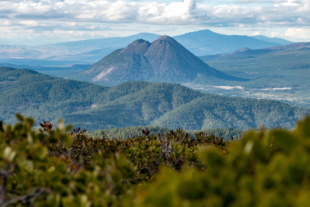
A double-humped gray summit rises behind layers of ridges cloaked in green vegetation. This is Black Butte, a small and extinct volcano on the flanks of Mt Shasta.
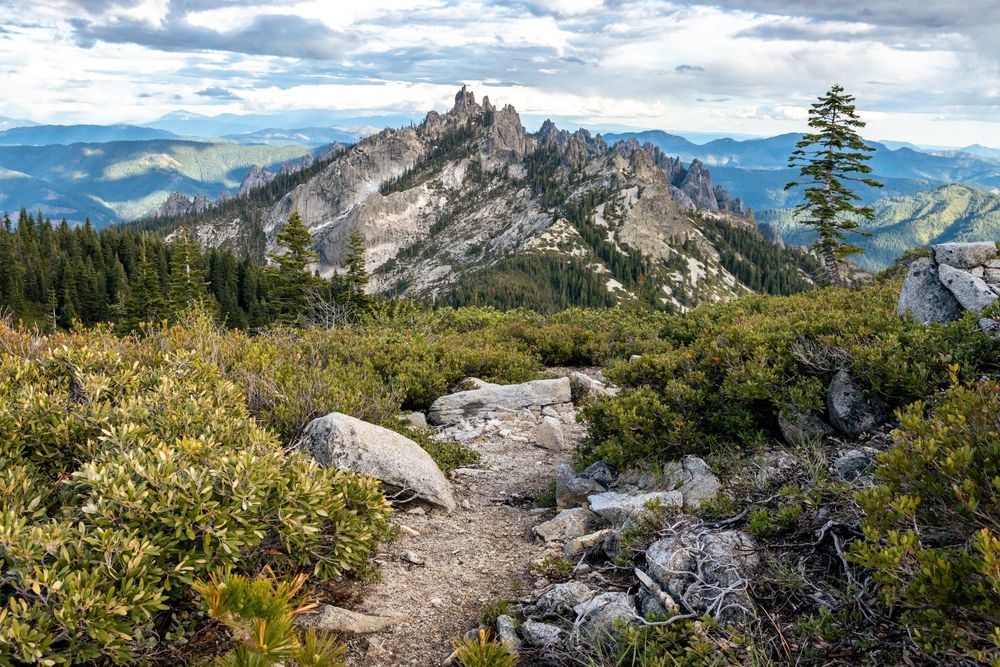
A gray rocky trail winds through green vegetation. A lone fir tree rises on the right. Craggy gray rocks rise in a massif in the distance, with sharp spires and patches of forest on their slopes. The sky is overcast.
Three years ago today was Day 1 of a #California field check near Mt Shasta, scoping out lava tubes and ending the day with views of Castle Crags and Black Butte.
18.06.2025 17:17 — 👍 0 🔁 0 💬 0 📌 0
Especially fond of the zoom-in for the bird's nest.
18.06.2025 16:04 — 👍 3 🔁 0 💬 0 📌 0
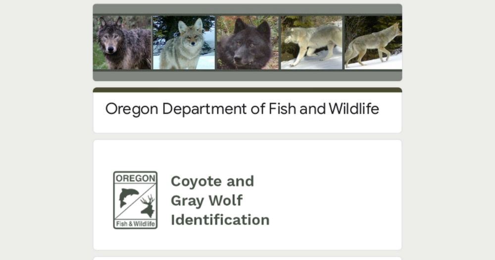
Oregon Department of Fish and Wildlife
Just aced the ODFW wolf/coyote identification quiz. No big deal.
docs.google.com/forms/d/e/1F...
17.06.2025 18:02 — 👍 0 🔁 0 💬 0 📌 0
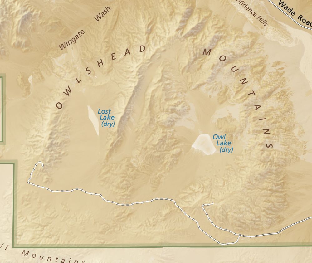
These mountains are supposedly named after the highest peak's resemblance to an owl's head, but come on... the whole range looks like an owl's facial disk with the two dry lakes as its eyes. It's uncanny.
12.06.2025 14:29 — 👍 1 🔁 0 💬 0 📌 0
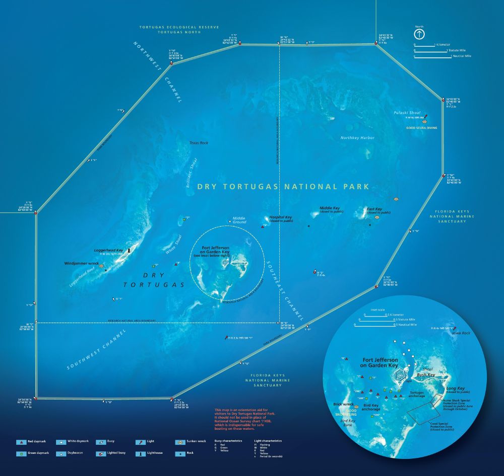
Map of Dry Tortugas National Park. There's so much on here and I never know how to do alt text for a map. The blue is the water, the yellow polygon is the park boundary, and there's a lot more to it.
Somehow I'd never seen the park map for Dry Tortugas, and man I've been missing out!
Worth exploring on your own:
www.nps.gov/media/photo/...
12.06.2025 14:19 — 👍 3 🔁 0 💬 0 📌 0
Heck yeah. Even tried out some different routes on the western end. Gotta see which bridge is the best.
03.06.2025 13:48 — 👍 1 🔁 0 💬 0 📌 0
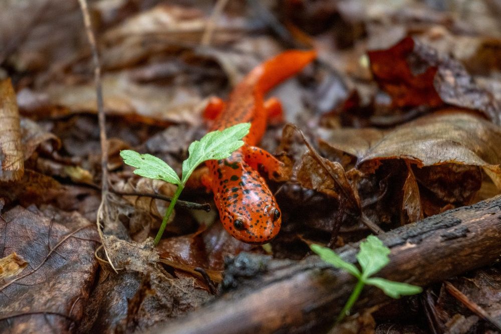
Black-chinned red salamander on the forest floor. Leaves decay around it while two sprigs of green rise above the detritus, one over the salamander's head. The salamander is a bright red color with black eyes, black dots along its back, and a black chin.
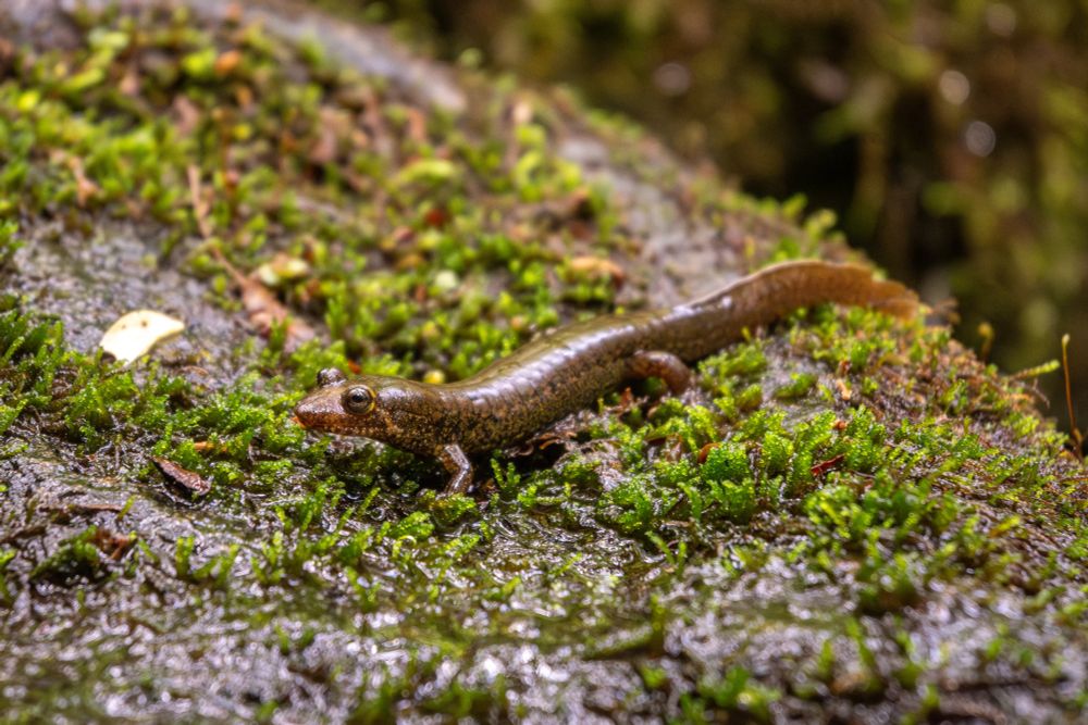
A dusky salamander (genus Desmognathus), probably a black-bellied? It sits on a mossy rock by a stream. The salamander is brown overall with intricate stipple patterns of black, gold, and orange along its sides.
Made some friends in the Smokies.
02.06.2025 17:15 — 👍 1 🔁 0 💬 0 📌 0
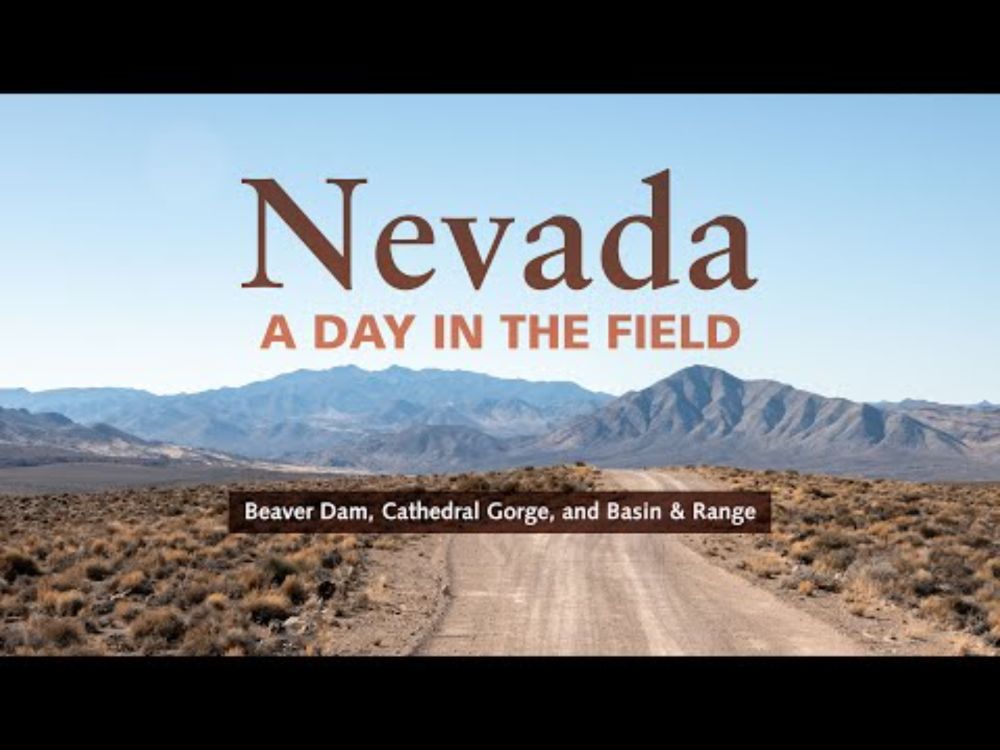
YouTube video by Benchmark Maps
A Day in the Field: Nevada (Beaver Dam, Cathedral Gorge, Basin & Range)
Another day from the Nevada field check. This one ended sweeter than the others with a private evening at a hot spring in the desert. Well, I wasn't totally alone... there were a lot of fish in there.
youtu.be/OkZ4wRwMfGA?...
30.05.2025 16:08 — 👍 1 🔁 0 💬 0 📌 0
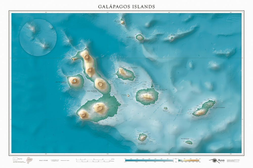
Map of the Galápagos Islands. Hypsometric tints color the islands to show elevation, with greens being the lowest and oranges the highest. A similar treatment is applied to the ocean, with light blue areas showing shallower water and dark blue showing deeper water.
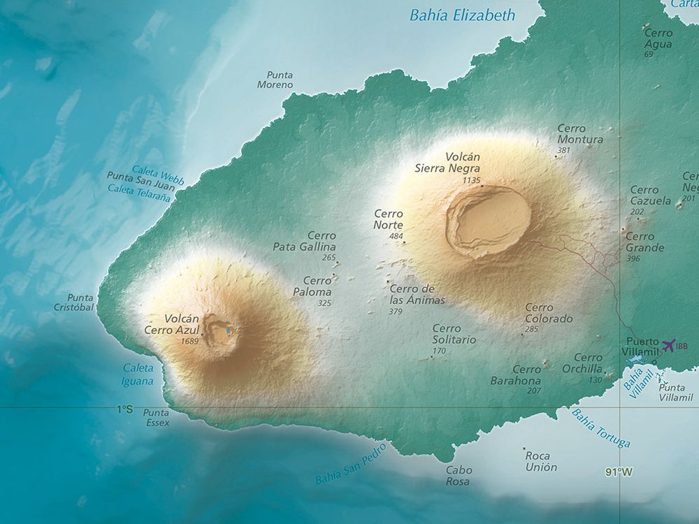
A portion of Isla Isabela in the Galápagos Islands. Hypsometric tints color the islands to show elevation, with greens being the lowest and oranges the highest. A similar treatment is applied to the ocean, with light blue areas showing shallower water and dark blue showing deeper water. Peaks and other physical features are labeled.
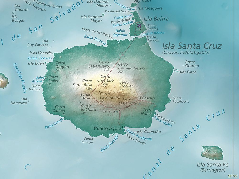
Isla Santa Cruz and Isla Santa Fe in the Galápagos Islands. Hypsometric tints color the islands to show elevation, with greens being the lowest and oranges the highest. A similar treatment is applied to the ocean, with light blue areas showing shallower water and dark blue showing deeper water. Peaks and other physical features are labeled.
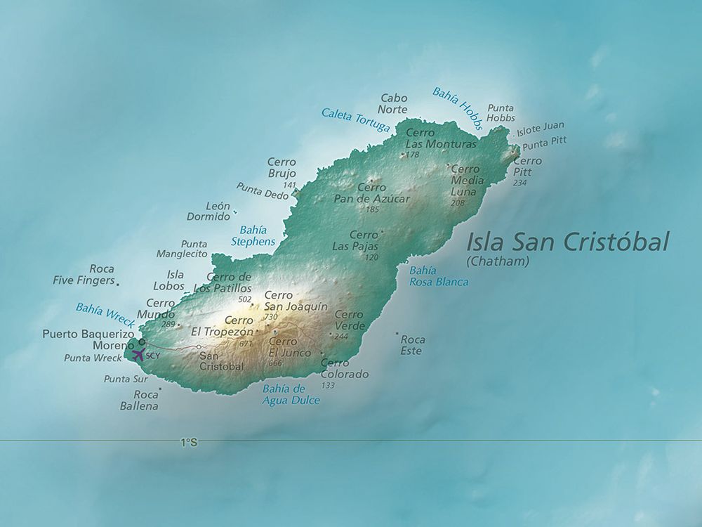
isla San Cristóbal in the Galápagos Islands. Hypsometric tints color the islands to show elevation, with greens being the lowest and oranges the highest. A similar treatment is applied to the ocean, with light blue areas showing shallower water and dark blue showing deeper water. Peaks and other physical features are labeled.
Another new Raven map: the Galápagos Islands. I've never been here, but it was fun to dream about it while working on this one. Fascinating landscapes, and some interesting bathymetry below the ocean's surface.
bit.ly/4mIz5HM
29.05.2025 15:54 — 👍 4 🔁 0 💬 0 📌 0
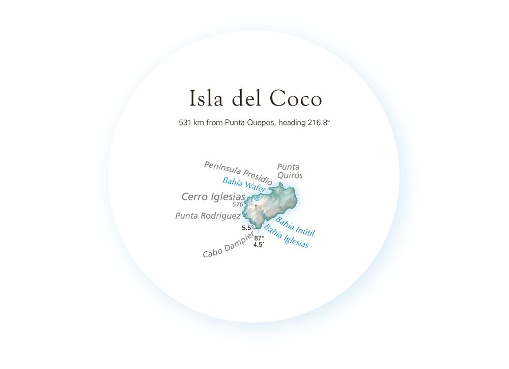
Map of Isla del Coco, surrounded by a faint blue glowing circle to show that it's an inset, plus text describing its location, all in an attempt to convey that this is not where the island actually sits in relation to mainland Costa Rica.
The "problem" with countries is sometimes they have outlying islands that don't fit in the scope of the main map. Raven Maps are generally neatline-free with lots of empty space around the focal area. So you get to come up with an interesting way to do an inset that still fits the overall look.
27.05.2025 20:30 — 👍 1 🔁 0 💬 0 📌 0
Maps—Rivers—Terrain
dancoecarto.com
KOHD/ABC & KBNZ/CBS on-air across the High Desert. News tips: tips@centraloregondaily.com. Find our app in the Apple and Google Play stores.
Website: centraloregondaily.com
Bend & Central Oregon's locally owned, independent & FREE weekly paper — news, music, food, outdoors, film & more.
Parody. Some hate Trump. I don't. He's just a wanker. We, on the other hand, are COLONIZED by a wanker.
50 Years of the Portland Timbers presented by Toyota 🪓
U.S. Senator for Oregon. Rotisserie chicken enthusiast. Senate’s resident privacy hawk.
senatefinance.bsky.social
wydenpress.bsky.social
🎥 https://www.youtube.com/@pablotorrefindsout
🎧 https://podcasts.apple.com/us/podcast/pablo-torre-finds-out/id1685093486
📩 www.pablo.show/about
tag or dm for submissions
support: https://www.patreon.com/TheLouvreofBluesky
"bluebirds, bluegrass, blueschist, bluesky"
Community college geology professor in Charlottesville, Virginia, USA
Looking into it. Chief Looker: @jenn.bsky.social
🏞️ Protecting America's national parks since 1919
Podcasts & media coverage of Saturday Night Live ⭐️ https://linktr.ee/saturdaynightnetwork
Writer (on science, travel & curiosity), Yorkshireman, tedious enthusiast, professional overthinker, Megathreader. Now: Scotland.
Writes Everything Is Amazing: https://everythingisamazing.substack.com/
star of snl / grimlin 3: dawn of desmond / shrek 5 / rightful owner of muppet ip / singer as well
classically trained artist.
theartofpants.com
Senior Fellow at @mmfa. Views expressed here my own. Husband of @alyssarosenberg. Dad. Not the former GOP congressman. Find me here: http://bio.site/mattgertz
Hi, I’m Chris. It’s 2025, but I’m back in 1980—tracking the eruption of Mount St. Helens (Lawilátɬa/Loowit) 45 years later. #MSH45
About Me: https://bsky.app/profile/mountsthelens1980.bsky.social/post/3lohgbvt4ab2d
Links: https://linktr.ee/sthelensin1980
Earth & EnviroSci Educator, Central Valley equity/sustainability advocate, Hiker, Photographer, 2015 NAGT FW Outstanding Educator. 🌋 Tissue Box Maker.
❤️🏕⛰🏜 w/ @Xenolith & Z.
BPR informs, inspires, connects, and reflects the people and places of Western North Carolina, on air at BPR News & BPR Classic and online at https://www.bpr.org/
NYT bestselling author lol //
my first book, ONE OF THE BOYS, is out now! //
buffalo-based football internet transsexual //
writer in residence @ texas roadhouse //
victoria.monster //
🇵🇸🇵🇸🇵🇸 //