ribbon falls on the north kaibab trail creating a mound of travertine geologic trail map of the grand canyon

north kaibab trail showing hiker and Bright Angel Creek geologic trail map of the grand canyon

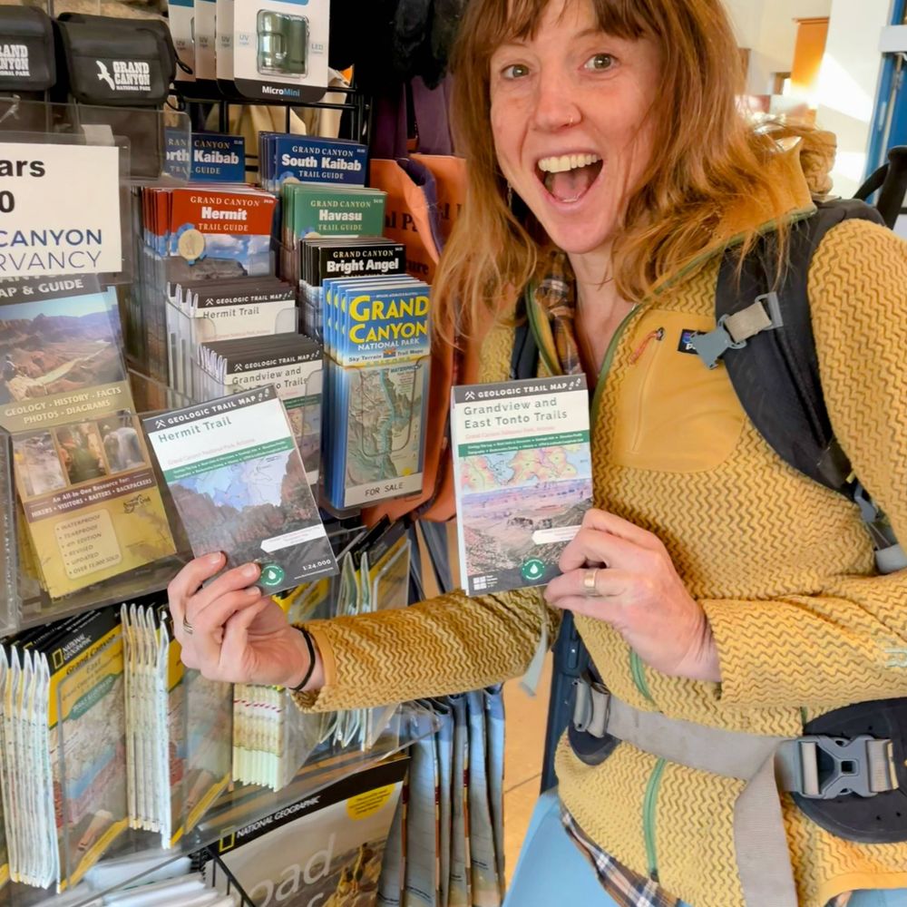
hiker consulting geologic trail map of the grand canyon

hiker consulting geologic trail map of the grand canyon
Scouting the North Kaibab Trail for the next Geologic Trail Map this June! At Ribbon Falls, calcium carbonate precipitates as travertine due to CO₂ degassing—forming a 30-ft mound. South Kaibab & Bright Angel maps in production!
🔗 fourcornersmapping.com/newsletter
#GrandCanyon #maps #cartography
02.05.2025 12:36 — 👍 3 🔁 0 💬 0 📌 0

A Water Map for the Desert
The map relies on a combination of Indigenous knowledge and government data to map water resources and Indigenous communities in a region known as Black Mesa, or Dził Yíjiin in Navajo.
My map of Black Mesa is featured on Esri’s Maps.com! Made for Tó Nizhóní Ání ("Sacred Water Speaks"), it shows the fragile water systems of Dził Yíjiin. A tool for advocacy + beautifully styled cartography. A map as reference, record, and resistance.
🔗 www.maps.com/a-water-map-...
21.04.2025 18:03 — 👍 3 🔁 0 💬 0 📌 0
YouTube video by Tó Nizhóní Ání
Webinar | BLACK MESA CARTOGRAPHY MAP
Last week, we conducted our first webinar of 2025, which featured members of our organization, @annariling.bsky.social of Four Corners Mapping & GIS, and Council Delegate Germaine Simonson. Check out the webinar recording to learn more about our Black Mesa Cartography Map. youtu.be/MhbJ2bvlH18?...
19.03.2025 20:51 — 👍 1 🔁 1 💬 0 📌 0
Oh wow, thank you for this introduction! I ordered the Turtle Island Decolonized map and the Atlas of Indian Nations book from the Map Center!
21.01.2025 20:39 — 👍 1 🔁 0 💬 0 📌 0

Turtle Island Decolonized
Turtle Island Decolonized: Mapping Indigenous Names across “North America” Indigenous place names carry the stories of the land and its people, reflecting the unbroken relationships bet…
are living and dynamic, none of these names are any less “authentic” than those passed down through continuous oral tradition. Embedded in all these names are ancestral words and worldviews. Above all, the map serves to illustrate that Indigenous peoples are still here. (4/4)
20.11.2024 03:58 — 👍 16 🔁 5 💬 0 📌 0