Excited to share more work with @navavfan.bsky.social as she continues this line of inquiry, expands upon this project, and continues towards completing her PhD! 3/3
20.01.2026 20:37 — 👍 1 🔁 0 💬 1 📌 0
This work uses the InVEST seasonal model to improve our understanding of runoff and partitioning dynamics in NE Mexico based on soil and land cover characteristics and sets the stage for continuing evaluations of water resources in Tamaulipas. 2/
20.01.2026 20:36 — 👍 2 🔁 0 💬 1 📌 0
@navavfan.bsky.social, a PhD student at Universidad Autónoma de Tamaulipas who spent the Fall as a visiting scholar with us @uisedu.bsky.social and in my lab, had her first paper on our work together published in ISPRS Annals today (isprs-annals.copernicus.org/articles/X-3...). 1/
20.01.2026 20:35 — 👍 2 🔁 1 💬 1 📌 0

MS student, Ava Maria Mendoza, will be presenting her poster on "Understanding the links between climate, watershed biogeochemistry, and Cyanobacteria growth in Lake Springfield, IL" during Wednesday afternoon's session.
14.12.2025 23:28 — 👍 1 🔁 0 💬 0 📌 0

Dr. Blount will also be presenting their work,"From Plots to Cities: Using Multiple Methods to Improve Our Understanding of Heat-Water Interactions Across Scales in the Built Environment", in H22I (room 238-239) at 11:30am.
14.12.2025 23:26 — 👍 1 🔁 0 💬 0 📌 0
PI, Kyle Blount, is co-convening #urban #ecohydrology sessions on Tuesday:
H21I (oral) 8:30-10am in 238-239
H22I (oral) 10:30am-12pm in 238-239
H23S (poster) 2:15-5:45pm
14.12.2025 23:26 — 👍 0 🔁 0 💬 1 📌 0
Are you going to be at @agu.org this week? The WATER Lab @uisedu.bsky.social would love to see you at events we are participating in! More details below...
#AGU25 #ecohydrology #WATERlab @hydrology-agu.bsky.social @aguecohydro.bsky.social
14.12.2025 23:19 — 👍 5 🔁 0 💬 2 📌 0
#hydrology #urbanhydrology #cities #water #eduction #training #interdisciplinary #conceptualmodel #community #participatoryresearch #collaboration #urban #communityofpractice #policy #academia 5/5
28.11.2025 14:46 — 👍 1 🔁 1 💬 0 📌 0
We also identify 10 action items to guide the development of the discipline and the need for improved strategic investment in education and training as well as support for community-engaged and participatory research and outreach. 4/5
28.11.2025 14:46 — 👍 1 🔁 1 💬 1 📌 0
We discuss the unique context of urban hydrology, with unique challenges, opportunities, and - we propose - responsibilities for scientists working in this space. We highlight the need for interdisciplinarity, a new conceptual organization, building a community of practice, and enhanced impact. 3/5
28.11.2025 14:46 — 👍 1 🔁 1 💬 1 📌 0
Thanks to the amazing team:
@jvwilkening.bsky.social, @akkagawa.bsky.social, @sledford.bsky.social, A. Cao, X. Chen, S. Fathel, X. Feng, @cgerleinsafdi.bsky.social, K. Kaiser, C. Oswald, @parolari.bsky.social, @ecowarrior-rex.bsky.social, C. Ross, P. Seibert & A. Willis 2/5
28.11.2025 14:46 — 👍 2 🔁 1 💬 1 📌 0
Happy to be a part of the convener team again this year! We'd love to have you join us and learn about your work! #AGU25 #UrbanEcohydrology @agu.org @aguecohydro.bsky.social @hydrology-agu.bsky.social
23.07.2025 20:54 — 👍 6 🔁 0 💬 0 📌 0
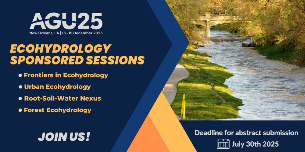
Abstracts for the AGU Ecohydrology Sponsored Sessions are due July 30!
We're offering four engaging sessions for ecohydrologists across all disciplines. Share your insights, spark new conversations, and be part of the vibrant #ecohydrology community at #AGU25!
#callforabstracts
21.07.2025 16:52 — 👍 9 🔁 4 💬 1 📌 3
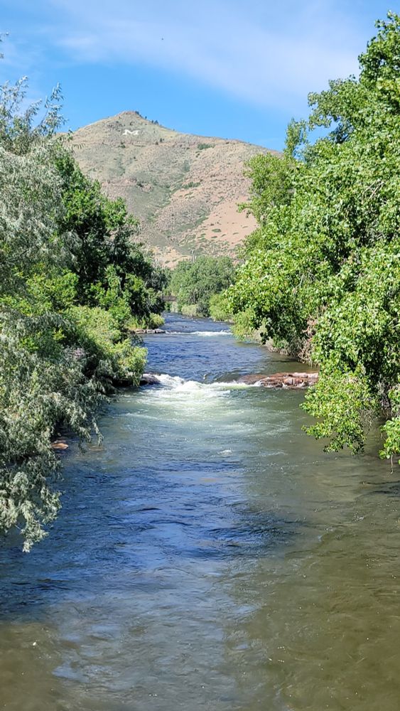
It's always nice when field work takes you beautiful places. Even better when those places have friends and memories! #Golden #Colorado
03.07.2025 16:28 — 👍 4 🔁 0 💬 0 📌 0
Yay, Paul!
19.06.2025 20:09 — 👍 1 🔁 0 💬 0 📌 0
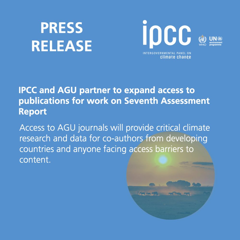
📣 PRESS RELEASE
🌎 📚 The full library of the @agu.org Publications is now available for #IPCC authors working on the Seventh Assessment Report.
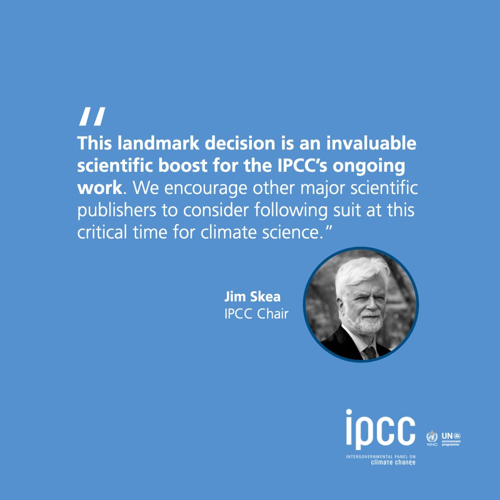
"This landmark decision is an invaluable scientific boost for IPCC's ongoing work…" - #IPCC Chair Jim Skea
🔗https://bit.ly/PRAGU
19.06.2025 14:27 — 👍 20 🔁 7 💬 0 📌 0
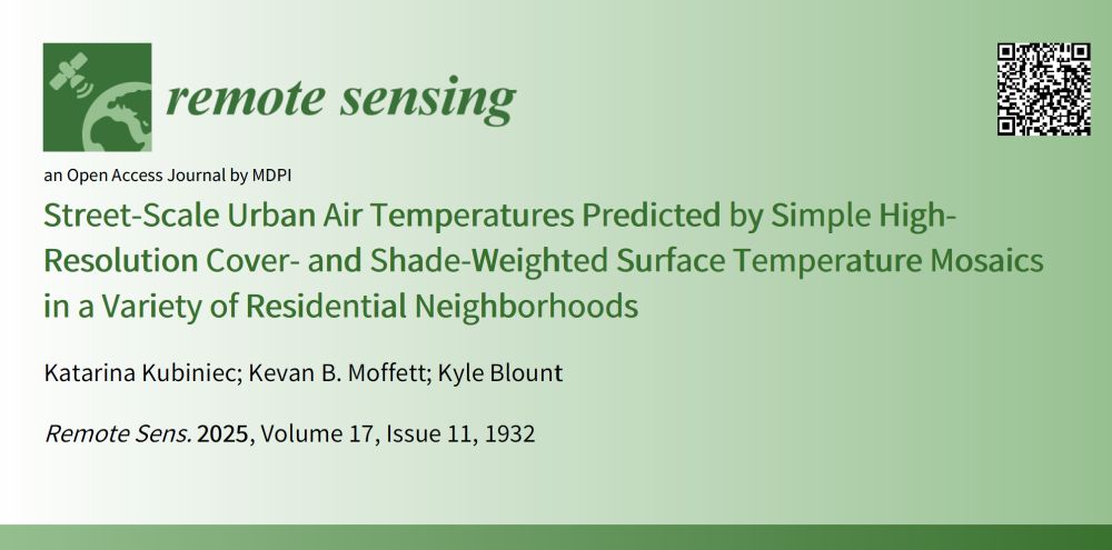
🏙️ In addition to providing guidance for city planning and landscape design, this method is simple, scalable, and accurate way for municipalities to evaluate urban heat. Cities can use it to map heat risk, guide tree planting, and protect vulnerable communities from extreme heat. 🔥🛠️
17.06.2025 22:21 — 👍 5 🔁 0 💬 1 📌 0
📊 Simple area-weighted surface temperature models closely matched pedestrian-level air temperatures—almost a perfect 1:1 correlation. Results show that streets with greater tree canopy were significantly cooler, both for shaded surfaces and for surfaces in sun during the time of analysis. 🌳🌡️
17.06.2025 22:20 — 👍 4 🔁 0 💬 1 📌 1
📡 We used aerial images, thermal imagery of surface temperatures, and air temperature data to evaluate the differences in urban heat characteristics associated with land cover and shading across Portland residential landscapes. 🌿🏘️
17.06.2025 22:17 — 👍 2 🔁 0 💬 1 📌 0
Hello, Bluesky! Excited that my first post gets to be a
🎉NEW PAPER ALERT🎉
🌆 New research shows we can predict street-level urban heat using simple tools—no complex models needed. Insights support climate resilience and urban planning. 🛰️🌳
www.mdpi.com/2072-4292/17...
17.06.2025 22:15 — 👍 89 🔁 8 💬 1 📌 1
thinking??? about hydroclimatic extremes and infrastructure systems @ Illinois
chai tea connoisseur - h2O enthusiast
\\ usual disclaimers
Weather and climate scientist focused on extreme events like floods, droughts, & wildfires on a warming planet. www.weatherwest.com
• San Francisco Bay Area • Queer • Too many nature pix • FAIR and open gov science in the public interest • Geoscience • Water Resources • Birds! • Public Lands • Burrowing Owl & Pupfish stan acct •
This is a personal account, obviously 🙄
M.Sc. Graduate, KNT University
Remote Sensing | Photogrammetry
---→ Environmental Monitoring, Forest Ecology, Wildfire, UAV Photogrammetry, Bundle Adjustment, Canopy Cover
#RemoteSensing #Photogrammetry #UAV #Drone #DeepLearning #GIS
Urban climates and other human habitats.
Architect by trade, urban climatologist by profession.
Chicago 📍
Header: hdl.loc.gov/loc.pnp/cph.3c31432
Avatar: Giacinto Brandi, L'Architettura(?)
PhD Student at EESC/USP
Interested in SW/GW interactions and hyporheic zone.
BEng. - UFC
MSc. - École Centrale de Lille/EESC
https://drive.google.com/file/d/1Xl8e1UqRRdMcLxSvQudH2TN4PLGiFvtP/view?usp=sharing
Geographer interested in water and climate. Editor of International Journal of Geospatial and Environmental Research (journals.tdl.org/ijger)
The Virginia Water Resources Research Center provides research and educational opportunities to scientists/students, and water science info for citizens and gov leaders. vwrrc.vt.edu
Mexican Historian & Philosopher of Biology • Postdoctoral Fellow at @theramseylab.bsky.social (@clpskuleuven.bsky.social) • Book Reviews Editor for @jgps.bsky.social • https://www.alejandrofabregastejeda.com • #PhilSci #HistSTM #philsky • Escribo y edito
CU Boulder Civil Engineering Ph.D. Student in the Hydro-Urban Bhaskar Research Group.
Interested in water conservation, urban hydrology, landscape change, urban microclimates, and remote sensing
University of Saskatchewan Environmental Engineering Alum
Hydrology Paper of the Day / Fellow of the Royal Geographical Society / Professor / Researcher / British Columbia, Canada. 🇨🇦 🇺🇦
Postdoctoral oceanographer studying the ocean carbon sink 🦈🤿🕹️
🏠 @imev-mer.fr (CNRS-Sorbonne Université) as part of the Horizon Europe @tricuso.bsky.social project
💻 https://louisedelaigue.owlstown.net/
🚀 http://bit.ly/3HWFD5I
The official Bluesky account of Texas A&M University, Home of the 12th Man! Whoop!
Leading the way in science, engineering, and innovation in Golden, Colorado
🔗 Mines.edu
CSU Spur is the Colorado State Univeristy System's Denver campus focusing on water, food, and health! 💧 🌱 🧡
K-Gray | Event space | Volunteers needed!
#CSUSpur
Coach🏋🏿♂️ | Muscle Man 🌬️| Mens Physique Competitor💪🏿 |Circuit Boy 🧲 | Muscle Bull 🐂 in training |Tributes ➡️🤑$NavyTron |
Check out my Throne Wishlist! https://throne.com/coach_q
Ecosystem ecologist at Stroud Water Research Center | Nutrient and algae dynamics in fluvial ecosystems | It's pronounced 'Pay-pock'
Wildlife, trees, terrestrial ecology, dark skies, night, corvids, coffee, cats. | Expressive Language Disorder. AuDHD. Nonverbal. Mutism (“situational”, “selective”).
You do NOT have my permission to speak for me. Please don’t.
Intergovernmental Platform on #Biodiversity & Ecosystem Services. Denialism/trolling/profanity may result in banning. Re-skoots ≠ endorsements.
www.ipbes.net
linktr.ee/ipbes
Hydrologist working on catchment hydrology, ecohydrology, stable isotopes, and Critical Zone research, https://matthiassprenger.weebly.com/