Diagonal panning video from a very detailed shaded map of Barcelona, Spain. The full map is 25000 x 25000 pixels with 0.5 m resolution and is available at https://shadedmaps.github.io Data source: https://www.icgc.cat [Institut Cartogràfic i Geològic de...
18.02.2026 13:50 — 👍 0 🔁 0 💬 0 📌 0

Resized shaded map of Barcelona, Spain.

A fragment from the shaded map of Barcelona, Spain.

A fragment from the shaded map of Barcelona, Spain.

A fragment from the shaded map of Barcelona, Spain.
A very detailed shaded map of Barcelona, Spain. The full map is 25000 x 25000 pixels with 0.5 m resolution and is available at https://shadedmaps.github.io Data source: https://www.icgc.cat [Institut Cartogràfic i Geològic de Catalunya]. #GIS #shadedrelief
18.02.2026 13:50 — 👍 0 🔁 0 💬 0 📌 0
Diagonal panning video from a very detailed shaded map of Toronto, Canada. The full map is 19720 x 19720 pixels with 0.5 m resolution and is available at https://shadedmaps.github.io Data source: https://open.canada.ca [Natural Resources Canada]. #geography
13.02.2026 13:54 — 👍 0 🔁 0 💬 0 📌 0

Resized shaded map of Toronto, Canada.

A fragment from the shaded map of Toronto, Canada.

A fragment from the shaded map of Toronto, Canada.

A fragment from the shaded map of Toronto, Canada.
A very detailed shaded map of Toronto, Canada. The full map is 19720 x 19720 pixels with 0.5 m resolution and is available at https://shadedmaps.github.io Data source: https://open.canada.ca [Natural Resources Canada]. #geography #shadedrelief #maps
13.02.2026 13:54 — 👍 0 🔁 0 💬 0 📌 0
Diagonal panning video from a very detailed shaded map of Honolulu, Hawaii, US. The full map is 20000 x 20000 pixels with 0.5 m resolution and is available at https://shadedmaps.github.io Data source: https://apps.nationalmap.gov [U.S. Geological Survey, Nation...
11.02.2026 19:46 — 👍 0 🔁 0 💬 0 📌 0

Resized shaded map of Honolulu, Hawaii, US.

A fragment from the shaded map of Honolulu, Hawaii, US.

A fragment from the shaded map of Honolulu, Hawaii, US.

A fragment from the shaded map of Honolulu, Hawaii, US.
A very detailed shaded map of Honolulu, Hawaii, US. The full map is 20000 x 20000 pixels with 0.5 m resolution and is available at https://shadedmaps.github.io Data source: https://apps.nationalmap.gov [U.S. Geological Survey, National Geospatial Program]. #GIS
11.02.2026 19:46 — 👍 0 🔁 0 💬 0 📌 0
Diagonal panning video from a very detailed shaded map of Ottawa, Canada. The full map is 17500 x 17500 pixels with 0.5 m resolution and is available at https://shadedmaps.github.io Data source: https://open.canada.ca [Natural Resources Canada]. #shadedmaps
09.02.2026 18:47 — 👍 0 🔁 0 💬 0 📌 0

Resized shaded map of Ottawa, Canada.

A fragment from the shaded map of Ottawa, Canada.

A fragment from the shaded map of Ottawa, Canada.

A fragment from the shaded map of Ottawa, Canada.
A very detailed shaded map of Ottawa, Canada. The full map is 17500 x 17500 pixels with 0.5 m resolution and is available at https://shadedmaps.github.io Data source: https://open.canada.ca [Natural Resources Canada]. #shadedmaps #gischat #dataviz #lidar
09.02.2026 18:47 — 👍 2 🔁 0 💬 0 📌 0
Diagonal panning video from a very detailed shaded map of Milano, Italy. The full map is 12000 x 12000 pixels with 1 m resolution and is available at https://shadedmaps.github.io Data source: https://gisportal.comune.milano.it [Comune di Milano]. #cartography #GIS
06.02.2026 10:14 — 👍 0 🔁 0 💬 0 📌 0

Resized shaded map of Milano, Italy.

A fragment from the shaded map of Milano, Italy.

A fragment from the shaded map of Milano, Italy.

A fragment from the shaded map of Milano, Italy.
A very detailed shaded map of Milano, Italy. The full map is 12000 x 12000 pixels with 1 m resolution and is available at https://shadedmaps.github.io Data source: https://gisportal.comune.milano.it [Comune di Milano]. #cartography #GIS #dataviz #shadedrelief #gischat
06.02.2026 10:14 — 👍 2 🔁 0 💬 0 📌 0
Diagonal panning video from a very detailed shaded map of Las Vegas, Nevada, US. The full map is 40000 x 40000 pixels with 1 ft resolution and is available at https://shadedmaps.github.io Data source: https://apps.nationalmap.gov [U.S. Geological Survey, Nation...
04.02.2026 17:03 — 👍 0 🔁 0 💬 0 📌 0

Resized shaded map of Las Vegas, Nevada, US.

A fragment from the shaded map of Las Vegas, Nevada, US.

A fragment from the shaded map of Las Vegas, Nevada, US.

A fragment from the shaded map of Las Vegas, Nevada, US.
A very detailed shaded map of Las Vegas, Nevada, US. The full map is 40000 x 40000 pixels with 1 ft resolution and is available at https://shadedmaps.github.io Data source: https://apps.nationalmap.gov [U.S. Geological Survey, National Geospatial Program].
04.02.2026 17:03 — 👍 0 🔁 0 💬 0 📌 0
Diagonal panning video from a very detailed shaded map of Washington, District of Columbia, US. The full map is 20000 x 20000 pixels with 0.5 m resolution and is available at https://shadedmaps.github.io Data source: https://apps.nationalmap.gov [U.S. Geological Survey, Nation...
31.01.2026 21:08 — 👍 0 🔁 0 💬 0 📌 0

Resized shaded map of Washington, District of Columbia, US.

A fragment from the shaded map of Washington, District of Columbia, US.

A fragment from the shaded map of Washington, District of Columbia, US.

A fragment from the shaded map of Washington, District of Columbia, US.
A very detailed shaded map of Washington, District of Columbia, US. The full map is 20000 x 20000 pixels with 0.5 m resolution and is available at https://shadedmaps.github.io Data source: https://apps.nationalmap.gov [U.S. Geological Survey, National Geospatial Program]. #maps #cartography
31.01.2026 20:57 — 👍 0 🔁 0 💬 0 📌 0
Diagonal panning video from a very detailed shaded map of Saint Louis, Missouri, US. The full map is 20000 x 20000 pixels with 0.75 m resolution and is available at https://shadedmaps.github.io Data source: https://apps.nationalmap.gov [U.S. Geological Survey, National Geospatial Program]. #maps
27.01.2026 22:33 — 👍 0 🔁 0 💬 0 📌 0

Resized shaded map of Saint Louis, Missouri, US.

A fragment from the shaded map of Saint Louis, Missouri, US.

A fragment from the shaded map of Saint Louis, Missouri, US.

A fragment from the shaded map of Saint Louis, Missouri, US.
A very detailed shaded map of Saint Louis, Missouri, US. The full map is 20000 x 20000 pixels with 0.75 m resolution and is available at https://shadedmaps.github.io Data source: https://apps.nationalmap.gov [U.S. Geological Survey, National Geospatial Program]. #maps #GIS #shadedmaps #cartography
27.01.2026 22:33 — 👍 1 🔁 0 💬 0 📌 0
Diagonal panning video from a very detailed shaded map of Porto, Portugal. The full map is 20000 x 20000 pixels with 0.5 m resolution and is available at https://shadedmaps.github.io Data source: https://cdd.dgterritorio.gov.pt [Direção-Geral do Território]. #maps #GIS #dataviz #shadedmaps #lidar
24.01.2026 15:10 — 👍 1 🔁 0 💬 0 📌 0

Resized shaded map of Porto, Portugal.

A fragment from the shaded map of Porto, Portugal.

A fragment from the shaded map of Porto, Portugal.

A fragment from the shaded map of Porto, Portugal.
A very detailed shaded map of Porto, Portugal. The full map is 20000 x 20000 pixels with 0.5 m resolution and is available at https://shadedmaps.github.io Data source: https://cdd.dgterritorio.gov.pt [Direção-Geral do Território]. #maps #GIS #dataviz #shadedmaps #lidar
24.01.2026 15:10 — 👍 1 🔁 0 💬 0 📌 0
Diagonal panning video from a very detailed shaded map of New York City [Financial District], New York, US. The full map is 20000 x 20000 pixels with 1 ft resolution and is available at https://shadedmaps.github.io Data source: https://gis.ny.gov [NYC Office of Technology and Innovation (OTI)].
22.01.2026 13:55 — 👍 0 🔁 0 💬 0 📌 0
![Resized shaded map of New York City [Financial District], New York, US.](https://cdn.bsky.app/img/feed_thumbnail/plain/did:plc:cf2qqayya55x236h6fxqcm32/bafkreibjcvqvcgvp33otw4lffy4p3uckh6gj35pxsssgz7kiroap2twxom@jpeg)
Resized shaded map of New York City [Financial District], New York, US.
![A fragment from the shaded map New York City [Financial District], New York, US.](https://cdn.bsky.app/img/feed_thumbnail/plain/did:plc:cf2qqayya55x236h6fxqcm32/bafkreibgemlz3ztmwunnc7uy3jj5z4notoxmxqlqkaoa4as3u4myeqt3rq@jpeg)
A fragment from the shaded map New York City [Financial District], New York, US.
![A fragment from the shaded map New York City [Financial District], New York, US.](https://cdn.bsky.app/img/feed_thumbnail/plain/did:plc:cf2qqayya55x236h6fxqcm32/bafkreigptgfrl3l3f5lm4s6ahie4yiripwgdpfsh4krrehqfjtsztzgcsy@jpeg)
A fragment from the shaded map New York City [Financial District], New York, US.
![A fragment from the shaded map New York City [Financial District], New York, US.](https://cdn.bsky.app/img/feed_thumbnail/plain/did:plc:cf2qqayya55x236h6fxqcm32/bafkreiavhglcwu7smdpxdriw62dmhydfanfa2agfcgdlqd3r6btr4mtz7y@jpeg)
A fragment from the shaded map New York City [Financial District], New York, US.
A very detailed shaded map of New York City [Financial District], New York, US. The full map is 20000 x 20000 pixels with 1 ft resolution and is available at https://shadedmaps.github.io Data source: https://gis.ny.gov [NYC Office of Technology and Innovation (OTI)]. GIS dataviz shadedmaps
22.01.2026 13:51 — 👍 0 🔁 0 💬 0 📌 0
Diagonal panning video from a very detailed shaded map of Indianapolis, Indiana, US. The full map is 20000 x 20000 pixels with 1 ft resolution and is available at https://shadedmaps.github.io
Raw data obtained from https://apps.nationalmap.gov/ by U.S. Geological Survey, National Geospatial Program.
21.01.2026 23:11 — 👍 0 🔁 0 💬 0 📌 0

Resized shaded map of Indianapolis, Indiana, US.

Cropped shaded map portion 0 of Indianapolis, Indiana, US.

Cropped shaded map portion 1 of Indianapolis, Indiana, US.

Cropped shaded map portion 2 of Indianapolis, Indiana, US.
A very detailed shaded map of Indianapolis, Indiana, US. The full map is 20000 x 20000 pixels with 1 ft resolution and is available at https://shadedmaps.github.io
Raw data obtained from https://apps.nationalmap.gov/ by U.S. Geological Survey, National Geospatial Program.
21.01.2026 23:10 — 👍 0 🔁 0 💬 0 📌 0

Work in progress for a very large and detailed shaded map #lasvegas #thesphere
17.01.2026 13:51 — 👍 0 🔁 0 💬 0 📌 0

Resized shaded map of Indianapolis, Indiana.

Resized shaded map of Indianapolis, Indiana.

Resized shaded map of Indianapolis, Indiana.

Resized shaded map of Indianapolis, Indiana.
Indianapolis, Indiana
16.01.2026 15:26 — 👍 0 🔁 0 💬 0 📌 0

Resized shaded map of Indianapolis, Indiana.
Indianapolis, Indiana
16.01.2026 13:27 — 👍 0 🔁 0 💬 0 📌 0
Shaded Maps
Full resolution [1 pixel = 50 cm] shaded map available at shadedmaps.github.io
The digital surface model has been obtained after processing a 38 GB point cloud dataset provided by #linzlds Thanks!
23.05.2025 19:44 — 👍 0 🔁 0 💬 0 📌 0
A very detailed [36.000 x 36.000 pixels] shaded map of Auckland / Tāmaki Makaurau, New Zealand / Aotearoa #shadedmap #auckland #tamakimakaurau #newzealand #aotearoa #nz #linz #lidar #pointcloud
Source: LINZ - Land Information New Zealand (data.linz.govt.nz)
23.05.2025 19:44 — 👍 1 🔁 0 💬 1 📌 0
North Vancouver just disappeared
09.04.2025 19:42 — 👍 0 🔁 0 💬 0 📌 0

A very detailed shaded map of Vancouver, Canada, available in full resolution [16.000 x 16.000 pixels] at shadedmaps.github.io
Source: City of Vancouver (opendata.vancouver.ca)
#shadedmap #vancouver #britishcolumbia #bc #canada #lidar #pointcloud #dsm #gischat
09.04.2025 19:39 — 👍 2 🔁 0 💬 1 📌 0

A very detailed shaded map of Amsterdam, the Netherlands! Full resolution [20.000 x 20.000 pixels] at shadedmaps.github.io
Point cloud data, as usual, from Actueel Hoogtebestand Nederland (ahn.nl)
#shadedmaps #amsterdam #netherlands #nederland #lidar #ahn #ahn5 #pointcloud #gischat #shadedrelief
02.04.2025 21:33 — 👍 2 🔁 0 💬 0 📌 0
High-performance LiDAR point cloud processing software using Bayesian inference. Strip alignment, waveform analysis, gridding, change detection, consulting and custom development.
💼 Co-lead data & visualizations @spiegel.de
🗺️ Blogging about maps at letsmakeamap.com
#dataviz #ddj #maps #rstats
An arboreal, poly, gender non-participant mapmaker.
• Portfolio & tutorials: somethingaboutmaps.com.
• Prints: https://somethingaboutmaps.com/Storefront
• You can support my art & teaching at http://patreon.com/pinakographos.
Associate Professor @UTKnoxville | Amazon Scholar | Creator of #geemap & #leafmap | Talk about #Geospatial #GeoPython #DataViz #GIS #FOSS #EarthEngine
We combine field measurements with geospatial technologies to understand plant distribution across time and space.
Led by Martin Kopecký, placed in @IBOTCZ
The FOSS4G Observatory (ex-OSS4gEO), is a 2- year activity funded by ESA through the permanently open call Future EO-1: EO Science for Society and carried out […]
[bridged from https://mastodon.social/@OSS4gEO on the fediverse by https://fed.brid.gy/ ]
International Hydrology and Water Resources | Elevation models | Mapping | Landscape, Groundwater and Ecohydrological Systems Analyses
#SpatialDataScience | #MovementDataAnalysis | #OpenSource #Geospatial | @qgis PSC Member | Creator of @movingpandas & #Trajectools | Senior Scientist & Thematic […]
🌉 bridged from ⁂ https://fosstodon.org/@underdarkGIS, follow @ap.brid.gy to interact
👋🏻 I'm Kate ᵉᵃᵗᵉʳ ᵒᶠ ᵖᵒᵗᵃᵗᵒᵉˢ ᵃⁿᵈ ᵐᵃᵏᵉʳ ᵒᶠ ᵐᵃᵖˢ
🌐 I make #geospatial & #GIS (more) fun by sharing #mappymeme s & #maptastic themes. #GISchat. ᵛᶦᵉʷˢᵐᶦⁿᵉ
http://linktr.ee/pokateo_maps
UW Madison Geography, opinions are mine. Geomorphology, soils, dunes, loess, in the Midwest, Great Plains, northern China. He/him. Living on Ho-Chunk lands.
I paint the world with #rstats and teach you how to unleash your inner #map artist. Join my map adventures and tutorials now:
https://youtube.com/@milos-makes-maps
Do you #lovemaps? The North American Cartographic Information Society has been the home for map enthusiasts since 1980.
Use #nacis to be featured.
Learn more at nacis.org
📊 Turning complex data into powerful visual stories!
Author of 'Powerful Charts'. Ex-physicist. He/him 🏳️🌈
Student Researcher @ RAI Institute, MSc CS Student @ ETH Zurich
visual computing, 3D vision, spatial AI, machine learning, robot perception.
📍Zurich, Switzerland
🏰✨ Disney ⚒💎 Geology 🐈🐱 Cats
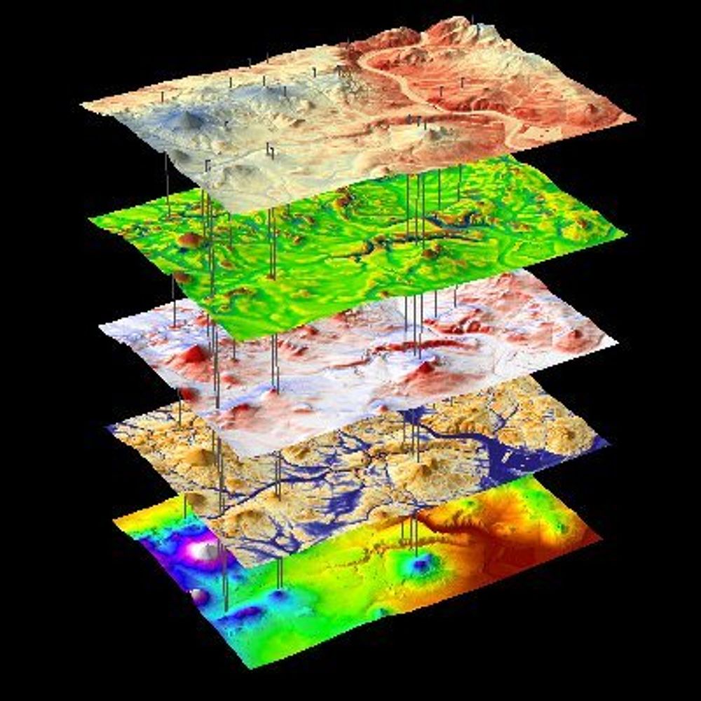
Open access to high-resolution, Earth science-oriented topography data, and related tools & resources. US National Science Foundation supported. #lidar https://www.opentopography.org
official Bluesky account (check username👆)
Bugs, feature requests, feedback: support@bsky.app