Very excited that our most recent paper on #ExplainableAI & #ActiveLearning has been accepted to the #SENTIS workshop at #semanticsconf https://sigmoid.social/@semantics
https://semsys.ai.wu.ac.at/sentis2025/

@underdarkgis.fosstodon.org.ap.brid.gy
#SpatialDataScience | #MovementDataAnalysis | #OpenSource #Geospatial | @qgis PSC Member | Creator of @movingpandas & #Trajectools | Senior Scientist & […] [bridged from https://fosstodon.org/@underdarkGIS on the fediverse by https://fed.brid.gy/ ]
Very excited that our most recent paper on #ExplainableAI & #ActiveLearning has been accepted to the #SENTIS workshop at #semanticsconf https://sigmoid.social/@semantics
https://semsys.ai.wu.ac.at/sentis2025/

Street network sub-patterns and travel mode
https://arxiv.org/abs/2507.19648
Upcoming special issue in Urban Planning (cogitatio): Citizen-Centric Urban Planning Through Participatory Sensing Data and Digital Tools
https://www.cogitatiopress.com/urbanplanning/issue/futureissues#i530
Abstract submission deadline in December.
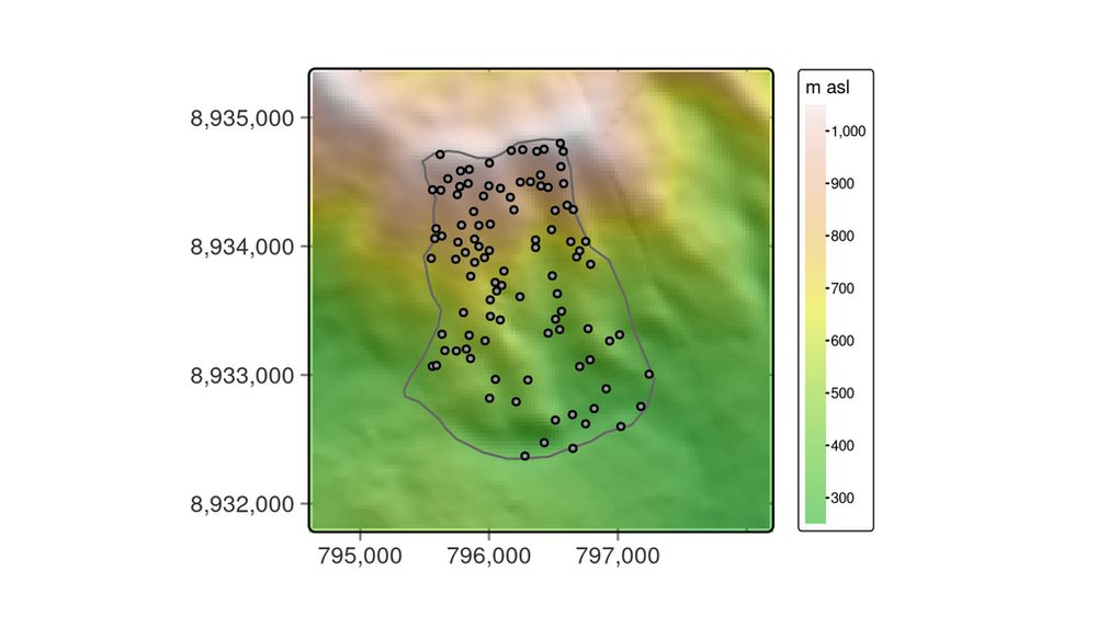
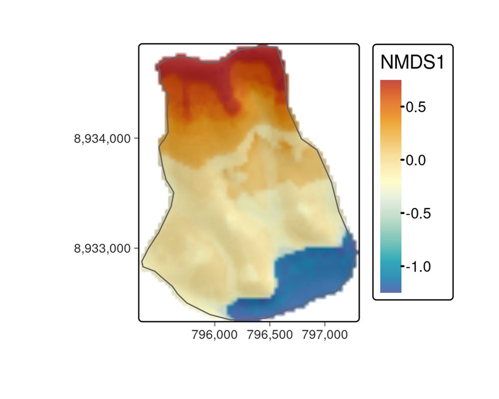
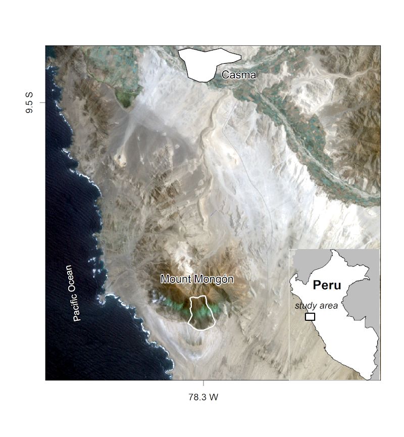
Chapter 15: Ecological Modeling & Geocomputation 🌱🗺️
Modeling the floristic gradient to reveal distinctive vegetation belts! 📌 Learn spatial modeling techniques with random forests & hyperparameter tuning to analyze ecological data in R.
🔗 https://r.geocompx.org/eco
#rstats #rspatial #geocompx
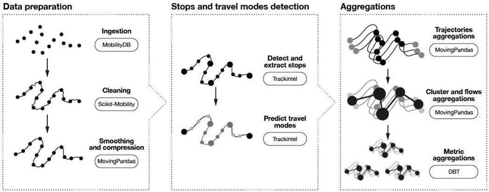
Interesting #MobilityDataAnalytics read:
📄 https://www.sciencedirect.com/science/article/pii/S0966692325002698
Featuring #MobilityDB, #scikitmobility, @movingpandas, #trackintel and #dbt

Do you have a #QGIS with #Qt6 already? Could you help me test if this new snippet for adding datetime fields works:
https://github.com/qgis/QGIS-Documentation/pull/10106/files
#gischat
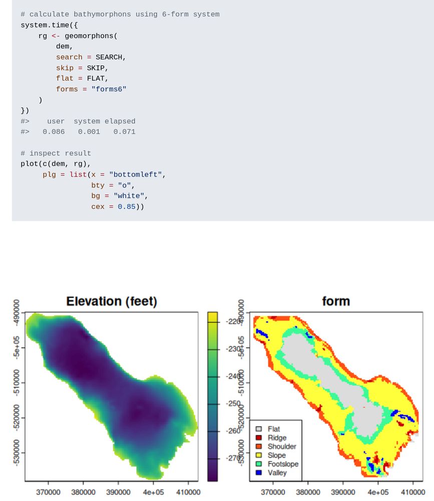
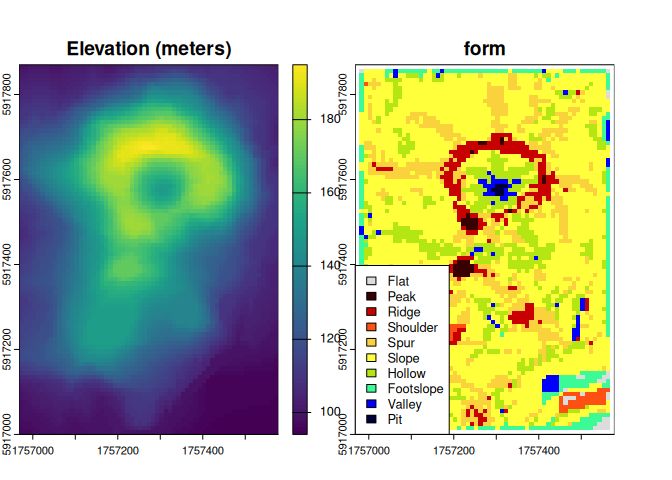
New R package: rgeomorphon 📦 by Andrew Brown
Classifies terrain forms using a parallel C++ implementation of the geomorphon algorithm.
🔗 https://github.com/brownag/rgeomorphon
#RStats #GIS #TerrainAnalysis #RemoteSensing #RSpatial
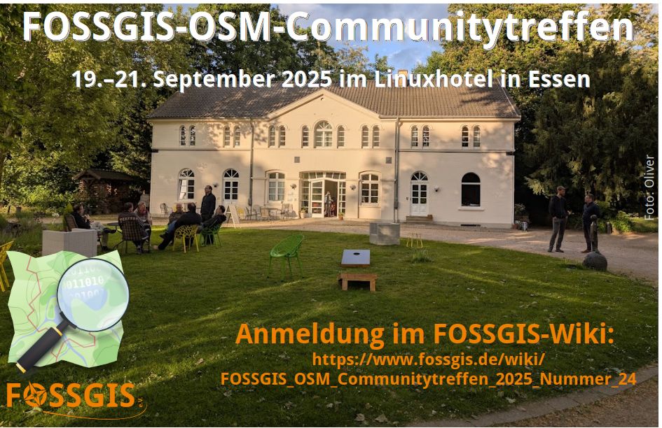
Bild zeigt Linuxhotel im Sonnenschein. Schriftzug: FOSSGIS-OSM-Communitytreffen, 19.-21. September 2025 im Linux-Hotel in Essen, Anmeldung im FOSSGIS-Wiki + URL zur Wikiseite; FOSSGIS e.V. Logo, OpenStreetMap-Logo. #OSM #FOSSGIS #OpenStreetMap #OSGeo #OpenSource #Community
Vom 19. – 21. September 2025 findet das nächste FOSSGIS-OSM-Communitytreffen @FOSSGISeV im @linuxhotel in Essen statt.
Wer teilnehmen möchte, trägt sich im Wiki ein
https://www.fossgis.de/wiki/FOSSGIS_OSM_Communitytreffen_2025_Nummer_24 oder liest die […]
[Original post on mastodon.online]

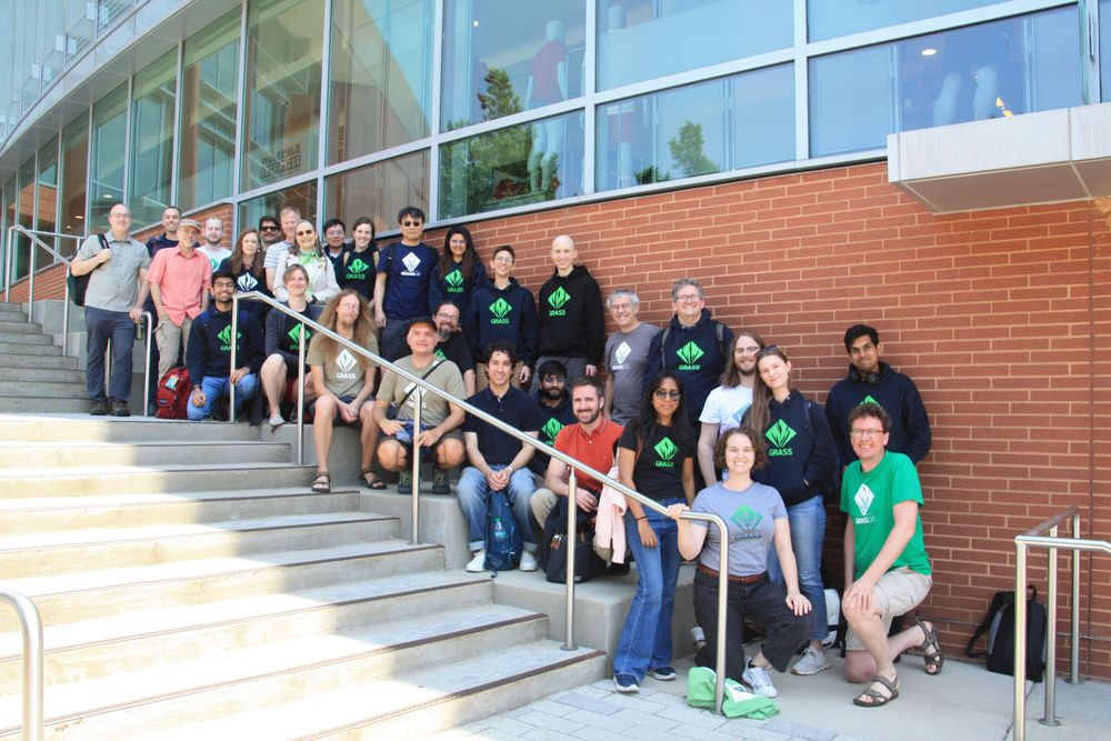
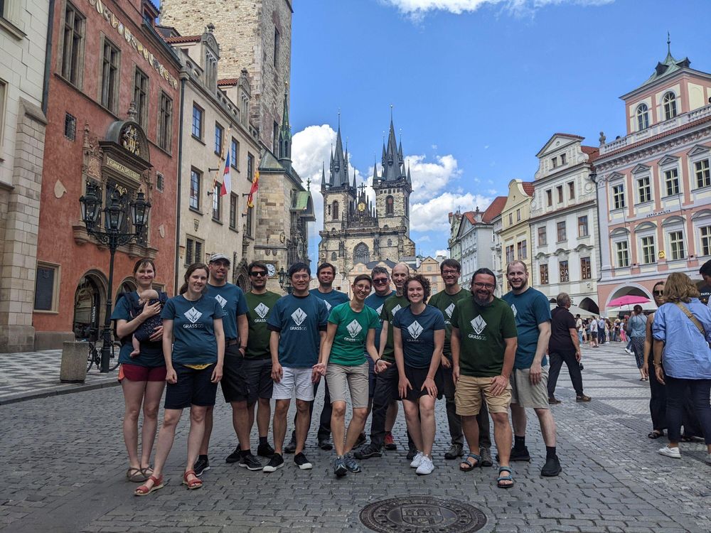
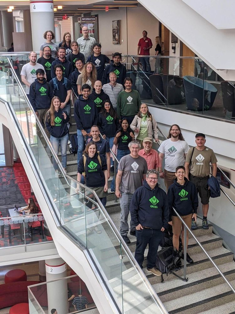
🎂 Happy Birthday, #GRASS! 🎉
A toast 🥂 to the incredible science-based, open-source geospatial processing engine and to all the contributors and developers who make it possible! 🙌 🚀
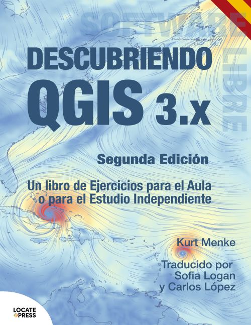
Only until end of July: #Geospatial ebook sale at @locatepress
Use coupon code: SUMMERSUN25
for your 10% discount on any e-book, including the #Spanish edition of Discover QGIS
https://mailchi.mp/locatepress/locate-press-summer-sale-8340239?e=e6235e72b6
#gischat #qgis #leaflet #pgrouting
@grassgis
42 years of GRASS - Happy Birthday!
I'm so proud to be part of this amazing international community 🤩 🚀
#grass #osgeo #foss #opensource #geospatial
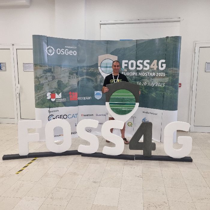
Just came back from #FOSS4GE 2025 in Mostar by public transport 🚉
From train delays to inspiring workshops, talks & riverside drinks, it was a ride!
📖 Read the full story: https://www.qwast-gis.com/l/foss4g-europe-2025-in-mostar-bosnia-and-herzegovina/
#FOSS4GEurope #OSGeo #QGIS #GIS #FOSS4G
The book cover
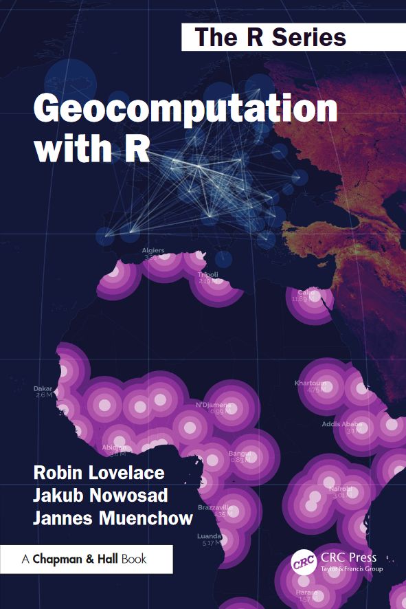
Have you read Geocomputation with R?📘
If you found it helpful, we’d really appreciate a quick review — it helps others find the book too!
Goodreads: https://www.goodreads.com/book/show/214736719-geocomputation-with-r
Amazon […]
[Original post on fosstodon.org]
In unserem Webinar haben wir gezeigt, wie großflächige Parkplätze im Stadtgebiet mithilfe offener Geodaten und Open-Source-Software systematisch erfasst, bewertet und dokumentiert werden können – als Grundlage für nachhaltige Stadtentwicklung, Flächennutzung und Klimaanpassung.
👉 Hier geht’s […]
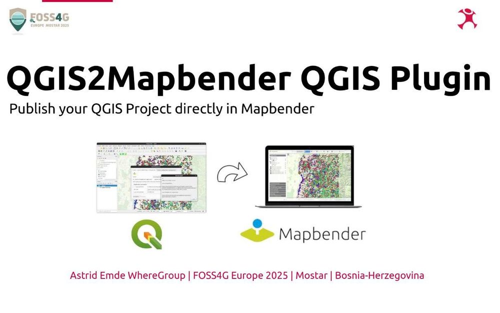
QGIS2Mapbender a QGIS plugin to administrate Mapbender
I presented #Mapbender at the #FOSS4GE2025 conference in Mostar & demonstrated how you can create great geoportal applications with Mapbender & talked about the news.
I also introduced #QGIS2Mapbender - a #QGIS plugin that publishes your QGIS Project as QGIS […]
[Original post on mastodon.social]
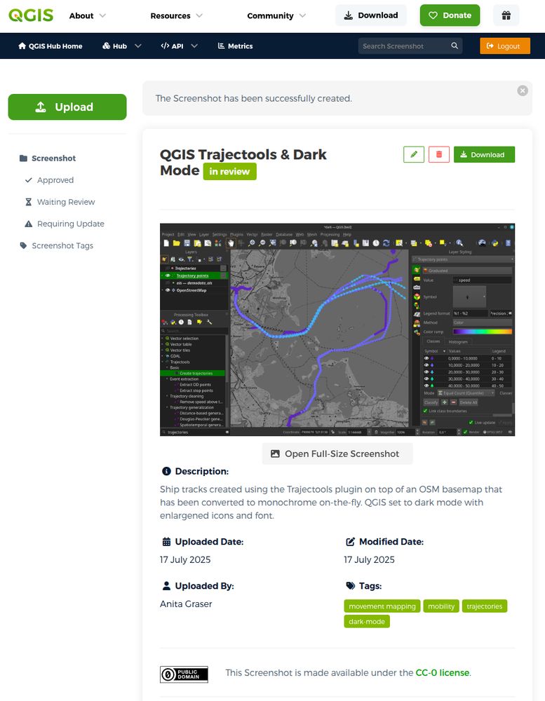
The new :qgis: @qgis screenshot gallery is ready for you contributions!
https://hub.qgis.org/screenshots/?sort=upload_date&order=desc
It's a new place to share visuals that don't fit in the map gallery
#GISChat #QGIS
In today's #gleo news: wind data!
Or, more technically: a 2-band raster covering the globe and properly warped (EPSG:4326→EPSG:3857) containing UV speed data, visualised as a particle trail simulation.
Thanks to the #FOSS4GE2025 for providing the […]
[Original post on mastodon.social]
#FOSS4GAsia 2026 — Asia’s biggest open-source GIS event — is happening in Nashik, India January 2026!
🎥 Watch the full announcement video: https://youtu.be/26RLDHdoR0Y
#GISChat #OSGEO #FOSS4G #Asia #India
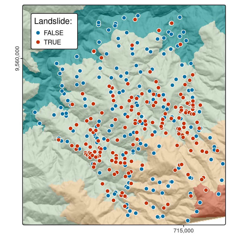
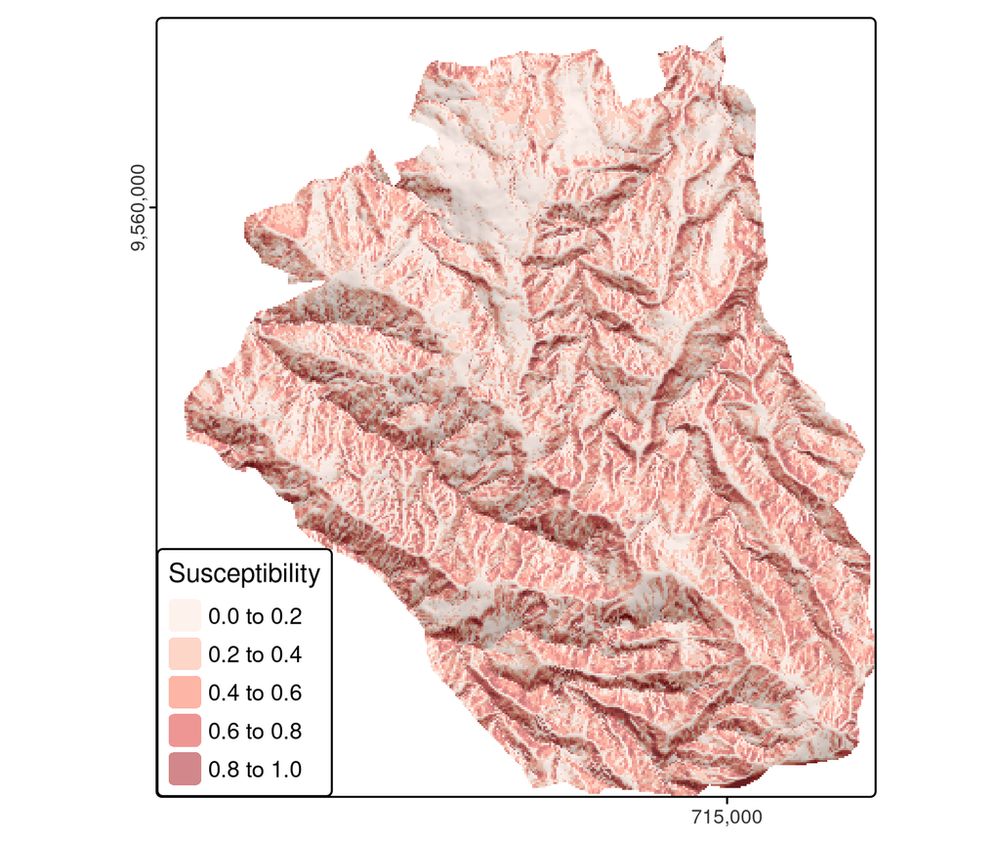
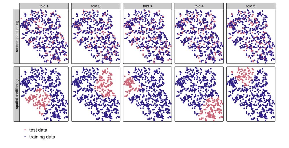
Chapter 12: Spatial Statistical Learning 📊🌍
Boost your spatial models! 📌 Learn about spatial autocorrelation, cross-validation, and machine learning with `mlr3`, using a real-world landslide prediction case study.
🔗 https://r.geocompx.org/spatial-cv
#rstats #rspatial #geocompx
Extracting Realistic Pedestrian, Cycling, and Driving Street Networks from OpenStreetMap
https://isprs-archives.copernicus.org/articles/XLVIII-4-W13-2025/103/2025/
#FOSS4G-E Streams are live: https://2025.europe.foss4g.org/livestream/
16.07.2025 09:30 — 👍 1 🔁 2 💬 0 📌 0I'm currently working on the first #CIVIS asynchronous course on "Interdisciplinary Perspectives on Sustainable Mobility".
Lots of work. Lots of fun. Lots of excitement.
Screenshot of a QGIS screenshots uploaded to the screenshot gallery and now under review.
Time to get creative and upload some #QGIS screenshots
https://hub.qgis.org/screenshots
#GISChat #PartyLikeAGISNerd
The new :qgis: @qgis screenshot gallery is ready for you contributions!
https://hub.qgis.org/screenshots/?sort=upload_date&order=desc
It's a new place to share visuals that don't fit in the map gallery
#GISChat #QGIS
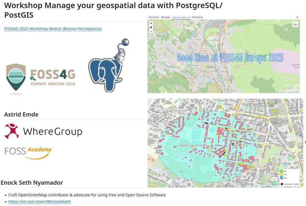
FOSS4G Europe 2025 Mostar
We hope you enjoyed the workshop about #PostgreSQL #PostGIS at #FOSS4GE2025 with @Enock4seth and me.
You find the workshop material at […]
[Original post on mastodon.social]
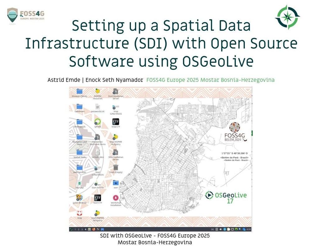
FOSS4G Europe 2025
WEe hope you enjoyed the workshop about #OSGeoLive at #FOSS4GE2025 with @Enock4seth and me.
You find the workshop material at: https://github.com/astroidex/foss4g-europe-2025-workshop-sdi-with-open-source-using-osgeolive
Enjoy the #FOSS4GE conference and […]
[Original post on mastodon.social]
There's some great explanation for how map projections work in this short, but it's too hot today for me to work it out 😅
https://youtube.com/shorts/hrGJIk7zpho?si=xITVIzbJhaNr_qNS
#GISChat
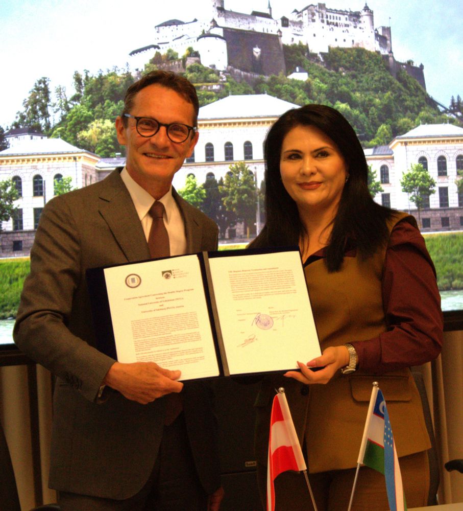
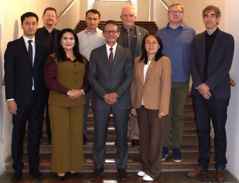
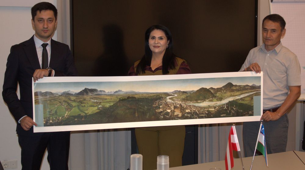
MSc #Geoinformatics @unisalzburg.bsky.social - recognized with another #DoubleDegree program with the National University of Uzbekistan - looking forward to excellent and ambitious students!
12.07.2025 10:49 — 👍 4 🔁 2 💬 0 📌 0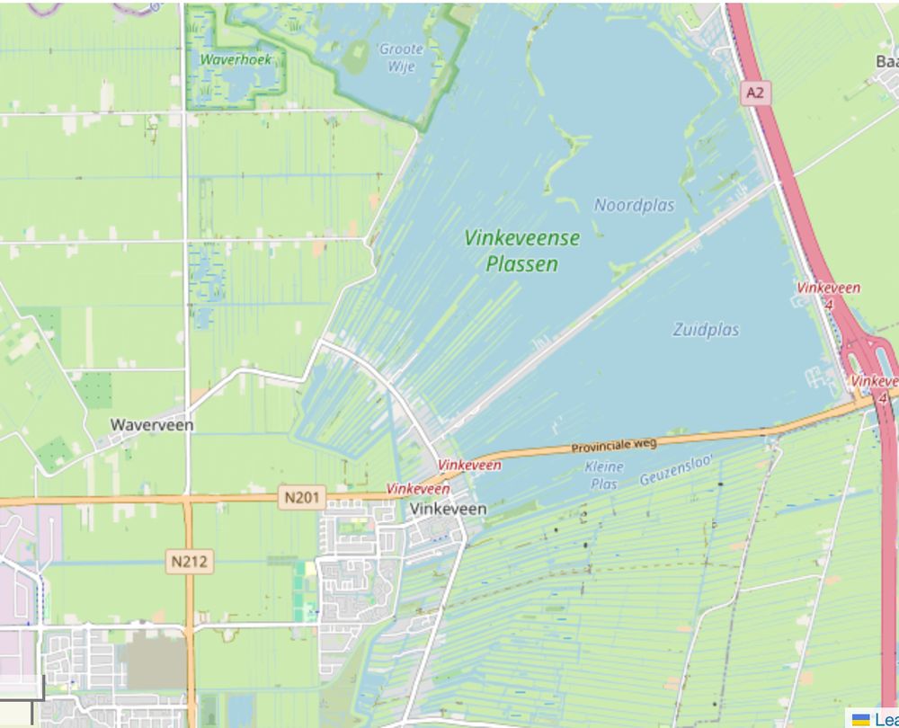
map excerpt of the Vinkeveense Plassen, with many long, thin straight lines of green land cutting across a suspiciously pie-slice-shaped pond, next to a bunch of long, thin straight lines of blue cutting across the fields
"geometry glitch in the map data, or just the Dutch again?"
11.07.2025 09:53 — 👍 18 🔁 77 💬 6 📌 0
$169 book published by Springer Nature is full of made-up citations https://retractionwatch.com/2025/06/30/springer-nature-book-on-machine-learning-is-full-of-made-up-citations/
09.07.2025 22:58 — 👍 1 🔁 6 💬 0 📌 0