This was one of my last things to organise at work before soon going on maternity leave and it's always so nice to see how much people still love paper maps. There's just something special about them and the joy, conversation and memories that they bring about 🥰
31.10.2025 14:17 — 👍 3 🔁 1 💬 1 📌 0
We are so pleased to announce the official launch of the new BAS Map Catalogue 🎉🗺
The catalogue contains open access topographic, thematic and geological maps, as well as full details on where to purchase our professionally printed published maps.
Have a look for yourselves at bas.ac.uk/maps!
1/2
19.09.2025 09:12 — 👍 4 🔁 5 💬 1 📌 0
Thank you so much to the British Cartographic Society for recognising 2 of @bas.ac.uk’s maps at last week’s conference. It was fantastic to collect the certificate for our recently-released Alexander Island map, one of the most interesting maps I’ve made in a long time!
12.09.2025 19:44 — 👍 11 🔁 2 💬 0 📌 0
#A23a iceberg continues its disintegration north of South Georgia in the South Atlantic, with a brilliant image from today finishing off this timelapse of Copernicus Sentinel-3 imagery over the last few weeks! It's always interesting to track these bergs out of Antarctica and into warmer waters 🌊🌴
11.09.2025 20:13 — 👍 21 🔁 8 💬 0 📌 0

A satellite image from 1st Sep. showing the island of South Georgia covered in snow and ice, and iceberg A23A lying about 65 km to the north. There are many clouds in the image. The berg remains as one large piece, with multiple smaller fragments around its edge. The largest fragment is still 35 km in length. A scale bar is shown in the bottom right corner, and a credit statement saying "Copernicus Sentinel-3 imagery acquired 1st Sep. 2025".
Iceberg A23A is currently located north of South Georgia & over the weekend has fragmented into a several large pieces. While these individual icebergs are large & may get new names, they may be short lived as further breakup is now likely as currents push them all further north into warmer waters.
02.09.2025 09:55 — 👍 6 🔁 1 💬 0 📌 0
Really looking forward to this conference at @bgs.ac.uk next week! Always great to catch up with other mapping enthusiasts. Is anyone else on here going to 1 or both days?
27.08.2025 21:37 — 👍 3 🔁 0 💬 0 📌 0

A grey-scale hillshade of Pourquoi-Pas Island in Antarctica. Mountain ridges can be seen, as well as glacier flowlines. The source data is REMA v2.

A grey-scale hillshade of a section of Adelaide Island, Antarctica. Rothera Point is covered in the extent. Large mountain ranges can be seen, along with glaciers and ice piedmonts. The source data is REMA v2.

A grey-scale hillshade of Horseshoe and Lagotellerie islands in Antarctica. A few mountains can be seen on the south of the island. The source data is REMA v2.
I'm just starting an update of BAS's published "Adelaide Island and Arrowsmith Peninsula" map. One of the first things I always work on is creating new hillshades & contours from the latest elevation data. These in-progress images show some of the interesting islands & landscapes in the region! 🏔️🧊
19.08.2025 15:49 — 👍 1 🔁 0 💬 0 📌 0
This new topographic map has been my big project for the last few months and I'm so pleased to see it finally printed and published! 🗺️
It's been a truly fascinating region to work in, with changes happening almost before my eyes as I attempted to keep the new data up to date. ❄️🧊
05.08.2025 16:02 — 👍 10 🔁 1 💬 0 📌 0
NOAA has released their official animation of the propagation of this week's tsunami. It took almost exactly one day to reach Antarctica and was reported at 0.6 feet high.
31.07.2025 16:29 — 👍 91 🔁 34 💬 1 📌 7
Bedmap3 map PDFs are now available to freely download from BAS
data.bas.ac.uk/items/757872...
15.07.2025 16:02 — 👍 11 🔁 5 💬 1 📌 1

A grey-scale SAR image of South Georgia. Mountains can be seen on land, and movements and currents can be seen in the water, affected by wind. The image contains the text "Copernicus Sentinel-1 image acquired 6th July 2025, accessed from icelogistics.info".

An optical RGB image of South Georgia. Mountains can be seen on land, mostly covered in snow and ice. Cloud covers the south-west half of the image. The image contains the text "Copernicus Sentinel-2 image acquired 31st May 2025, accessed from Copernicus Browser".
South Georgia in winter 😍
These SAR and optical images show the island of South Georgia in the South Atlantic. SAR imagery allows us to see these locations through winter and cloud-covered days, and then the optical imagery adds extra content when it's not cloudy or dark!
11.07.2025 10:02 — 👍 1 🔁 0 💬 0 📌 0

Iceberg A23a on 7/7/25 Eumetsat/Meteosat 12
In case you were wondering... Iceberg A23a seen cruising around South Georgia today by Meteosat 12. The old berg still has an area of 2,846 sq km.
07.07.2025 15:43 — 👍 6 🔁 2 💬 0 📌 0
📢 We're hiring! My team is currently advertising for my maternity cover for 12 months.
Join us, making maps and working on some of the most interesting aspects of my role. You'll get to work in beautiful Cambridge and meet all kinds of interesting people at the British Antarctic Survey ❄️🗺️
25.06.2025 09:11 — 👍 4 🔁 1 💬 0 📌 0
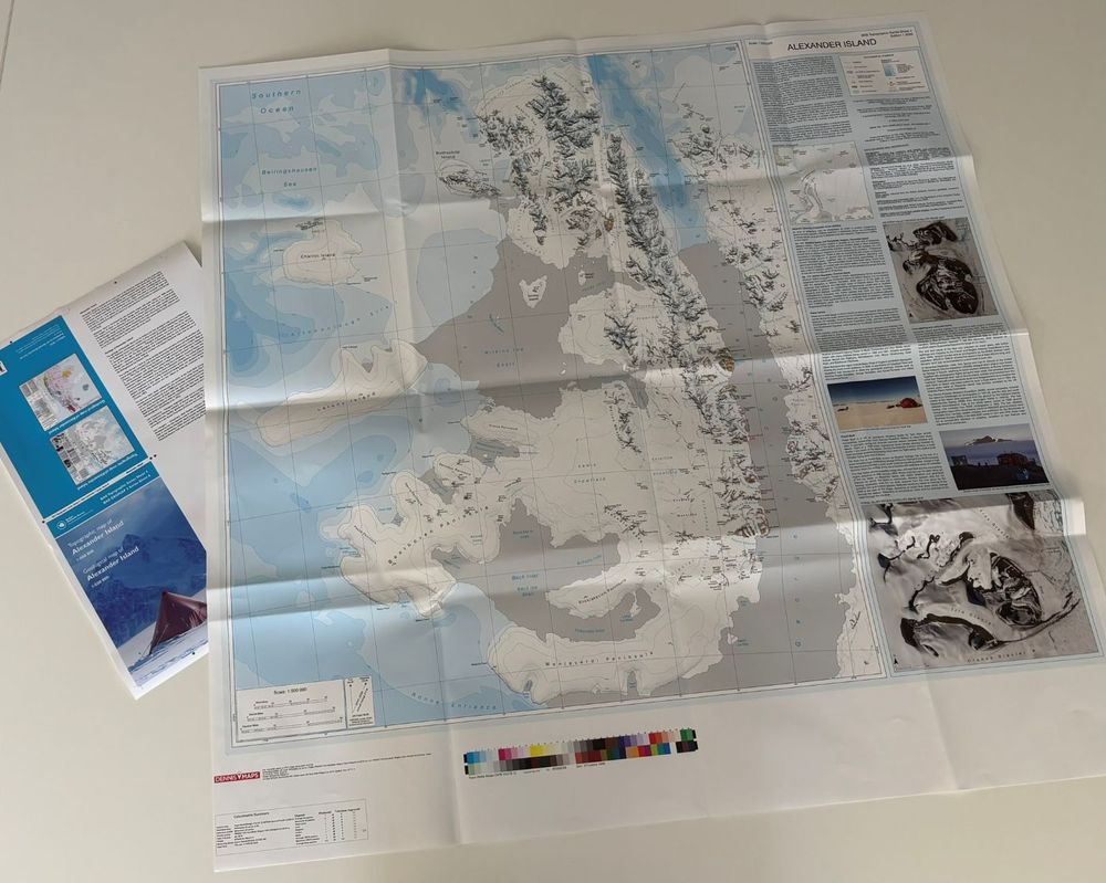
A photo of a map on a table. The map covers Alexander Island, a long island with large peninsulas coming off to the west. The land is white with contours and place names visible. Ice shelves are grey. Bathymetry is shown with intervals of cyan. A large information is shown to the right of the map with photos and text.
We've just received the proofs of our new Alexander Island map from Dennis Maps printers and have given the go ahead for printing!
This is the first comprehensive map of the entire region produced in decades. At 1:500 000 scale, it also features a geological map on the reverse 😍 Watch this space!
19.06.2025 14:03 — 👍 7 🔁 2 💬 0 📌 0
The NERC Arctic Office have printed a giant version of our main published Arctic map and it's come out beautifully! We can't wait to see this being used at upcoming events. Who doesn't want a huge 3 metre map?!
05.06.2025 08:45 — 👍 14 🔁 2 💬 1 📌 0
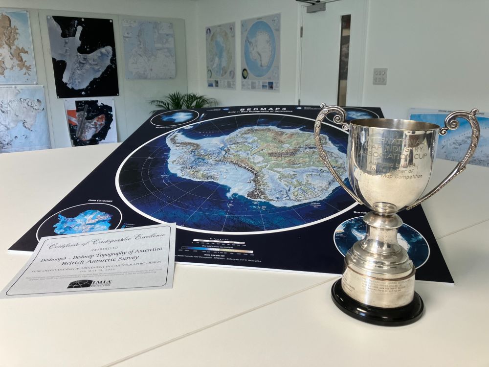
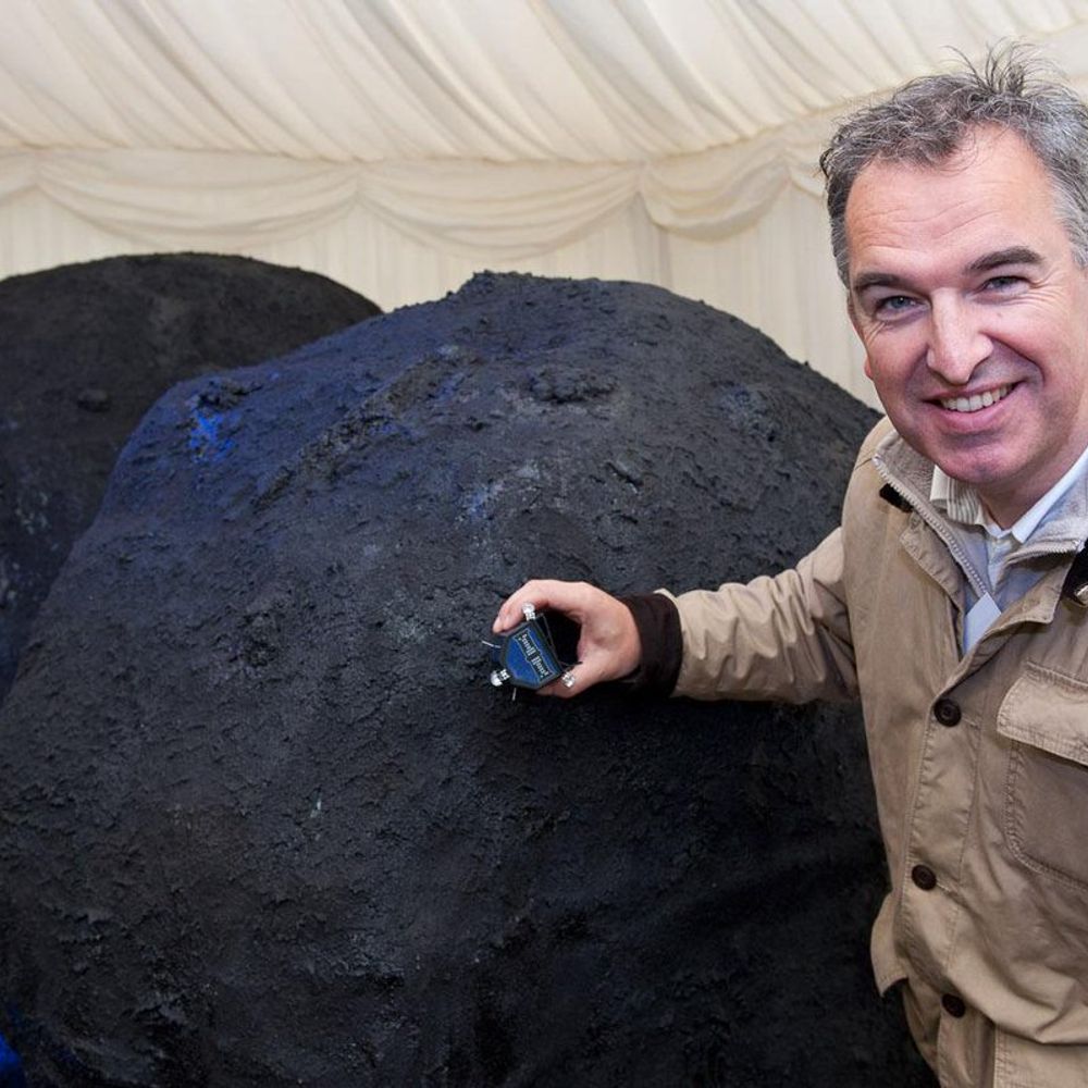
A photo of the trophy and certificate, with side A of the Bedmap 3 map shown behind. The map shows the bed topography of Antarctica underneath the ice.
We're proud to share that our Bedmap3 map won "Best Map" at the International Map Industry Association (IMIA) forum in London last week! 🏆
This international award celebrates Outstanding Cartographic Design & we’re honoured to be recognised alongside leading names in the field from previous years. 🗺️
21.05.2025 15:20 — 👍 32 🔁 8 💬 3 📌 2

Mapping Leaders Forum - IMIA | International Map Industry Association
May 14-15, 2025 | The News Building, London
The IMIA Mapping Leader Forum brings together industry leaders, business experts, and technology innovators during this annual two-day event to explore the...
I'm speaking at the IMIA Mapping Leaders Forum next week in London.
Is anyone here attending? I'm looking forward to meeting other mapping enthusiasts and experts at the 2 day event!
There are still a few spaces left if you'd like to come along. More details here: imiamaps.org/mapping-lead...
07.05.2025 20:53 — 👍 2 🔁 0 💬 0 📌 0
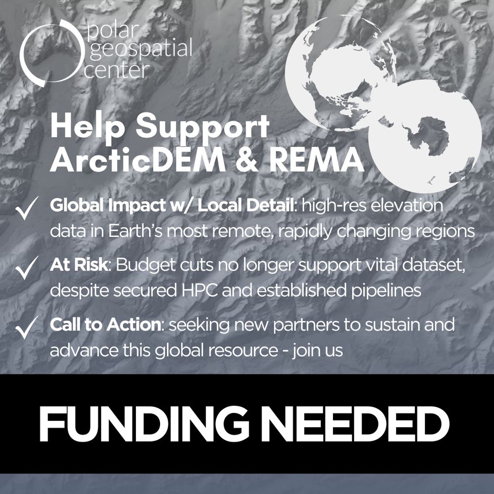
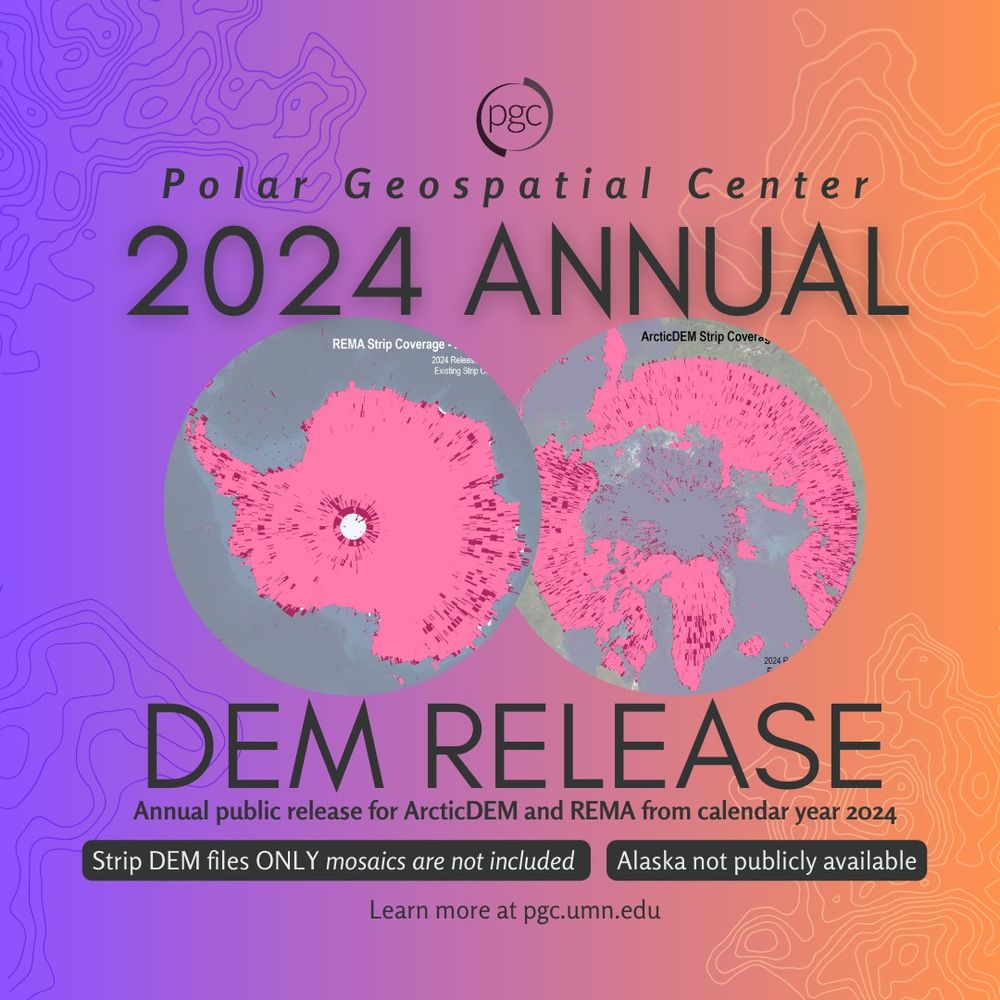
📢 The final ArcticDEM & REMA release is here - and it might be the last. Funding cuts put vital polar data at risk. Help us rally support: take the survey! 🔗https://z.umn.edu/pgc-dem-survey #PolarScience #SavePolarData
28.04.2025 17:37 — 👍 20 🔁 16 💬 1 📌 6

New coasts emerging from the retreat of Northern Hemisphere marine-terminating glaciers in the twenty-first century - Nature Climate Change
As marine-terminating glaciers retreat, they reveal new coastlines in many regions. Here the authors use satellite data to quantify these changes for the Northern Hemisphere, finding that between 2000...
Did you know that from 2000 to 2020, retreat of marine-terminating glaciers exposed >2,400 km of new Arctic coastline?
www.nature.com/articles/s41...
Congratulations, @mettebendixen.bsky.social, @cpecz.bsky.social, Jan Kavan, Matt Strelecki, and co., on your excellent paper!
23.03.2025 18:10 — 👍 10 🔁 4 💬 0 📌 0
More data! 😄 I love looking at Sentinel-1 imagery through these portals because it gives a near-real-time insight into changes in Antarctica, and the detail in the sea ice patterns can be so insightful for a range of people working in the region 🚢 🛰️ 🌊
08.04.2025 17:52 — 👍 4 🔁 0 💬 0 📌 0

A simple map showing a Copernicus Sentinel-2 satellite image from 27th Feb 2025. Lines are overlaid on the image with a red line showing the ice shelf front from November 2024, purple lines showing the grounding line, and blue lines showing the ice coastline.
I've picked up my new Alexander Island map today after a month or two of other work, and while double checking some data, I noticed that this section of ice shelf has retreated by over 1.5 km in places since I updated the data in November. Can things just stop melting?! Keeps me busy for sure!
03.04.2025 11:14 — 👍 7 🔁 2 💬 0 📌 0
A map showing the topography of Antarctica, without ice
We’ve just published the most detailed map yet of the landscape beneath Antarctica’s ice sheet (called Bedmap3), and we learnt some pretty cool facts about Antarctica that you can use to impress your pals. Ready?
Graphic: Hamish Pritchard et al
14.03.2025 15:17 — 👍 382 🔁 136 💬 11 📌 17

A satellite image covering Busen Region and Thatcher Peninsula. The land is rocky, with a few green areas visible. Many of the glaciers have got large areas of moraine. The water is bluey green, with sediment plumes from the glaciers.

A satellite image. St Andrews Bay is visible in the north, and Twitcher and Herz bays in the south. The ice-free land is rocky, with a few green areas visible. Glaciers cover most of the land. The water is bluey green, with sediment plumes from the glaciers.

A satellite image showing Bird Island. The land looks quite green, with brown rocky areas visible. The water is very dark.

A satellite image covering the Bay of Isles to the north of the land and King Haakon Bay to the south. The land is largely covered in glaciers and the ice-free areas are brown. The water is bluey green, with sediment plumes from the glaciers.
We've been working with this beautiful Copernicus Sentinel-2 imagery this week, showing South Georgia in all its glory in Feb. 2018.
The sediment plumes are clearly highlighted here and it is extremely rare to get an almost cloud-free image of the whole island 🏔️😍
12.03.2025 10:07 — 👍 35 🔁 8 💬 3 📌 0

A satellite image showing a large iceberg as a big white block, and an island in the NE corner with blue-ish sediment blooms coming away from the glaciers on land. There are clouds in the south/bottom of the image.

A satellite image showing a large iceberg as a big white block, and an island in the NE corner with blue-ish sediment blooms coming away from the glaciers on land. There are clouds in the south/bottom of the image. The image has labels showing the sizes of the main island (170 km long) and the iceberg (57 x 62 km), and the distance from the iceberg to land (73 km).
Lovely image from the NOAA-20 satellite yesterday showing the location of grounded A23a iceberg close to the island of South Georgia 😍
It's still crazy to me that this iceberg has been in the Southern Ocean since 1986, taking a few little pauses along its way to this current position!
@bas.ac.uk
05.03.2025 10:49 — 👍 8 🔁 1 💬 1 📌 1
Back to one of my favourite tasks of iceberg mapping 😄
04.03.2025 14:14 — 👍 4 🔁 1 💬 0 📌 0
I'm thrilled to be a part of developing and populating this new catalogue! I’ve created hundreds of maps (maybe even over a thousand!) during my time at BAS - many used once and then forgotten. Now we'll be making them openly available for all to use. Watch this space! 👀🗺️
20.02.2025 20:14 — 👍 12 🔁 1 💬 2 📌 0
I love these spinning Antarcticas made by my colleague @jonnydawe.github.io! My favourite is the middle one where a little iceberg breaks off 👋🧊
14.02.2025 15:54 — 👍 0 🔁 0 💬 0 📌 0
This is a map I first started about 4 years ago, and it’s been put down and picked back up about 5 times since then (we’ve all had projects like this!) but I’m so glad to see it finally released! The front cover shows some of the very varied terrain that has been mapped 😍
13.02.2025 18:00 — 👍 7 🔁 1 💬 0 📌 0
Interesting article written by BAS scientist Dr Ella Gilbert, featuring a little map that I made the other day. I always like mapping the fast-changing and important region of Thwaites and Pine Island glaciers! 🗺️
12.02.2025 11:47 — 👍 14 🔁 7 💬 1 📌 0
A new iceberg, ~30x14 km in size, recently calved from the southern end of the George VI Ice Shelf. It's called A84 and is already making quite an impact, bumping into the Stange Ice Shelf over the weekend! These Copernicus Sentinel-1 images from Polar View show the new berg over the last few days.
04.02.2025 15:07 — 👍 47 🔁 25 💬 1 📌 2
We are the UK’s learned society and professional body for geography, supporting geography and geographers across the world.
ECMWF senior scientist working on monitoring global #wildfire emissions, #airquality, atmospheric chemistry & #scicomm for the #CopernicusAtmosphere Monitoring Service @copernicusecmwf.bsky.social @ecmwf.int
Woodwell Climate conducts science for solutions and partners with leaders and communities for just, meaningful impact to address the climate crisis.
Glaciology research at Durham University on the past, present and future of our mountain glacier and ice sheet environments ❄️
https://durhamglaciology.wordpress.com/
The Danish Arctic research institutions present updated knowledge on the condition of two major components of the Arctic: The Greenland Ice Sheet and the sea ice.
Find us on https://polarportal.dk/en.
Data Visualization. Ex-Planet & NASA Earth Observatory. Blue Marble, Earth at Night, color, cartography, occasionally skewed views of Earth. Looking for a job.
Researching and reporting the science and impacts of climate change 🌎
climatecentral.org
#SpatialDataScience | #MovementDataAnalysis | #OpenSource #Geospatial | @qgis PSC Member | Creator of @movingpandas & #Trajectools | Senior Scientist & Thematic […]
🌉 bridged from ⁂ https://fosstodon.org/@underdarkGIS, follow @ap.brid.gy to interact
@cartonaut elswhere
Map-o-phile / GIS wrangler / M.S. GIS / GISP / mischief / 🗺️ / solvitur ambulando
To get my top 10 Brilliant Maps for free please join my newsletter here: https://brilliantmaps.beehiiv.com/subscribe
#Satellites #Science #SeaIce #ExtremeLatitudes.
Remote Sensing of Polar Regions at University of Bremen,
Institute of Environmental Physics (IUP).
https://seaice.uni-bremen.de
Climate geophysicist at WHOI || Assistant Professor at Texas A&M starting fall 2025 || sea level + ice sheets + permafrost || PhD Columbia / BA Amherst || rogercreel.com || Views my own.
Studying the poles - sea ice, ice shelves, and now emperor🐧, using 🛰️ & field work❄️. Postdoc at Durham. Formerly of UChicago, UTSA, UVic.
Journalist. Former BBC Science Correspondent. Way too interested in icebergs for my own good.
BSc Geology Graduate, Project Management Apprentice and Museum Volunteer #AuDHD Former teacher using free time for fossils, Lego and crafts
The world's largest independent Map and Travel Bookshop. In love with adventure, since 1853.
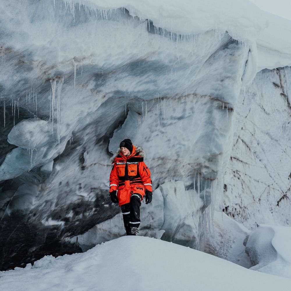
Iceland-obsessed Landscape Photographer. UK-based.
10% discount on website - WINTER10
Join me on Oct 2026 workshop! https://jvn.photo/photo-workshops/iceland-south-coast-2026-photo-workshop-sophie/
www.sophiecarrphotography.com
Keeping you posted on space science activities from the European Space Agency.
Web: http://www.esa.int/science
Privacy Notice: esa.int/connectwithus
#astronomy #space #science
A global network that inspires, unites and empowers women+ in the geospatial field to become strong changemakers.
🏔️ Glaciologist ❄️ Winner of the inaugural Shackleton Medal for the protection of the polar regions. #Climate #glaciers #outreach #EYL40 Views my own