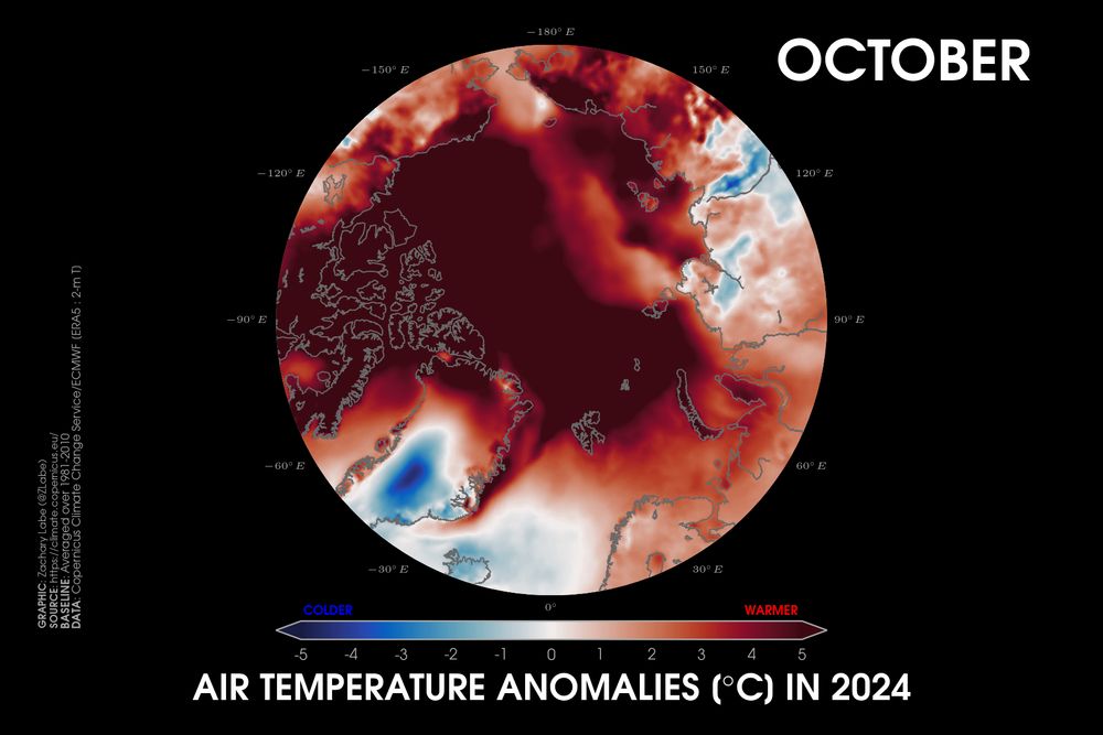
Polar stereographic map showing 2-m air temperature anomalies in October 2024 for the Arctic Circle with red shading for warmer anomalies and blue shading for colder anomalies. Most areas are warmer than average and well exceeded the colorbar maximum of 5°C above average. The baseline is a 1981-2010 reference period using ECMWF ERA5 data.
Yes, I realize that my usual temperature anomaly scale is less than ideal for visualization purposes in this image here. But that's also because the #Arctic was absurdly warm compared to the 1981-2010 climatological average in October 2024.
Data from @copernicusecmwf.bsky.social ERA5 reanalysis.