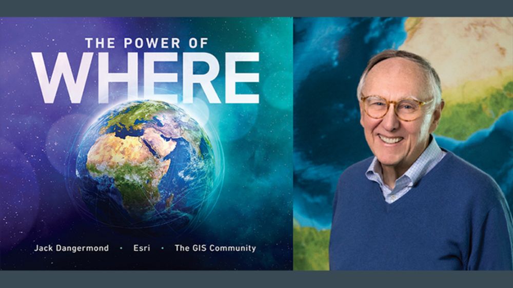
Esri Founder Jack Dangermond's 'Secrets' To Building A Legendary Business
The 80-year-old software billionaire shares startup and life lessons that have kept him "all in" while running a high-impact global business for 50+ years.
Tech legend Jack Dangermond founded Esri in 1969. Now 80 years young and with a net worth of $10B+, he's still "all in" on his company and global mission.
@upstarts.bsky.social spent an hour with Jack this week for one of our best interviews yet, full of lessons on startup-building and life.
28.08.2025 14:27 — 👍 12 🔁 8 💬 0 📌 0

The ArcGIS StoryMaps team is planning an excellent webinar that will help unpack the creative process for your stories. Explore, learn, and be inspired: storyscape-esriwhere.hub.arcgis.com/pages/commun...
#ArcGIS #storymaps #GIS #community
28.03.2025 21:05 — 👍 2 🔁 0 💬 0 📌 0

Introducing the American Community Survey (ACS) Atlas Collection
Introducing the new American Community Survey (ACS) Atlas collection, a group of 5 Atlas Instant Apps highlighting ACS maps in the Living Atlas.
Explore the latest 5-year estimate American Community Survey data (2019-2023) from the U.S. Census Bureau in a collection of curated Atlas Instant Apps.
Demographics
Social Characteristics
Economic Characteristics
Housing, and
All Characteristics
www.esri.com/arcgis-blog/... #LivingAtlas #GIS
20.02.2025 21:46 — 👍 4 🔁 1 💬 0 📌 0

Map and analyze updated Citizen Voting Age Population (CVAP) content in ArcGIS Living Atlas
2019-2023 Citizen Voting Age Population (CVAP) data layers and maps now available.
The Citizen Voting Age Population (CVAP), is the population that is both 18 years or older and a U.S. citizen. All CVAP content in ArcGIS Living Atlas now contains and displays the latest vintage: 2019-2023. www.esri.com/arcgis-blog/...
20.02.2025 19:34 — 👍 1 🔁 1 💬 0 📌 0

Reminder! We're still accepting nominations for the 2025 Women in GIS Awards and Scholarships program! You have until the end of this month.
In collaboration with Esri, WiGIS will recognize the contributions of women to geospatial fields and award scholarships for undergraduate, graduate, and practitioners/researchers.
Deadline to apply: February 28, 2025
Full details available on our website:
https://womeningis.wildapricot.org/2025AS
Reminder! We're still accepting nominations!
In collaboration with Esri, WiGIS will recognize the contributions of women to geospatial fields and award scholarships for undergraduate, graduate, and practitioners/researchers.
apply by February 28, 2025
womeningis.wildapricot.org/2025AS
#GISChat
04.02.2025 19:38 — 👍 18 🔁 12 💬 0 📌 1

The secret life of bridges
Examine the historical evolution and current state of bridges across the United States in this interactive, map-based story.
Iconic bridges such as the Golden Gate or Brooklyn Bridge are favorite spots for tourists, but they are also a critical part of the nation's expansive ground transportation infrastructure. storymaps.arcgis.com/stories/92b2... #GIS #Esri #storymap
04.02.2025 18:37 — 👍 0 🔁 0 💬 0 📌 0

The collaboration between Taylor Guitars and UCLA’s Congo Basin Institute (CBI) demonstrates how partnerships working toward the greater good can be found, even in the unlikeliest of places. storymaps.arcgis.com/collections/... #ArcGIS #StoryMaps
28.01.2025 16:58 — 👍 1 🔁 0 💬 0 📌 0

Head to the Science & Environment Showcase at the Esri Federal GIS Conference to meet @deepseadawn.bsky.social, learn about her work, and get a signed copy of her book, Mapping the Deep. registration.esri.com/flow/esri/25... #GIS #mapping
27.01.2025 15:30 — 👍 4 🔁 1 💬 0 📌 2

How to Make Maps Fast (Using Snow Data!)
Learn how to make a map with SNODAS data in ArcGIS Pro and design a map quickly by planning ahead.
It's 19°F outside where I am (but feels like 10! 🫠). Publishing a blog post on mapping snow felt right... 🥶
www.esri.com/arcgis-blog/... #mapping #cartography
21.01.2025 17:27 — 👍 19 🔁 2 💬 2 📌 1

This Drought Aware app provides information on drought-affected areas in the US, and integrates critical information including population, housing, river flow, reservoirs, crops, and agricultural labor. livingatlas.arcgis.com/drought-awar... #GIS #LivingAtlas
24.01.2025 16:26 — 👍 5 🔁 4 💬 1 📌 0

Join Esri's Chief Scientist @deepseadawn.bsky.social for a free course on how a geographic approach can help tackle a complex changing climate. www.esri.com/training/cat... #GIS #EsriTraining
23.01.2025 16:05 — 👍 8 🔁 5 💬 0 📌 0

You can search on Genasys Protect for an address or mapped zone to determine if an area is under evacuation. protect.genasys.com/search?z=14&... #California #wildfires
09.01.2025 18:11 — 👍 1 🔁 0 💬 0 📌 0

The Geography of Heating US Homes
Homes in the US are heated by a variety of fuels. The interplay of who, what, and where is on full display in this detailed map.
Homes in the United States are heated by a variety of fuels. Most homes rely on natural gas for heat, but oil, propane, electricity, and wood are also common. www.maps.com/home-heating... #GISchat
16.12.2024 18:35 — 👍 20 🔁 6 💬 0 📌 3

New blog by Lisa Berry on authoritative historical fire perimeter data from the California Department of Forestry and Fire Protection (CAL FIRE).
CAL FIRE offers this digital record as a ready-to-use layer within ArcGIS Living Atlas of the World.
www.esri.com/arcgis-blog/... #GISchat
06.12.2024 21:43 — 👍 4 🔁 2 💬 0 📌 1

2024 ArcGIS StoryMaps Competition | Esri
Enter the 2024 ArcGIS StoryMaps Competition: Storytelling for a Better World. Get competition details and find inspiration for your story in our online gallery.
Final day to enter the 2024 ArcGIS StoryMaps competition. Submit a story in one of five categories:
Digital Humanities
Health and Safety
Nature and Physical Science
Planning and Infrastructure
Humanitarian and Disaster Response
www.esri.com/en-us/arcgis... #GISChat
06.12.2024 16:44 — 👍 1 🔁 0 💬 0 📌 0

Coral reefs at a crossroads: "Every coral we see is fighting" - GPS World
This is a challenging time for coral reefs. Although they cover less than 0.1% of the ocean floor, coral reefs support 25% of all marine creatures.
In this new article Dawn Wright discusses the work of the 100 Island Challenge, the worldwide initiative which captured an ecological survey of coral reefs in the Pacific, Caribbean, and Indian oceans.
www.gpsworld.com/coral-reefs-...
@deepseadawn.bsky.social #GISchat #science
05.12.2024 21:07 — 👍 15 🔁 3 💬 0 📌 0
The Science— and joy — of snow and ice. Meet the people behind scientific expeditions and climate studies who inspire action to protect the landscapes we treasure.
Read the new issue of StoryScape from the ArcGIS StoryMaps team: storyscape-esriwhere.hub.arcgis.com #GISchat #science
05.12.2024 18:30 — 👍 2 🔁 1 💬 0 📌 0

The ArcGIS Living Atlas Policy Mapping team provides the GIS community with a collection of free layers with data from the US Census Bureau’s American Community Survey.
On December 12, the US Census Bureau will release its updated five-year estimates (2019-2023). www.esri.com/arcgis-blog/... #GIS
05.12.2024 14:31 — 👍 6 🔁 2 💬 1 📌 1

PortWatch is an open platform designed to help policymakers and the public assess the impact of maritime trade disruptions that result from natural disasters or other large-scale events.
The platform is a collaboration between the IMF and the University of Oxford. portwatch.imf.org #GIS #climate
27.11.2024 15:33 — 👍 4 🔁 2 💬 0 📌 0

Summit to Shore
Celebrating and Protecting the Waters of the Lake Champlain Basin
Lake Champlain is fed with waters delivered by a large network of rivers and streams. The expansive watershed is known as the Lake Champlain Basin.
Organizations in communities throughout the Basin are helping to protect and restore their shared waters.
storymaps.arcgis.com/stories/5b36...
26.11.2024 19:56 — 👍 1 🔁 0 💬 0 📌 0

NOAA Pollution Assessment and Restoration in Your State
NOAA Damage Assessment, Remediation, and Restoration Program
NOAA’s Damage Assessment, Remediation, and Restoration Program (DARRP) holds polluters accountable.
This story map shows the locations of pollution events where the program is pursuing protection and restoration of natural resources. storymaps.arcgis.com/stories/d9da... #GIS
26.11.2024 18:10 — 👍 3 🔁 0 💬 0 📌 0

Improving Food Security in Senegal
Targeting Actions to Improve People's Lives, Protect Nature, and Mitigate Climate Change
Can food security efforts also protect nature and fight climate change? A new study by Project Drawdown and the University of Minnesota says yes.
This story map gives insights into solutions, analysis and action. storymaps.arcgis.com/stories/35e0...
26.11.2024 16:37 — 👍 1 🔁 0 💬 0 📌 0

This course is free and provides practical techniques to elevate your spatial analysis. Sign up here: www.esri.com/training/cat... #Esri #GIS
25.11.2024 19:32 — 👍 2 🔁 2 💬 0 📌 1

The Power of Maps to Influence Decisions
Anna Riling, a geologist-turned-cartographer, owns Four Corners Mapping, which creates custom cartography for policy advocacy campaigns and print media.
Anna Riling, geologist-turned-cartographer, owns Four Corners Mapping, in Durango, Colorado. In this Q&A she discusses how she used bivariate symbology on a mapping project to bring clarity the most important multimodal transportation needs and concerns of the community. www.esri.com/about/newsro...
22.11.2024 19:51 — 👍 4 🔁 0 💬 0 📌 0

This infographic features transit stops from Houston Metro.
Following up on the Esri Transit initiative launched in summer 2024, the release of the first-ever transit infographic is available in Esri’s Business Analyst Web App.
The data provided helps transit agencies understand the populations and destinations they serve. www.esri.com/arcgis-blog/...
22.11.2024 13:53 — 👍 4 🔁 0 💬 0 📌 0
Cutting-edge research on global environmental changes from University of Maryland’s Department of Geographical Sciences. #remotesensing #gis #geospatialscience
New York Times Opinion writer and New York Times Magazine columnist. Newsletter on climate and the messy future (https://tinyurl.com/dwwnyt). Author of The Uninhabitable Earth.
https://www.nytimes.com/newsletters/david-wallace-wells
U.S. Senator from the great state of Michigan. Working to boost the middle class, protect our country, our kids and our democracy. Former national security official.
Liberal talking head (co-host of The Five on Fox News) and excellent mom if I do say so myself. Democracy enthusiast. Perusing the blue skies.
Ezra Klein’s tweets, articles, clips and podcasts on Bluesky.
We are an independent, nonprofit successor to Climate(.)gov, safeguarding public access to trusted climate data, tools, and information.
Donate: https://givebutter.com/valentines-day-matching-2026
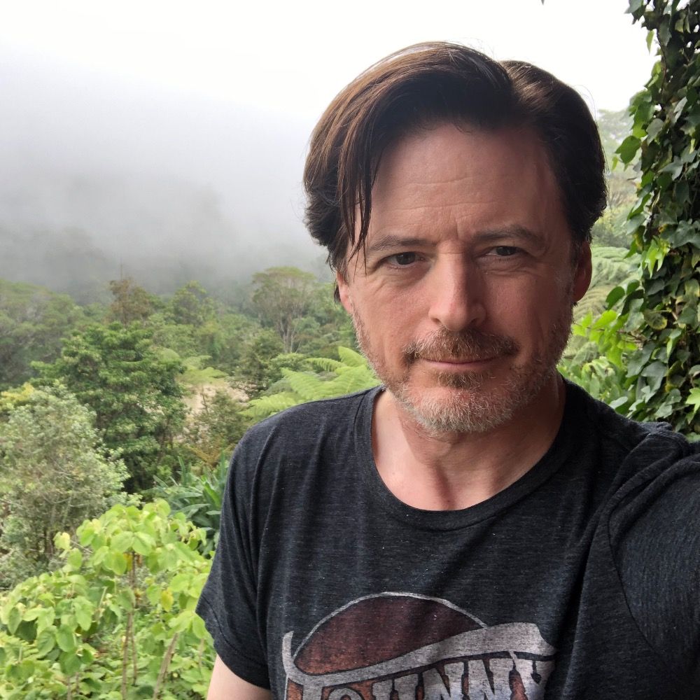
Founder and editor of @upstarts.bsky.social, a tech publication focused on the startup ecosystem. Previously Forbes senior editor. Email: tips@upstartsmedia.com
Reporter and writer: https://fallows.substack.com/ and https://www.ourtownsfoundation.org/ One-time speechwriter, long-time pilot, longer-time husband of linguist/writer Deborah Fallows. Note same wristwatch in the two photos, more than 50 years apart.
Senior Digital Editor for MeidasTouch.com
Clips made with SnapStream
Internet Hooligan...
Earth & EnviroSci Educator, Central Valley equity/sustainability advocate, Hiker, Photographer, 2015 NAGT FW Outstanding Educator. 🌋 Tissue Box Maker.
❤️🏕⛰🏜 w/ @Xenolith & Z.
My book, SEPARATION OF CHURCH AND HATE, is on sale now: https://www.simonandschuster.com/books/Separation-of-Church-and-Hate/John-Fugelsang/9781668066898.
Truth-Teller | Independent Journalist and Legal Analyst | Trial Lawyer | @katiephang on Substack, Instagram, Threads, & TikTok
https://linktr.ee/katiephang?utm_source=linktree_admin_share
“Though She Be But Little, She Is Fierce”
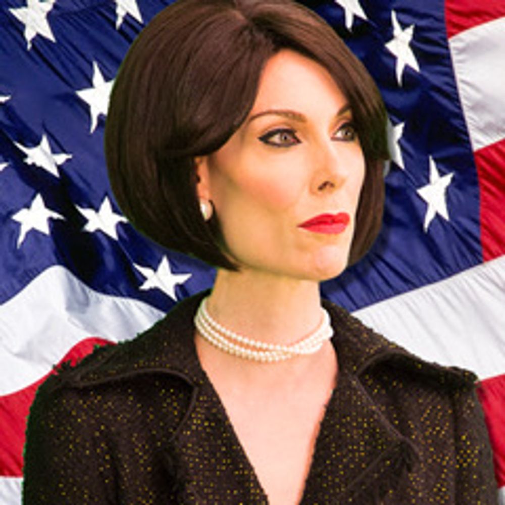
I am America’s Best Christian™. But you knew that. You can find exclusive content here: https://www.patreon.com/c/MrsBettyBowers
TITHE: https://www.paypal.com/donate/?hosted_button_id=Q6REDKBBVUJLU
@kylegriffin1 from that Twitter thing
Executive Producer @weeknightmsnow.bsky.social
Independent journalist, SnapStream brand ambassador, and publisher of the Public Notice newsletter https://www.publicnotice.co/subscribe
Jokes by John Hartzell. He/him.
Engineering Human Resources. A job board and career portal for engineers, researchers and developers. Our website: https://www.engineering.hr
Northwell Health - Division of Kidney Disease and Hypertension, NY
https://physicians.northwell.edu/education/graduate-medical-education/fellowship-nephrology-nsuh-lij