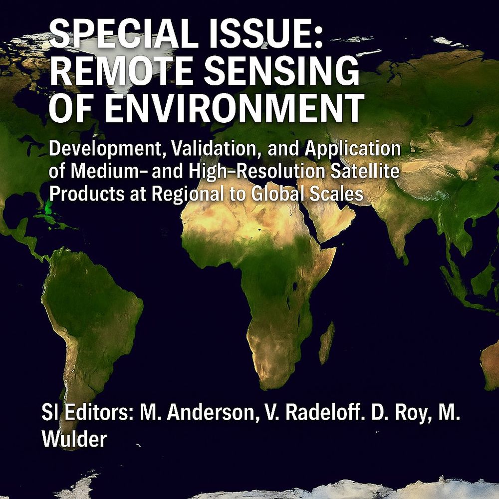
Announcement: Remote Sensing of Environment, Special Issue:
➡️Development, Validation, and Application of Medium- and High-Resolution Satellite Products at Regional to Global Scales
Builds on Radeloff et al. 2024 (113918) data products review in RSE.
Details: www.sciencedirect.com/special-issu...
06.05.2025 20:23 — 👍 14 🔁 4 💬 0 📌 0
Remote sensing is our Time Machine.
17.02.2025 17:41 — 👍 1 🔁 0 💬 0 📌 0

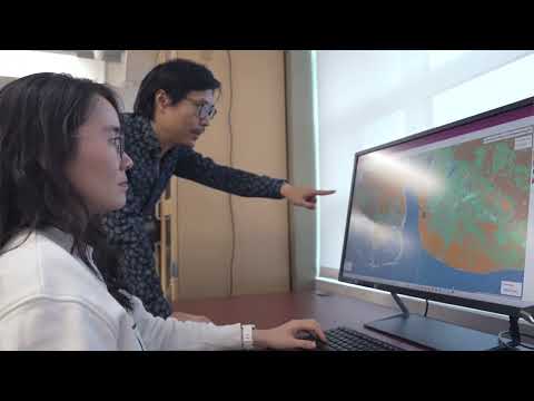
UConn Researchers Tracking Change in Precious Ecosystems - UConn Today
Remote Sensing is a powerful tool and can be used as a time machine to track biodiversity loss
Old-growth forests are some of the most diverse ecosystems on the planet. Remote sensing works as a "time machine" to understand how these forests change -- and how these changes impact biodiversity. 🌎 @gerslab.bsky.social
today.uconn.edu/2025/02/ucon...
17.02.2025 16:06 — 👍 3 🔁 1 💬 1 📌 0
GERS Laboratory is featured in UConn Today with a cool video!
01.02.2025 03:11 — 👍 0 🔁 0 💬 0 📌 0

How unique is branch arrangement—unique enough to be like fingerprints? 🧐
Yrttimaa et al. Quantifying architectural uniqueness of Scots pine trees using terrestrial laser scanning: toward individual tree fingerprinting. Forestry. #TLS #lidar #openaccess
🔗https://doi.org/10.1093/forestry/cpae058
31.12.2024 18:43 — 👍 9 🔁 5 💬 0 📌 2
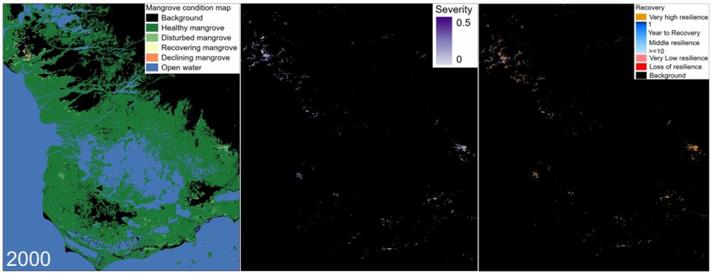
GIF photo that show the spatial-temporal pattern of disturbances and the subsequent recovery and resilience estimates.
21.11.2024 21:43 — 👍 1 🔁 0 💬 0 📌 0
DECODER - expanded on the DECODE algorithm for tracking mangrove recovery (where the last letter R comes from) is developed by @xiucheng_yang. Change is never a binary thing, and we gave four mangrove conditions: healthy, disturbed, recover, & decline.
authors.elsevier.com/sd/article/S...
17.11.2024 01:58 — 👍 0 🔁 0 💬 0 📌 0
Senior Research Scientist with the Canadian Forest Service. 🍁
#Landsat super-fan. #Lidar. #Forests. #Remotesensing. 🌲🛰
Member of the #OrderOfCanada. 🎖
📎https://www.researchgate.net/profile/Michael-Wulder
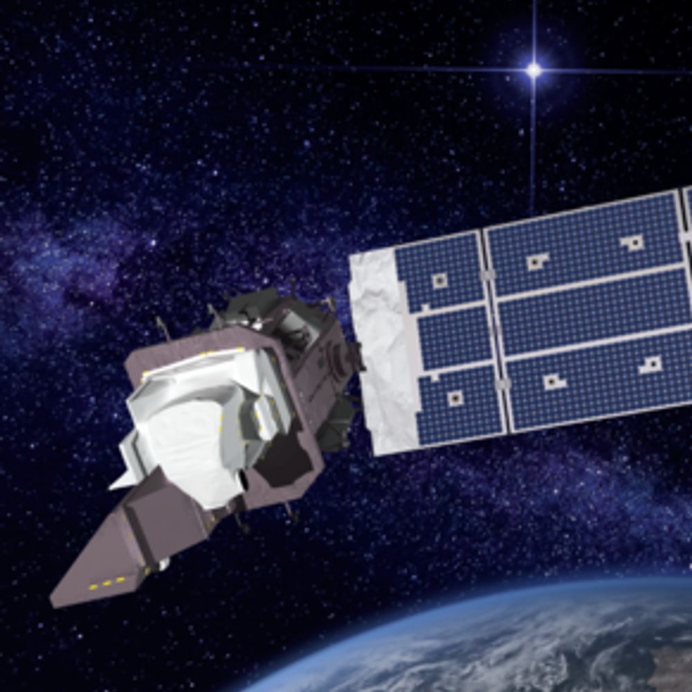
🛰️📡 Unofficial mirror/fan account for the Landsat Program, a series of Earth-observing satellites co-managed by USGS & NASA, imaging the Earth since 1972. Posts do not necessarily reflect the views of USGS or NASA.
Transforming knowledge, lives, and communities -- across Connecticut and beyond.
Researches pyroecophysiology, fire ecology, remote sensing, fire social science, lidar, and anything else that interests me. Prof and Chair - Earth and Spatial Sciences - College of Science - University of Idaho
Remote sensing of our living environment from space-borne to UAS/UAV, from the tropics to the Arctic -- at @uni-wuerzburg.de, Germany -- https://www.remote-sensing.org http://www.earth-observation.org - managed by Dr Martin Wegmann
Mainly focused on covering extreme weather events worldwide. Also interested in climate dynamics, geohazards and satellite remote sensing.
Also on X: x.com/wxnb_
Development econ PhD Student at Goethe Universität Frankfurt and WZB.
Doing research at the corner of development, transport and remote sensing.
https://cannoncloud.github.io/
You can find he/him knitting silly hats or riding funny bikes.
Magic the Gathering 🃏 Software Development 💾 Remote Sensing 🚀 Video games 🎮 e foto das minhas Gatas 🐱
No fundo só um adulto cansado
ig de cartinha: https://www.instagram.com/marujo_rennan/
minhas outras redes: https://linktr.ee/marujo_rennan
Geophysicist at the Alfred Wegener Institute (@awi.de) und 🇩🇪, Research focus: 🌊🧊🛰️ #seaice thickness #remotesensing using satellite #altimetry. Also @sthendric@fediscience.org
Views are my own.
Spatial Genetics Lab at the University of Zurich, Switzerland.
Prof Merry C Schuman. Plant ecological chemistry, genomics, remote sensing, biodiversity.
Associate professor, Landscape archaeologist, early medieval and Roman landscapes, frontiers and borders, spatial arrangements of the built environment, GIS, remote sensing, human-environment interactions.
Forest ecology | remote sensing | disturbance ecology
Assistant Professor | Colorado State University | Department of Forest and Rangeland Stewardship
GIS, Geodesy, Remote Sensing, Drupal, OpenStreetMap, GNU/Linux, PostGIS & Large Language Models. #teamADHD
Forest Fire Research Scientist with Canadian Forest Service 🔥🌲🌳 and the WildFireSat mission 🚀🛰 📡 | Advancing how we use satellites to monitor fires and their impacts | Woman in Remote Sensing | Mother in Science 💻👩💻👩🔬🧪 | she/hers | celiac | 📚🎵🎶👟☕️ | 🇨🇦🇺🇸
Tectonics and structural geology, remote sensing and satellite images. Science. Energy
Tectónica y geología estructural. Teledetección e imágenes de satélite.
Energía. Ciencia
www.jorgegines.com
📍 West Sussex, UK 🇬🇧
Assistant Professor at Indiana University. I think about nature-based climate solutions, remote sensing, drylands, and plant-climate interactions.
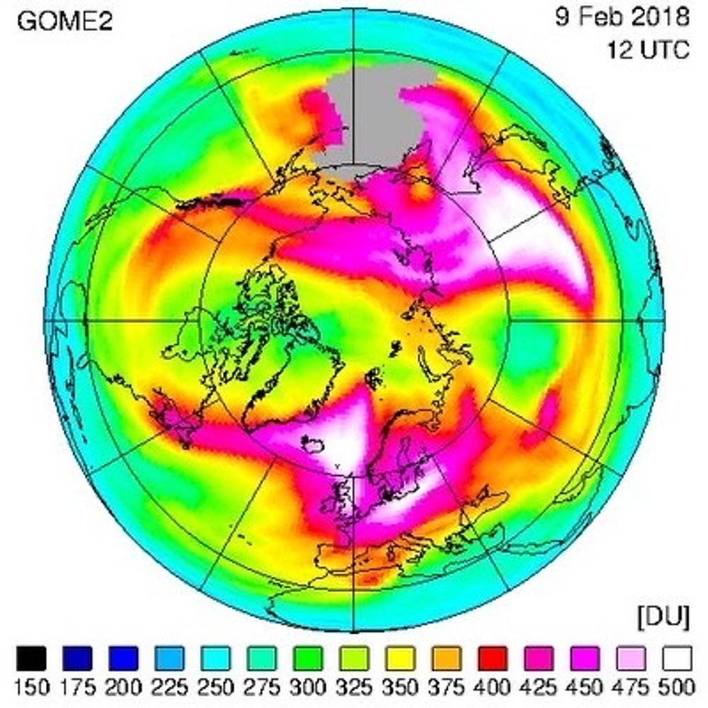
Weather and Climate; Stratosphere, UV, AQ, methane; hydrogen; EU CAMS, ESA remote sensing etc ; employed at knmi.nl ; If we would change, climate wouldn’t need to; @MichielvanWeele.bsky.social
Environmental scientist, Associate Professor, UC Berkeley. Remote sensing, GIS, wetlands, biodiversity, urban ecosystems, natural climate solutions. Bridges among science, landscape practice, and policy. I stand with Ukraine. Opinions are my own.
Earth Scientist. PhD. Agriculture, water, and climate. Likes: Geospatial, remote sensing, reproducible research, kids. Thoughts are my own.