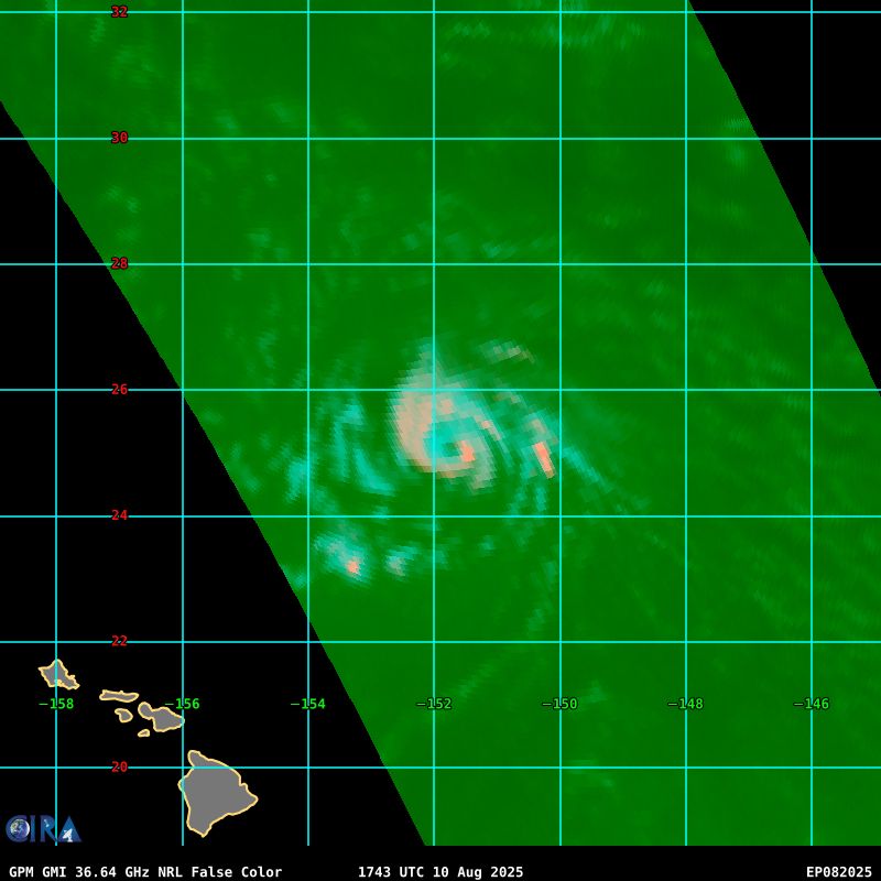
Recon is heading into #Erin as we speak. Will be good to know its exact position, how strong it is, and how much tilt there is. This data will be a big help for the forecasts
14.08.2025 21:45 — 👍 7 🔁 2 💬 0 📌 0
@yellowevan.bsky.social
Tropical Meteorologist. Lakers/Rams/UNLV fan. BS Oklahoma 2021. MS Hawaii 2023.
Recon is heading into #Erin as we speak. Will be good to know its exact position, how strong it is, and how much tilt there is. This data will be a big help for the forecasts
14.08.2025 21:45 — 👍 7 🔁 2 💬 0 📌 0The newest bursts of convection with #Erin have been powerful. When seen on a loop, you can see their impact quite well, looking almost like shockwaves emanating from where they began. Looks pretty cool!
14.08.2025 02:36 — 👍 26 🔁 6 💬 2 📌 0


A pair of microwave passes suggest that Hurricane #Henriette completed an eyewall replacement cycle yesterday. A window of further intensification exists today at an unusually high latitude for a Pacific hurricane.
11.08.2025 13:55 — 👍 1 🔁 0 💬 0 📌 0Latest ASCAT now confirms gale force winds and a closed center well embedded in the deep convection. #Erin is likely coming at 15z.
11.08.2025 13:38 — 👍 1 🔁 0 💬 0 📌 0


Upper environment for Invest #97L is quite favorable for the next 4 to 5 days, with dual outflow channels and a potent upper level anticyclone. Given how convectively active it looks, odds are increasing for a significant hurricane before encountering increased shear from an upper trough.
11.08.2025 13:33 — 👍 1 🔁 0 💬 0 📌 1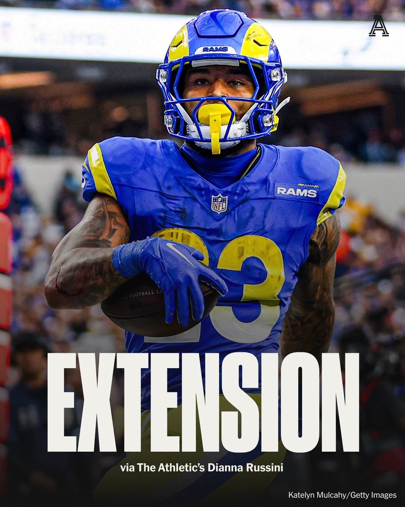
The Rams and RB Kyren Williams have agreed to terms on a three-year, $33 million extension, per sources. The deal includes $23 million guaranteed.
After back-to-back 1,000-yard seasons, Los Angeles rewards its top running back.
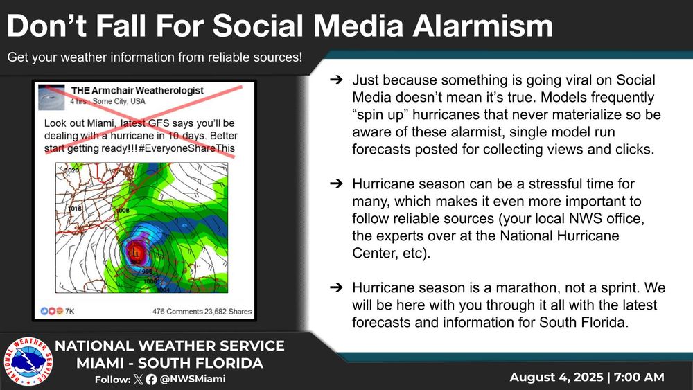
The @nws.noaa.gov offices are starting to notice an uptick in #tropical #weather hype. Please ensure you get your forecast information from reliable sources, and not those attempting to just gain views or clicks. #PSA #HurricaneSeason2025
05.08.2025 03:12 — 👍 45 🔁 20 💬 4 📌 1
FROM SHAMS:
Just in on @SportsCenter -- Luka Doncic lands a $165M extension with the Lakers six months to the day of his stunning trade out of Dallas: https://t.co/7JaV2xTAfH
Today's jobs report shows what many Americans already knew: despite record highs in the stock market, the “economy” is not working for ordinary people.
Rather than accept reality & try to address it, Trump chooses to fire the bearers of bad news.
This is what authoritarians do.
🚨🚨 I've independently confirmed with @NOAA that they received a late-breaking notice from @DeptofDefense that SSMIS data will continue to flow for the remainder of the lifespan of the satellites. I will be updating my reporting shortly. Here is the official NOAA statement 👇
29.07.2025 14:43 — 👍 189 🔁 92 💬 9 📌 16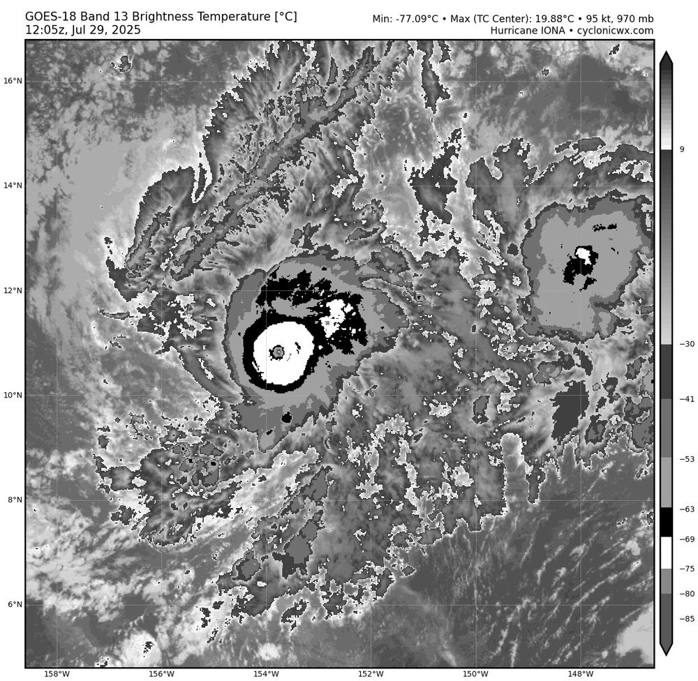
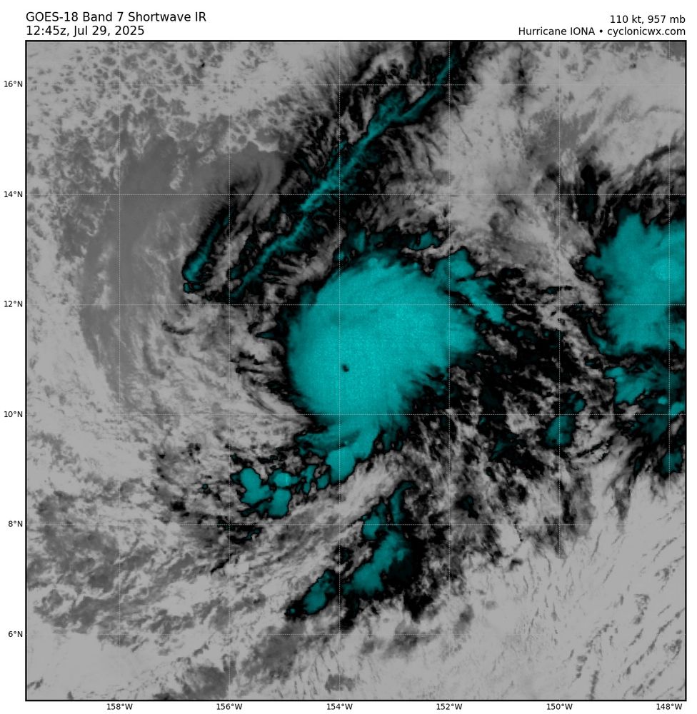
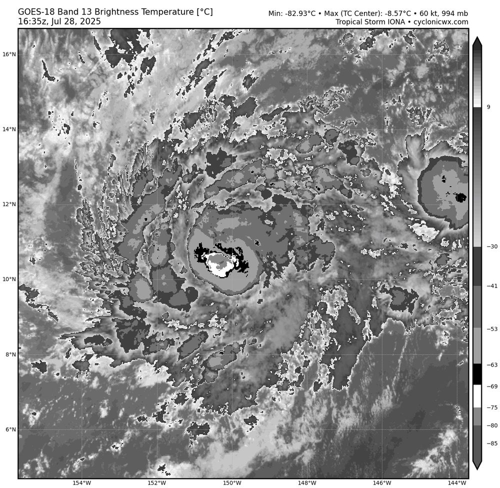
Hurricane #Iona has continued its rapid intensification episode overnight. Although the eye has not fully cleared, the CDO has become quite circular and upper level outflow remains well established. Satellite classifications from SAB and JTWC support T6.0/115 kts.
29.07.2025 13:17 — 👍 0 🔁 0 💬 0 📌 0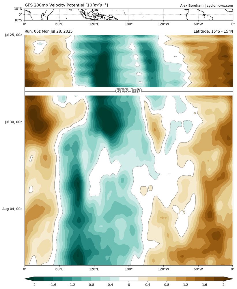
A passing Kelvin Wave has resulted in monsoon trough penetration past 140W and the development of an upper anticyclone until around 150W. This is in contrast to the La Niña and -PDO/PMM dominant conditions that have shut down this region of the world since 2019.
28.07.2025 17:13 — 👍 1 🔁 0 💬 0 📌 0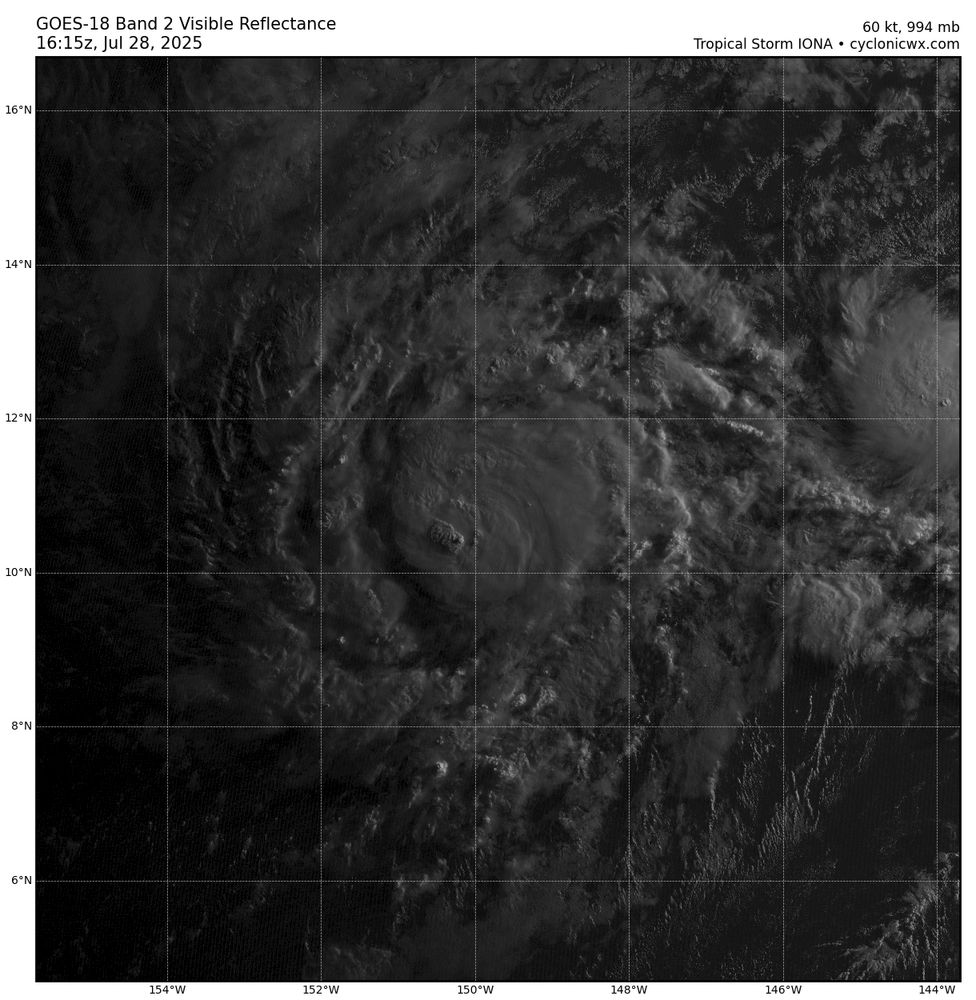
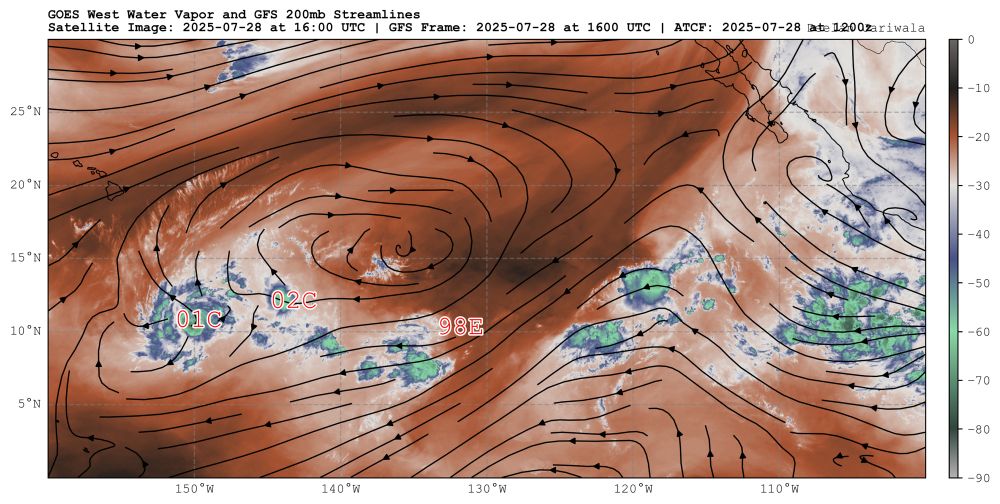
First visible and IR imagery shows hot towers lingering in the southwest quadrant of Hurricane #Iona, which has rapidly intensified since yesterday. This episode is likely to continue until westerly shear picks up overnight. To the left, Tropical Depression #02C has also formed.
28.07.2025 17:13 — 👍 1 🔁 0 💬 1 📌 0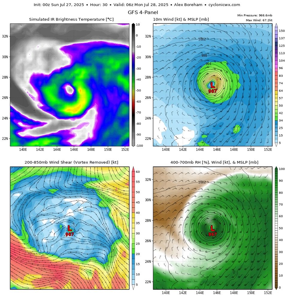
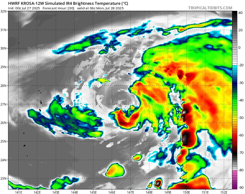
Hurricane and global models agree that #Krosa will suffer from a significant dry air intrusion in about 18-24 hours, likely as a result of persistent northerly flow. Whether the peak tomorrow will be the final peak is still to be determined.
27.07.2025 05:22 — 👍 0 🔁 0 💬 0 📌 0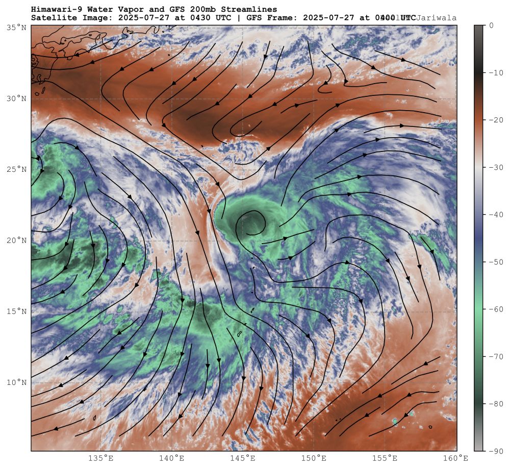
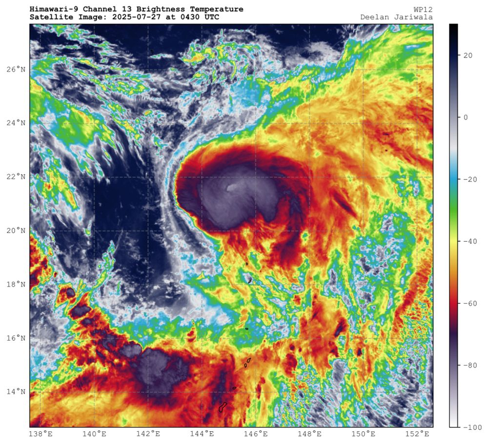
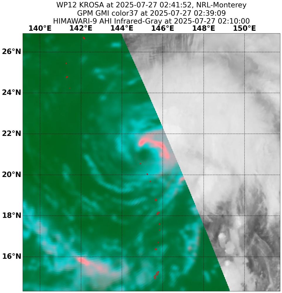
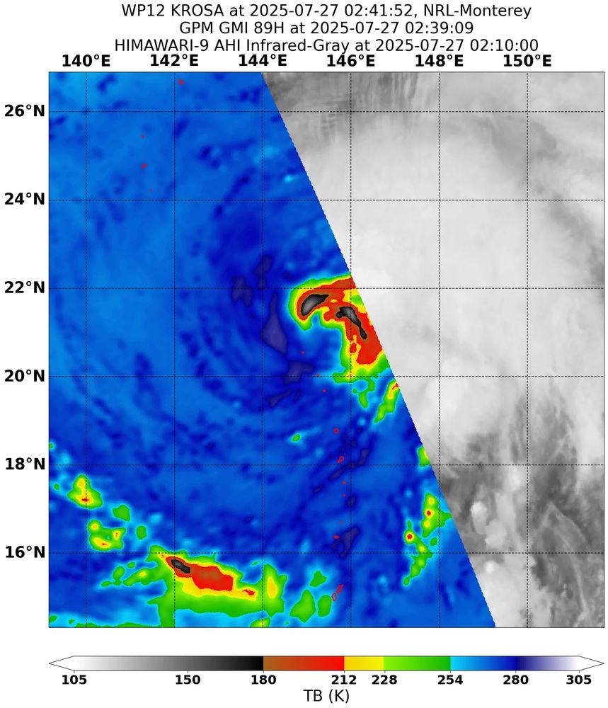
After eroding an upper level low, Typhoon #Krosa has managed to find a favorable environment that has yielded intensification. Microwave imagery suggests an inner core is forming and deep convection has recently wrapped into the northwest quadrant.
27.07.2025 05:22 — 👍 0 🔁 0 💬 1 📌 0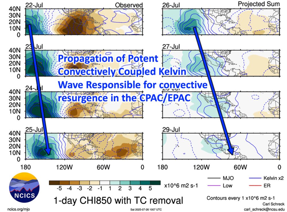
Plot of the western hemisphere showing the filtered Kelvin Wave band (blue solid lines indicate upward vertical motion). Note the wave propagating eastward across from 22 Jul to 29 Jul (following the blue arrow).
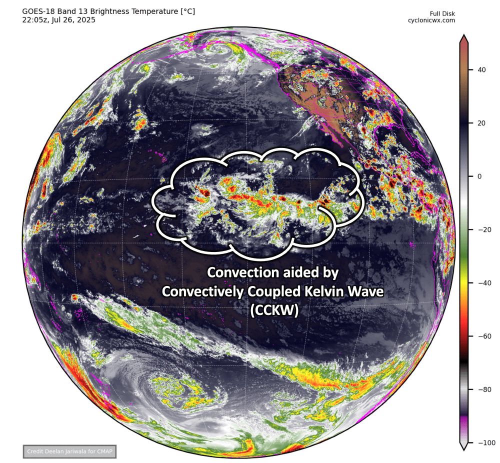
GOES-18 Full Disk View Infrared Satellite Image valid 2205 UTC 26 July. Annotated is the bubble is convection being enhanced by the CCKW.

Graphical Tropical Weather Outlook for 11am PDT highlighting three areas for development.
Not hard to see what is causing the abrupt uptick in convective activity in the Central & East Pacific. A potent Convectively Coupled Kelvin Wave, #CCKW, has been marching eastward, activating the #ITCZ.
This convection may aid #ITCZ breakdown, with 3️⃣ areas being monitored for #TC formation.
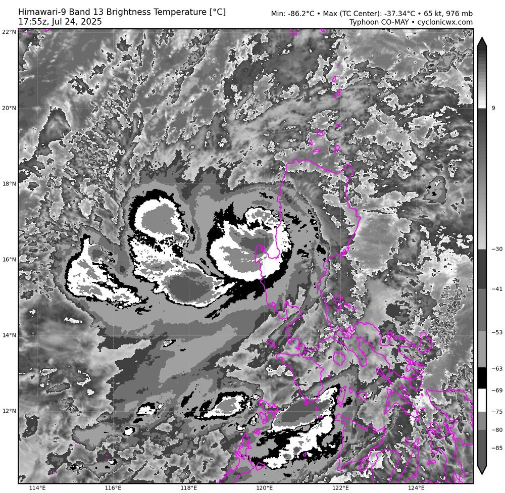
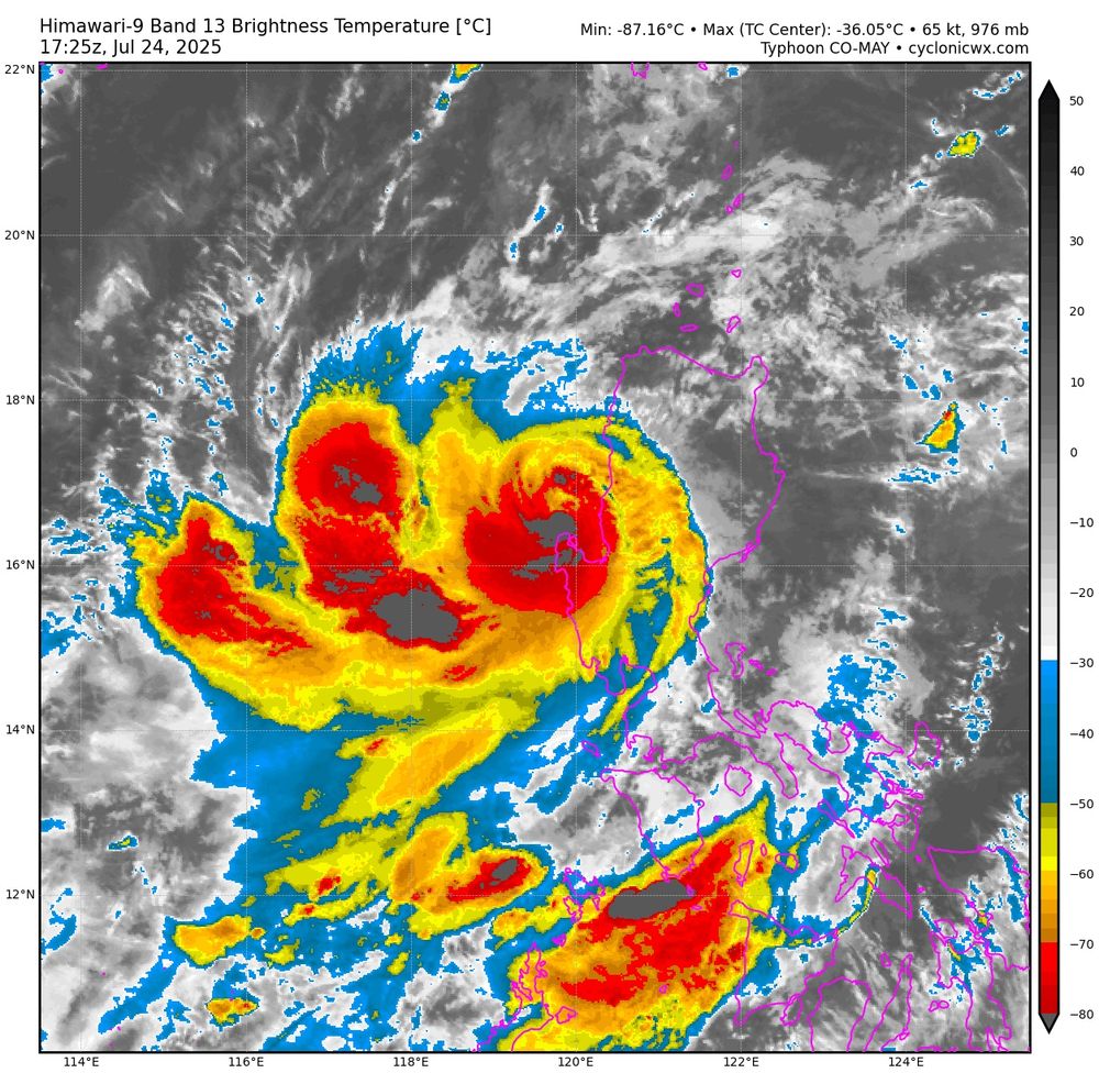
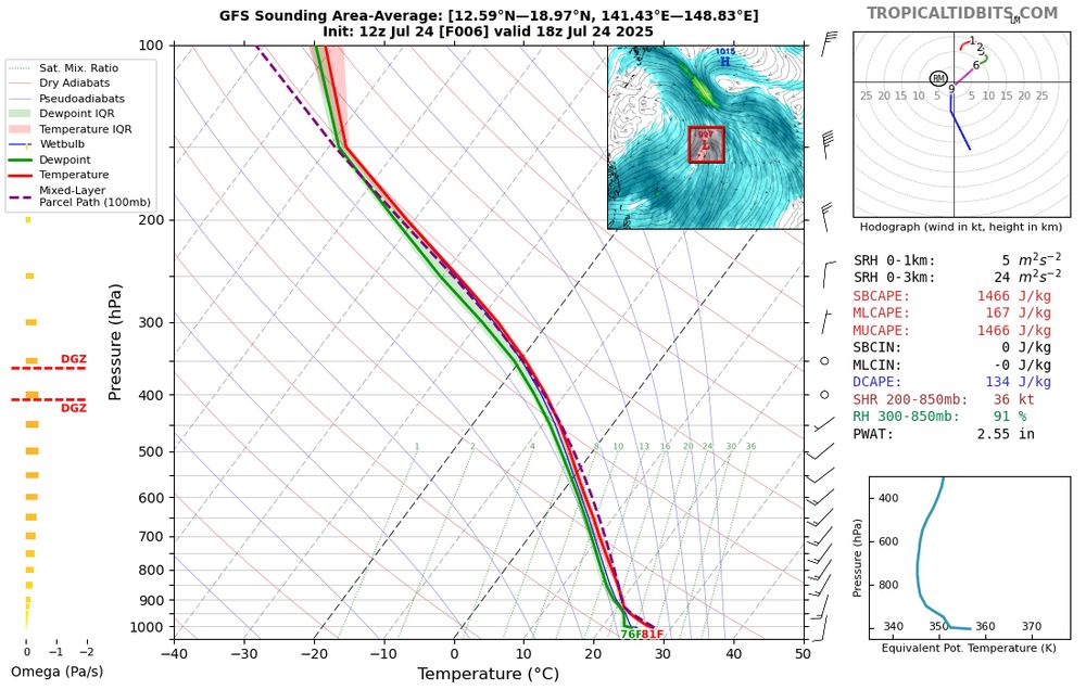
With deep convection wrapping around, a ragged warm spot has become apparent. However, time is running out as #Co-May is likely only a couple hours from making landfall in Luzon.
24.07.2025 18:18 — 👍 1 🔁 0 💬 0 📌 0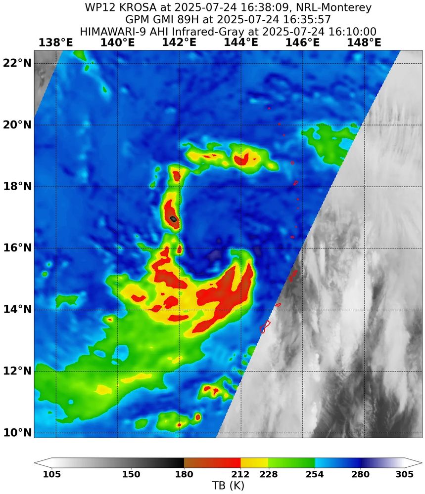
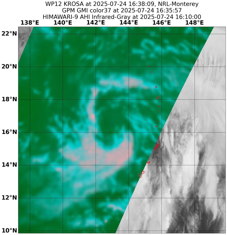
Significant outflow layer shear from the anticyclone of #Framsico has made it difficult for Tropical Storm #Krosa to sustained organized deep convection. However, it has not stopped a a well-defined curved band signature and a low-level primitive core from forming.
24.07.2025 18:14 — 👍 0 🔁 0 💬 0 📌 0
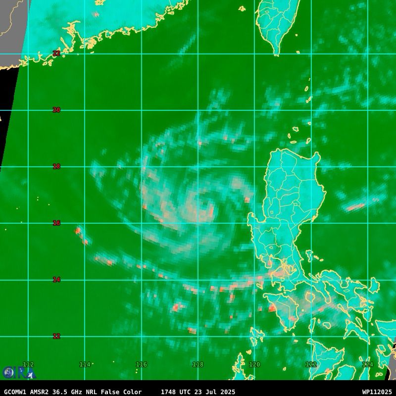
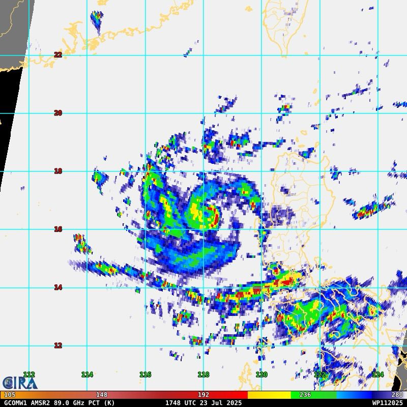
After forming yesterday, Tropical Storm #Co-may has been quickly intensifying, with an expansive CDO, well established anticyclonic outflow, and a small but not yet fully closed core. With moderate easterly shear, additional intensification is likely in the short term.
23.07.2025 21:12 — 👍 2 🔁 0 💬 0 📌 0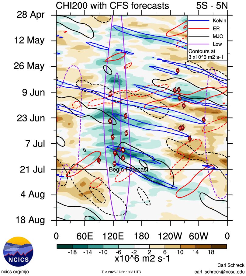
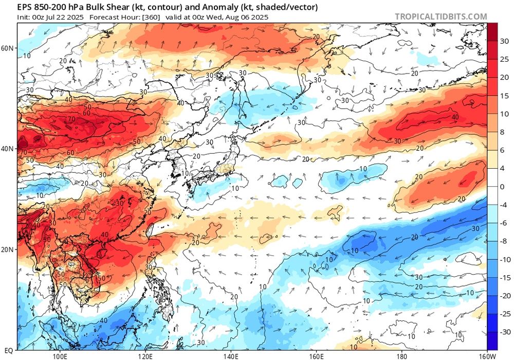
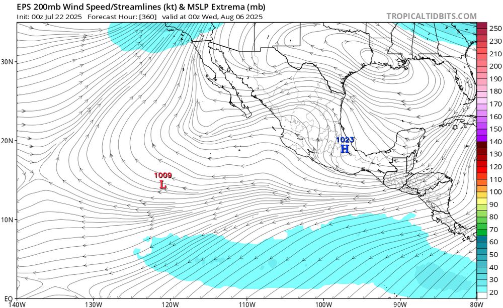
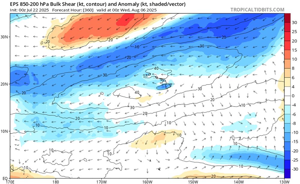
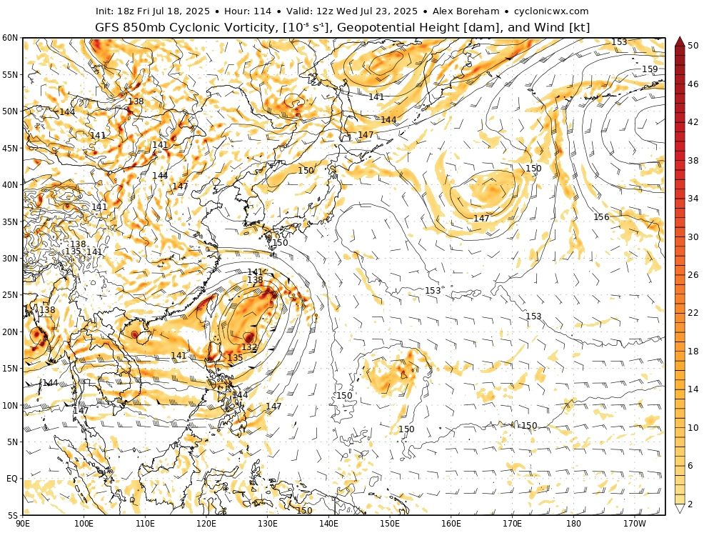
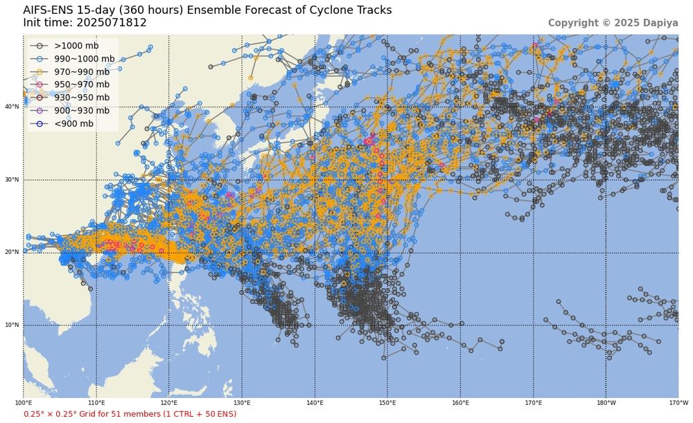
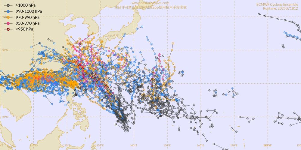
With low frequency forcing still centered near the Philippines and the passage of multiple Convectively Coupled Kelvin Waves across the Pacific, upper level conditions will be quite favorable for tropical cyclone activity across both the eastern and western Pacific over the next few weeks.
22.07.2025 17:43 — 👍 2 🔁 1 💬 0 📌 0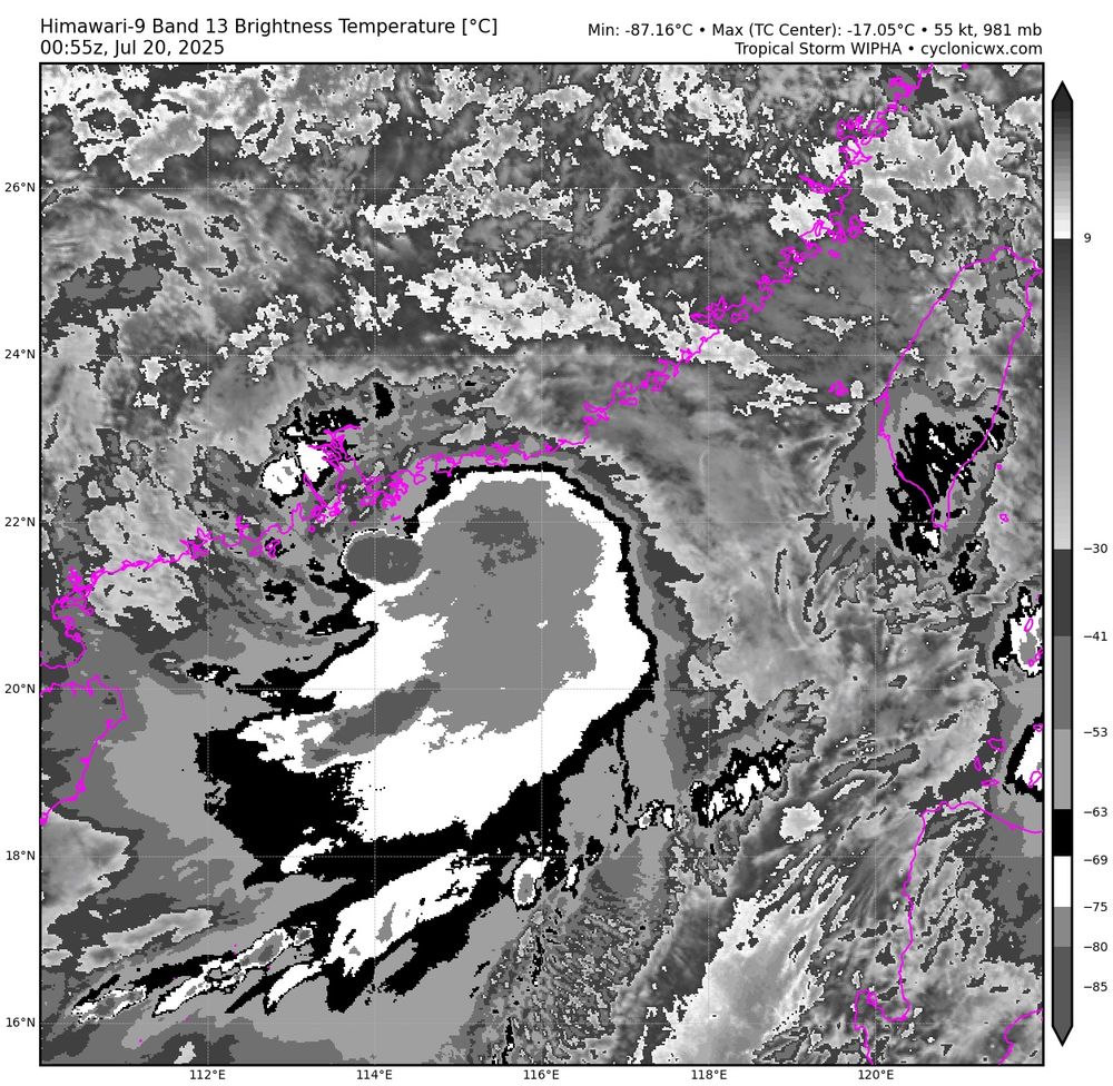
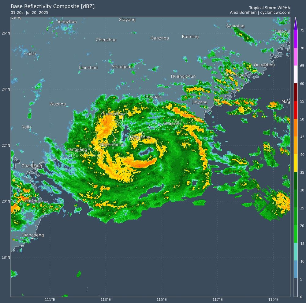
Although IR remains lackluster, #Wipha has become much better organized on radar, likely in response to friction with the coastline, with a well defined eye now apparent.
20.07.2025 01:31 — 👍 1 🔁 0 💬 0 📌 0
A Convectively Coupled Kelvin Wave is passing through the tropical Pacific, increasing convection near 125W. As it progresses through, low level westerlies and anticyclonic flow aloft may aid in the development of an unusually far west northeastern Pacific tropical cyclone for late July.
19.07.2025 00:42 — 👍 1 🔁 0 💬 0 📌 0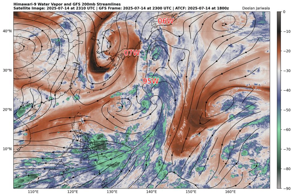
The passage of the Madden Julian Oscillation has increased convection over the western Pacific, but upper toughing initially prevented any consolidated tropical cyclones from forming. As upper troughing has lifted out, European ensemble members have begun to show an increase in TC activity.
19.07.2025 00:16 — 👍 0 🔁 0 💬 0 📌 0
The passage of the Madden Julian Oscillation has increased convection over the western Pacific, but upper toughing initially prevented any consolidated tropical cyclones from forming. As upper troughing has lifted out, European ensemble members have begun to show an increase in TC activity.
19.07.2025 00:16 — 👍 1 🔁 0 💬 0 📌 0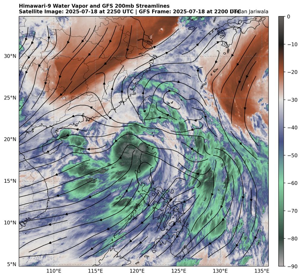
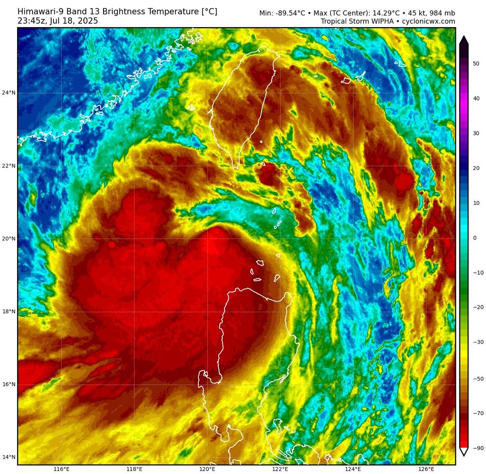
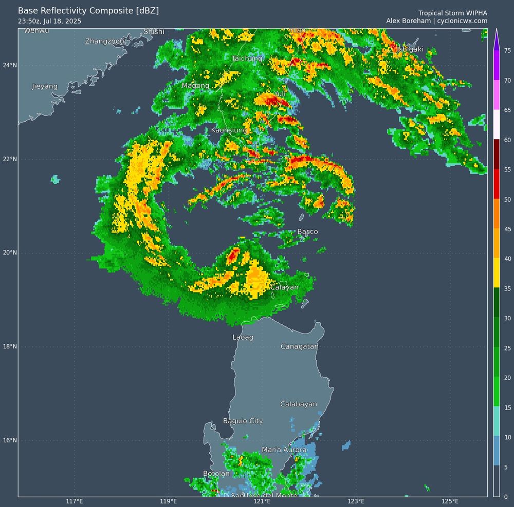
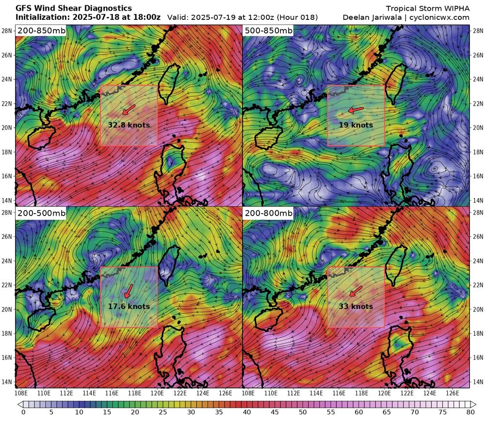
Tropical Storm #Wipha is intensifying this evening, with IR showing a shrimp look as convection attempts to wrap around. Radar shows a partial eyewall. Easterly shear will likely prevent significant intensification prior to reaching southern China in a little over 24 hours, however.
19.07.2025 00:07 — 👍 1 🔁 0 💬 0 📌 0Not really an overstatement to say that the test of a free society is whether or not comedians can make fun of the country's leader on TV without repurcussions.
18.07.2025 15:39 — 👍 73965 🔁 18928 💬 1487 📌 835CBS canceled Colbert’s show just THREE DAYS after Colbert called out CBS parent company Paramount for its $16M settlement with Trump – a deal that looks like bribery.
America deserves to know if his show was canceled for political reasons.
Watch and share his message.
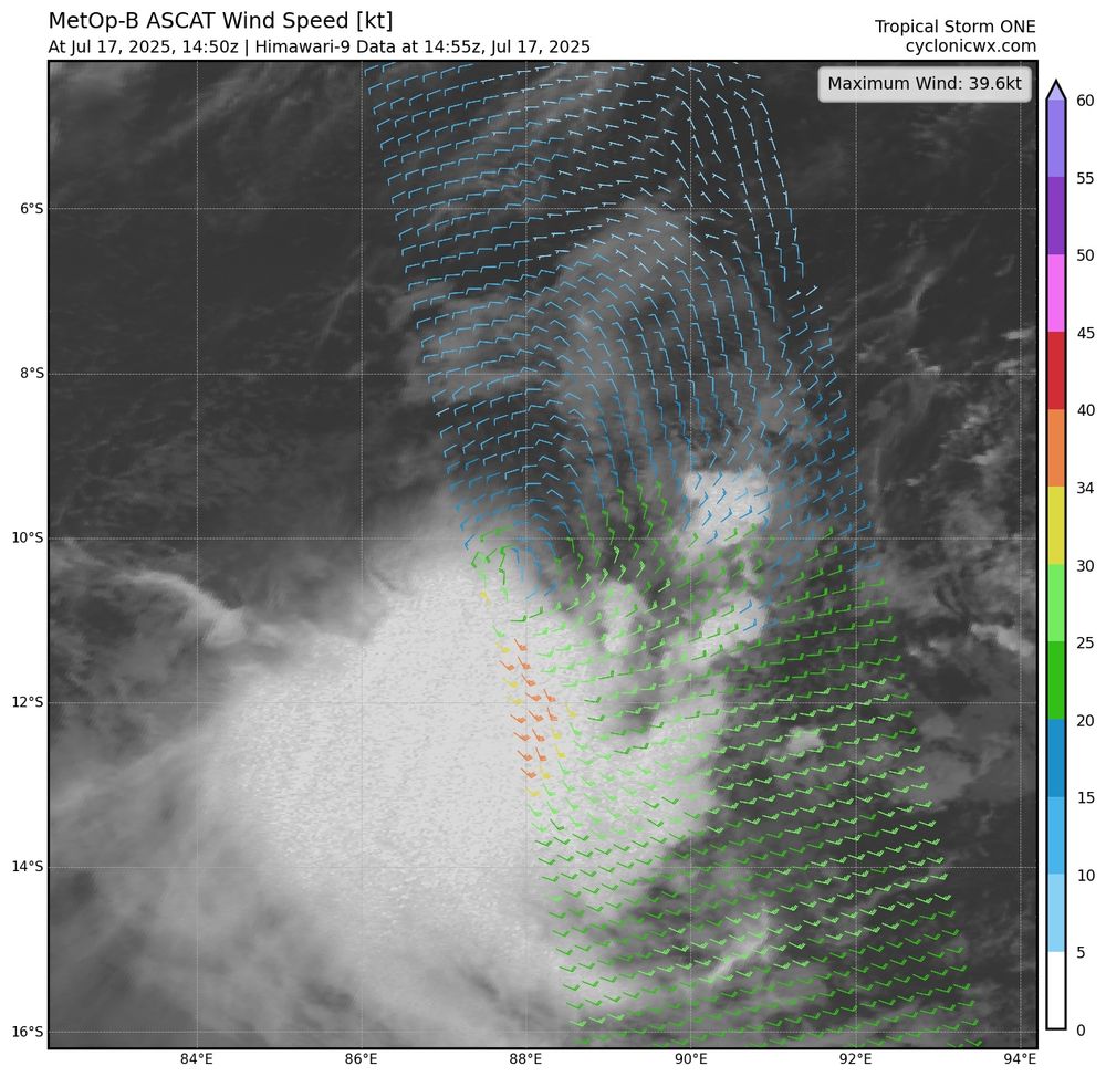
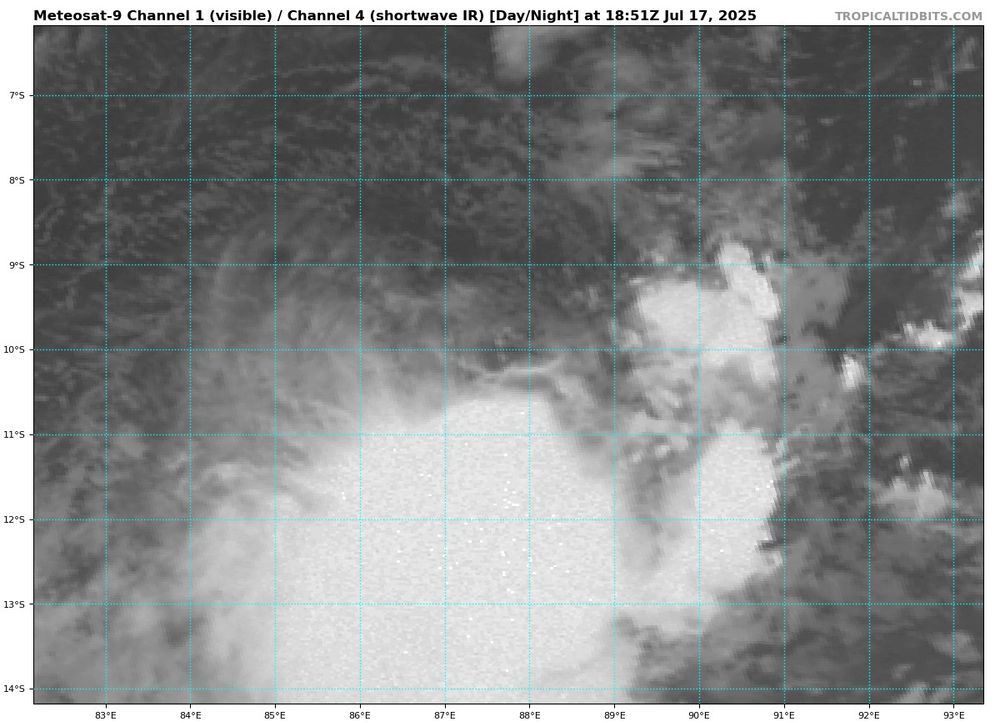
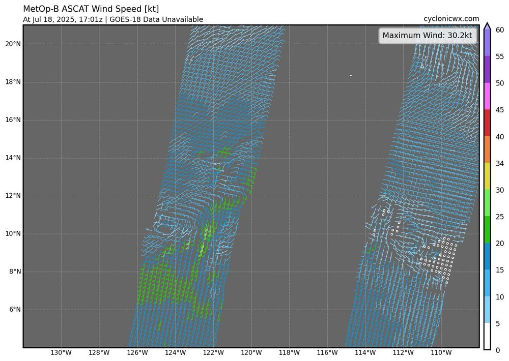
Latest ASCAT from Tropical Storm #01S shows gale force winds. With undersampling, that supports around 45 kts. Strong wind shear is displacing the convection from the center, although this shear could relax tomorrow as it aligns more favorably with an approaching trough.
17.07.2025 19:28 — 👍 0 🔁 0 💬 0 📌 0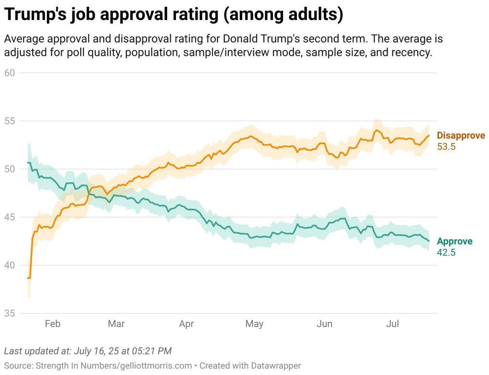
Trump’s approval rating just hit a new low — he’s now at 42.5% approve and -11 net among adults www.gelliottmorris.com/p/data
17.07.2025 15:00 — 👍 133 🔁 23 💬 7 📌 7