 07.04.2025 06:38 — 👍 0 🔁 0 💬 0 📌 0
Imagine being in the Five Guys family and being the 6th guy
19.03.2025 03:54 — 👍 0 🔁 0 💬 0 📌 0
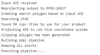
Image of text showing geo processing results
Learning stac-client, coming along nicely so far
23.11.2024 20:00 — 👍 0 🔁 0 💬 0 📌 0
First post here and it has an typo
09.11.2024 22:25 — 👍 2 🔁 0 💬 0 📌 0
@earthbytelab.bsky.social
Research Scientist #geospatial #remotesensing #earthobservation #mappingearth #googleearthengine
Assoc prof in policy and engineering at UC San Diego. Decarbonizing world’s toughest grids @ Power Transformation Lab. pwrlab.org
Head of AI Platform at JLL. Empowering the humans of commercial real estate.
Geospatial Product Owner at Toitū Te Whenua LINZ
🪣 s3://nz-imagery | s3://nz-elevation
🔗 https://basemaps.linz.govt.nz/
🌍 https://osgeo-oceania.org/ | https://2025.foss4g.org/
Musician (https://shorturl.at/oUoXC), Soccer Ref, Husband, Dad, game dev, Brother, Geographer, Geospatial Applications and Products, Non fiction reader.
I made these sites:
www.realbloc.com
www.wtfmap.com a daily dot map game
www.defensibleapp.com
Geographer and Geospatial professional! Interested in all things GIS and Remote Sensing. Transit planning, Maps, indoors positioning system.
GeoMeetup Organizer and author of Python for ArcGIS Pro
Conservation Geographer @uni-hamburg.de. Land system science🏔️ | Conservation science🐼 | Protected area🏞️ | Spatial analysis🛰️
Geographer, cartographer & developer for the open science in archaeology. PhD candidate in digital prehistory (is that a thing?).
I run 🌍 https://Mapstodon.Space 🌍 , the maps & geo Mastodon instance.
Fr-En-Es (in that order) • https://mapper.fr
Postdoctoral researcher in Earth Observation @ Charles University, Prague, Czechia | SAR | Time Series | 🌳🌲Forests | Machine Learning | 🎓 Capacity Building | 🚴🏼🏐
French and main website: https://geotribu.fr
English blog: https://blog.geotribu.net/
#OSGeo #FOSS4G #opensource #GIS #GeoRDP #QChat
Publishing geospatial open data efficiently using GeoNetwork, GeoServer and Bridge. We offer software, services, cloud hosting, support and consulting
A mapish developer working at GeoCat. Active with the OSGeo and LocationTech communities working on a wide range of free and open source geospatial goodness!
Riding some bikes, writing some code, still making Geocode Earth after 7 years
Remote Sensing expert @planetlabs #forest🌳 #LUC #carbon #supplychain | Geospatial Rising Star 2022 | @GoogleDeveloperExpert #EarthEngine, co-founder of geoinclusion and member of @rsategroup #earthobservation #Amazon #Cerrado
🌏🛰️ #Earthobservation #remotesensing #geospatial #dronemapping | Co-founder She Maps and GeoNadir | Assoc/Prof JCU | she/her |🔗https://linktr.ee/drkjoyce
Geologist & #EarthObservation Engineer at EUMETSAT/Innoflair. Decoding #ClimateRisks & #NaturalHazards.
Passionate about flood risks 🌊, geohazards ⚠️, weather 🌦️, remote sensing 🛰️, maps 🗺️, & risk comm 🚨.
Also in 🏀, ⛵️ and 👨🌾.
👉 www.niklasjordan.com | 🇪🇺🇩🇪🇩🇰
🌏🌱
trying to make Geospatial Foundation Models work
Research Fellow at @ESA PhiLab
Previously at @KULeuven, @Cnam
PhD in Data Science at @Sapienza
website: https://sites.google.com/uniroma1.it/valeriomarsocci
#AI4EO #GeoAI #SSL4EO
Ph.D. student on generative models and domain adaptation for Earth observation 🛰
Previously intern @SonyCSL, @Ircam, @Inria
🌎 Personal website: https://lebellig.github.io/