Three men upgrade a seismic monitoring station in a clearcut under a powerline.

Two men upgrade a seismic monitoring station at the edge of a forest.

A seismic monitoring station is at the edge of a forest.

A snowcapped mountain rises above surrounding forests and hills.
DYK the Pacific Northwest Seismic Network is managed jointly by UO, UW, and USGS? Together we operate 700+ seismic monitoring stations! #FieldWorkFriday
Field technicians from OHAZ and UW recently teamed up to upgrade VLM, a @pnsn1.bsky.social site NW of Mt. Hood. Team work makes the dream work! 🦆🐾
07.11.2025 16:50 — 👍 3 🔁 1 💬 0 📌 0

CRESCENT's Twinning Program is seeking mentor pairs to guide undergraduate students through a yearlong research project.
⏰ Applications close January 15, 2026
Program begins Fall 2026
Learn more and apply here ⬇️
cascadiaquakes.org/2024/10/03/m...
05.11.2025 17:47 — 👍 3 🔁 2 💬 0 📌 0

Thumbnail showing rupture zone of the 2004 earthquake and subsequent propagation of tsunami waves with text "Surprise Earthquake?"
On this World Tsunami Awareness Day, we look back at the 2004 Sumatra–Andaman earthquake and tsunami and reflect on the lessons learned and scientific advances made in tsunami warning. #TsunamiDay
Watch: The Science Behind the 2004 Sumatra–Andaman Earthquake & Tsunami
📽️ https://loom.ly/nvoYSSA
05.11.2025 10:10 — 👍 9 🔁 4 💬 0 📌 0

This graphic tells people to go to high ground if they are at the coast and get an earthquake early warning alert or feel shaking.
Today is World Tsunami Awareness Day.
If you are on the coast and feel shaking or get an earthquake early warning alert, you should #DropCoverHoldOn. Wait for shaking to stop. Then evacuate to high ground or inland. A tsunami may be coming!
Learn about #ShakeAlert at usgs.gov/FAQ/BeShakeAlertSafe.
05.11.2025 18:05 — 👍 4 🔁 1 💬 0 📌 0

A wildfire camera is on top of a telecommunications tower with the Columbia River Gorge visible in the background.

A young man hoists a wildfire camera on top of a telecommunications tower, with a desert and blue sky in the background.
We just added two new wildfire cameras in the Columbia River Gorge! #FieldworkFriday
The Stacker and Juniper cameras are in WA so they can spot fires on both sides of the river. Thanks Klickitat PUD for hosting them!
Live feeds will be available soon on ALERTWest.live and the @watchduty.org app.
24.10.2025 16:19 — 👍 4 🔁 1 💬 0 📌 0
This webinar is happening today at 1pm!
23.10.2025 16:15 — 👍 1 🔁 0 💬 0 📌 0

This graphic encourages people to register for a Zoom webinar about ShakeAlert Earthquake Early Warning for lifeline infrastructure.
The #ShakeAlert System rapidly detects earthquakes and alerts people before dangerous shaking arrives.
A free @cascadiaeqs.bsky.social webinar on 10/23 will share how community lifelines can use #EEW technology to protect critical infrastructure.
🔗 Register: cascadiaquakes.org/2025/09/08/c...
20.10.2025 16:56 — 👍 3 🔁 0 💬 0 📌 0

This flyer encourages people to attend a walk and talk program at the Museum of Natural and Cultural History at 2pm on October 16 at the Museum of Natural and Cultural History.
Today is the #ShakeOut earthquake drill! Join us at the @uoregon.bsky.social Museum of Natural and Cultural History for a special Walk & Talk about earthquakes and preparedness.
The program begins at 2pm at @uomnch.bsky.social. Learn more at mnch.uoregon.edu/index.php/learn/great-oregon-shakeout.
16.10.2025 16:03 — 👍 4 🔁 3 💬 0 📌 0

It's International ShakeOut Day! Take a moment at 10:16 a.m. (local time) to practice your “Drop, Cover, and Hold On."
If you live in an earthquake-prone region, it isn’t a question of if, but when an earthquake will occur. Be sure to make a plan and be prepared!
📽️ https://loom.ly/Nh4BnmE
16.10.2025 06:25 — 👍 9 🔁 5 💬 0 📌 0

Recent @Mariners games have been shaking things up enough for our seismometers to notice but those waves are all in good fun. It's a great reminder that real quakes can happen anytime. Join us tomorrow (10/16) for @ShakeOut and practice what to do when the ground really moves.
15.10.2025 18:00 — 👍 17 🔁 7 💬 0 📌 0
Only 2 days left until The Great #Nevada #ShakeOut on October 16th and 10:16am! Do you know what to do during an earthquake if you're indoors? What about outdoors? Learn some tips from our video: tinyurl.com/yxyseyb2
14.10.2025 21:30 — 👍 4 🔁 2 💬 0 📌 0
Tomorrow is the last day to donate to OHAZ via our Duckfunder! Your contribution would directly benefit our wildfire camera network. Thank you to everyone who has already supported us!
duckfunder.uoregon.edu/project/46953
14.10.2025 22:59 — 👍 2 🔁 0 💬 0 📌 0
Learn more about upcoming #ShakeOut events at cascadiaquakes.org/2025/09/08/2025-great-oregon-shakeout!
14.10.2025 16:05 — 👍 1 🔁 1 💬 0 📌 0

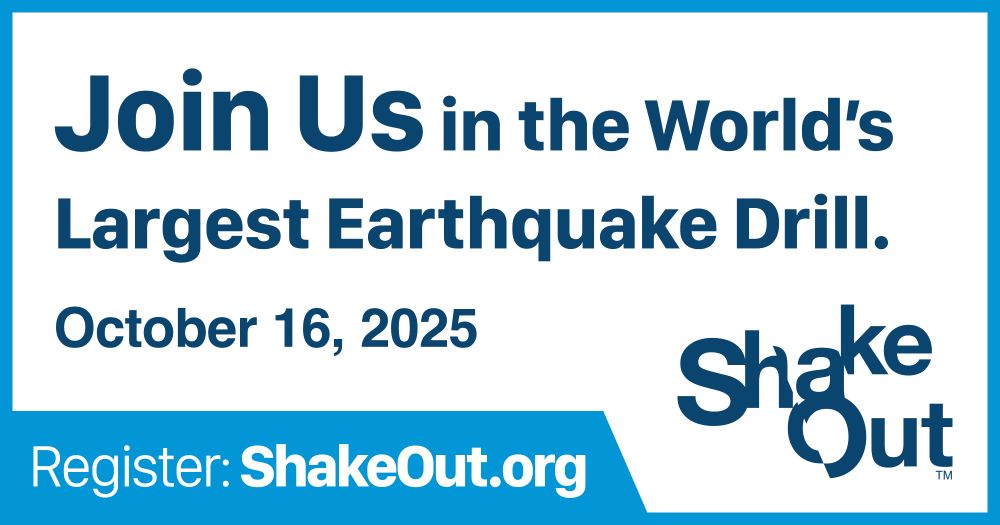
This infographic encourages people to participate in the ShakeOut earthquake drill on October 16.
ShakeOut is this Thursday! Are you participating in the world’s largest earthquake drill?
Register your family, school, or workplace to participate at shakeout.org.
Learn about #ShakeOut events on the @uoregon.bsky.social on campus at cascadiaquakes.org/2025/09/08/2025-great-oregon-shakeout.
13.10.2025 16:16 — 👍 11 🔁 3 💬 0 📌 0
Our week of events for #ShakeOut begins today! If you are a @uoregon.bsky.social student or employee, stop by our table in the EMU Fishbowl between 10am and 3pm to learn about earthquakes and preparedness!
13.10.2025 16:13 — 👍 4 🔁 2 💬 0 📌 0

This infographic encourages people to participate in the ShakeOut earthquake drill so they can practice how to Drop, Cover, and Hold On.
10/16 is #ShakeOut – the world’s largest earthquake drill!
Practice how to protect yourself during an earthquake. As soon as you feel shaking or get an alert from the #ShakeAlert #EEW System, #DropCoverHoldOn!
Register your drill at shakeout.org. #SeismicSaturday
11.10.2025 14:37 — 👍 2 🔁 1 💬 0 📌 0

Image with Dubs the Husky and PNSN Team Member doing a drop cover and hold on drill. Text about ShakeOut noting date (October 16, 2025) and link (shakeout.org). Bottom part of image shows cartoon Drop, Cover, Hold On panels.
Dubs is ready to #ShakeOut... Are you?
We’re just ONE WEEK away from the Great ShakeOut earthquake drill on October 16! Join Dubs in practicing Drop, Cover, and Hold On.
Register your participation and explore all the ways you can boost awareness for this event at shakeout.org.
10.10.2025 00:00 — 👍 41 🔁 12 💬 1 📌 1

PNSN install team standing along dugout with the empty green seats of TMobile Park behind them.

PNSN Field Engineer installing seismic instrument on concrete ground. Tool bag in foreground, black wall in background.

Looking over the right shoulder of PNSN Field Engineer working on laptop with green seismic instrument in background.

Green seismic instrument on ground, Grey and blue cable extending from rear.
Happy #FieldworkFriday Mariners fans! Cal Raleigh said he could feel the ground shaking in Game 2, so PNSN came to take a closer look! We installed a seismometer right here in T-Mobile Park to record seismic energy during game 5. Seattle, we want to feel this place rocking! #SeizeTheMoment
10.10.2025 17:02 — 👍 93 🔁 29 💬 2 📌 5
Join emergency preparedness and earthquake experts for a Reddit AMA starting today at 11am!
reddit.com/r/AMA/comments/1o1sb2j/ama_were_pacific_northwest_earthquake_tsunami/
09.10.2025 16:13 — 👍 4 🔁 1 💬 0 📌 0
International #ShakeOut Day is one week away! On Thursday, October 16 at 10:16 am (local time), join millions of people around the world practicing earthquake safety. Register and learn more at shakeout.org.
Be prepared and practice your Drop, Cover, and Hold On!
09.10.2025 07:45 — 👍 15 🔁 11 💬 1 📌 0

This graphic encourages people to register for the ShakeOut earthquake drill on October 16.
The #ShakeOut earthquake drill is on October 16!
OHAZ, @cascadiaeqs.bsky.social, UO Safety & Risk Services, and the Museum of Natural & Cultural History are hosting multiple events on the @uoregon.bsky.social campus next week.
Learn more at cascadiaquakes.org/2025/09/08/2025-great-oregon-shakeout.
09.10.2025 16:06 — 👍 0 🔁 0 💬 0 📌 0

This infographic shows a seismic monitoring station and encourages people to read the Oregon Hazards Lab newsletter.
Our fall 2025 newsletter has arrived! We provide important updates about OHAZ, recap the summer field season, and share upcoming ShakeOut events.
🔗 Read and subscribe at bit.ly/OHAZOct2025.
07.10.2025 21:39 — 👍 1 🔁 0 💬 0 📌 0

This graphic encourages people to sign up for ShakeAlert earthquake early warning alerts, OR-Alert, and UO Alerts.
Can your phone get #ShakeAlert #EEW alerts? Check that emergency alerts are enabled in your settings! You can also download @myshakeapp.bsky.social.
To get local and campus emergency alerts, register via oralert.gov and safety.uoregon.edu/alerts.
#ShakeOut #DropCoverHoldOn #SeismicSaturday
04.10.2025 15:27 — 👍 4 🔁 1 💬 0 📌 0

A Great Washington Shake Out bingo card. The free space is drop, cover, and hold on. Other spaces are filled with suggested activities such as telling a friend about shake out, registering for shake out, testing your evacuation plan, signing up for local emergency alerts, and learning about local hazards.
We're just 😱 2 weeks away 😱 from the Great Washington #ShakeOut. Looking for ways to shake up your ShakeOut game? Check out our bingo card for some good ideas and see if you can get a full house!
And don't forget to register at shakeout.org/washington/ to help us hit 1.7 million participants!
02.10.2025 15:13 — 👍 15 🔁 7 💬 0 📌 0
YouTube video by EMDPrepare
Washington Earthquakes and Tsunamis 101
Did you miss our "Earthquakes and Tsunamis 101" webinar?
Thank you to everyone who attended and asked questions- using this opportunity to learn about earthquake and tsunami hazards and preparedness before the Great ShakeOut on 10/16!
Here's the recording: www.youtube.com/watch?v=L_Ty...
02.10.2025 21:37 — 👍 13 🔁 5 💬 0 📌 0

The University of Washington husky mascot, DUBS, sits on an office chair with a computer screen behind him reading "Get Ready to ShakeOut." A banner at the top encourages viewers to join the Great ShakeOut, and three graphics at the bottom explain how to Drop, Cover, and Hold On.
Who’s ready to #ShakeOut!? @DubsUW sure is! The Great @ShakeOut earthquake drill is just 2 weeks away, on October 16. Every year, millions across the globe participate. When the ground starts shaking, the best way to protect yourself is simple: DAWG (Drop), COVER, and HOLD ON!
02.10.2025 23:10 — 👍 25 🔁 5 💬 1 📌 1

This graphic describes upcoming events for ShakeOut on the University of Oregon campus during October.
The #ShakeOut earthquake drill is two weeks away!
OHAZ, @cascadiaeqs.bsky.social, and other partners are co-hosting a series of events on the @uoregon.bsky.social campus the week of October 13-17.
Learn more: cascadiaquakes.org/2025/09/08/2025-great-oregon-shakeout
02.10.2025 16:22 — 👍 1 🔁 0 💬 0 📌 1
This graphic encourages people to participate in the ShakeOut earthquake drill on October 16.
Join us in the #ShakeOut earthquake drill on October 16!
ShakeOut empowers you to practice #DropCoverHoldOn before you feel shaking or get a #ShakeAlert #EEW alert.
Learn about ShakeOut events on the @uoregon.bsky.social campus at cascadiaquakes.org/2025/09/08/2025-great-oregon-shakeout.
01.10.2025 16:07 — 👍 6 🔁 1 💬 0 📌 0
OHAZ mobile camera units are already making a difference on the #MoonComplexFire.
Rapidly deployed to incident last week, OHAZ Mobile Unit 3 is providing firefighters with real-time intelligence to make faster, safer decisions. This situational awareness helps to protect both crews and communities!
30.09.2025 19:28 — 👍 2 🔁 0 💬 0 📌 0

An infographic encourages people to know what to do in an earthquake that occurs while they are outside.
Happy National Public Lands Day! Oregon's beautiful landscapes were shaped by powerful geologic forces like earthquakes.
If you visit a park today for #NPLD, remember to be #ShakeAlert Ready Outdoors! Double check that you can get #EEW alerts on your phone and know the signs of earthquakes.
27.09.2025 13:30 — 👍 1 🔁 0 💬 0 📌 0
We believe that avoiding devastating wildfires requires urgent, innovative, and collaborative solutions. Our mission is to bring people together to break down the barriers that currently exist between wildfire-related data, models, and tools.
California Governor's Office of Emergency Services
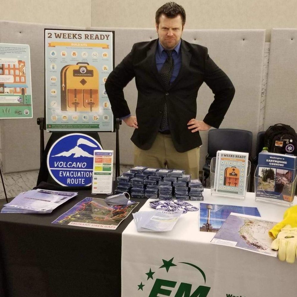
Earthquake and Volcano safety/preparedness focused emergency manager for Washington State. Volcano Geophysicist. Song Parodyifier? Living/breathing/walking pile of Dad Jokes.
AGU is a global community supporting more than half a million advocates and professionals in Earth and space sciences.
MyShake is a free global earthquake app and California's official earthquake early warning app.
Email us at myshake-info@berkeley.edu and visit https://myshake.berkeley.edu/
Caltech Seismological Laboratory | A focal point and source for earthquake science, discovery, and research in Southern California for over 100 years!
The International Seismological Centre (ISC) is a Charitable Incorporated Organisation (#1188971) that provides free worldwide #earthquake #data #products for #seismology and #geoscience #geology #EarthScience
Community-driven Diamond Open Access journal for seismology and earthquake science. seismica.org
Become a reviewer: http://reviewer-database.seismica.org
In chronological order: Son, American, Chicagoan, Sports fan, Christian, Voter, Teacher, Seismologist, Husband, Mentor, Badger, Professor, Ohioan, Father, Business owner, Coach.
Oregon's science and culture museum. Located on the University of Oregon campus in Eugene, Oregon. State repository for archaeological and paleontological artifacts.
EarthScope Consortium supports transformative global geophysical research and education. Operator of the NSF National Geophysical Facility. #NSFfunded
Managing, sustaining, and protecting the health & productivity of Washington's lands and waters.
The Seismological Society of America (SSA), founded in 1906, is an international scientific society devoted to the advancement of earthquake science.
Earthquake geologist 🧪⚒️ | Scicomm specialist 🎙️| Formerly USGS, IRIS, NASA | she/her | Views are mine | website: https://wendybohon.com/
“A delightful blend of scientific rigor and domestic chaos.”
Assistant prof leading Coastal Hazards Lab @vtgeosciences. I employ diatom-based paleoseismology to reconstruct EQ and tsunami records. #marshcat #hokie
http://www.coastalhazardslab.com
Cutting-edge research, news, commentary, and visuals from the Science family of journals. https://www.science.org
Eos is a leading source for trustworthy news and perspectives about the Earth and space sciences and their impact. Published by the American Geophysical Union (@agu.org).
Director of the Cascadia Region Earthquake Science Center (@cascadiaeqs.bsky.social) and Associate Professor of geophysics at University of Oregon. I research big earthquakes and tsunamis.
Seismologist in Southern California. Viol player. Founder of Tempo: Music for Climate Action