Pre-event (13 Jun 2024) and post-event (7 Aug 2025) satellite images of Dharali, Uttarkashi, India reveal how a sudden cloudburst unleashed mudflows that blanketed the Bhagirathi and Kheer Gad channels in thick grey sediment, erasing roads, orchards and buildings. #Disaster #Flood #GLOF #Cloudburst
Pre-event (13 Jun 2024) and post-event (7 Aug 2025) satellite images of Dharali, Uttarkashi, India reveal how a sudden cloudburst unleashed mudflows that blanketed the Bhagirathi and Kheer Gad channels in thick grey sediment, erasing roads, orchards and buildings. #Disaster #Flood #ISRO #Cloudburst
07.08.2025 15:21 — 👍 1 🔁 0 💬 0 📌 0

On August 5, 2025, a catastrophic cloudburst-induced flash flood and debris flow struck Dharali village, Uttarkashi, Uttarakhand, approximately 10 km from Harshil, causing significant loss and damage....
On August 5, 2025, a catastrophic cloudburst-induced flash flood and debris flow struck Dharali village, Uttarkashi, Uttarakhand, approximately 10 km from Harshil, causing significant loss and damage....
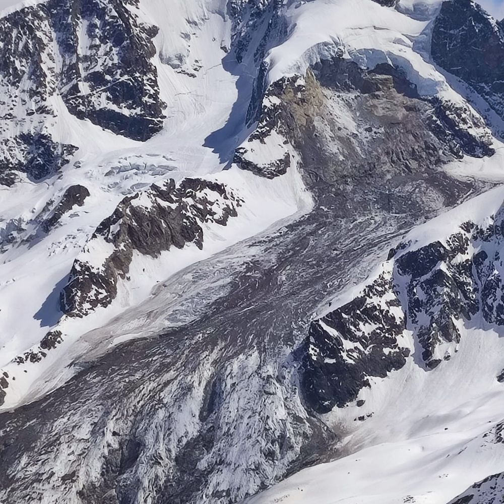
Cloudburst-induced flash flood and debris flow devastated village in Uttarkashi, India today. A glacial sedimentary deposit at 6,700 m, 7 km upstream, triggered by intense rainfall, caused rapid debris flow through a steep nala, reaching Dharali in under a minute. www.linkedin.com/posts/pravee...
05.08.2025 18:01 — 👍 0 🔁 0 💬 0 📌 0
Aug 5th 2025, flash floods due to cloudburst in Uttarakhand, India represent a tragic and complex natural disaster, highlighting the vulnerability of mountainous regions to extreme weather events. The vulnerability to extreme weather events demands urgent focus on resilient infrastructure and EWS.
05.08.2025 10:30 — 👍 1 🔁 2 💬 1 📌 0
After AlphaEarth Foundations newly launched Geospatial Reasoning by Google. This is a collection of AI models designed to solve complex spatial problems. From predicting weather patterns to forecasting floods and planning urban development. #RemoteSensing #GIS
research.google/blog/geospat...
02.08.2025 07:50 — 👍 1 🔁 1 💬 0 📌 0

AlphaEarth Foundations helps map our planet in unprecedented detail
New AI model integrates petabytes of Earth observation data to generate a unified data representation that revolutionizes global mapping and monitoring
Google's Satellite Embedding dataset offers 64D vectors capturing land dynamics globally. We're applying it in Earth Engine for crop classification for India, mapping agricultural patterns with high precision. #Geospatial #Agriculture #India #RemoteSensing #AI
deepmind.google/discover/blo...
31.07.2025 17:50 — 👍 4 🔁 1 💬 0 📌 0
India-US space collaboration hits new heights! The $1.5B NISAR satellite, jointly developed by ISRO & NASA, launched today aboard GSLV F-16 — set to scan the entire Earth every 12 days, aiding agriculture, disaster response & climate research
#EarthObservation #RemoteSensing
30.07.2025 13:14 — 👍 1 🔁 0 💬 0 📌 0

XAI: a magnifying glass for AI in geoscience
XAI enhances understanding of geoscience AI systems by revealing data imperfections, such as spurious correlations, and pinpointing model limitations, including sensitivity to minor image variations in RS applications.
www.nature.com/articles/s41...
26.07.2025 09:36 — 👍 0 🔁 0 💬 0 📌 0

Concerning trend shown in the Earth Overshoot Day chart (1971-2025). The date moves earlier each year, with 2025 at 1.8 Earths indicating unsustainable resource use. Over-consumerism is a key driver. Super rich should reduce their carbon footprint.
#EarthOvershootDay #ClimateChange #ClimateCrisis
17.07.2025 09:31 — 👍 0 🔁 0 💬 1 📌 0

Our latest Hydrological Processes study improves hydrologic model calibration using bias-insensitive metrics of spatial patterns & temporal dynamics of GLEAM ET and limited streamflow data. TOPSIS selects optimal strategies transparently. #RemoteSensing #GLEAM onlinelibrary.wiley.com/doi/10.1002/...
11.07.2025 14:25 — 👍 2 🔁 0 💬 0 📌 0
Yes
04.07.2025 19:00 — 👍 0 🔁 0 💬 1 📌 0

I’m having trouble separating natural forests from plantations in my LULC maps using GEE—they often get merged into same class.I want to separate them using unsupervised classification only. What additional data, indices or processing steps would you recommend to distinguish them more reliably?
04.07.2025 10:15 — 👍 0 🔁 0 💬 1 📌 0
Posting it on Bluesky to save the post:
My grandfather built motors that powered big machines. In a lab not so different from his workshop, my colleagues and I uncovered the assembly of the bacterial motor. www.nature.com/articles/s41... @natureportfolio.bsky.social #MolecularNodes #Science #STEM
05.01.2025 02:41 — 👍 99 🔁 18 💬 4 📌 3

Just discovered the “Insect Hotel” – logs drilled with varied-diameter holes to create nesting sites for solitary bees, wasps, ladybugs & other beneficial insects. Boosts pollination, natural pest control & local biodiversity.
Photo Credit: Pujan Thapa
19.06.2025 09:57 — 👍 0 🔁 0 💬 0 📌 0
India, Yamuna river
09.06.2025 12:09 — 👍 1 🔁 0 💬 0 📌 0

While analyzing FAO WaPOR Biomass data, I noticed a striking pattern along a river: one bank shows high vegetation growth, the other much lower. Remote sensing (RS) data reveals these stark differences in Total Biomass Productivity (TBP), possibly due to irrigation, soil type, or groundwater. #IWMI
09.06.2025 06:39 — 👍 3 🔁 0 💬 1 📌 0

Integrating GIS and Multi-Criteria Analysis for Sustainable Livestock Grazing: A Holistic Assessment of Biophysical and Socio-Economic Determinants in Semi-Arid Dawa Watershed of Ethiopia
Brook Legese, Praveen Kalura, Arega Degife, Galma Godana, Jida Chamara
First published: 08 June 2025 https://doi.org/10.1002/ldr.5658
Our latest study reveals sustainable grazing strategies for semi-arid rangeland. We recommend an enhancement of infrastructure and market integration, coupled with specific zoning as the prerequisite sustainable land management practices. #LDD #SDGs
Link: onlinelibrary.wiley.com/doi/10.1002/...
09.06.2025 05:09 — 👍 0 🔁 0 💬 0 📌 0

Most rivers, especially in remote or rural areas, have no streamflow gauges. That makes it hard to predict floods, manage water or plan infrastructure. Researchers use LSTM to estimate upstream flow based on observed downstream flow. @ciroh.bsky.social
awi.ua.edu/news/machine...
31.05.2025 05:52 — 👍 3 🔁 1 💬 0 📌 0

Recently attended training at National Institute of Hydrology Roorkee on the EQIPA platform, organized by the World Bank. EQIPA is a web-based tool utilising satellite data to evaluate irrigation performance via ET analysis, providing critical insights for optimizing water use in agriculture.
#RSGIS
17.05.2025 04:51 — 👍 2 🔁 0 💬 0 📌 0

Exclusive: IWT Needs Review But Storing Water In Jammu Kashmir Rivers To Have Implications, Says Top Hydro Expert
A noted expert in the hydro sector, Iftikhar Drabu, in an exclusive interview with ETV Bharat, talks about the practicality of storing water.
India’s suspension of the Indus Waters Treaty sparks debate. Hydro expert Iftikhar Drabu says reviewing the treaty is key due to climate change & population growth, but storing water in J&K rivers faces challenges like topography & silting. #WaterManagement #IndusWatersTreaty #JammuKashmir #Pahalgam
08.05.2025 06:10 — 👍 1 🔁 0 💬 0 📌 0
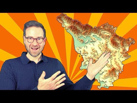
YouTube video by Milos Makes Maps
Master the Art of Relief Maps: Tanaka Highlights Unveiled!
🌄 Master the Art of Relief Maps with Tanaka Highlights!
Discover how to transform your geospatial data into stunning contour maps and 3D terrains using the Tanaka method.
👉 Watch now:
🔗 youtu.be/q4GIQGRnTNI
04.05.2025 15:32 — 👍 9 🔁 1 💬 0 📌 0
Biomass satellite launched by ESA on April 29, measures forest biomass using P-band radar, aiding climate & carbon cycle research. This mission, part of ESA’s FutureEO programme, will address significant uncertainties in carbon stocks & fluxes, essential for climate change mitigation. #ESA #Biomass
03.05.2025 06:07 — 👍 4 🔁 1 💬 0 📌 0

India is set to submit its first-ever National Adaptation Plan to the UNFCCC by September, aligning with the Paris Agreement. This comprehensive framework aims to address climate change impacts across economic and social sectors
#ClimateChange #Policy
#SDGs
www.business-standard.com/india-news/i...
25.04.2025 05:23 — 👍 2 🔁 0 💬 0 📌 0

Interesting article on "Dynamic Time Warping (DTW) for Satellite Image Time Series Classification" by William Ouellette.
DTW allows comparing the similarity of pairs of temporal patterns of heterogeneous lengths and/or sampling intervals.
medium.com/soilwatch/dy...
25.04.2025 04:49 — 👍 2 🔁 0 💬 0 📌 0
PhD Student at EESC/USP
Interested in SW/GW interactions and hyporheic zone.
BEng. - UFC
MSc. - École Centrale de Lille/EESC
https://t.co/TZmax6xs50
Hydrologist at UKCEH | National River Flow Archive | Wallingford Meteorological Station
💧🌍🌳🏳️🌈🇬🇧
Columbia Sociology & Sustainable Development…
Fan of math, science, evidence based practice & nuance…
Pragmatic realist & autodidact…
R/ts are NOT endorsements, all standard disclaimers apply.
Hydrologist in the PNW 🐻🌲 | Interested in rivers, bluegrass music, and wild places | Views my own
https://adamnicholasprice.github.io
Assoc Prof @PSUgeography @PSUEarth, exploring human impacts on water under changing climate and land use. she/her 🏳️🌈
Scientist, educator, advocate for inclusive excellence in STEM. Former Director of DOE Office of Science.
Soil biogeochemistry | Climate Change |Political Ecology.
aaberhe.com
Assistant professor of environmental engineering @ UC Berkeley CEE. Ecohydrologist - water, carbon, plants, isotopes, satellites. Fighting the War On Cars on my cargo bike 🚲, one pedal stroke at a time. 🇫🇷+🇨🇴 in 🇺🇸. She/her.
Working on the intersection of Earth Systems Science and AI/ML. Interested in education, teaching, and python. Currently at NSF Unidata, these views are my own :).
PhD student, Earth and Marine Sciences.
Global Hydrology Lab at University of North Carolina at Chapel Hill #EarthObservation
Ecohydrologist studying how water💧& plants 🌳 react to a changing climate | Lover of deserts 🌵 & desserts 🧁| Previously UC Berkeley, Cambridge, & U Arizona | she/her | Views my own
PhD student in CEE @ Stanford; interested in geomorphology 🏞, sediments 🪨, and fluids 🌊; she/her; go birds 🦅🦅🦅
Climate Researcher I PhD I PMRF I IIT KGP I Land-Atmosphere Interactions I Carbon-Water I Earth Observation I ML I Extreme Events
https://sites.google.com/view/rahulkashyaprsm/home
Opinionated cartoons and views on how we are doing, backed with evidence, but happy to learn more.
Unfortunately my limited talent to draw isn't matching the ideas in my head. I seem to be using this account for commentary.
A Scientific Standing Group of the International Association of Cryospheric Sciences (IACS) and the International Permafrost Association (IPA). Here for networking, collaboration, exchange.
Find us at gaphaz.org!
Unter dem Motto "Technik für Menschen" wird an der Technischen Universität Wien seit mehr als 200 Jahren geforscht, gelehrt und gelernt.
https://www.tuwien.at
#Geographer | Postdoc Researcher at the ENGAGE group, @univie.ac.at
PhD in #RemoteSensing from INPE (she/her/ela)
#NaturalHazards #landslide #flood #geomorphology #climatechange
The Global Lake Ecological Observatory Network conducts innovative science to understand, predict and communicate the role and response of lakes in a changing global environment.
Assistant Professor, Cleveland State University, Cleveland, Ohio.
Biogeochemistry, Paleolimnology, Big Data
#WOCinSTEM
Computational hydrologist researching subglacial water systems using remote sensing and cloud computing.
Researching and reporting the science and impacts of climate change 🌎
climatecentral.org