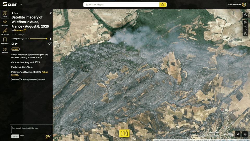
A wildfire has broken out in France. Thanks to two Airbus satellite images, we can get a better look at what's happening! France is battling its biggest wildfire of the summer, it's already larger than Paris. 🚒
Map 1: soar.earth/maps/europe-...
Map 2: soar.earth/maps/europe-...
#Aude #incendie
07.08.2025 03:40 — 👍 5 🔁 1 💬 0 📌 0
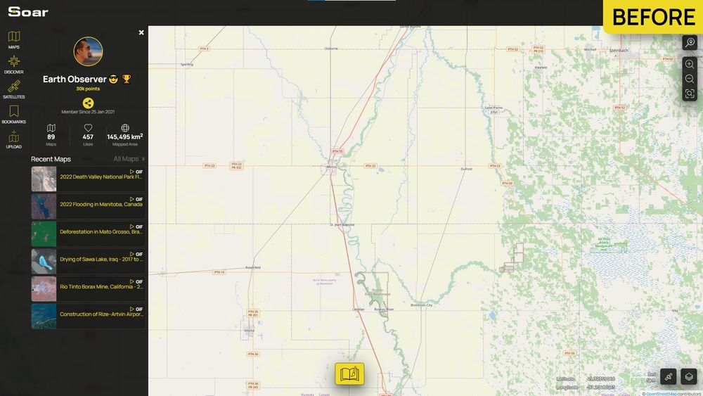
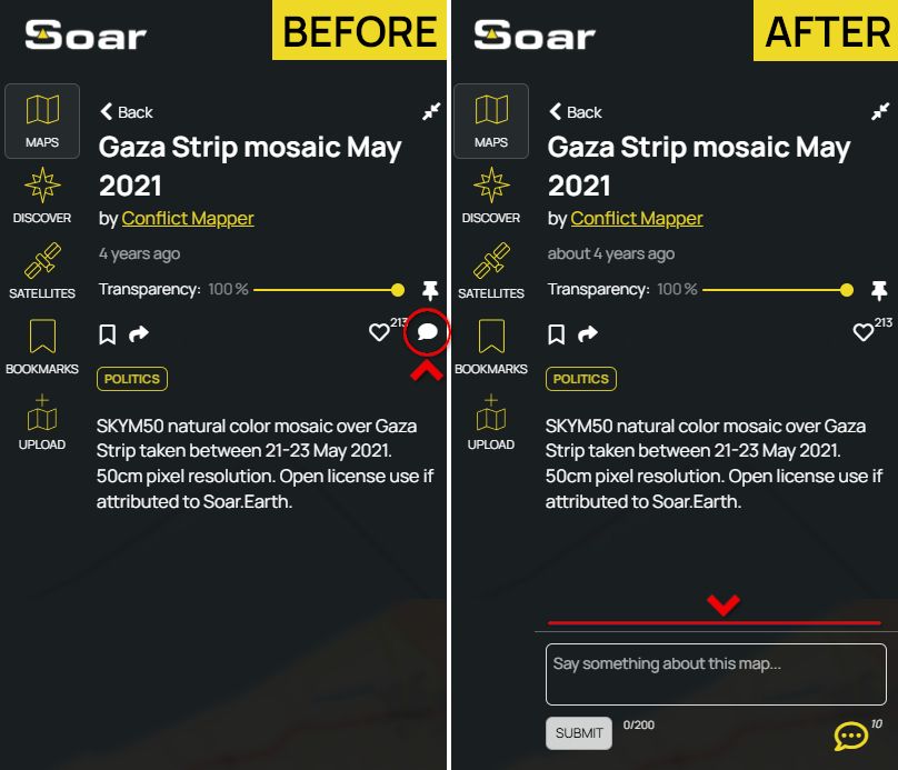
Maps are becoming social! Users can now comment on Maps they find on Soar. Start the conversation today! 💬
Find a map and check it out: soar.earth/discover
#GIS #mapping #Soar #Space
07.08.2025 01:51 — 👍 3 🔁 1 💬 0 📌 0
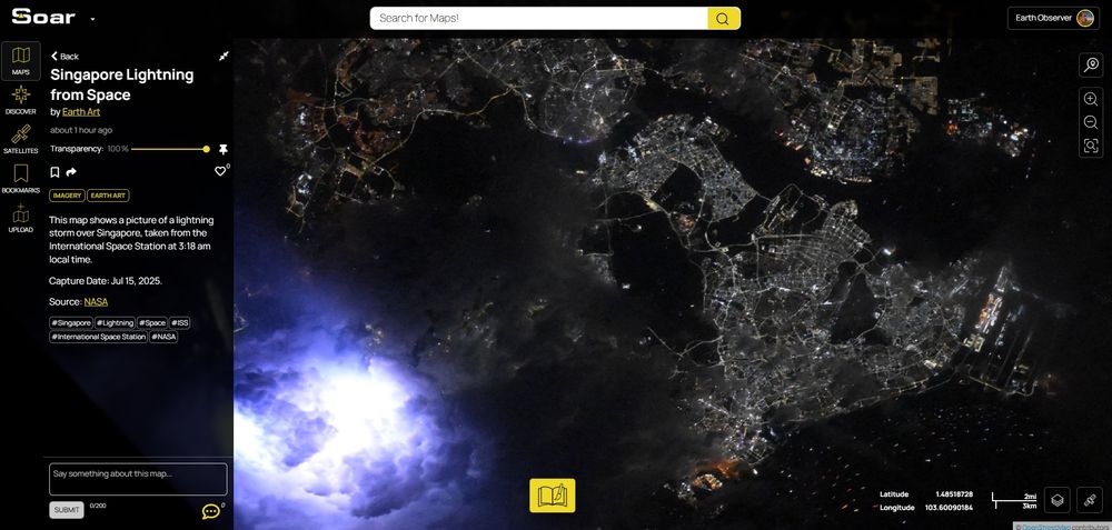
We've now updated this map with a new link that's higher resolution and more accurate! Tell us what you think of this fascinating event. 🌩️
Map: soar.earth/maps/asia-in...
06.08.2025 07:16 — 👍 1 🔁 0 💬 0 📌 0
Looks beautiful Harry! We're glad it can be a place to showcase your work like a wall of art. 😎
06.08.2025 01:56 — 👍 2 🔁 0 💬 0 📌 0
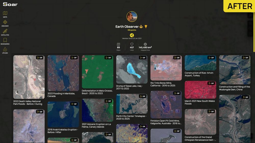
This now makes it much easier for anyone to dig through all of my uploads on Soar!
soar.earth/profile/spac...
05.08.2025 23:30 — 👍 10 🔁 2 💬 1 📌 1
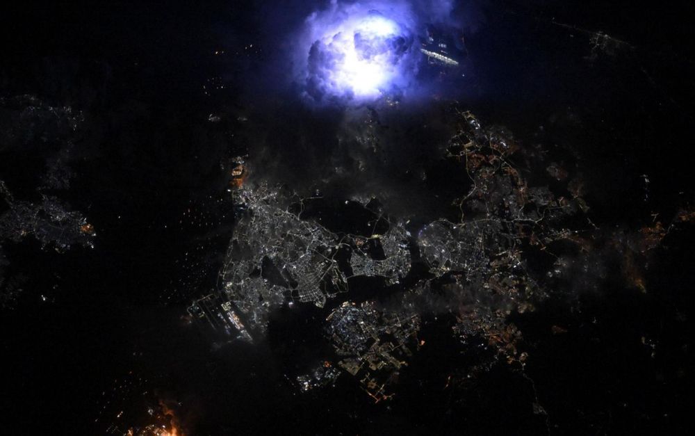
From 259 miles above Earth, the ISS captured this breath-taking shot of a lightning bolt bursting inside a cloud during a storm over Singapore and Johor Bahru.🌩️
We've georeferenced it and put it on Soar for everyone to explore!
Check out the map: soar.earth/maps/asia-in...
04.08.2025 08:05 — 👍 8 🔁 1 💬 3 📌 0
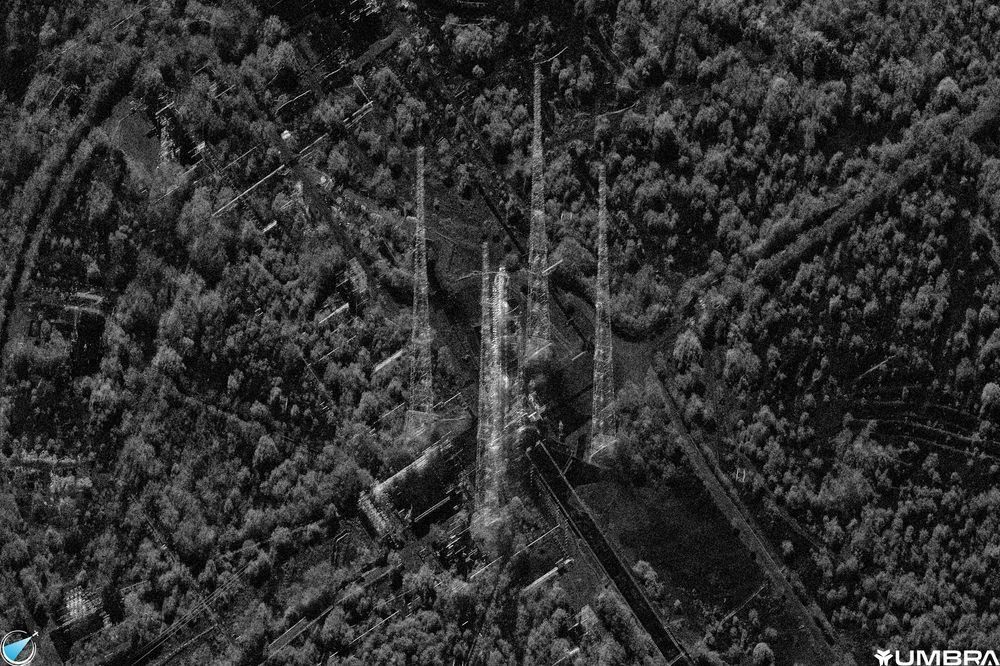
A black and white very high resolution Umbra radar satellite image on NISAR on the launch pad 19hrs before its launch.
An incredibly detailed 25cm/pixel @umbra.space radar satellite image on NISAR on the launch pad 19hrs before its launch.
Full image on @soar.earth: soar.earth/maps/136160?...
31.07.2025 12:33 — 👍 20 🔁 8 💬 1 📌 0
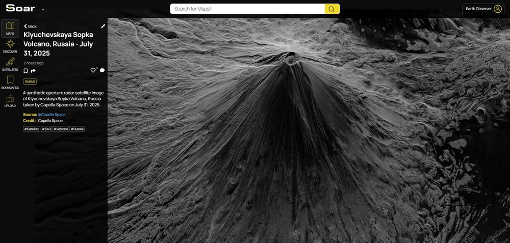
🌋 A powerful view of Russia’s tallest active volcano. This synthetic aperture radar (SAR) image of Klyuchevskaya Sopka was captured by Capella Space on July 31, 2025.
SAR allows us to see through clouds and darkness, revealing volcanic activity in any conditions.
Map: soar.earth/maps/klyuche...
01.08.2025 01:41 — 👍 4 🔁 0 💬 0 📌 0
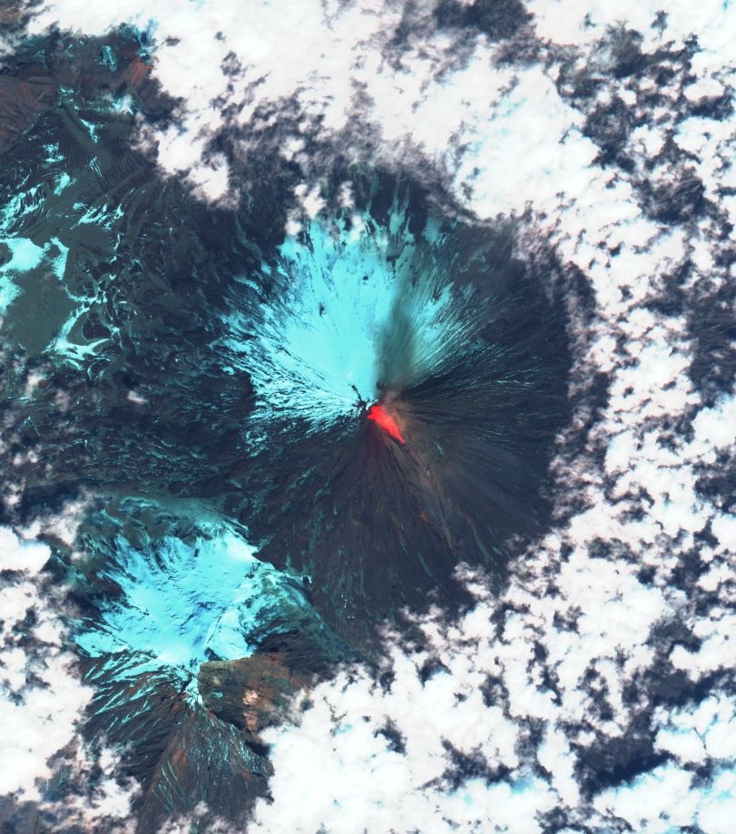
🌋 BREAKING: Following yesterday’s devastating 8.8 earthquake, a volcano in Russia has now erupted!
We’re still waiting on fresh imagery, but satellite maps from past eruptions at this site reveal similar visuals.
Visit the map: soar.earth/satellites/s...
#RussiaEarthquake #Kamchatka #Volcano
31.07.2025 06:36 — 👍 3 🔁 0 💬 0 📌 1
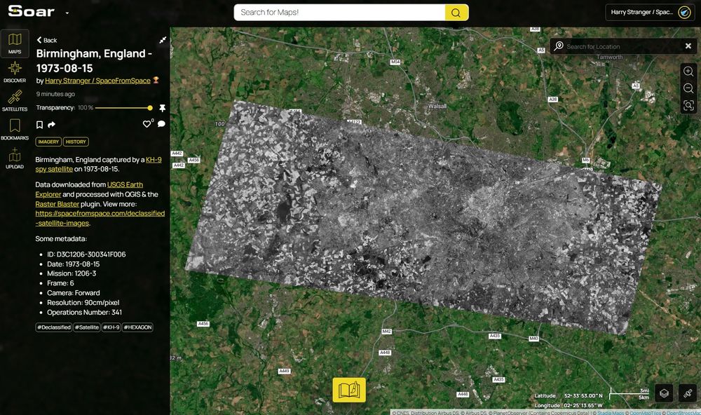
A screenshot of Birmingham, England, captured by a KH-9 HEXAGON spy satellite on August 15, 1973 on Soar.
I've uploaded to full scene to @soar.earth: soar.earth/maps/136146?...
31.07.2025 01:04 — 👍 5 🔁 2 💬 0 📌 0
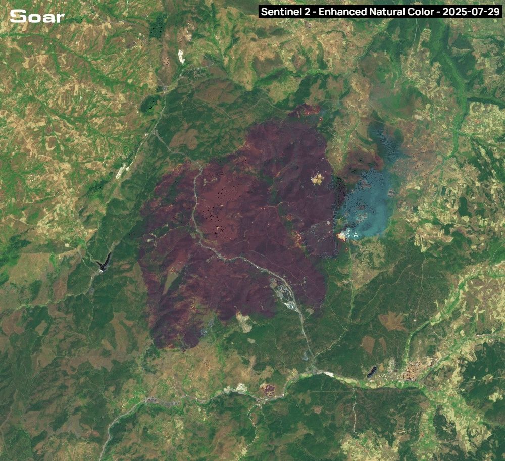
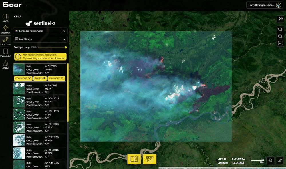
A massive wildfire tore through Turkey on Tuesday, captured in stunning detail by Sentinel-2 on Soar. 🔥
Wildfires have doubled globally since 2001, driven by rising heat and drought. Using Enhanced Natural Colour we can see the burn marks left behind.
Explore it here: soar.earth/satellites/s...
31.07.2025 03:51 — 👍 1 🔁 0 💬 0 📌 0
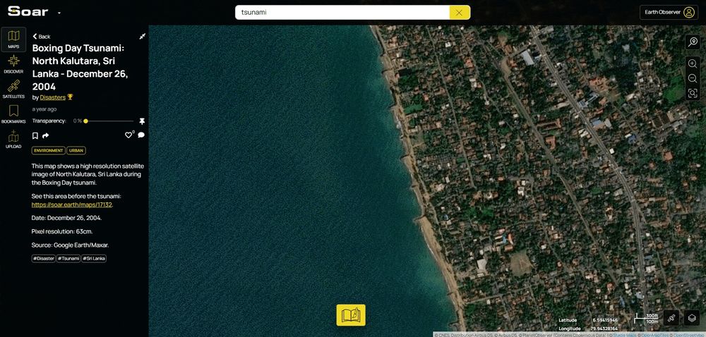
Looking to the past, this 2004 satellite map of Sri Lanka shows the sea dramatically pulled back just before the Boxing Day tsunami struck.
📍Map: soar.earth/maps/asia-sr...
We’ll be highlighting more tsunami-related maps in the coming days.
#Tsunami #DisasterAwareness #SriLanka #SatelliteImagery
30.07.2025 07:52 — 👍 5 🔁 0 💬 0 📌 0
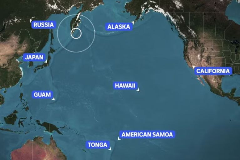
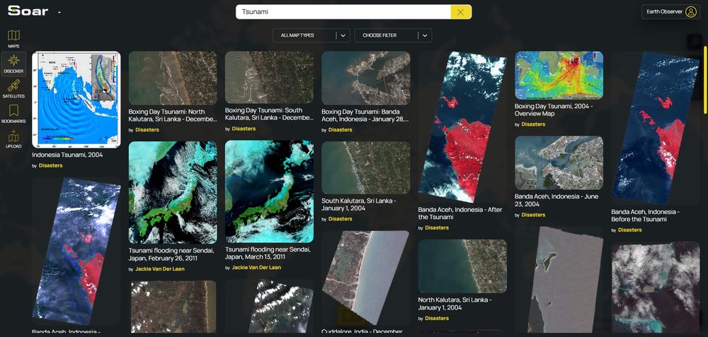
A massive 8.8 earthquake near Russia has triggered #tsunami warnings across the world.
We've shared tsunami maps on Soar before during big events like this 🌊
Soar: soar.earth/discover?q=t...
We'll keep an eye out and highlight any new ones that are shared. Stay safe! 🙏
#TsunamiAlert #TsunamiWatch
30.07.2025 07:28 — 👍 5 🔁 0 💬 0 📌 0
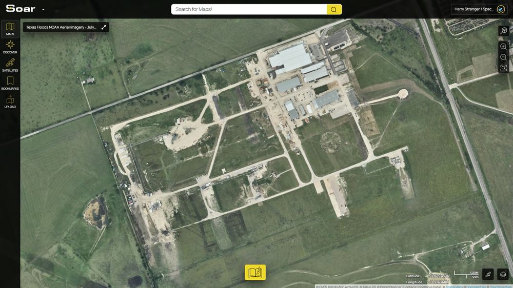
A screenshot of a NOAA aerial imagery map on Soar, focused on Firefly Space's facility in Briggs, Texas.
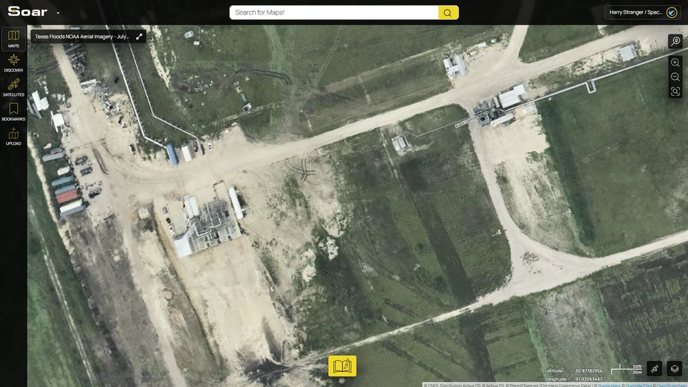
A screenshot of a NOAA aerial imagery map on Soar, focused on Firefly Space's facility in Briggs, Texas.
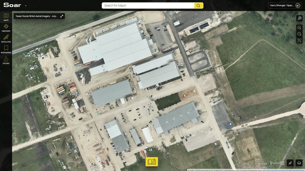
A screenshot of a NOAA aerial imagery map on Soar, focused on Firefly Space's facility in Briggs, Texas.
As NOAA continues flying incredibly important aerial imagery missions over Texas following recent devastating floods, one of their flights on July 19 captured Firefly Space's growing facility at Briggs, Texas.
Screenshots from the map on @soar.earth: soar.earth/maps/136064?...
21.07.2025 01:10 — 👍 27 🔁 3 💬 0 📌 0
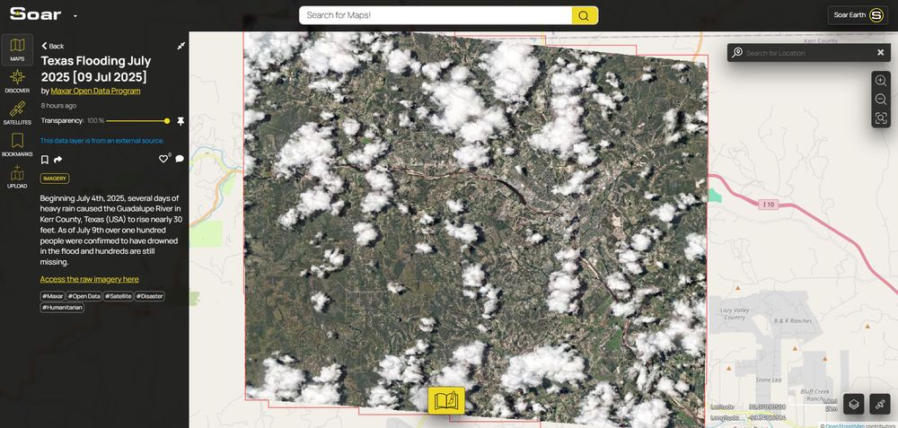
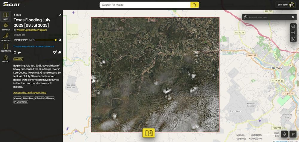
Texas Flooding July 2025 [09 Jul 2025] | Soar
satellite imagery #Maxar #Open Data #Satellite #Disaster #Humanitarian
The scale of destruction from the Texas floods remains staggering. With ecosystems torn apart, and communities forever changed, these satellite images tell part of that story. 🌎
Thanks again to @Maxar's open access. 🧵 [4/4]
🗺️Explore the map: soar.earth/maps/texas-f...
#TexasFloods #CampMystic
11.07.2025 14:02 — 👍 3 🔁 0 💬 0 📌 0
Zooming in on this specific area, we can observe a structure, possibly a small dam or retention basin, that appears to have been overwhelmed.
Events like this highlight the limits of infrastructure under extreme weather conditions. 🧵 [3/4]
🗺️Map: soar.earth/maps/texas-f...
11.07.2025 14:02 — 👍 2 🔁 0 💬 1 📌 0
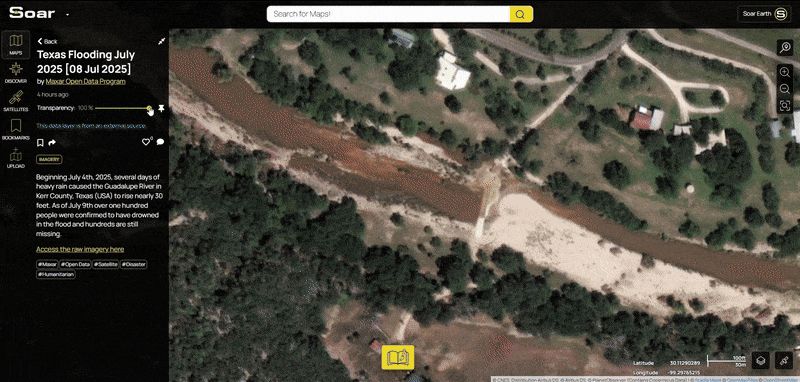
We can clearly see widespread damage to the vegetation lining the river. Trees that once stood tall along the banks now appear uprooted. The ground, previously covered in green, now shows large patches of bare soil, a strong indicator of the flood’s force. 🧵 [2/4]
🗺️Map: soar.earth/maps/texas-f...
11.07.2025 14:02 — 👍 2 🔁 0 💬 1 📌 0
Thanks to Maxar for another look at the #TexasFloods. We believe this data should be viewed by everyone, so again, we’ve added it to Soar to be easy to explore.
Explore the full map: soar.earth/maps/texas-f...
Here’s some closer looks… 🧵 [1/4]
11.07.2025 14:02 — 👍 8 🔁 4 💬 1 📌 0
The data team at Soar will be doing our best to keep Maxar's open data flowing to the public in an easy to access manner during these heartbreaking events.
10.07.2025 13:07 — 👍 13 🔁 3 💬 0 📌 0

Soar | The New Atlas
Explore view and share maps and imagery of the Earth.
While this imagery is difficult to look at, knowing the lives this flood has taken, it’s important that this data is accessible. We’re grateful to Maxar for making this public, and we’ll keep adding more images to Soar as they become available. 🧵 [6/6]
🗺️Explore the map: soar.earth/maps/texas-f...
10.07.2025 12:56 — 👍 5 🔁 0 💬 0 📌 0
On a small island in the river, you can see a line of flattened trees. We don’t yet know the full impact on local wildlife, but changes like this will be felt for some time. 🧵 [5/6]
10.07.2025 12:56 — 👍 4 🔁 0 💬 1 📌 0
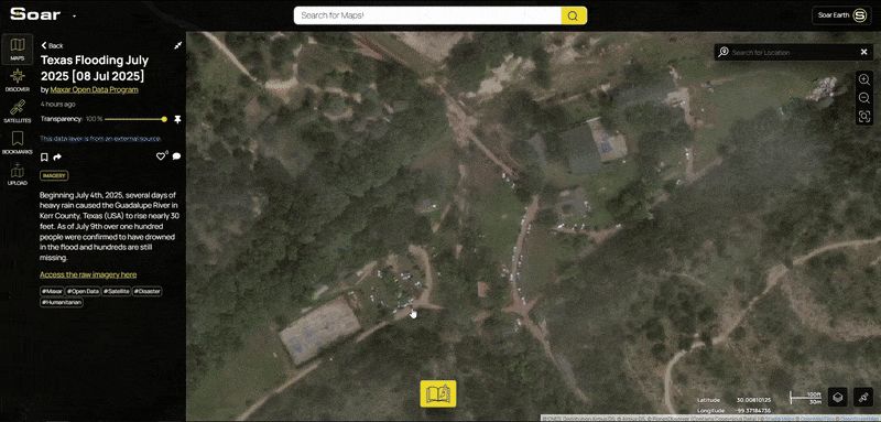
This area here is Camp Mystic. You’ll notice a number of vehicles, likely part of the ongoing recovery and search efforts.🧵 [4/6]
10.07.2025 12:56 — 👍 4 🔁 0 💬 1 📌 0
Following the river’s course, sections of land have clearly been scoured by floodwaters. In one area, the sand appears to have been pushed up and dried out completely, leaving behind a barren patch. 🧵 [3/6]
10.07.2025 12:56 — 👍 4 🔁 0 💬 1 📌 0
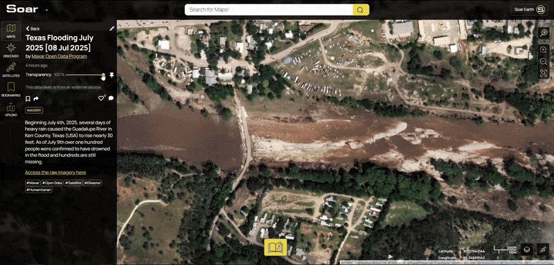
One of the first things we spotted were trees on the right, uprooted and dragged downstream. The river itself runs a deep, muddy brown, signs of sediment and flooding still fresh in the landscape. 🧵 [2/6]
10.07.2025 12:56 — 👍 4 🔁 0 💬 1 📌 0
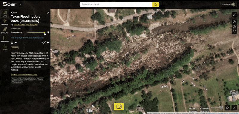
The recent Texas floods have been devastating.
Thanks to new satellite imagery from Maxar, we now have a clearer view. These files can be hard to access. We believe this data should be viewed by everyone, so we’ve added it to Soar to be easy to explore.
Here’s what we found… 🧵 [1/6]
10.07.2025 12:56 — 👍 7 🔁 2 💬 1 📌 2
A screenshot of soar.earth showing Sentinel-2 satellite imagery of burning wildfires.
Good catch. Using one of the enhanced scripts on @soar.earth soar.earth/satellites/s...
05.07.2025 06:41 — 👍 3 🔁 1 💬 0 📌 0
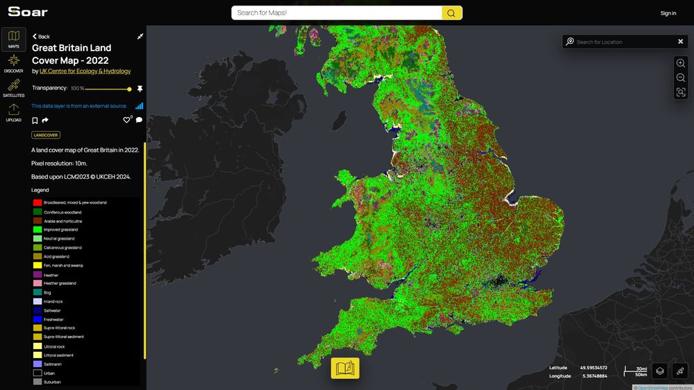
🗺️ Map of the day! Cor blimey, it's a land cover map of Great Britain from 2022! ☕ 💂♂️
Check it out here ▶️ soar.earth/maps/133995
30.04.2025 15:23 — 👍 1 🔁 0 💬 0 📌 0
Atmospheric phenomena, astronaut photography of earth, co-organizer of Science Café Deventer, geomorphologist by education, co-founder of the Dutch Association for Science Journalism and Science Communication (VWN), posts mostly in Dutch and English
Self determination advocate.
Keeping Phoenix families on the road with Consolidated Auto Sales & Service, educating civic leaders with the Libertarian Policy Foundation, providing affordable self-defense with the Altor.
https://nsarwark.substack.com/
ASA Fellow; #rstats developer of graphical methods for categorical and multivariate data; #datavis history of data visualization; #historicaldatavis; Milestones project
Web: www.datavis.ca
GitHub: github.com/friendly
Yes it's me from twitter and @bigbookofr.com!
#dataBS #RStats
#rstats | #energy | #climate | #carbonmanagement | #sustainability | #ESG
https://shelkariuki.netlify.app
Freelance Data Visualization Specialist and Data Analyst. 📊 Book nerd📚. Always seeking new insights and knowledge💡Available for Projects.
https://deepalikank.in/
Data visualization designer
krisztinaszucs.com
Professor Emeritus of geography & environmental studies, Saint Mary's University, Canada.
Interested in mapping, urban planning, transportation, time use, Nova Scotia
#geography #location #maps #transportation #urban
#Urbanismo, Política y Filosofía | Maestría en Planificación y Políticas Urbanas.
https://substack.com/@fernandomaidana
(Mis opiniones son personales)
Research Faculty at Michigan State University. Geodesy, Tectonics, and Glaciers. All opinions my own.
data scientist in toronto / maps and dataviz / almost useless trivia knowledge
https://ivabrunec.github.io/
#LFC fan, from Plymouth, lives in Corfe Mullen Dorset, husband, father, grandad, brother, son.
Climate scientist at DMI, Greenland, Antarctica, polar regions in general.
Dipping a toe in yet another social media site. Mostly on mastodon though @ruth_mottram@fediscience.org
Blogging at sternaparadisaea.net
I like collating data,
and getting thoughts in the brain.
I run https://thoughtfulnz.quarto.pub/nzcovidreport/
All for Public data, Aotearoa New Zealand, and informed communities. #openData #NewZealand #Aotearoa #rstats. He/him.
He tangata tiriti ahau
Pro Genealogist & Scientist at www.khronicle.co.uk, #Genealogy Expert for Time Team. Oxford D.Phil.(SysBio), Fiend for #maps & #research methods. Big hair, big heels, weakness for cake.She/her.
Blog: www.parchmentrustler.com
Climate Scientist -Earth -Water -Data.
PhD, PG
https://scholar.google.co.uk/citations?hl=en&pli=1&user=aEgv38gAAAAJ
Associate Prof of Geography | @UofSouthAlabama | Climate Change | Agriculture | Viticulture/Wine | GIS | Certified Spin 🚴 Instructor | Tacos | Not necessarily in that order
Researcher @CIBIO_InBIO interested in #climatechange #biodiversity #spatialecology #remotesensing
Strong addiction to maps🤷♂️
UW Madison Geography, opinions are mine. Geomorphology, soils, dunes, loess, in the Midwest, Great Plains, northern China. He/him. Living on Ho-Chunk lands.
TUDelft BK-Urbanism community of practice that aims to empower students, researchers, and practitioners to use open-source software and open science practices to answer urban questions effectively and with confidence | #rstats #urbanism | rbanism.org