The emissions between 1990-1995MHz appear compliant with FCC grants. docs.fcc.gov/public/attac...
07.12.2025 18:48 — 👍 3 🔁 0 💬 0 📌 0
After days of monitoring the Starlink V2 Mini DTC emissions on ~2010.5MHz, I deployed the 1.8m dish to track a number of the objects this morning. Here's STARLINK-11321 emitting broadband data (4.5MHz) centred on ~1992.5MHz. Every Starlink DTC object I tracked emitted similarly.
07.12.2025 17:46 — 👍 15 🔁 1 💬 1 📌 0
It's doing the trick. Thanks for the report.
06.12.2025 01:28 — 👍 0 🔁 0 💬 0 📌 0
Thank-you.
06.12.2025 00:33 — 👍 1 🔁 0 💬 0 📌 0
Can you provide a rough general location of where you heard this?
06.12.2025 00:23 — 👍 1 🔁 0 💬 1 📌 0
My own research and that of others hasn't found any publicly accessible authorizations for these emissions. What is known is @SpaceX is in the process of obtaining grants to use this spectrum. 🛑
05.12.2025 19:40 — 👍 9 🔁 0 💬 1 📌 0

A snapshot of the operational satellites in the Starlink DTC constellation. A maximum coverage band along the most populated latitudes of the northern hemisphere is clearly obvious. Data definitely shows widespread emissions over the Pacific Northwest. ⬇️
05.12.2025 19:40 — 👍 10 🔁 0 💬 1 📌 0
A full day of @SpaceX
Starlink V2 mini DTC satellites emitting on ~2010.5MHz. The video shows the raw curves then the fit of 649 spacecraft IDs (green) with nominal operational altitudes for this bus class. 🧵⬇️
05.12.2025 19:40 — 👍 17 🔁 2 💬 1 📌 0

Next steps will include tracking known Starlink V2-Mini DTC busses to get a sense of the emission levels with my calibrated dish antenna system and also a sense of the emissions they are using. 🛑
03.12.2025 14:12 — 👍 5 🔁 0 💬 0 📌 0

The Starlink V2-mini DTC bus has a slightly larger antenna. It's uncertain if the larger antenna contributes to it's increased brightness as noted from the internet only versions vs the DTC capable version. Per A. Mallama et. al. ⬇️
arxiv.org/pdf/2407.03092
03.12.2025 14:12 — 👍 4 🔁 0 💬 1 📌 0


The active satellites appear to be turning on as they rise in the west and then turning off as the set in the east. The strong pass of 58708 can be seen plotted below with it's Doppler for comparison. Perhaps indicative of testing with western North American ground station(s).⬇️
03.12.2025 14:12 — 👍 2 🔁 0 💬 1 📌 0

Here are three passes of Starlink 11079, the middle pass is the one that produced the very loud signals. This implies to me that the antenna onboard is directional as off nadir the signals are much weaker. I'm using a fairly omnidirectional antenna for this monitoring. ⬇️
03.12.2025 14:12 — 👍 3 🔁 0 💬 1 📌 0

Unlike the Starshield emissions, Starlink S-band emissions appear to be weaker. But at times there are huge signals like this pass of Starlink 11079 [58708, 2024-002D]. The dark vertical lines indicate the signal was strong enough to overload my preamp front end. 🧵⬇️
03.12.2025 14:12 — 👍 11 🔁 4 💬 1 📌 0


Starlink (NOT Starshield) has taken up residence on ~2010.5MHz. Continuous emissions over me.
@SpaceX is known to have purchased rights to this spectrum from Echostar. Anyone know if they are authorized to be emitting here yet or at all from space?
Sense the plot thicken?
01.12.2025 16:17 — 👍 20 🔁 2 💬 1 📌 0

Yeap, one was active this morning :-)
14.11.2025 20:52 — 👍 0 🔁 0 💬 0 📌 0

Create Spacecraft CH3;
CH3.DateFormat = UTCGregorian;
CH3.Epoch = '21 Sep 2025 00:00:00.000';
CH3.CoordinateSystem = EarthMJ2000Eq;
CH3.DisplayStateType = Keplerian;
CH3.SMA = 262218.0079696243;
CH3.ECC = 0.07748658771195915;
CH3.INC = 34.61461920174589;
CH3.RAAN = 358.9200612642715;
CH3.AOP = 325.6737116968048;
CH3.TA = 106.4094123318676;
There could be another lunar encounter in April of 2026 and after that things get really unstable. We're now in a very chaotic realm where CHANDRAYAAN 3 service module could end up in solar orbit or impacting the Moon or even Earth.
See alt text for state vector.🛑
14.11.2025 03:07 — 👍 11 🔁 0 💬 0 📌 1

The best I can tell there was no burn and this seems corroborated by @ISRO's statement below. The orbit wandered close enough to the Moon in early November 2025 that the Moon’s gravity took over. This wasn’t an intentional manoeuvre, it was natural 3-body drift.⬇️
14.11.2025 03:07 — 👍 8 🔁 0 💬 1 📌 0
HANDRAYAAN-3 was last reported by Space-Track.org on 2025-06-27. In September it became obvious from asteroid tracking data that the service module would encounter the Moon in early November twice. 🧵⬇️
14.11.2025 03:07 — 👍 12 🔁 3 💬 1 📌 0


CHANDRAYAAN-3 service module has been recovered.
She's located about 7 degrees south east of the Moon this morning.
13.11.2025 18:55 — 👍 9 🔁 1 💬 0 📌 0

Thanks to the some hawk eyed followers, CHANDRAYAAN 3 service module appears to be engaged in cis-lunar navigation activities and is in a new orbit.
isro.gov.in/Chandrayaan_...
13.11.2025 18:53 — 👍 5 🔁 1 💬 0 📌 0
Here's an Earth centred J2000 equatorial state vector for DRO-B:
2025-11-11T00:45:50.816
x= 213253.13473
y=-74960.25633
z=-77939.72821 km
vx=-0.034651
vy=0.84254
vz=1.05605 km/s
🛑
11.11.2025 01:55 — 👍 5 🔁 0 💬 0 📌 0

DRO-B has been confirmed to be in a new orbit based on reception of X-band signals.
The spacecraft remains at low declination but will rapidly rise northward over the next couple of days allowing more data to be obtained. 🧵⬇️
11.11.2025 01:55 — 👍 5 🔁 0 💬 1 📌 0

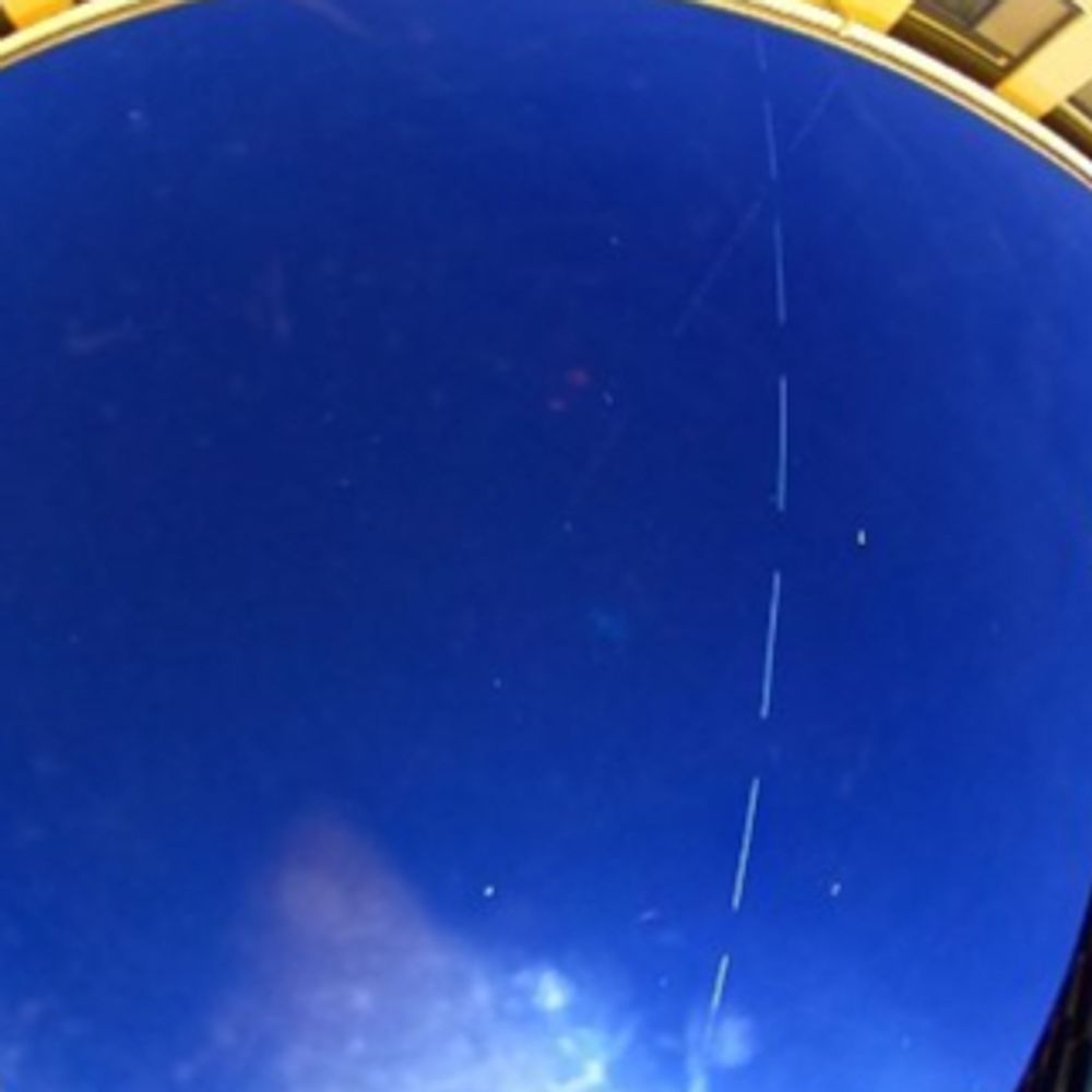
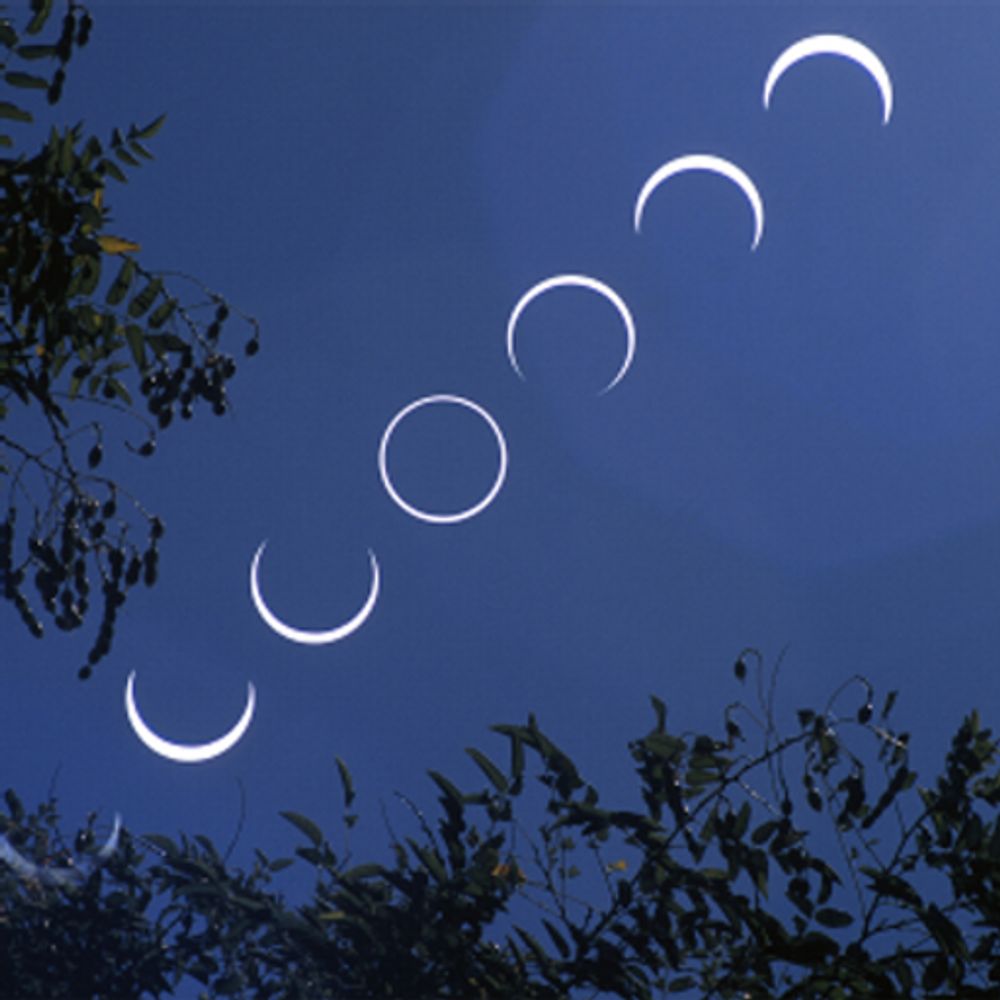
Spooky Moon and natural cobwebs over the dish antennas...
Happy Halloween all! 🎃
01.11.2025 04:21 — 👍 13 🔁 0 💬 0 📌 0


DRO-A still hanging around the Moon and actually angularly close to it tonight.
Data sidebands clearly visible and tantalizing close to being decodable.
01.11.2025 04:18 — 👍 8 🔁 0 💬 0 📌 0

TIANWEN-2 is presently about 36 million km from Earth and out aheard of us and will rendezvous with asteroid 469219 Kamoʻoalewa in July of 2026. 🛑
30.10.2025 19:51 — 👍 4 🔁 0 💬 0 📌 0

TIANWEN-2 doesn't emit much on X-band. It's theorized that it is using solar electric propulsion (SEP) to some extent and not aiming at Earth all the time. I periodically check in on it and plot it's heard position since recovery in late August 2025. ⬇️
30.10.2025 19:51 — 👍 2 🔁 0 💬 1 📌 0


Earlier releases by CNSA indicated that the burn would happen on 2025-10-30. So it could have already occurred earlier today or will be conducted as TW-2 comes into view of China later today. ⬇️
30.10.2025 19:51 — 👍 0 🔁 0 💬 1 📌 0
Real-time machine motion control software engineer. Loves science, electronics, RF and space stuff.
Retired. Telecoms background. Radio ham. Mostly 6m to 24GHz.
EME, VHF DX chasing. Equipment development
Official ARISS! ARISS lets students worldwide experience the excitement of talking directly with crew members of the International Space Station via amateur radio, inspiring them to pursue interests in careers in science, technology, engineering and math.
CTO at Goonhilly Earth Station Ltd (@goonhilly.org). Worked on Shuttle, MIR, Mars Express, TopSat, ExoMars, now the Moon/Artemis
All my tweets are my opinion and not those of my employer or related institutions.
Satellites, Radio Astronomy, SDR, Signal Processing, GPU.
CTO Lacuna Space. Dwingeloo Radio Telescope.
Consultant in satellite communications and wireless spectrum. I enjoy annoying billionaires.
AMSAT-Deutschland e.V. https://amsat-dl.org
charitable non-profit organisation, designing, building and operating hamradio #AMSAT satellites since 1973. Home of the Phase3 satellites and first Phase4A geostationary #QO100 S/X transponder
AMSAT-SM (Sweden) - Amateur radio satellite group. News and tweets about amateur radio satellites and amateur radio.
Editor: Lars Thunberg SM0TGU
Freelance journalist mainly tracking Chinese space activities. Correspondent at SpaceNews, also bylines at Spacedotcom, IEEE Spectrum and more.
planetary scientist 🪐 science illustrator 🎨 trekkie 🖖 dog dad 🐶 Pasadena 🌹 views are my own 🏳️🌈 he/him
Astronomer at ASTRON in the Netherlands, working with the LOFAR low frequency radio telescope.
A random 21yo interested in satellites and other stuff :-)
Probably mostly known as SatDump's author.
http://ko-fi.com/aang23
Radioamateur, interested in satellites, and microwave electronics. 21M
Political commentary. Over 3 billion views on YouTube. #1 NYT bestselling author. Past: MSNBC
https://linktr.ee/briantylercohen
Lunar lander GNC engineer at KARI. Views are my own. ISU alum.