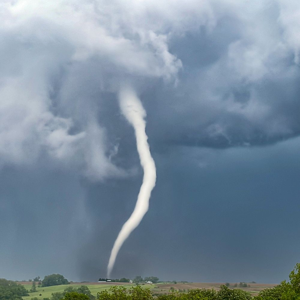
A transient supercell developed SE of #Victoria this evening around 7:17pm. A very rare treat over this part of the world. #BCstorm #BCwx @tylerhamilton.bsky.social @yvrwxwatcher.bsky.social
27.03.2025 03:24 — 👍 29 🔁 10 💬 1 📌 1
Rocky IV.
20.02.2025 17:07 — 👍 9 🔁 0 💬 1 📌 0
 30.11.2024 16:37 — 👍 7 🔁 2 💬 1 📌 0
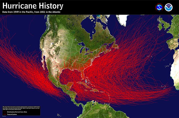
#Hurricane Season in the Atlantic ends on Saturday. The first season above 1.5 degrees for the whole year. How does it compare?
#Climate
2024 $191bn 375 deaths
2023 $4.13bn 15 deaths
2022 $118bn 239 deaths
2021 $80bn 106 deaths
2020 $54bn 35 deaths
26.11.2024 14:01 — 👍 66 🔁 19 💬 2 📌 0
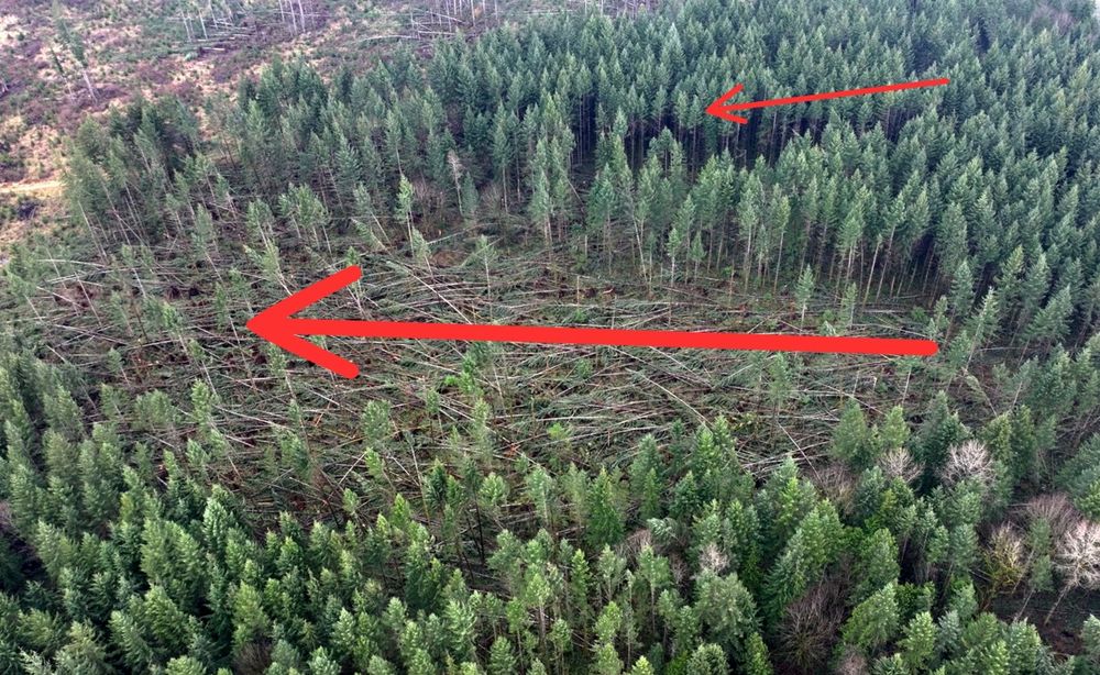
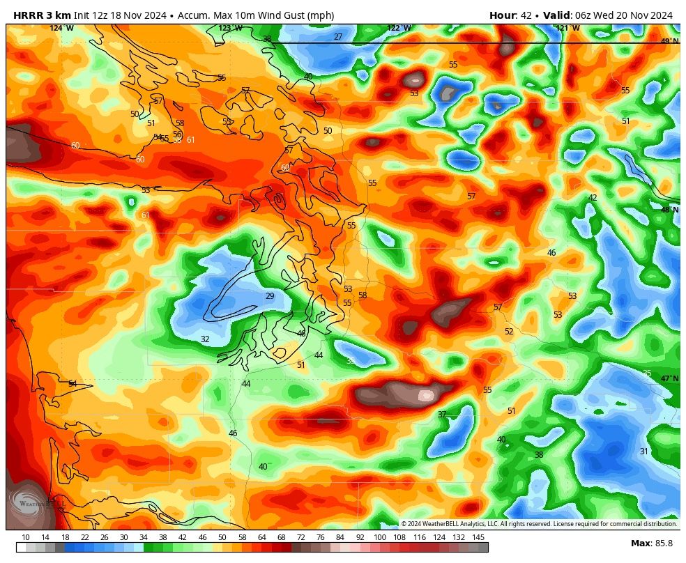
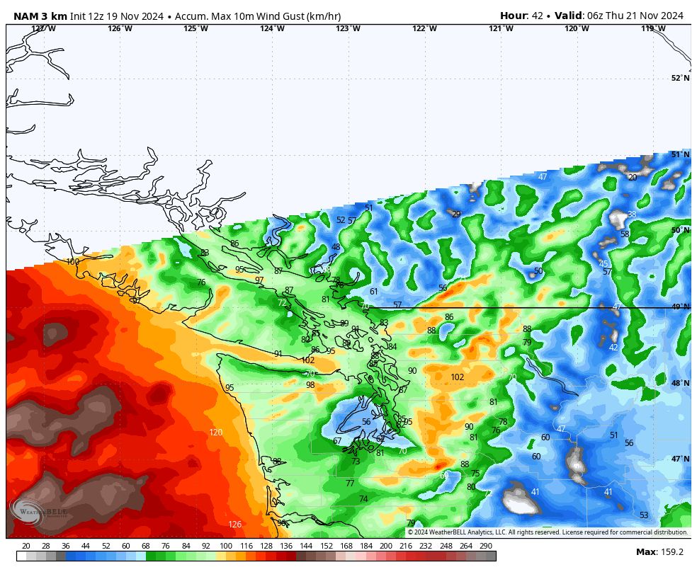
Unreal paths of damaging winds, east of Everett, WA near Forest Glade, WA #wawx #bombcylone #weather #mountainwave #wind
27.11.2024 04:55 — 👍 172 🔁 23 💬 7 📌 3
this place feels fresh. I love it so far! And yes...so much weather...and no more hate!
21.11.2024 15:10 — 👍 2 🔁 0 💬 1 📌 0
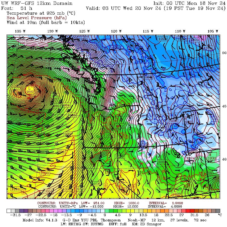
Massive & intense low continues to spin off our coast spanning from the AB/SK border to out in the #Pacific & AK to Central CA!
Across SW #BC, 95,953 customers w/o power this AM w/ Wind Warnings still covering many parts of #VanIsle; several roads closed w/ travel not recommended.
#BCwx #BCstorm
20.11.2024 15:34 — 👍 30 🔁 4 💬 0 📌 1
What it's like to watch a plane land during a bomb cyclone. 💨✈️ #wawx
20.11.2024 05:23 — 👍 98 🔁 21 💬 10 📌 3
942mb bomb cyclone!! Likely the lowest pressure ever recorded in this area of the Pacific Ocean #wawx
20.11.2024 06:13 — 👍 108 🔁 31 💬 3 📌 3
There she blows!! #wawx #BCwx
20.11.2024 04:04 — 👍 27 🔁 11 💬 3 📌 2
This is what it's like on Hwy 4 in Cathedral Grove just before the hwy was closed. The person taking the video tells me "It was scary. 5-7 ft branches raining down. Trees swaying, wind howling. I felt like a sitting duck waiting for a tree to fall." #bcstorm @CHEK_News
20.11.2024 02:34 — 👍 28 🔁 13 💬 3 📌 1
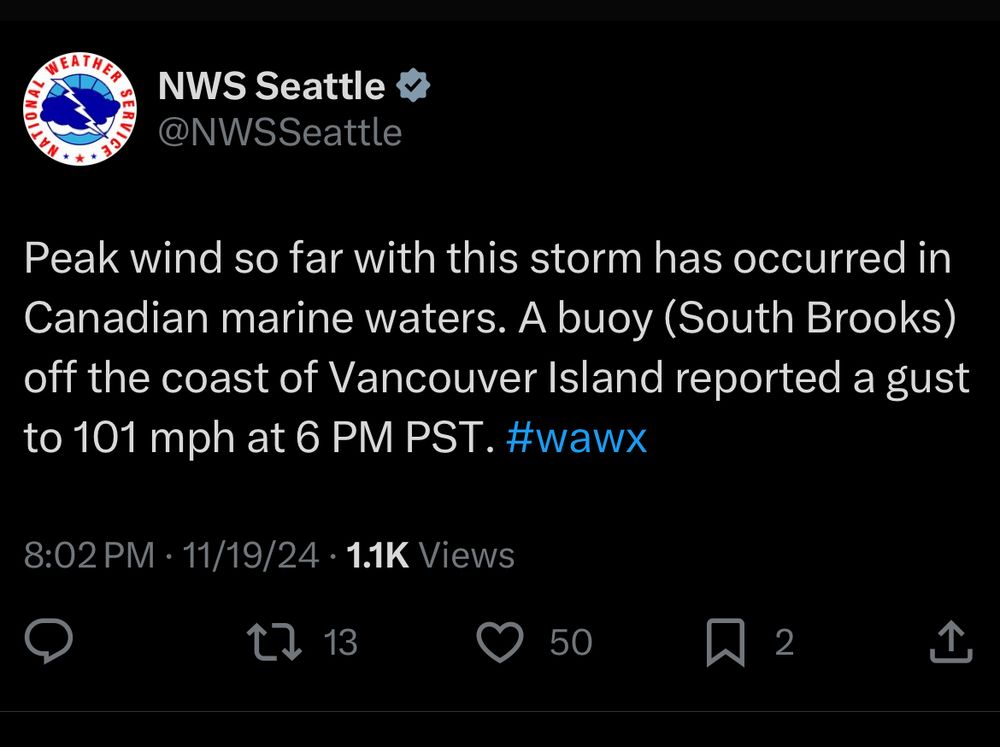
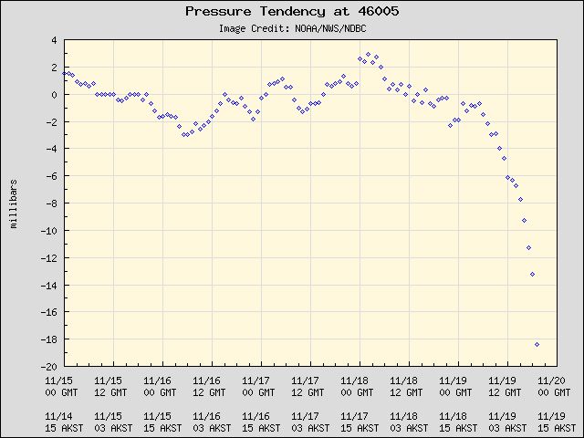
The barometric pressure at buoy 46005, 300mi/480km off the Washington coast near Aberdeen down to 954hPa!!
Looks at that steep drop in pressure as a result of the rapidly intensifying low in the NE Pacific
#BCstorm #WAwx #PNWwx #ORwx #PNWwx #BCStormWatch #BCwx #Bombogenesis #BombCyclone
19.11.2024 21:43 — 👍 24 🔁 2 💬 0 📌 0
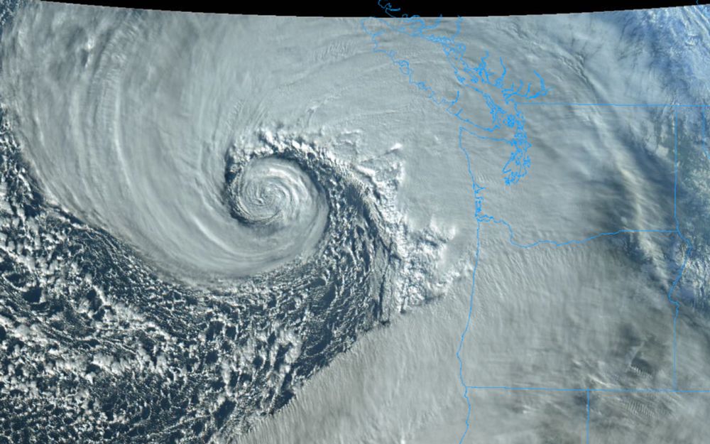
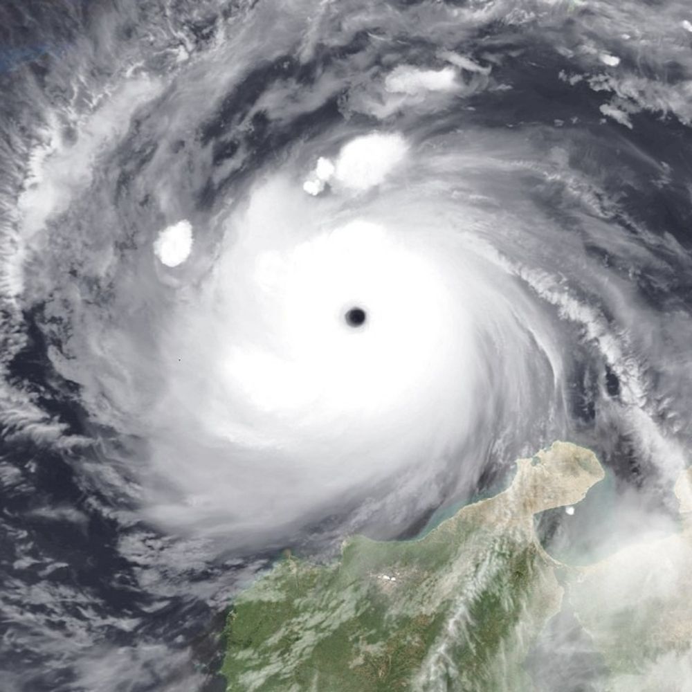
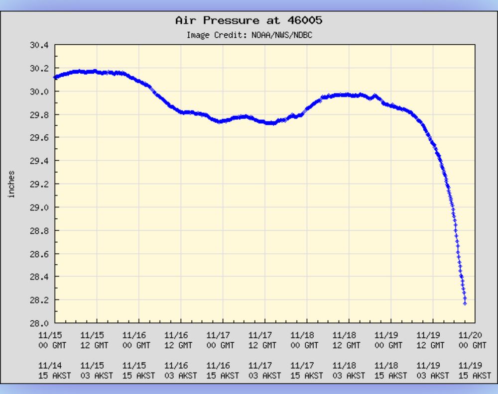
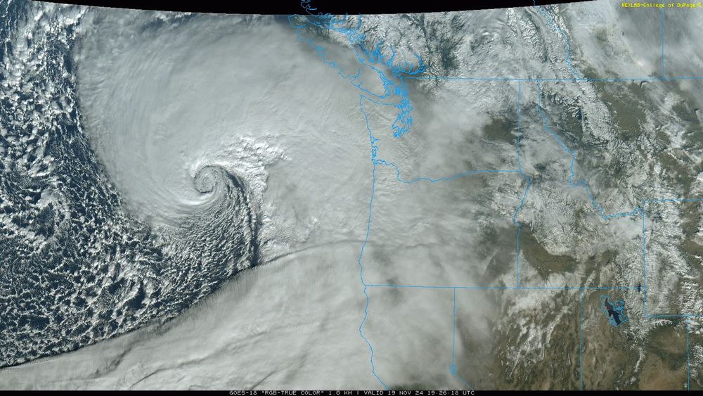
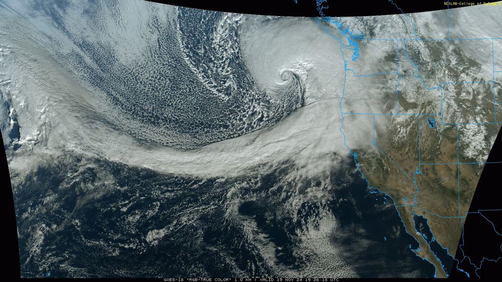
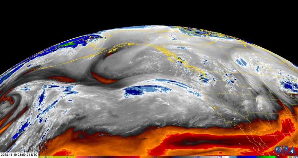
For anyone that’s curious, here’s a satellite picture of this storm - it’s massive, and quite picturesque from that height! The state borders are in light blue - so the center of the circulation is due west of Long Beach. #wawx
19.11.2024 23:35 — 👍 15 🔁 5 💬 1 📌 0
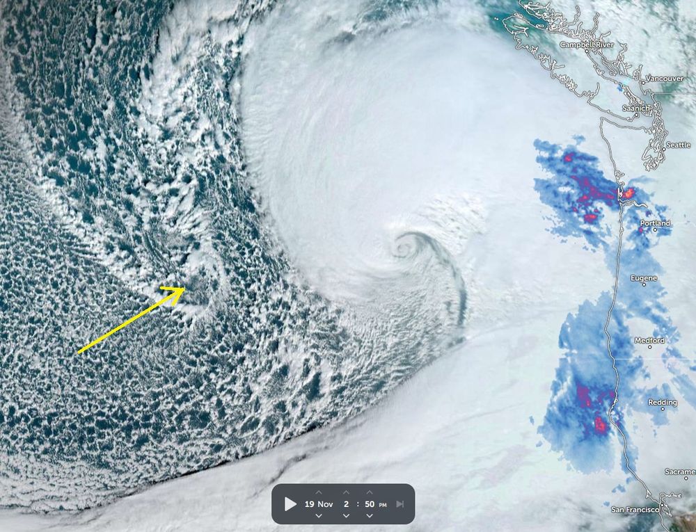
Amazing. This feature in BL cloud caught my attention! Upper trough / trop-fold punching down very low.
19.11.2024 19:36 — 👍 14 🔁 2 💬 1 📌 0
The model guidance suggests a significant windstorm is likely for all of Vancouver Island, potentially affecting 200,000+ customers. Unlike typical wind events that last 6 to 8 hours, this storm is expected to persist for twice that duration and not be isolated. #BCStorm
19.11.2024 19:10 — 👍 46 🔁 18 💬 4 📌 1
Bomb cyclone stuns in new photos.
19.11.2024 19:35 — 👍 235 🔁 69 💬 4 📌 19
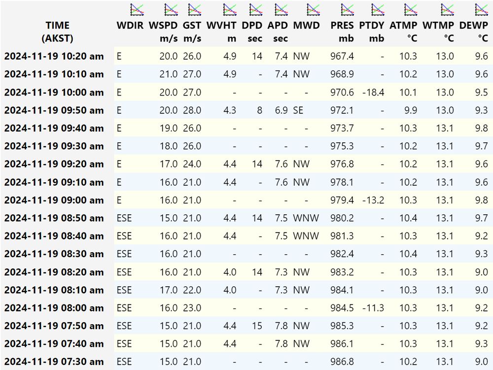
Pressure falls at buoy 46005 are just incredible #wawx #bombcyclone
19.11.2024 20:00 — 👍 25 🔁 6 💬 4 📌 0
Bombogenesis at the latitude of New York City (40.7°N) is ~18mb/24hrs. This storm just eclipsed that in one hour... #wawx #bombogenesis #bombcyclone
19.11.2024 20:06 — 👍 13 🔁 3 💬 2 📌 0
Not every day you see a sub-950 hPa low form this close to the WA/OR coast. In fact, it’s entirely outside of the 30-year climatology for mid-November in that particular location.
19.11.2024 04:50 — 👍 79 🔁 20 💬 3 📌 4
Structurally, this is the most fascinating storm I've seen here. The strong east winds are a bonus addition to the oddity (albeit not a welcome one. Half my fir trees will be raining twigs and branches onto my house and truck). On the plus side, most deciduous trees are nearly leafless now. #wawx
19.11.2024 06:24 — 👍 5 🔁 2 💬 0 📌 0
Fun fact: the criteria for bombogenesis is dependent on latitude! At ~48°N, the threshold is roughly a 22mb pressure drop in 24hrs. This storm will likely 3x that rate and then some! It doesn't look impressive on satellite quite yet, but this is a true instance of "just give it a few hours." #wawx
19.11.2024 04:27 — 👍 30 🔁 3 💬 3 📌 1
I believe that would be triple bombogenesis
GFS has -62mb drop in 24 hours. After adjustment from 45°N to 60°N (which is used for the -24 mb / 24 hr rule) that's a -75.6mb drop
19.11.2024 04:53 — 👍 2 🔁 1 💬 0 📌 0
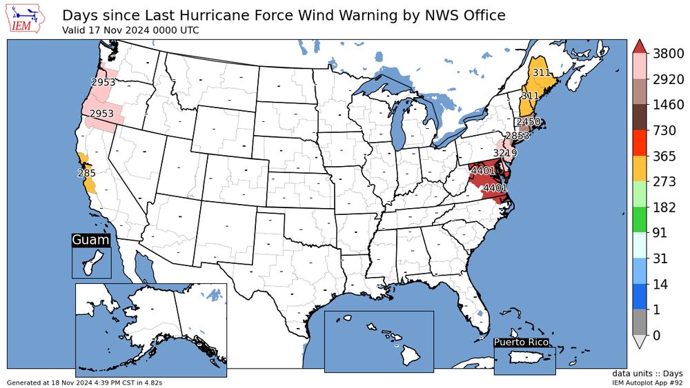
A map of the United States showing how many days it has been since the most recent hurricane force wind warning. Medford and Portland have gone 2953 days, Maine has gone 311 days and further south on the Atlantic Coast is 2000+.
NWS Medford has issued their first hurricane force wind warning since October 2016.
#ORwx #weather
18.11.2024 22:43 — 👍 26 🔁 9 💬 1 📌 1
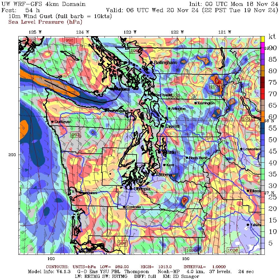
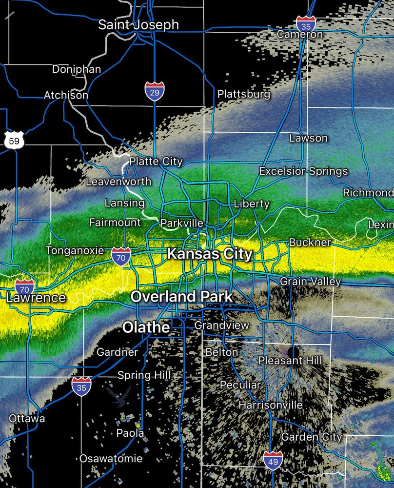
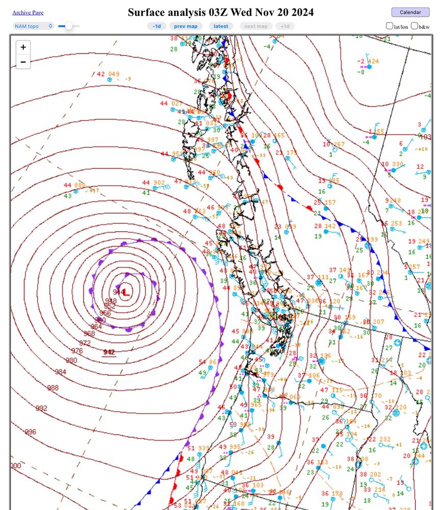
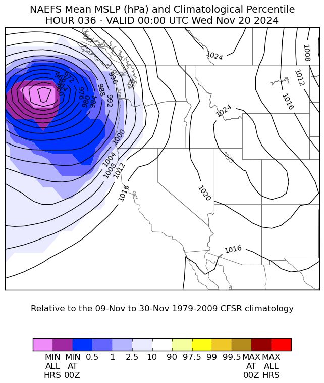
GFS forecast model showing a strong low pressure storm off the West Coast on Tuesday.
Latest GFS has 950mb low but it’s the bunching of black lines (pressure isobars) that tell the story. Incredible near the low but also look at them bunching close together over the Cascades. #wawx
18.11.2024 07:11 — 👍 20 🔁 2 💬 2 📌 1
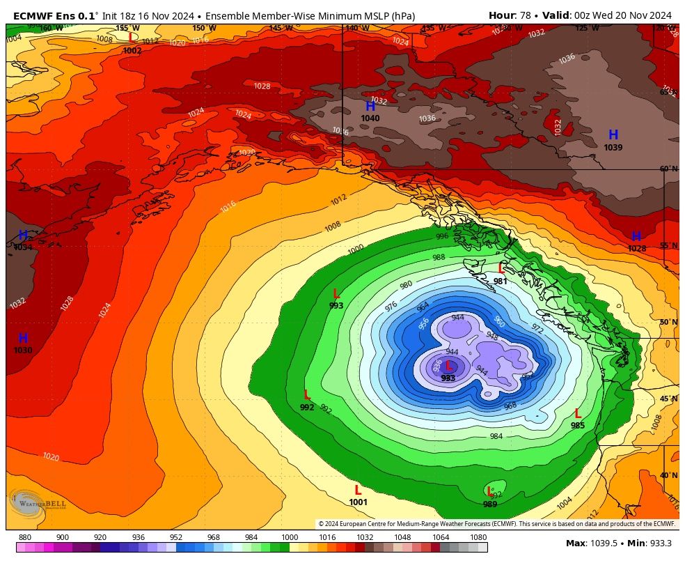
*Not a Forecast*
Ain’t one for posting mdls but when a 933mb low shows up, well, you gotta share.
For ref Cat5 Hurricane Beryl bottomed out @ 934mb & had winds to 165 mph (270 km/h).
While not likely to reach that, it is gonna be an impactful low - how much? we’ll see!
#BCwx #BCstorm #BCstormwatch
17.11.2024 00:52 — 👍 50 🔁 6 💬 8 📌 1
Thank you. 🍻
17.11.2024 00:30 — 👍 2 🔁 0 💬 0 📌 0
Storm Chase & Photography 📷⛈️🌪️
Severe Weather Enthusiast 🌩️
Nature, weather, climate 🌱⛅️🌍
Website : https://photo.quentinrey.com
--------
Adhérent @infoclimat.fr
Contributeur @visov1.bsky.social
psych nurse • storm chaser
Journalist & 6pm host at CBC Manitoba
Previously Global Winnipeg/680 CJOB
Storyteller at heart. West Coast girl living on the prairies
Tips: brittany.greenslade@cbc.ca
Hiking, wx, beer. California.
Canadian 🇨🇦 West Coast. Retired from Unifor the Union. Live on the Left side of life.
*Your Source For Specialized Forecasts*
info@WeatherForecastSolutions.com
@WxForecastSolns
Meteorologist, storm chaser/spotter.
Meteorologist for CBC in the Maritimes
Covering all news on wars, politics, climate change, science, travelling, photography and more.
🌌 🌋 🌊 🦠 📚 🔫📸🧳
WeatherNation Meteorologist, Oklahoma Grad, Terrible Social Media Game
Meteorologist
Ontario, Canada 🇨🇦
Documenting 🌪️🌩️weather, OU Meteorologists & and an MPA: severe weather education & resilience
https://www.atmosphericchaos.com
Meteorologist👨🎓
Storm Chaser & Photographer🌪📸
Forecaster & Radar/Tornado Expert
@dwdderwetterdienst.bsky.social
📍Oberursel • Frankfurt/M.• Idar-Oberstein | Germany
Average weather enthusiast -
Main areas of interest: Tropical Cyclones and (European) severewx
Weather warrior and Operational Meteorologist. Conquering hurricanes, winter storms, and data. Embracing the outdoors, sports, and sharing personal opinions.
Bike commuter
Toronto➡️Vancouver ➡️Victoria
True Blue, Nature lover, adventurer, photographer and all-around fun seeker.
All photos are copyrighted
#photographer #aurora #MilkyWay #landscape #PNW #animalphotography #photographersofbluesky #photographersunited #womenphotographers #bioluminescence