Neat returns on Melbourne radar this evening following the Indian River. Not too sure exactly what's going on here but looks cool
09.02.2026 00:41 — 👍 12 🔁 1 💬 2 📌 0
I'm changing the way that the model plots are generated and ECMWF got caught in a bug with that. 18z looks like it's back to normal
08.02.2026 04:03 — 👍 0 🔁 0 💬 1 📌 0

Though still murky thanks to warm water off Japan the PDO is looking more positive than most times this decade. You can see the +PMM connect with warmth in the WPAC as well. This has been slowly headed east. El Nino is on the way and it should have more PDO support than 2023
07.02.2026 17:14 — 👍 8 🔁 1 💬 1 📌 0
January's WWBs have taken effect in the subsurface. The warm pool at the dateline is becoming stronger as another downwelling Kelvin Wave loads up. Will give us another push towards El Niño
03.02.2026 19:31 — 👍 19 🔁 2 💬 0 📌 0
A tale of two extremes in the CONUS today. Numerous and widespread daily/monthly record lows fell last night with the impressively cold airmass in the SE. At the same time, Western ridging means some areas there have broken daily temperature records. Very uneven pattern!
01.02.2026 22:53 — 👍 3 🔁 2 💬 1 📌 0
Once again, there is snow in Florida. A bit of moisture from the snowstorm in the Carolinas has made its way to the Florida panhandle, where it is cold enough to snow. Have seen numerous reports of snow out of Tallahassee. That's how you know this cold blast is the real deal!
31.01.2026 19:19 — 👍 16 🔁 2 💬 0 📌 0
As the coastal low develops, it will bring a very cold Arctic airmass south into Florida. This will lead to freezes in much of the state during the weekend in the state's biggest cold snap since 2010. < -10C at 850mb is about as low as it ever gets in Central Florida!
31.01.2026 02:48 — 👍 10 🔁 2 💬 2 📌 1
With the winter storm's squall line entering the area of CAD, a large portion of it has turned into sleet and freezing rain. You certainly don't see that every day!
25.01.2026 23:16 — 👍 11 🔁 1 💬 0 📌 0
The winter storm that has been talked about all week has begun producing widespread wintry precipitation over the Southern Plains. It will become far more expansive during the weekend and reach all the way to the East Coast. Stay safe and stay inside if you can during the storm!
24.01.2026 01:28 — 👍 9 🔁 1 💬 0 📌 0
The result is a large, long-lived winter storm this weekend into Monday. Warmer, moister air aloft interacting with a cold surface layer means widespread icy conditions. Keep an eye on updates if you are in the area impacted and make sure to be prepared for the potential of heavy snow and/or ice
21.01.2026 04:42 — 👍 5 🔁 0 💬 0 📌 0
Some snow in the Deep South today, even into the Florida panhandle as the frontal system passes by and causes another cold outbreak. Not nearly as impressive as the winter storm a year ago but always neat to see snow reaching this far south!
18.01.2026 15:59 — 👍 12 🔁 2 💬 2 📌 1


On top of increasing shear, another factor leading to #Dudzai's weakening is its meandering. It's been over the same area (and strong) long enough to create a noticeable cold wake. This eliminates latent heat flux nearby and makes it difficult to produce convection or fight shear
13.01.2026 04:55 — 👍 7 🔁 0 💬 0 📌 0
With a powerful cold front coming through the country, we can see this on the hourly pressure changes from METAR stations. Very easy to see the rising pressure as the front passes! About to be very cold for a lot of people
30.12.2025 02:50 — 👍 20 🔁 4 💬 0 📌 0
Thanks in part to the very generous donations this year, cyclonicwx.com has been upgraded to a new server! It is far more powerful than the last. I have kicked off this upgrade with new true color satellite imagery! And there is way more on the way! Very excited to see what I can do this winter
26.12.2025 00:07 — 👍 20 🔁 2 💬 0 📌 0
RAL | Tropical Cyclone Guidance Project | Real-Time Guidance
Yeah, best track for JTWC is a huge pain right now. Not sure why it's so difficult to find a data source that works. Right now I'm leaning on hurricanes.ral.ucar.edu/realtime/cur... and its beta version (there's a link in the page). They have their own shortcomings but it's better than nothing
11.12.2025 20:36 — 👍 2 🔁 0 💬 0 📌 0
With this system pulling to the east, the northerly flow behind is producing a lot of lake effect snow off Lakes Michigan and Huron. Getting to that time of year!
10.11.2025 03:20 — 👍 10 🔁 1 💬 0 📌 0
#FungWong has turned out to be a very large typhoon with quite the broad core. This means previous guidance suggestions of a very strong storm did not come to pass, but it also means a larger region impacted as it comes ashore. Stay safe if you are in the path!
08.11.2025 05:34 — 👍 32 🔁 8 💬 0 📌 0
#TD32W has become a large, sprawling tropical cyclone with lower shear and impressive upper divergence. Will be interesting to see the size of the inner core that forms from this. If on the smaller side, will lean towards stronger solutions. Something to keep an eye on this weekend in Luzon
05.11.2025 22:22 — 👍 21 🔁 2 💬 0 📌 0
#90W is trying to get itself together with an LLC in a broader area of rotation. Some decent upper divergence right now, but it is sheared. The environment will get even more divergent and shear should drop tomorrow. Some guidance has been quite aggressive, we'll see how it fares
04.11.2025 04:00 — 👍 6 🔁 1 💬 0 📌 0
As it was when it developed, #Melissa is once again sheared. Its MLC is becoming displaced from its LLC, and if you get far enough up, it's much harder to see a TC signature and it turns into a trough in the middle of the jet stream flow. Lots of neat stuff on TDR data!
30.10.2025 21:03 — 👍 13 🔁 5 💬 0 📌 0
I've added radar data from Taiwan to the lineup. Between this and JMA radar, there's nice coverage in this part of West Pacific to see typhoon structures!
30.10.2025 20:05 — 👍 8 🔁 1 💬 1 📌 0


#Melissa is much weaker as expected coming off of Jamaica. However, with some time over water and the improved satellite presentation, there will likely be increased winds from what recon is finding. Luckily for Cuba, Melissa will not be able to intensify as strongly as before due to the disruption
28.10.2025 23:55 — 👍 23 🔁 5 💬 0 📌 0

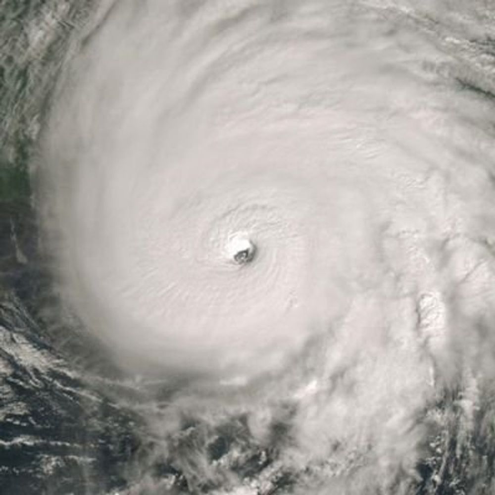
Insane dropsonde from #Melissa's southern eyewall. Stronger than the one yesterday morning, strongest I can remember seeing. Agrees with 160kt intensity from NHC
28.10.2025 14:15 — 👍 9 🔁 2 💬 0 📌 0
Clean and sober tree-hugging gardener with an odd skill set. Go in peace, carry on. ☀️🌱💚
M.S. student at Colorado State University studying tropical cyclones + airborne radar. B.S. CS + Atmospheric/Oceanic Sciences from UW-Madison.
Also enjoys diving + photography + storm chasing + television + Wisconsin Sports + F1
Professor of Atmospheric Science at
University of Miami, Hurricane Expert, and Weather Consultant at rfqweather.com
Florida Meteorologist | Penn State Meteorology | Husband & Father | Hurricane Irma, Hurricane Ian | Florida Born & Raised
Hurricane enthusiast tracking online since 1998 at www.hurricanecity.com
statistical database for cities and islands impacted by hurricanes
Chief Meteorologist (Royal Caribbean International, CBS, FOX, ABC), Marine Meteorologist, Expert Witness for trials, Advisor for Emergency Management
Chief Meteorologist at WBZ-TV in Boston, MA.
Storms, nature, sports, beer. Not necessarily in that order.
Graduate student University of Oklahoma · B.A. in political science and communication University of North Carolina Wilmington · probably should've majored in meteorology instead
Storm chaser, photographer, meteorologist, frequent coffee drinker, fellow user of the internet.
Private sector meteorologist. Flooding/weather history enthusiast. From the Northeast, currently living in the Midwest. Thoughts are mine alone.
Atmospheric scientist // Global model evaluator at the NWS Environmental Modeling Center // Ph.D., M.S., B.S. from UAlbany // Yoga, NY sports, wine // Restaurant Reviewer // Opinions are mine
www.AliciaMBentley.com
📍Washington, DC
Meteorologist for Crown Weather. Avid amateur astronomer. Happily married for 15 yrs to @icecat516. Dog dad to 6 rescues. Bruins, Red Sox & Celtics fan. I live in Central Mass but have lived in Maine & New Hampshire.
Was On X/Twitter as @crownweather
Meteorologist and journalist. I cover wacky weather, changing climate, and how we live, love, work, get around, and dream.
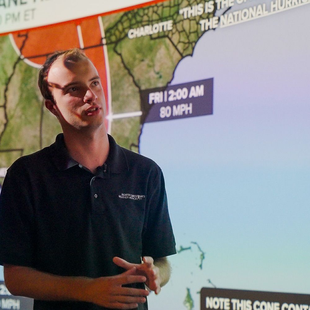
@NCState | Meteorologist/Stormwater for @RaleighGov and Freelance for @WRAL| Founder of North Carolina’s Weather Authority with over 650k followers on FB|
https://t.co/rmPgbwdgpH
Meteorology Student FSU 25’ 🍢 | Musician 🎶 | Founder of Florida’s Weather on Facebook
PhD Candidate with Dasog Lab at Dalhousie University. Amateur hurricane tracker. NAFO Fella.
Proud Nasty Canadian.
Oklahoma & Virginia Tech alum | Specialized in GIS, tropical meteorology, and climate teleconnections.
(Ironically Tropical) Meteorologist 🌀⛈️
Assistant Professor of Atmospheric Sciences at the University of North Dakota 🟢⚪️
3-time Florida State alum 🔴🟡🍢, short-term Penn Stater 🔵⚪️🦁
LOT ➡️ MFL ➡️ TAE ➡️ CTP ➡️ FGF
Website: carstensweather.com
LSU Coastal Meteorology Master’s student, B.S. Meteorology from Texas A&M.
Fan of baroclinicity and ball. Native Texan living in the bayou!