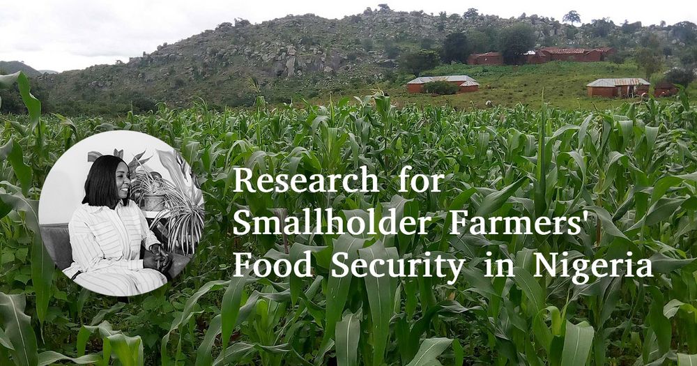
Header Image of Maize field with a picture of Esther Shupel Ibrahim and text: Research for Smallholder Farmers' Food Security in Nigeria
Using Remote Sensing and Agro-Ecosystem Modelling 🛰️🌽📈, Esther Shupel Ibrahim analyzes impacts of climate change and diseases on smallholder agriculture in Nigeria and develops strategies to support and empower smallholder farmers.
Find out more about her PhD research in this StoryMap:
arcg.is/1bG48K
21.07.2025 11:09 — 👍 7 🔁 5 💬 1 📌 1
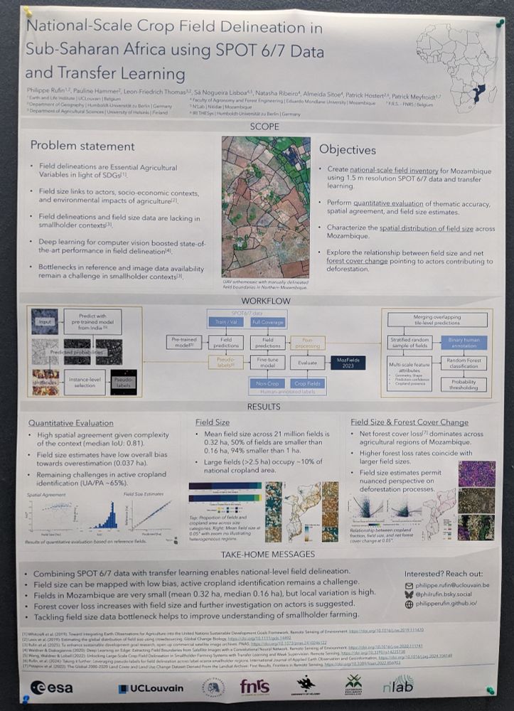
#LPS25 poster alert: National scale field delineation in #Mozambique using 1.5m SPOT data, mapping field size & linking to #deforestation. Come by @ Hall X5, Poster S18.
25.06.2025 09:23 — 👍 11 🔁 2 💬 0 📌 0
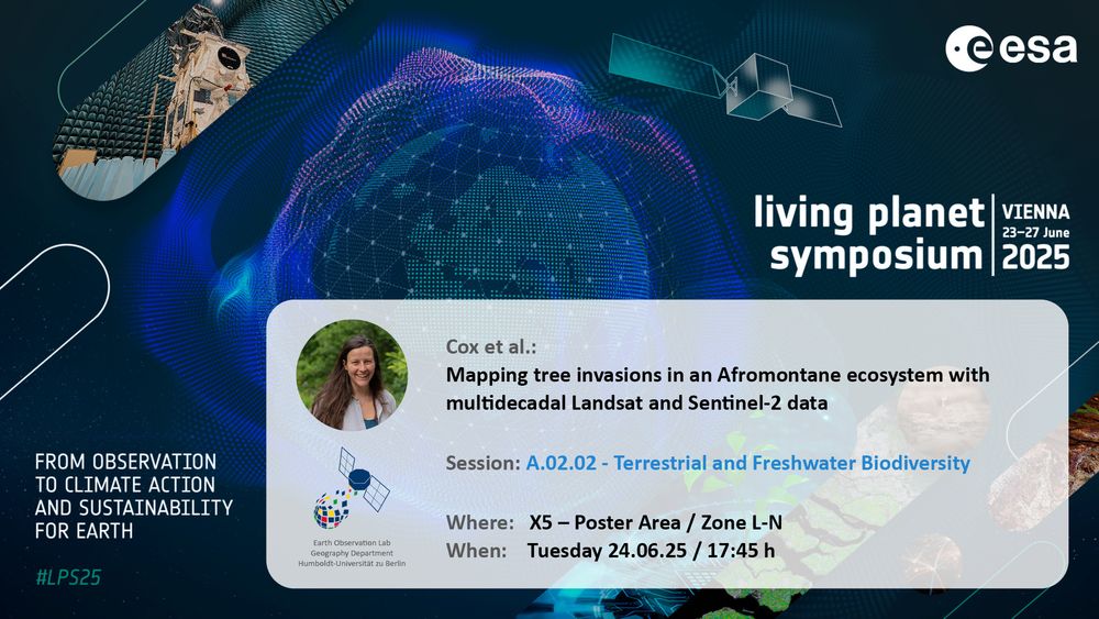
Announcement for upcoming Earth Observation Lab contribution at living planet symposium 2025:
Cox et al.: Mapping tree invasions in an Afromontane ecosystem with multidecadal Landsat and Sentinel-2 data
Part of Session: A.02.02 - Terrestrial and Freshwater Biodiversity
Where: X5 Poster Area – Zone L-N
When: Tuesday 24.06.25 / 17:45 h
Last EOLab contribution at #LPS25 for today:
Heather Cox et al.: Mapping tree invasions in an Afromontane ecosystem with multidecadal #Landsat and #Sentinel-2 data
17:45 at X5 – Poster Area, Zone L-N
More to come in the next days, have a look: eolab.geographie.hu-berlin.de/uploads/EOLa...
24.06.2025 15:06 — 👍 8 🔁 1 💬 0 📌 0
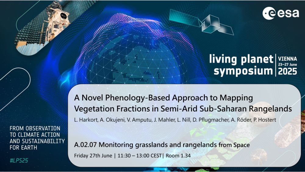
LPS 2025
Excited to present at #LPS25! 🛰️
I’ll share how Phenological Feature Spaces help map vegetation fractions in semiarid rangelands.
🔗 Paper: www.sciencedirect.com/science/arti...
Make sure to check @humboldteolab.bsky.social at #LPS25 eolab.geographie.hu-berlin.de
#EOchat #LPS25
22.06.2025 10:14 — 👍 11 🔁 2 💬 0 📌 0
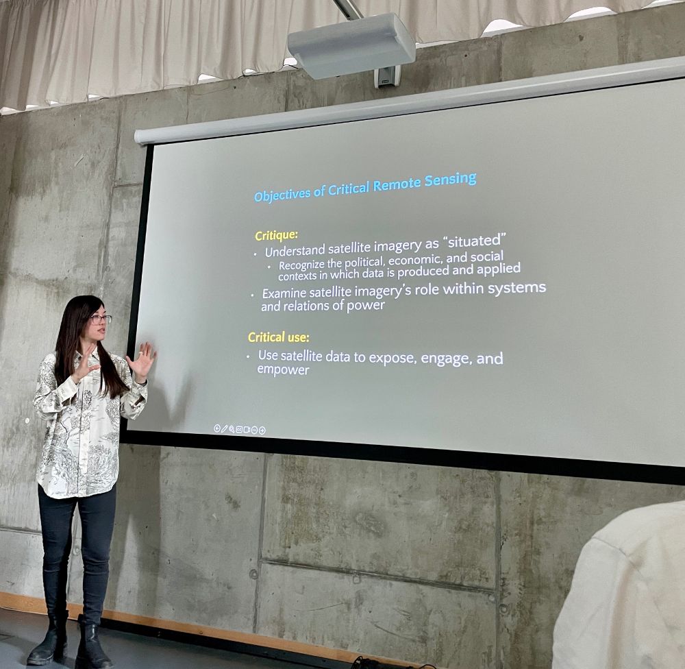
Grateful to Prof. Mia Bennett (@cryopolitics.com ,Univ. of Washington) for stirring questions at today’s EO Lab colloquium. “Pixel Politics” probed who owns the satellites—and the narratives—behind our data. Exposure→engagement→empowerment: roadmap for critical #RemoteSensing
16.06.2025 15:41 — 👍 9 🔁 6 💬 0 📌 1
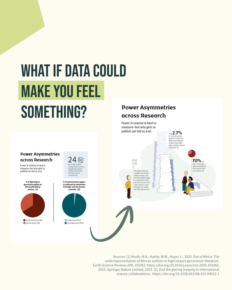
Most scientific figures aim to be clear.
But what if they also aimed to be compelling?
I love clean, well-structured data visuals — often, they’re exactly what’s needed.
But when data is about people — shouldn’t we also show them? #DataVisualization #SciComm @humboldteolab.bsky.social
30.04.2025 13:05 — 👍 12 🔁 3 💬 1 📌 0
Girls'Day logo on blurred background picture of a pc-pool exercise with multiple students
Girls’Day at the Earth Observation Lab!
This year we participated in the Girls’Day for the first time, an annual action day that gives schoolgirls from the 5th grade onwards the opportunity to explore various professional fields. Have a look here: storymaps.arcgis.com/stories/8529...
28.04.2025 09:50 — 👍 7 🔁 2 💬 0 📌 1
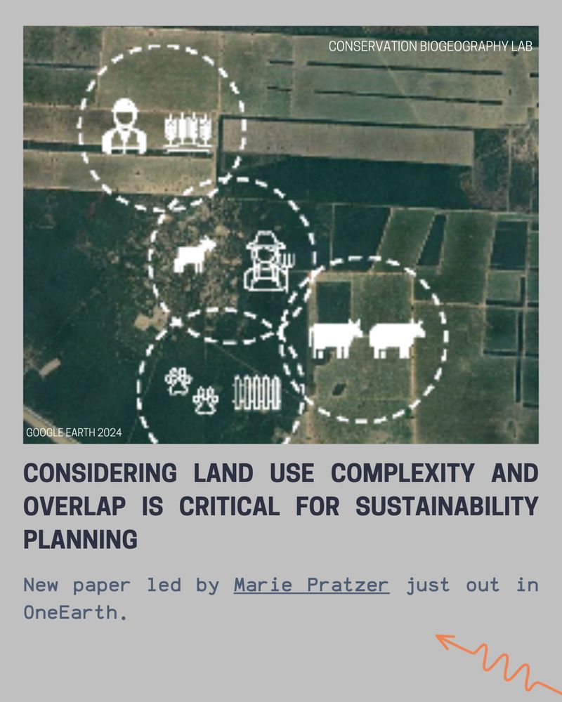
Considering land use complexity and overlap is critical for sustainability planning. New paper led by Marie Pratzer - out in OneEarth:
www.sciencedirect.com/science/arti...
@tkuemmerle.bsky.social @matthiasbaumann.bsky.social @pedrofernandez91.bsky.social @oneearthofficial.bsky.social
07.04.2025 07:30 — 👍 14 🔁 9 💬 1 📌 0
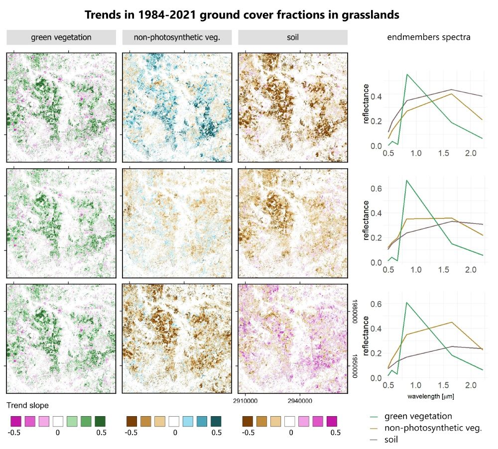
📣In our new paper we analyzed the impact of #Landsat and #Sentinel-2 🛰️ #satellite data density and SMA endmembers on trends in #grasslands ground cover:
- for monthly composites data density is irrelevant
- correct endmember definitions are critical‼️
Check out the full paper tinyurl.com/wha6pzax
04.04.2025 13:05 — 👍 23 🔁 10 💬 1 📌 1
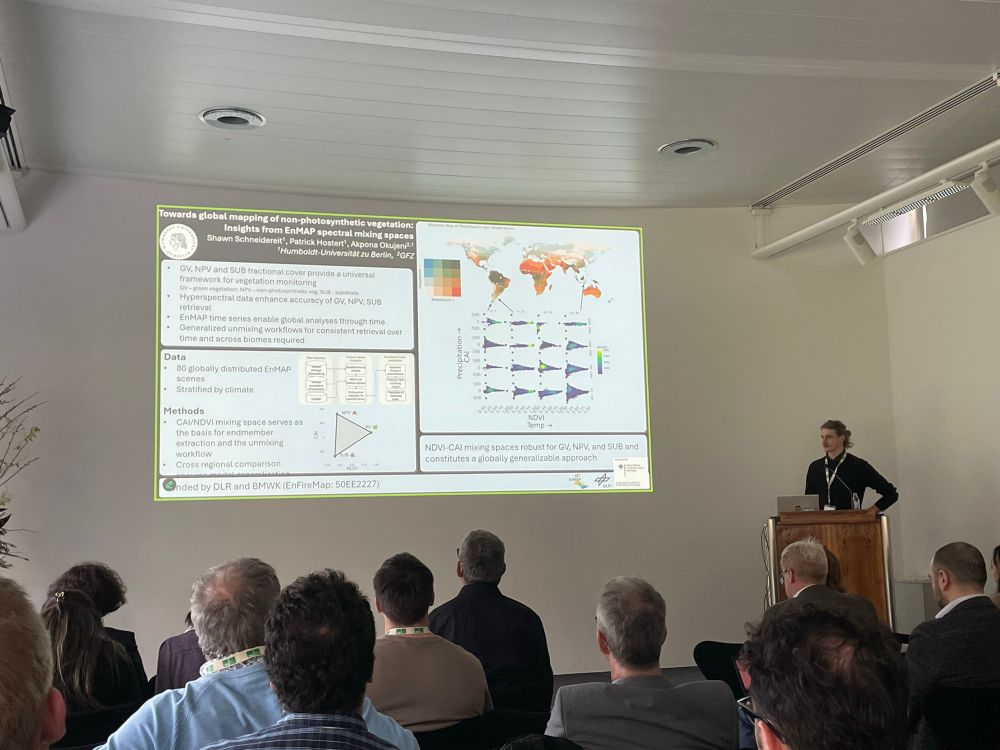
Our PhD student Shawn Schneidereit at the EnMAP User Workshop in Munich presenting his research on global NPV mapping 🛰️
The EnMAP User Workshop is goes until Friday 4th
enmap.geographie-muenchen.de
Join online via:
lmu-munich.zoom-x.de/meeting/regi...
02.04.2025 17:40 — 👍 11 🔁 1 💬 0 📌 0
How can AI for #EarthObservation deliver for social good? Read our recent #openaccess IEEE Geoscience and Remote Sensing Magazine article, co-authored by @hostertp.bsky.social and @philrufin.bsky.social!
03.03.2025 20:06 — 👍 4 🔁 6 💬 0 📌 0
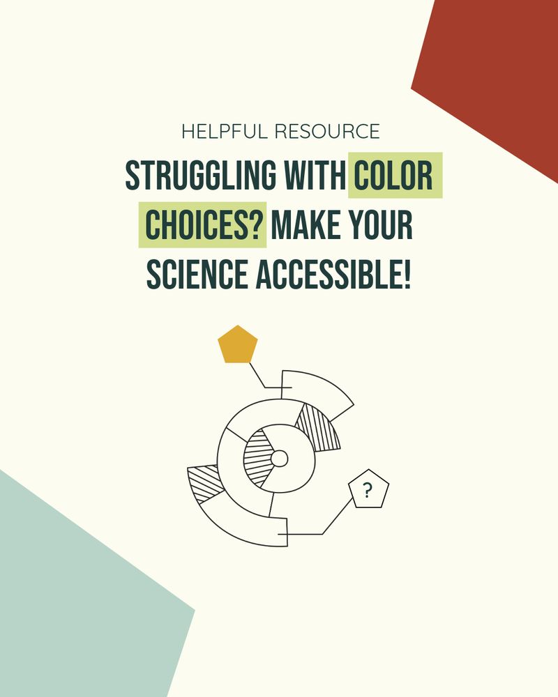
The image is an informational graphic with the title: "Struggeling with color choices? Make your science accessible" The text is presented in a clean, modern font, with the phrase "Helpful Resource" highlighted in a light green box, emphasizing accessibility in scientific visuals. The background is a light beige color with abstract geometric shapes in muted red and light blue scattered around. In the lower right, there is a circular diagram composed of segmented parts, some of which are hatched, connected to smaller geometric shapes, including a yellow pentagon and another pentagon with a question mark inside, suggesting inquiry or guidance. The design is minimalist and visually appealing, aimed at guiding color choices for accessible scientific graphics.
🎨 Need help choosing colors for scientific visuals? This tool ensures your graphics are not only beautiful but also colorblind-friendly! 📊 Check it out: personal.sron.nl/~pault/#sec:...
#SciComm #DataViz #ColorBlindness @lasseharkort.bsky.social
26.02.2025 09:08 — 👍 7 🔁 1 💬 1 📌 0
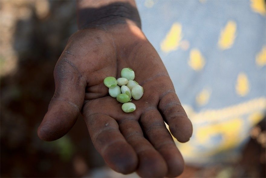
To adequately study smallholder farms, researchers need access to high-resolution satellite data. This will provide critical tools, data, and scientific underpinning for the policies necessary to meet the targets defined under the SDGs. Pictured is a hand holding some beans. Image credit: Cristina Chiarella (photographer).
Opinion piece: To advance #SustainableDevelopmentGoal research, open up commercial #satellite image archives for better #farm data. www.pnas.org/doi/10.1073/...
#SDGs #SmallholderFarm #ClimateChange #agriculture #LandUse #CropProductivity
18.02.2025 18:16 — 👍 10 🔁 5 💬 0 📌 1
🚀 EO Lab Bluesky Starter Pack 🌍
Want to connect with Earth observation & remote sensing experts? We’ve curated a list of EO Lab members & close network connections.
🔗 Check it out & start following: go.bsky.app/LsrpBNW
Let’s grow the EO community! #EOchat #RemoteSensing
17.02.2025 08:14 — 👍 8 🔁 4 💬 0 📌 0
Separating woody, herbaceous, and bare cover in semiarid Sub-Saharan rangelands isn’t easy—spectral similarity makes it tricky. 🌍🛰️
We developed a Phenological Feature Space (PFS) to solve this, using Sentinel-2 time series.
Excited to share our latest work!
doi.org/10.1016/j.rs...
14.02.2025 06:34 — 👍 8 🔁 1 💬 0 📌 0
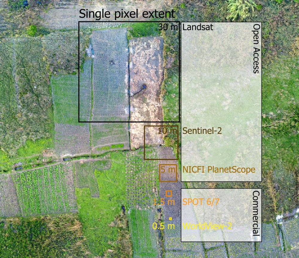
A drone capture of a smallholder farming landscape. Overlaid are squares of the size of typical optical satellite missions. Openly accessible data (e.g. Landsat or Sentinel-2) is often not sufficient to capture the landscape complexity in full detail, for example when trying to delineate individual fields. Here, one Landsat pixel contains fractions of multiple fields. Commercial data come at higher spatial resolution, offering potential to discriminate indivudual landscape components.
📣PNAS piece led by @philrufin.bsky.social: commercial very-high-resolution EO data is needed for monitoring SDG 2 indicators in smallholder landscapes but costs are prohibitive. A call for open access for sustainability-centered research: doi.org/10.1073/pnas... @humboldtuni.bsky.social
13.02.2025 09:28 — 👍 39 🔁 13 💬 0 📌 2
We left behind ~10k followers on X, please reskeet to help us reach the community! #EOchat
12.02.2025 15:57 — 👍 12 🔁 7 💬 2 📌 0
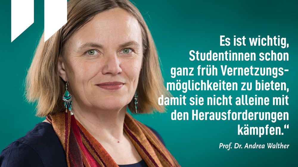
HU-Prof Dr. Andrea Walther. Foto: Kay Herschelmann / MATH+
🔭 #WomenInScience: Heute feiern wir den Internationalen Tag der Frauen und Mädchen in der Wissenschaft! Im Interview mit der #HU spricht Prof. Dr. Andrea Walther @mathplusberlin.bsky.social über ihre Begeisterung für die Mathematik.
👉 www.hu-berlin.de/de/pr/nachri...
11.02.2025 10:51 — 👍 20 🔁 3 💬 0 📌 1
Global Forest Monitoring - ICI Berlin
Though a powerful tool for both transnational forest product companies and Indigenous activists, global forest monitoring platforms present ethical and political dilemmas.
Excited to share this event:
🌍🌳 Global Forest Monitoring: Protection or Surveillance?
Join tonight at 19:00 at @iciberlin (or via livestream) for a deep dive into the ethics of space politics w/ Birgit Schneider & Lynda Olman.
Details & access: www.ici-berlin.org/events/globa...
10.02.2025 15:34 — 👍 10 🔁 1 💬 0 📌 0
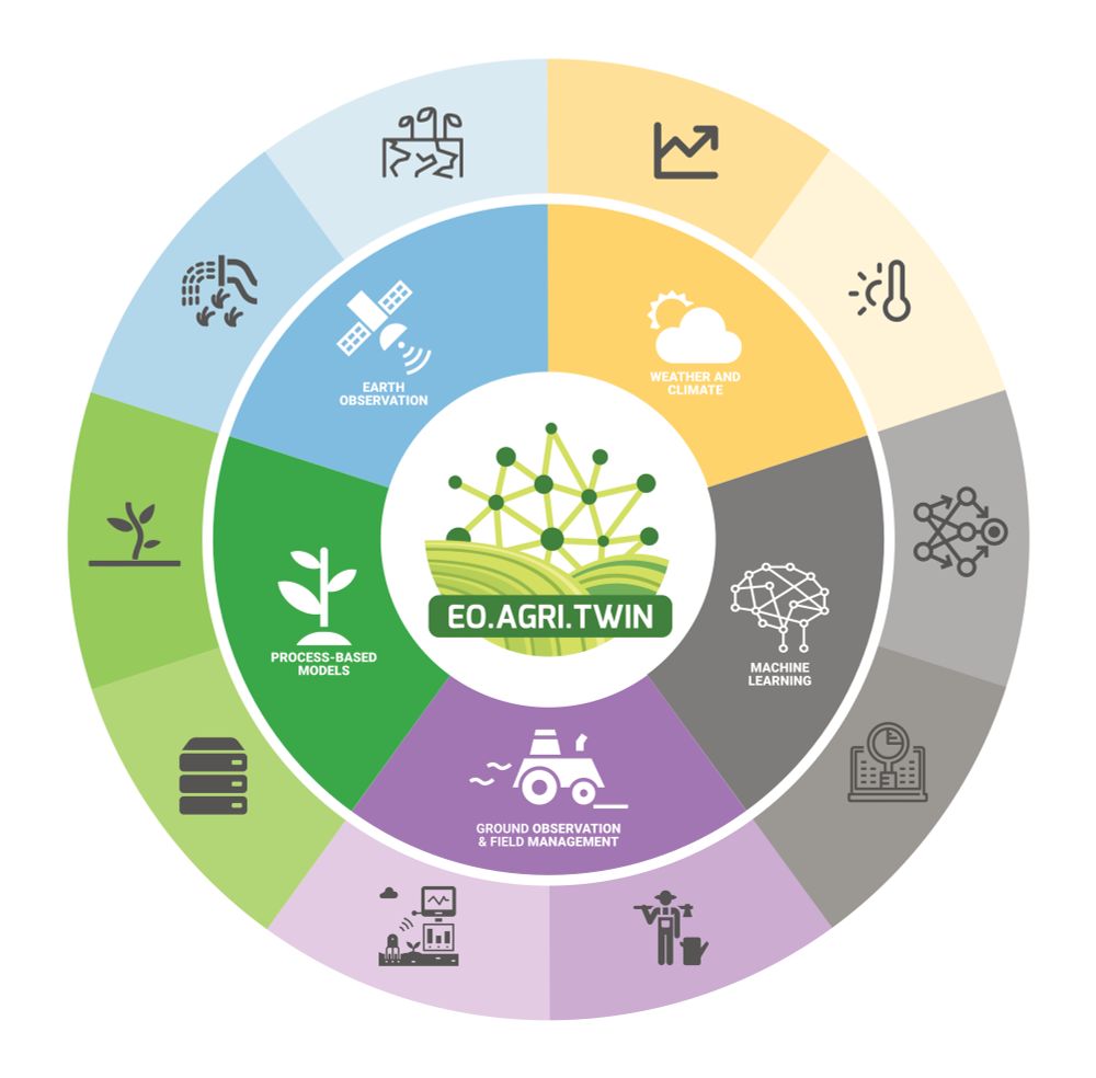
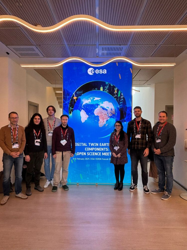
Productive days at @esaearth.esa.int Digital Twin Earth Open Science Meeting!
We presented #EOAgriTwin, a project that uses #EO data to assess stressors & build #DigitalTwin for drought, heat, pests & pathogens.
Collab: @zalf.bsky.social, RSS, @humboldtuni.bsky.social, ICIPE & UCSC.
🔗 eoagritwin.eu
06.02.2025 08:03 — 👍 7 🔁 5 💬 0 📌 0
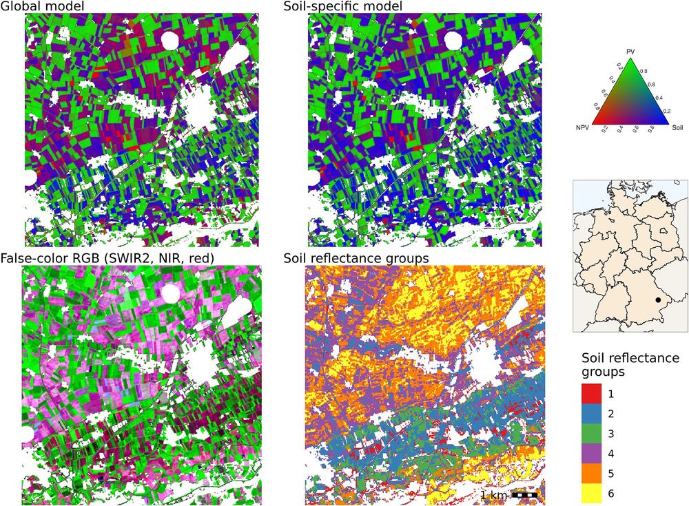
Happy to share our new paper on soil-specific unmixing of croplands in Germany led by Felix Lobert.
We adapted @katjakowalski.bsky.social’s approach using #Landsat and #Sentinel-2 🛰️ to account for soil variability using a soil reflectance composite developed at @thuenen.de EO:
tinyurl.com/5n92ae5z
13.01.2025 09:53 — 👍 26 🔁 7 💬 1 📌 0
Vorträge zu Faschismus, Antifeminismus und Klassismus.
Recherchen und Analysen zur AfD und Kapitalismus, insb. 'Neofeudalismus' (Privatstädte, Proprietarismus, Adel usw.) https://andreaskemper.org
Curated news and policy updates from the Southern African Development Community (SADC) and wider region. Tracking governance, economics, and development trends. Focus on Politics, Data, Human Rights, Economics, Biodiversity and Climate Change.
@FragDenStaat.de, @Freiheitsfonds.de
Geographer|Earth Observation Scientist
I combine optical and radar remote sensing to understand spatio-temporal dynamics of savanna ecosystems of Southern Africa.
Doctoral Researcher @uni-jena.de
Guest Doctoral Researcher @humboldteolab.bsky.social
Germanwatch is an independent development, environmental, and human rights organisation that lobbies for sustainable global development. Sustainable development means socially equitable, ecologically sound, and economically stable. 🌍🇪🇺 germanwatch.org
Geographer @ Humboldt-University Berlin. | working on land use and its impact on biodiversity
Geographer studying Computational Science @Uni Potsdam
Homepage: https://www.florian-katerndahl.de/
GitHub: https://github.com/Florian-Katerndahl
Remote sensing ecologist. University of Washington Research Scientist and Senior science advisor for Digital Earth Africa. Background in conservation management and wetland ecology.
Permafrost researcher passionate about Arctic ecosystem dynamics and climate change impacts🌲🌞❄🔥🍃🌡
Land surface modeling 🖥📊 | Arctic fieldwork 🌏🧭 | Remote sensing 📡🛰
Postdoctoral researcher @humboldteolab.bsky.social
Ag Economist @ IAMO | Prof of Geography @ Humboldt-Universität zu Berlin | #landuse #climatechange #sustainability; focus on #WesternBalkan #formerSovietUnion | GLP SSC member: https://bsky.app/profile/glp-earth.bsky.social
http://www.iamo.de/en/mueller
Asst. Professor at the University of California, Santa Barbara. Environmental economist. Land systems scientist.
X-tronomer, Senior Research Scientist (data scientist) - @ Data61/CSIRO. I mostly tweet about AI. Opinions are my own.
Associate Professor in Copenhagen, using satellite images and deep learning to map vegetation
Researcher at TUM @eoem-tum.bsky.social
| Earth observation for Ecosystem Management |
• remote sensing 🛰️ • spatial analysis 🗺️
• landscape ecology 🏞️🌲🌳🏔️
Researcher in social ecology, land use, ecosystems and climate change mitigation. BOKU. SEC. Austrian Panel for Climate Change. Scientist 4 Future Austria.
Professor in Ecohydrology, Isotopes, Landscape Ecohydrology, Scotland, Berlin
Scottish meteorologist based in London | MMet University of Reading | Former co-owner WXCHARTS | opinions are my own