For clarity absent in the first post...: The Headwaters Project is a concerted effort to support critical libraries and software projects upstream of our project.
04.11.2025 20:20 — 👍 1 🔁 0 💬 0 📌 0
The first project that we're funding through the Headwaters Project will upgrade OpenMVS with an improved texturing method, replacing MVS-Texturing.
It's a win-win-win: upstream support for a core dependency, improved algorithms in that library, and reduced memory bottlenecks in OpenDroneMap.
03.11.2025 21:38 — 👍 2 🔁 0 💬 1 📌 0

“See how we can help you” Industry, e.g. Agriculture, and Looking for, e.g. Farm health monitoring
As we build out the new website, our designer added a section that will link on to Industry and Application for OpenDroneMap data.
What would you put for Industry and Application?
03.10.2025 23:24 — 👍 3 🔁 0 💬 0 📌 0
This is a great reminder of a thoroughly written and thoughtful workflow. Thanks for the reminder!
19.09.2025 18:50 — 👍 1 🔁 0 💬 0 📌 0

Drone Mapping Software - OpenDroneMap™
Drone mapping software. Generate maps, point clouds, 3D models and DEMs from images, any orientation, any camera.
🤔
We’re collecting cool datasets to show on OpenDroneMap.org, but it also might be useful to have a sentence from you on how you use OpenDroneMap and how it has effected you in your industry.
How has OpenDroneMap changed / improved / supported what you do in your sector?
🤔
22.08.2025 23:24 — 👍 6 🔁 2 💬 0 📌 0

Sometimes stuff is just bananas. www.youtube.com/watch?v=1bma...
15.09.2025 21:32 — 👍 1 🔁 1 💬 0 📌 0

OpenDroneMap Community
Discussion, Questions, and Collaboration surrounding the OpenDroneMap toolchain
That'd do it. Biggest challenge might be quality of the GNSS/GPS data, but it'll stitch, just need to choose the right camera type, and probably defaults otherwise. And join us at community.opendronemap.org if you get stuck or when you succeed!
15.09.2025 23:20 — 👍 1 🔁 0 💬 1 📌 0

Following up on the prior request for cool datasets: whether for posting on the website or just showing off for fun, what cool elevation datasets are folks rocking these days? Anything to show off?
We've got some cool things already posted here:
community.opendronemap.org/t/cool-datas...
09.09.2025 22:55 — 👍 4 🔁 1 💬 0 📌 0

We're working on an updated OpenDroneMap website and we want to showcase datasets from OpenDroneMap enthusiasts there.
You’ll be credited on the website, your cool work shown off, and we’ll be able to highlight the cool stuff that OpenDroneMap can do!
community.opendronemap.org/t/cool-datas...
15.08.2025 23:24 — 👍 4 🔁 3 💬 1 📌 0
Drone Mapping Software - OpenDroneMap™
Drone mapping software. Generate maps, point clouds, 3D models and DEMs from images, any orientation, any camera.
🤔
We’re collecting cool datasets to show on OpenDroneMap.org, but it also might be useful to have a sentence from you on how you use OpenDroneMap and how it has effected you in your industry.
How has OpenDroneMap changed / improved / supported what you do in your sector?
🤔
22.08.2025 23:24 — 👍 6 🔁 2 💬 0 📌 0
BTW, the model in the upper left of this sequence is the Honda crest from Himeji Castle, in Japan. Watch for a future post where we debadge a Honda and add a crest tile from Himeji Castle, reconstructed from photos last summer.
18.08.2025 01:21 — 👍 0 🔁 0 💬 0 📌 0
We're working on an updated OpenDroneMap website and we want to showcase datasets from OpenDroneMap enthusiasts there.
You’ll be credited on the website, your cool work shown off, and we’ll be able to highlight the cool stuff that OpenDroneMap can do!
community.opendronemap.org/t/cool-datas...
15.08.2025 23:24 — 👍 4 🔁 3 💬 1 📌 0
One thing maybe not discussed enough is the long term opportunity cost of not investing and supporting open source software. Imagine the more and better Blenders, GIMPs, Firefoxs, InkScapes, QGISs etc we would of had (+ could have) if open source was taken more seriously by government and businesses
23.02.2025 20:19 — 👍 27 🔁 8 💬 1 📌 0
And we'd be remiss if we didn't mention the other feature this brings in: you can download the camera locations as a text file now (geo.txt), meaning you can edit it and upload it again in another task with corrections to your camera locations, e.g. adjust your Z to a local datum.
22.02.2025 16:50 — 👍 0 🔁 0 💬 0 📌 0
Right?! Didn't know how needed it was until it was right there.
21.02.2025 23:38 — 👍 1 🔁 0 💬 1 📌 0
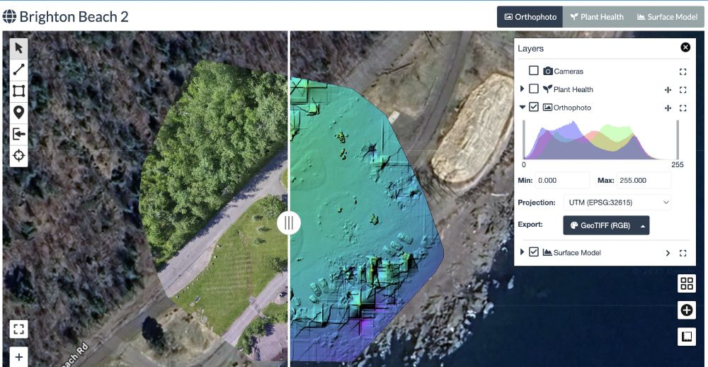
The align interface allows alignment of a dataset with another: think ensuring adjacent datasets align, or multi-temporal datasets need to be well aligned geographically.
21.02.2025 22:32 — 👍 1 🔁 0 💬 1 📌 0
Previews allow you to (ahem) preview the project orthophoto without opening it.
21.02.2025 22:32 — 👍 1 🔁 0 💬 2 📌 0
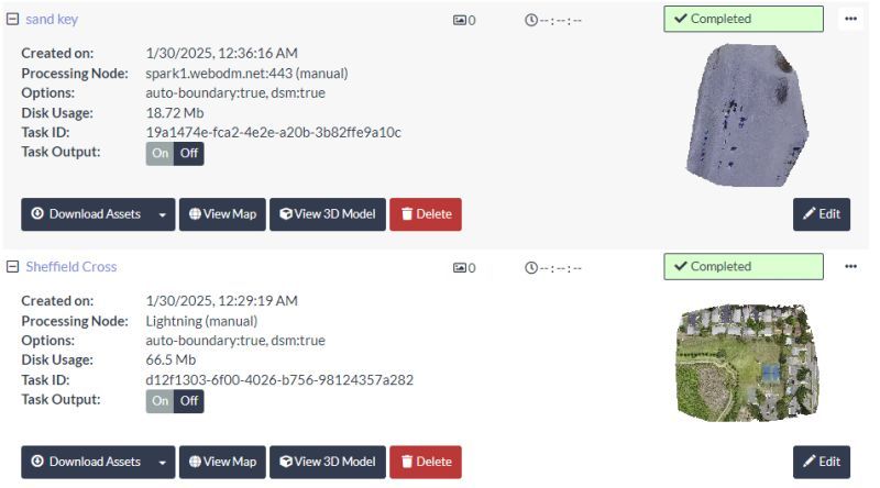
Screen shot of WebODM interface with new feature: previews of orthophotos on right hand side. Orthophotos include a gravel pit and a park with houses.
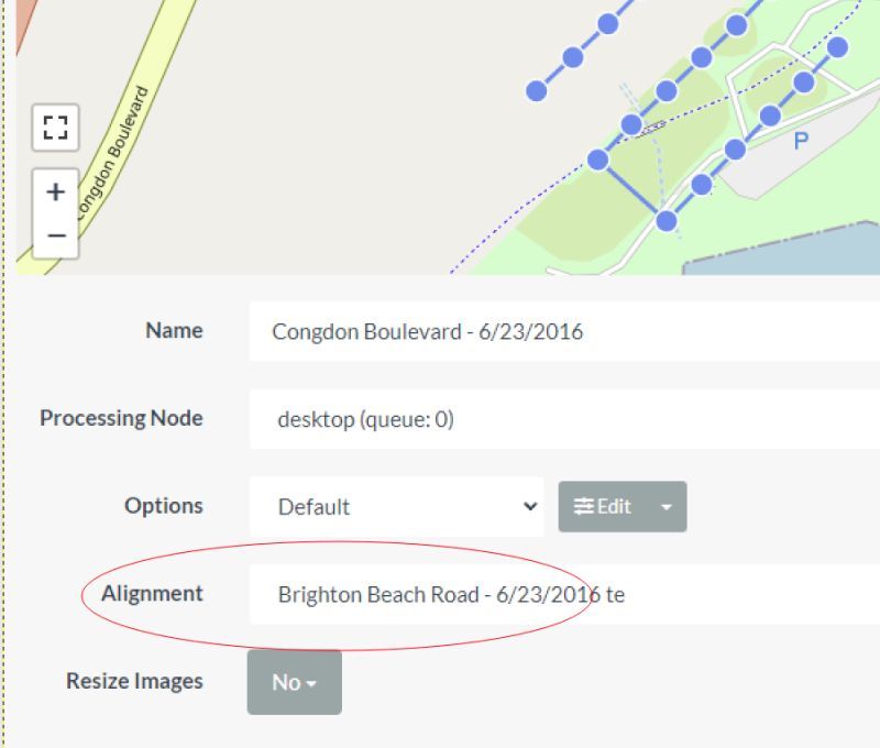
Screenshot showing updated interface with new "Alignment" option, here with a dataset titled "Brighton Beach" highlighted. Map at top with image locations shown as dots, and Name, Processing Node, Options, Alignment, and Resize images in interface below.
Continuing the heavy hits on WebODM updates. This list looks short, but it's substantive:
OpenDroneMap/WebODM
V2.7.1
---
- Geolocation file download
- Task thumbnails
- Task alignment support
21.02.2025 22:32 — 👍 2 🔁 2 💬 1 📌 0
This is wonderful! Leymus mollis is California's native beach grass. Introduced European beach grass that was there makes a very different dune structure. The native grass builds lower slope dunes leaving space for foredune plants while the non-native builds steep slopes & less plant diversity.
20.02.2025 23:43 — 👍 6 🔁 2 💬 0 📌 0
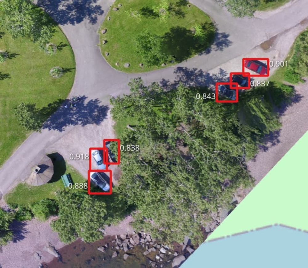
So what's GeoDeep? Just a bit of object detection and segmentation:
12.02.2025 21:48 — 👍 6 🔁 4 💬 1 📌 0
Also, with an update independent of release you get this cool new feature too!
bsky.app/profile/pier...
12.02.2025 21:38 — 👍 3 🔁 0 💬 0 📌 0
This one took a while, but finally found the time. Compare layers in WebODM (works also across tasks). github.com/OpenDroneMap... Time to update!
12.02.2025 18:00 — 👍 6 🔁 3 💬 1 📌 1
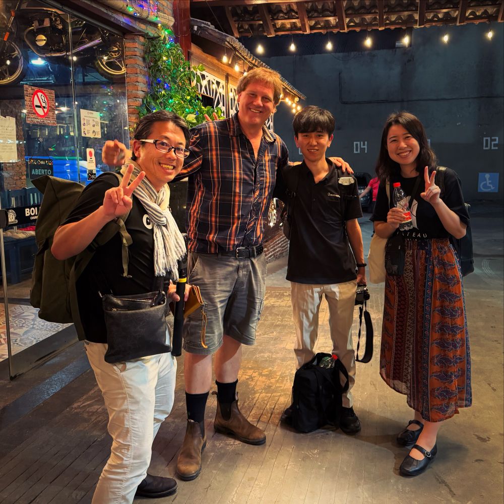
FOSS4G Workshop Day2 おつかれシュラスコを食べに、地元の領事館おすすめシュハスカリアにやってきました。OpenDroneMapのIvanとArcEdge Space鈴本さん、PLATEAUの十川さん、増田さん、古橋のドローン・地球観測衛星・3D都市デジタルツインテーマにさまざまな技術的方向性を意見交換。
#OpenDroneMap #ArcEdgeSpace #PLATEAU #DRONEBIRD #Brasil #Belem #FOSS4G #sotmlatam #FuruhashiLab #古橋研究室 #AoyamaGSC #地球社会共生学部 #青学 #一億総伊能化
04.12.2024 09:51 — 👍 2 🔁 1 💬 0 📌 0
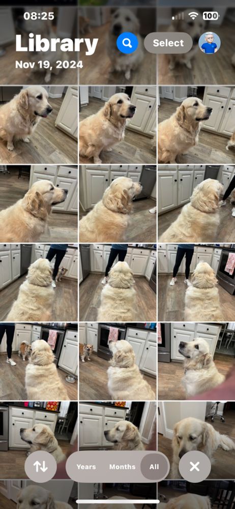
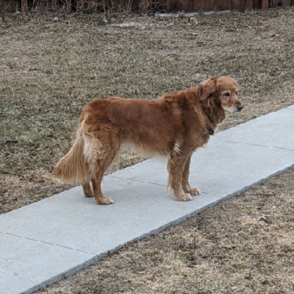
I have been trying to build a 3D model using OpenDroneMap and am looking for guidance how to capture a moving object. I used a Canon D3300 with a constant focal length because my iPhone camera did not work well. #goldens #opendronemap #photogrammetry
07.12.2024 13:32 — 👍 4 🔁 1 💬 0 📌 0
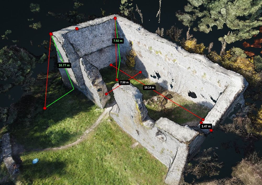
Bydlin castle remains. Measures made with OpenDroneMap WebODM tools.
Bydliński zamek to wdzięczny obiekt do ćwiczeń z obsługi #OpenDroneMap #WebODM - obsługa wirtualnej taśmy mierniczej to cenna umiejętność. Ilustracji do podręcznika ciąg dalszy ;)
20.11.2024 09:22 — 👍 1 🔁 1 💬 0 📌 0
M.Sc. Graduate, KNT University
Photogrammetry | Remote Sensing
Remote Sensing → Environmental Monitoring, Forest Ecology, Wildfire
Photogrammetry → Bundle Adjustment, UAV, Canopy Cover
#RemoteSensing #Photogrammetry #UAV #Drone #DeepLearning #GIS
Geospatial Technologist, Amateur photographer & Astrophotographer, Explorer of Road Trips.
Full stack software engineer. Transit, cycling & public spaces advocate. Violinist, dancer, OpenStreetMap contributor.
https://jakecoppinger.com
https://mastodon.social/@jakecoppinger
;
Because shame is loud.
Kindness has to whisper.
Geospatial open source @developmentseed.org
https://github.com/gadomski
https://www.gadom.ski/
Runner. Coder. Database hacker. Accidental geographer. Perpetual novice. Chaotic neutral.
Geospatial Data Engineer/Scientist Phd, Technologist, Photographer doing Open Source, Open Data, Open Science. @developmentseed.org
Geospatial Communicator.
Data + Stories for @developmentseed.org
@osmus.bsky.social Board Member
Hiking shenanigans. Desert dweller.
Associate Professor @UTKnoxville | Amazon Scholar | Creator of #geemap & #leafmap | Talk about #Geospatial #GeoPython #DataViz #GIS #FOSS #EarthEngine
CEO @developmentseed.org
Still a big fan of Freedom, but not in a shitty way
@cartonaut elswhere
Map-o-phile / GIS wrangler / M.S. GIS / GISP / mischief / 🗺️ / solvitur ambulando
'Peddler of Wheres,' job creator, Owner at The Map Center in Pawtucket RI- it's like a hip record store but for maps.
www.mapcenter.com
Cartographer, GIS specialist and educator
Linktr.ee/ecoandrewtrc
Working to advance conservation for people and biodiversity in cities through open source, open data, and partnerships. Herpetologist in my free time + dog & kid parent
Geo tech consultant for conservation/ecology. PostGIS, Mapbox, Typescript, React, NestJs, QGIS, DuckDb, AWS/GCP, D3, Angular. Sr Software Engineer
@zevross
Geographer and geospatial technologist. Owner of Sand Hill Geographic and Board member of the American Geographical Society. KU PhD.
Open Source GIS developer and co-founder of Sourcepole 🇨🇭.
#rust programmer, #paragliding, #railway tours.