when you are running
the anxious world drifts away
and you become time
2025-04-27
#running + #writing + #mapping

@mikusthetiger.bsky.social
geographer by day, traveler by night
when you are running
the anxious world drifts away
and you become time
2025-04-27
#running + #writing + #mapping
Thanks brother
08.04.2025 20:10 — 👍 0 🔁 0 💬 0 📌 0
down the pine alley
i am witnessing the trees
as they witness me
2025-04-06
#running + #writing + #mapping


'A spring walk among the cherry blossoms' - this aerial embroidery, plus two smaller ones, has now been added to my site! I feel like I've been reawakened with spring finally here and of course blossoms were my go to 😊 all here: victoriaroserichards.co.uk/collection/a... #landscape
26.03.2025 15:04 — 👍 409 🔁 41 💬 11 📌 2
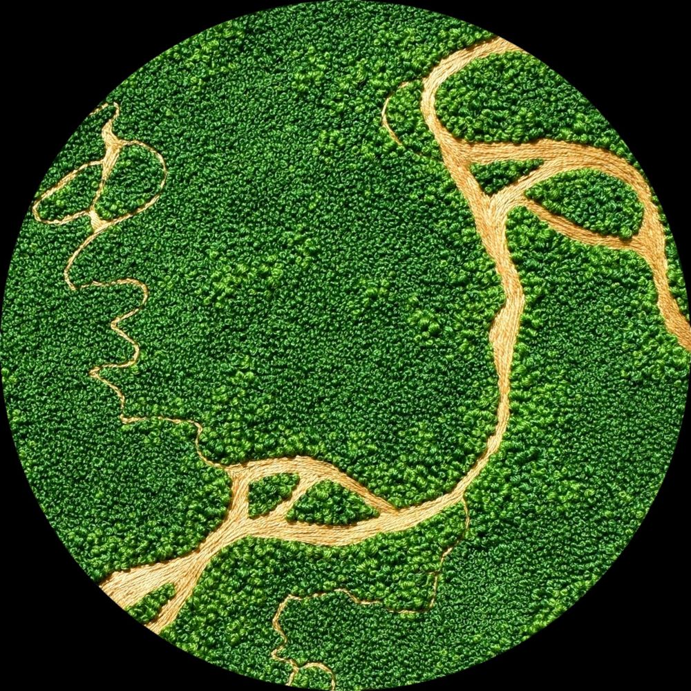
ooooh the azaleas
an exploding pink mural
nature’s graffiti
2025-03-23
#running + #writing + #mapping
I've found the use of #LLMs most effective when they augment, not replace, existing workflows.
Shown here: a proof-of-concept #rstats / Shiny app where an LLM is used to "explain" a geocoded location on a map.

From the archives: "On Edges," a 2021 post that just came back to my mind recently. somethingaboutmaps.wordpress.com/2021/06/01/o...
19.03.2025 21:12 — 👍 11 🔁 4 💬 0 📌 0
spring dreams untethered
when the ruby throats arrive
up up and away
2025-03-16
#running + #writing + #mapping
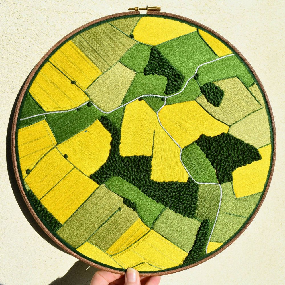
A hand holding an embroidery hoop in front of a cream wall. The hoop contains a sewn aerial landscape depicting oilseed meadows in bright yellow, green grass fields and areas of deep green trees. There's a grey road that breaks into two passing through the whole landscape.
'My heart beats [in fields of gold]'... its coming to that time of year so time to share this oilseed aerial from a past spring! That rich acid yellow has a spot in my heart 💛💛 I have to do another embroidery landscape like it very soon!! #fiberarts #embroidery
17.03.2025 19:37 — 👍 483 🔁 84 💬 6 📌 2
#datascience
oho, neat : one can treat pandas/dateteime timestamps like numbers and round them off, according to the time unit one's using (here [D]ay ) :-)
pandas.pydata.org/docs/referen...
Ooooh helpful. Thank you for sharing!
14.03.2025 13:18 — 👍 1 🔁 0 💬 1 📌 0
amsterdam/brussels:
a celebration of parks
and more love for home
2025-03-09
#running + #writing + #mapping
Was honored to help out @mapcenter.com with their new logo! Andrew's livin' the dream of running a brick and mortar map shop, and killing it being a positive advocator for maps and mapmakers old and new.
12.03.2025 15:42 — 👍 50 🔁 3 💬 1 📌 0
less than one hundred
so much pollen in the air
spring sprung a headache
2025-02-27
#running + #writing + #mapping

wow i am super excited about traveling to #amsterdam next week for mardi gras
look at that strava heat map
so many parks and water vistas
amsterdam looks like a #running paradise!
anyone here familiar and care to share recommendations? also any good local running shops?

sun kissed your bare skin
and a hint of foreign air
never more alive
2025-02-22
#running + #writing + #mapping

soaring red-tailed hawk
arctic air and bluebird skies
notice the small joys
2025-02-20
#running + #writing + #mapping

oh how suffering
can be so freeing when you
lose your self and live
2025-02-16
#running + #writing + #mapping

there comes a point in
every run when it feels like
you might forever
2024-12-22
#running + #writing + #mapping

lil’ spot on the butt
now you see it everywhere
yellow-rumped warbler
2025-02-13
#running + #writing + #mapping (and #birding too!)

dead wren on the porch
tear drops falling from the sky
the suffering ends
#running #writing #mapping

default: run away!
when what’s life asking of you?
to keep showing up
#running #writing #mapping

on long runs i write
as the feet pound, the thoughts clear
a mind-body sys
#running #writing #mapping
Oswald + Open Sans
12.02.2025 15:41 — 👍 1 🔁 0 💬 0 📌 0


i was asked by folks to do more with small-scale map resources so i've been tinkering with this strip, or ribbon, map of a stretch of the Red Cedar River.
07.02.2025 13:01 — 👍 19 🔁 1 💬 3 📌 0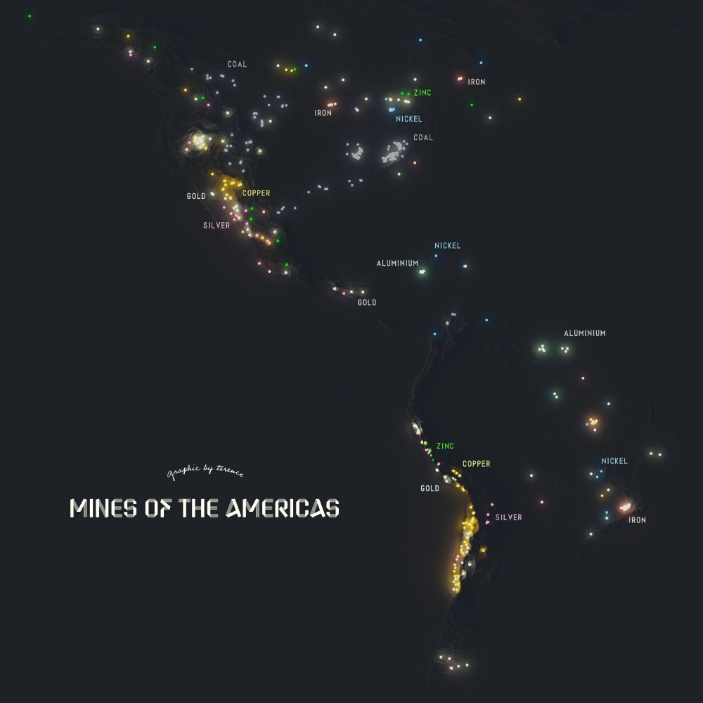
A visualisation of the mines of the Americas
Mines of the Americas.
#rayshader adventures, an #rstats tale
Hi BlueSky community! If you’re hiring for GIS/ carto positions, do you mind threading them here? I am trying to help friends who have been recently laid off to find opportunities. I appreciate you!
05.02.2025 23:56 — 👍 24 🔁 8 💬 3 📌 0
cover page of Minneapolis Star Tribune: July 5, 1942. top half shows map of north pole with trade routes. bottom half shows detailed map of Alaska. textbox header reads “the strategy of Alaska is based on modern aviation”

Small map globe view of the pacific, showing Alaska’s close proximity to Asia. Text reads: The strategy of Alaska is based on modern aviation. It took the modern long-distance bomber to make Alaska a strategic area in this first global war. On the great circle (shortest) route between America and Asia, Alaska may be the outpost of United States defense against Japan—or it may be a springboard for United States attack on Japan. Realization of Alaska's important position in the Pacific war theater (see globe) is difficult for persons who think in terms of flat maps. In the Arctic regions the tight, sharp curves of the earth work many strange wonders on distances, wonders that air-minded U. S. military strategists are not overlooking in the case of Alaska. That's why troops, planes and supplies are reinforcing Alaska almost every 24 hours. "He who holds Alaska," said the late General William Mitchell, "holds the world."

Close-up screenshot of map detail, showing Alaskan panhandle and Alaska’s huge size in comparison to the contiguous U.S. Annotation reads: On Alaskan “panhandle” are forests which could supply one-quarter of United States’ newsprint perpetually.

Close-up screenshot of where Alaska and Asia meet, separated only by the narrow Bering Strait. We see the international date line between the continents, with a “Sunday” label on Asian side and “Saturday” label on Alaskan side. Also on the Alaskan side, an annotation reads “United States’ only tin deposits — still underdeveloped.”
Mappy hour find!
Front page of the Minneapolis Sunday Tribune and Star Journal on July 5, 1942.
Cartographer: Warner S. Nelson
Link to full, zoomable map in thread
Only in Louisiana
21.01.2025 17:10 — 👍 1 🔁 1 💬 0 📌 0


OK wow this is historic! Blizzard conditions in parts of Louisiana
21.01.2025 16:18 — 👍 0 🔁 0 💬 0 📌 0