Some very stormy charts continue to be shown for Friday by the global models - there remains great uncertainty on exact positioning and potential intensity of the winds. Location will matter on areas at greatest risk of strongest of the winds.
Eyes peeled on the models!
20.01.2025 23:39 — 👍 4 🔁 0 💬 1 📌 0


THUNDERSTORM OUTLOOK
VALID: Tomorrow, 26th September
More info: www.instagram.com/p/DAW0QSdiBLE/
25.09.2024 22:19 — 👍 14 🔁 1 💬 0 📌 0

THUNDERSTORM OUTLOOK
VALID: Today
Interactive map: ukwxupdates.org
More info: www.instagram.com/p/DALV3XLClzZ/
[UPDATE 1] Thunderstorms are expected to develop again through this afternoon, some of which may be locally strong.
21.09.2024 11:19 — 👍 10 🔁 0 💬 0 📌 0

THUNDERSTORM OUTLOOK
VALID: Tomorrow, 20th September
Interactive map: ukwxupdates.org
More info: www.instagram.com/p/DAGfQ18C8pw/
[UPDATE 1] A trough moving through tomorrow afternoon, with embedded instability, will allow the development of thundery showers and thunderstorms.
19.09.2024 14:04 — 👍 4 🔁 0 💬 0 📌 0

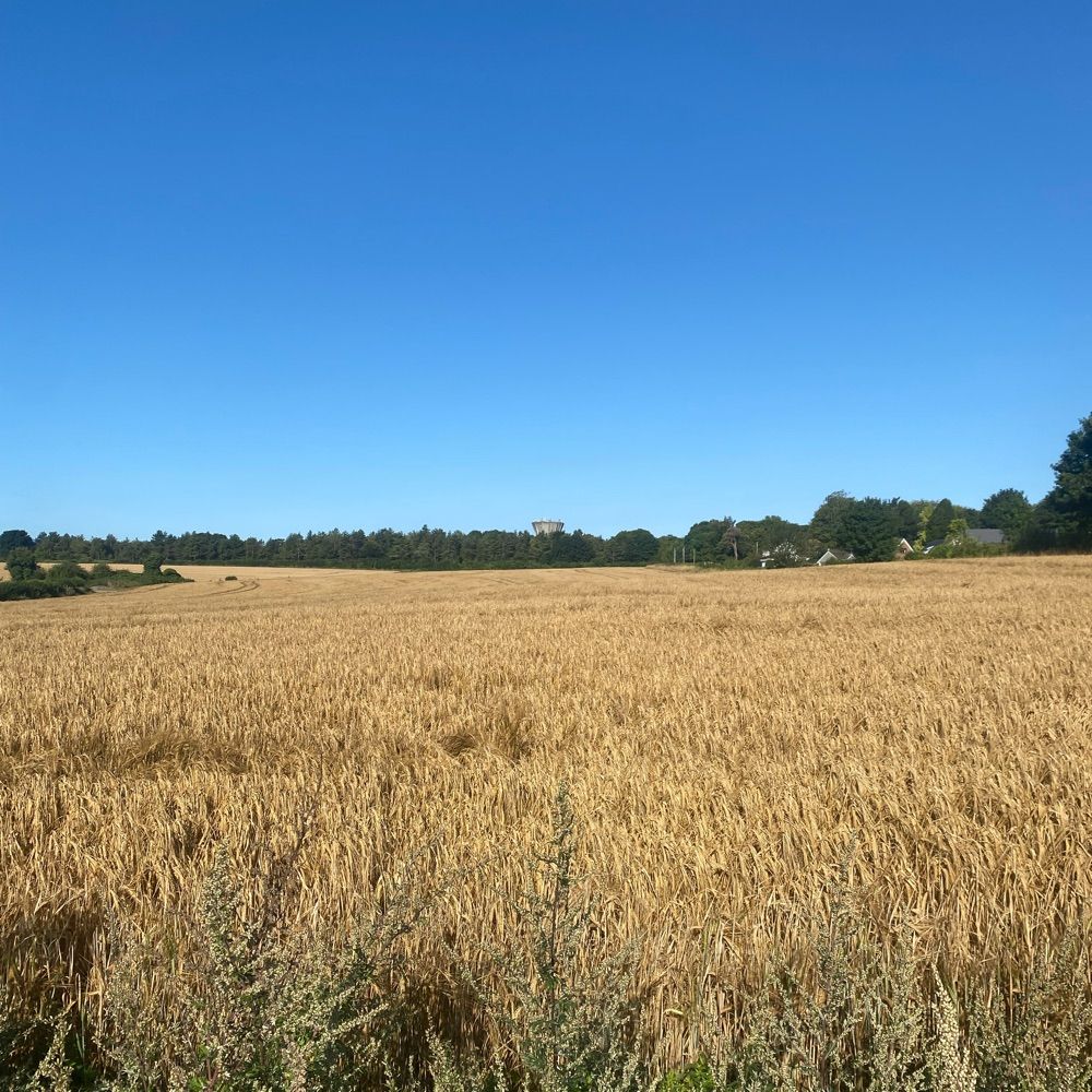
A sunshine and shower kind of day again - less windy today so could fly the drone up and catch this passing heavy shower ☔️
12.09.2024 15:22 — 👍 7 🔁 0 💬 0 📌 0

THUNDERSTORM OUTLOOK
VALID: Tomorrow, 6th September
Interactive map: ukwxupdates.org
More info: www.instagram.com/p/C_iMn87C-Lp/
[UPDATE 1] Through early tomorrow morning, with an unstable air continuing to be present, this is likely to bring a further risk of thunderstorms.
05.09.2024 11:48 — 👍 0 🔁 0 💬 0 📌 0

THUNDERSTORM OUTLOOK
VALID: Tomorrow, 1st September
Interactive map: ukwxupdates.org
More info: www.instagram.com/p/C_WCbEaij84/
[UPDATE 1] Significant uncertainty remains on thunderstorm development, if any, through tomorrow afternoon.
31.08.2024 18:29 — 👍 3 🔁 0 💬 0 📌 0
Meteorological summer ends tomorrow, and what a rather uneventful summer it's been in terms of weather for me! The only real things I will take away from this summer's weather is end of July heat, thunderstorms on 1st August and Storm Lilian.
30.08.2024 13:01 — 👍 3 🔁 1 💬 1 📌 0
Significant discrepancies arise just 5 days out with how this weakness plays out, as undoubtedly, the positioning of the resulting disturbance (or the 'green blob of doom' as I like to call it) will matter on how warm it gets.
29.08.2024 12:42 — 👍 2 🔁 0 💬 0 📌 0


All that build of high pressure just for us to sit under the 'green blob' of doom thanks to a weakness in the ridging. 🧐
One of many possible outcomes as we go into this weekend and start of next week.
26.08.2024 19:13 — 👍 6 🔁 2 💬 0 📌 1

Please be aware that currently the weather
24.08.2024 13:26 — 👍 1 🔁 0 💬 0 📌 0

It is a different disturbance that has developed courtesy of an active jet after Ernesto's passage this morning. The remnants of Ernesto have been largely consumed by the larger more dominant low to the east of Iceland, while Lilian is a discreet intensifying area of low pressure.
22.08.2024 18:15 — 👍 1 🔁 0 💬 2 📌 0

#StormLilian located just to the west of Ireland at the moment
22.08.2024 18:04 — 👍 5 🔁 0 💬 1 📌 0

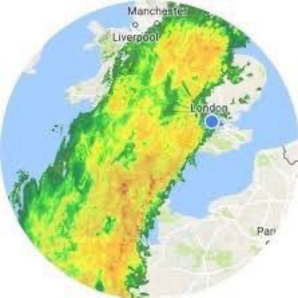
Possible rainfall totals over the next 72 hours ☔️
22.08.2024 18:01 — 👍 6 🔁 1 💬 0 📌 1
With #StormLilian being named, that brings this storm season's storm count to 12, beating 2015/16's 11 to become the most active storm season so far.
Additionally, Lilian is the 5th named storm in August and the 2nd latest named storm on record, just beaten by Francis (2020) named on 24th August.
22.08.2024 10:31 — 👍 7 🔁 1 💬 1 📌 1

ChatGPT does not mess around 🫢
20.08.2024 10:40 — 👍 4 🔁 2 💬 2 📌 0

#Ernesto remains a hurricane at a relatively high latitude of 43.8°N (similar latitude to just off the northern coast of Spain).
19.08.2024 21:42 — 👍 6 🔁 1 💬 0 📌 0


Going to be a windy one tomorrow afternoon through the majority of the country. Widespread heavy showers in the NW, some, potentially a bit thundery.
19.08.2024 21:27 — 👍 3 🔁 2 💬 1 📌 0

Weather we so love is back ☔️
19.08.2024 12:29 — 👍 5 🔁 0 💬 0 📌 0


Wildfires from Canada making for a murky sunset here in the UK. Cheeky shot of an airplane on the right of course!
18.08.2024 19:40 — 👍 6 🔁 1 💬 0 📌 1


The jet stream behind Ernesto's passage will become quite enhanced - while not a washout, could be a rather showery and breezy period of weather through 22nd-26th.
16.08.2024 11:39 — 👍 7 🔁 1 💬 0 📌 0


A small risk of some thundery downpours around the Home Counties tomorrow - UKV showing a somewhat greater extent of thundery showers.
13.08.2024 21:27 — 👍 6 🔁 1 💬 0 📌 0

Could be quite a wet night for a few places tonight within this area, varied model outputs, but below is the UKV for 4am. Some quite heavy rain mixed in with that. ☔️
13.08.2024 08:02 — 👍 8 🔁 0 💬 0 📌 0

Lightning strikes over the past 32 hours. ⚡️
Over 20000 lightning strikes!
12.08.2024 14:18 — 👍 11 🔁 0 💬 0 📌 0

From left to right.
1. Convective rain associated with the cold front
2. Trough likely to become fairly active and bring a risk of thunderstorms into Scotland
3. Model failure to forecast such extensive shower development. Risk of thunderstorms with all of this; locally large hail possible.
12.08.2024 02:53 — 👍 7 🔁 0 💬 0 📌 1
ITV Meteorologist and Weather Presenter
Previously Met Office
STEM Climate Ambassador
All views my own. He/him 🌈☀️
chrispage.co.uk
Steve Amateur weather enthusiast, tradesman, sports fan .
Age: 22, hobbies: Weather crazy, love football, love Palace, FM addict! Currently work as a graduate meteorologist!
I record weather data. Sometimes photos/timelapses of what the weather is doing in my area and occasional forecasts when I've got time. https://www.weatherlink.com/embeddablePage/show/3a59b11cb4864b229cf642bccb2faedc/fullscreen
Meteorological stats and phenomena for East London. FRMetS
Conditions https://www.weatherlink.com/embeddablePage/show/e3a1d9968b954a97895098a26bd9fbe9/slim
AKA @wanstead_meteo over on X
A privately supported organisation, founded in 1974, which carries out research into high impact convective weather in the UK.
www.torro.org.uk
Latest short, medium and long range weather forecasts for the UK from GavsWeatherVids (GWV) owner Gavin Partridge.
Find all our daily weather videos here: https://www.youtube.com/c/GavsWeatherVids
Forecasting Thunderstorms & Convective events within the British Isles. Forecasted by a small group of amateur meteorologists.
Weather forecasts for #London #Essex #Kent #Sussex #Suffolk #Norfolk. Readings taken from a PWS on Canvey Island.
𝗦𝗶𝗺𝗼𝗻 • 𝗠𝟳𝗪𝗪𝗫 • 𝟯𝟮𝟯.𝟬𝟰 𝗽𝗽𝗺
𝗜𝗻𝗱𝗲𝗽𝗲𝗻𝗱𝗲𝗻𝘁 #𝗪𝗲𝗮𝘁𝗵𝗲𝗿 𝗦𝘁𝗮𝘁𝗶𝗼𝗻 𝗻𝗲𝗮𝗿 𝗪𝗶𝗺𝗯𝗼𝗿𝗻𝗲 #𝗗𝗼𝗿𝘀𝗲𝘁 🇬🇧
• #WX • #Meteorology • #Clouds
• #Climate • #ClimateChange
• #Astronomy • #AstroPhotography
• #Radio • #Satellite
⚠️ 𝗣𝗲𝗿𝘀𝗼𝗻𝗮𝗹 𝗮𝗰𝗰𝗼𝘂𝗻𝘁!
🌍 wessexweather.net
Weather shenanigans et al https://patreon.com/TheSnowDreamer?utm_medium=clipboard_copy&utm_source=copyLink&utm_campaign=creatorshare_fan&utm_content=join_link
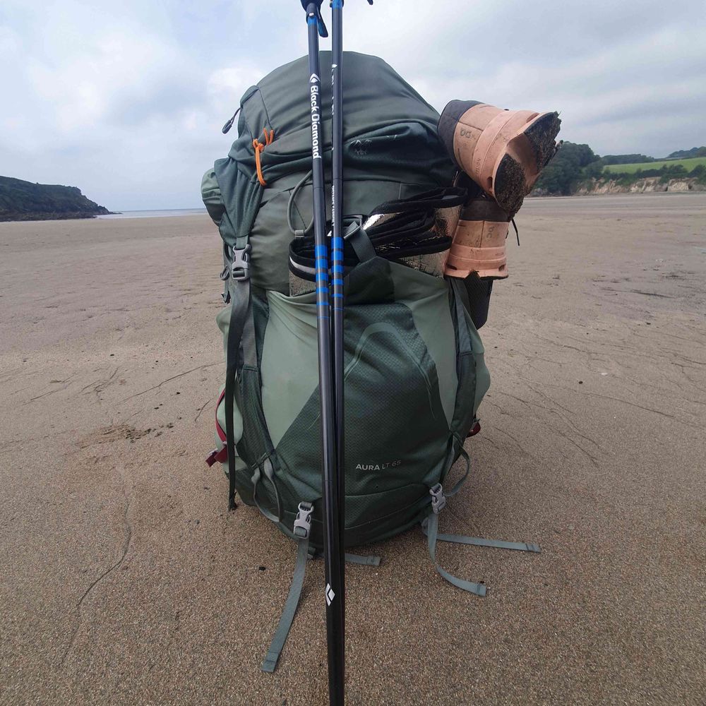
TORRO tornado site investigator, maths tutor, keen hiker, mediocre runner. Connecting home to towns across the UK by foot. Loves weather!
BSc MSc
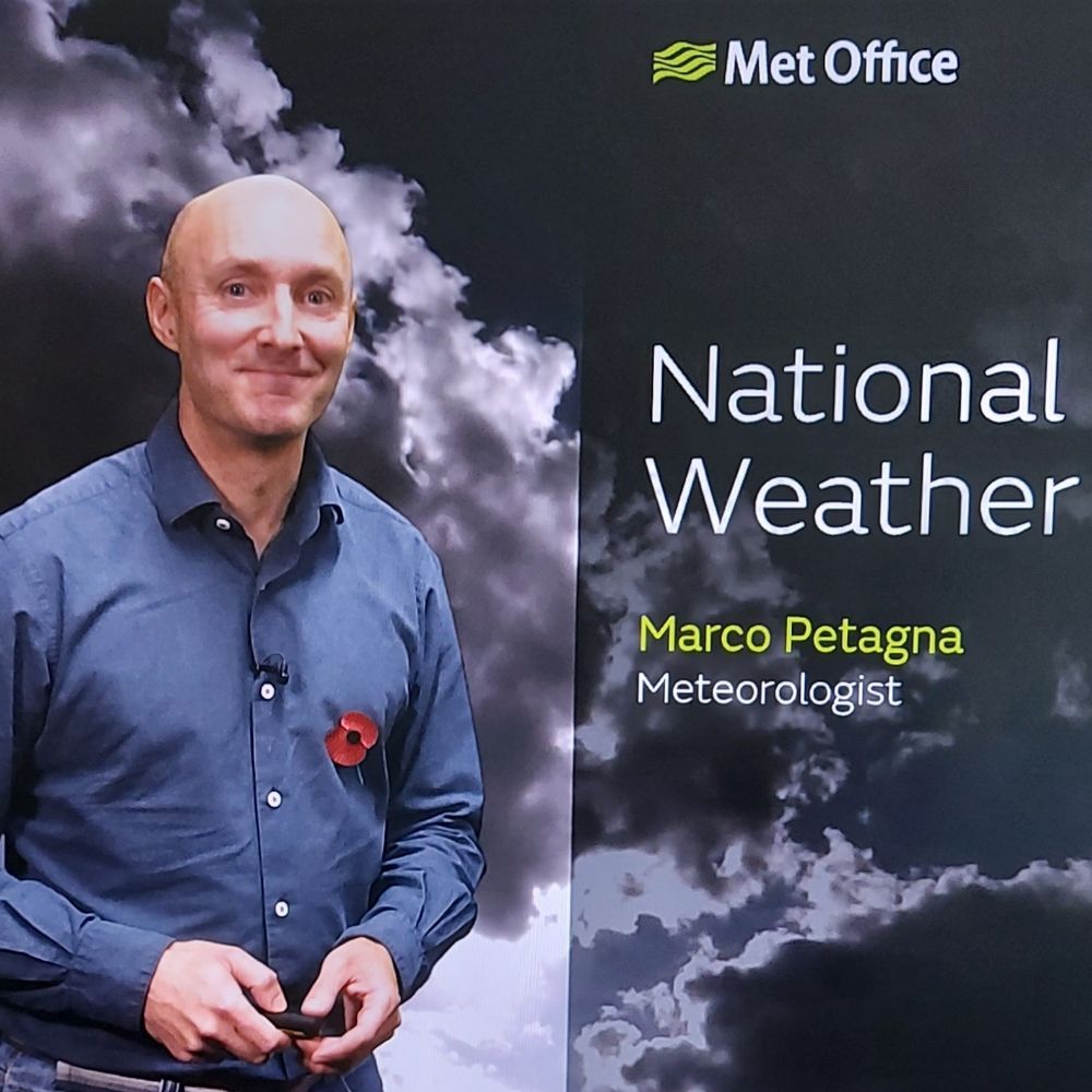
Media Advisor & Senior Operational Meteorologist UK Met Office
Parent to 2 mini daxies
Love running
Views & opinions my own
@Petagna on X
Mainly focused on covering extreme weather events worldwide. Also interested in climate dynamics, geohazards and satellite remote sensing.
Also on X: x.com/wxnb_
Mad into weather and tech capturing any interesting sky phenomena.
Tweet about weather and sometimes astro stuff
Weather forecasts and warnings for somerset & Bristol plus international weather news and breaking news stories.
Short range forecasts and real time updates for the UK/Ireland • Est 2008 • Report snowfall at http://report.snowwatch.org • Support: https://ko-fi.com/uksnowwatch ☕
2023 was Netweather's 20th year! We're a leading independent UK weather forecasting co, run by a small, friendly team. https://www.netweather.tv