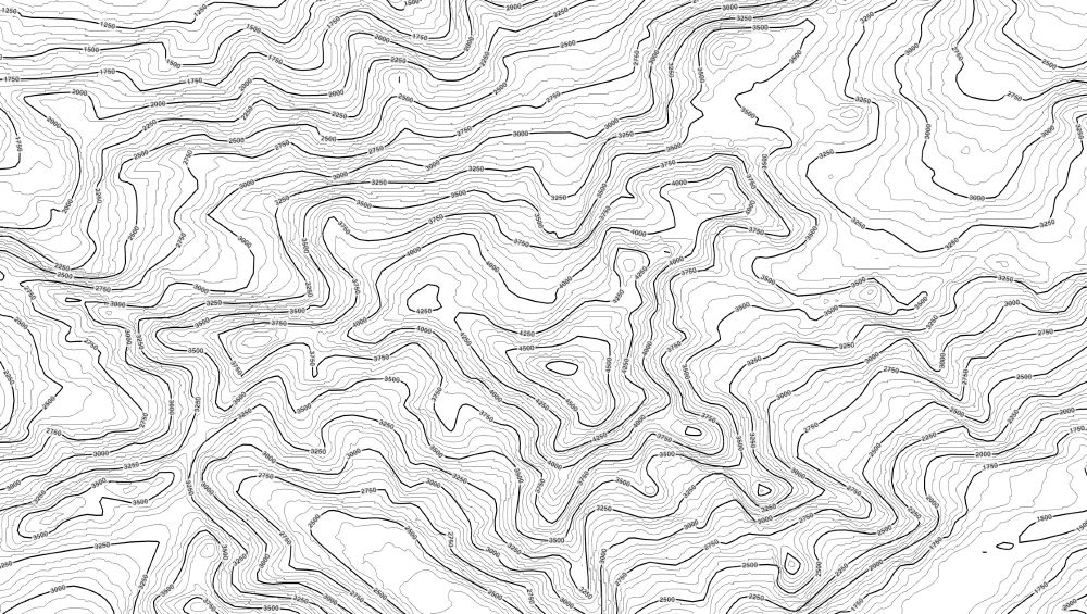
You can use three.js as GIS to render contour lines from a Geotiff with customizable labels! Work in progress.
(P.S. can you tell where this might be? ;) ) #gischat

@domegis.bsky.social
GIS, Geo Data Science, GeoAI, LLMs & NLP Democratizing Geodata & Tools
You can use three.js as GIS to render contour lines from a Geotiff with customizable labels! Work in progress.
(P.S. can you tell where this might be? ;) ) #gischat
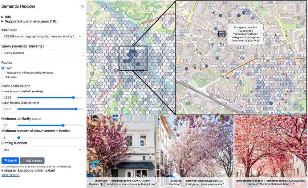
A map of Bonn with hotspots for cherry blossom trees based on geospatial semantic search
Paper Alert!
"Embedding-Based Multilingual Semantic Search for Geo-Textual Data in Urban Studies," is published in @springernature.com
I developed an open-source, lightweight method to map phenomena using natural language, like "cherry blossom spots" or "skate parks" with VGI. Demos:
geo.rocks/gss
Announcing sff: A fast, on-the-fly SemanticFileFinder written in Rust! 🦀
Scans a dir, finds most semantically relevant files & chunks (model2vec-rs). No vector DBs, no GPU needed. Index ~2500 files w 10k chunks in 250ms. Search your notes
𝚌𝚊𝚛𝚐𝚘 𝚒𝚗𝚜𝚝𝚊𝚕𝚕 𝚜𝚏𝚏
𝚜𝚏𝚏 "𝚠𝚘𝚛𝚔𝚒𝚗𝚐 𝚠𝚒𝚝𝚑 𝚐𝚒𝚝"
github.com/do-me/sff
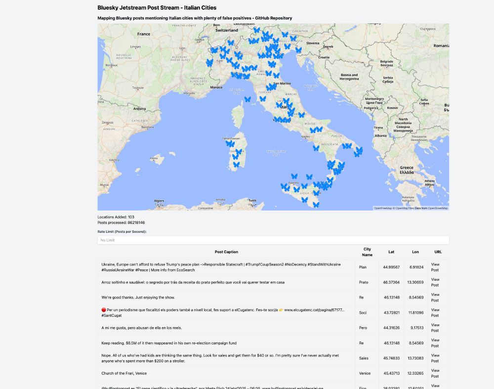
I streamed 86M bluesky posts in my browser from their open jetstreams and naively mapped all mentioned Italian cities.
Even though most of them are false positives, it was still a fun app to build!
do-me.github.io/bluesky-ital...
It's a pity bluesky doesn't offer proper location tagging.
#gischat
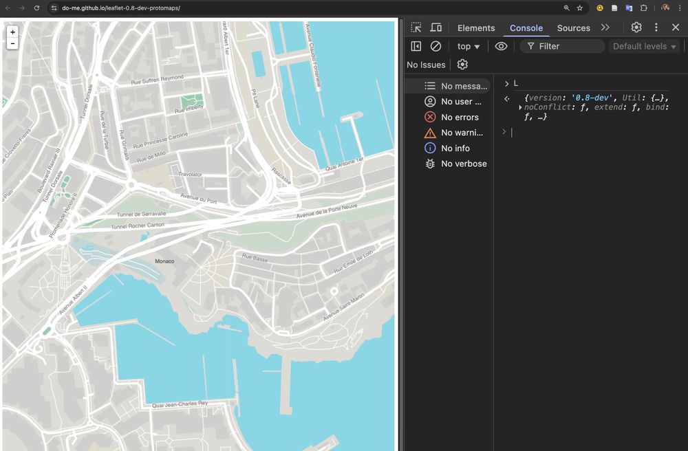
Leaflet 0.8-dev from 10 years ago with a high performance @protomaps.com basemap canvas renderer from 2025? Yes it works 😅
So if you have legacy systems running where you don't have the resources to upgrade you can still replace costly raster tile APIs.
github.com/do-me/leafle...
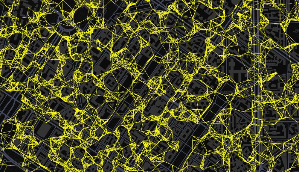
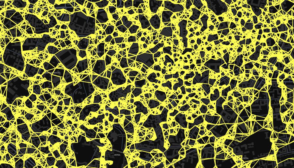
Geospatial graphs have something inherently artsy! Working on large POI DBs at the moment but I'm just too fascinated by these patterns...
#gischat
New blog post! Spatially filter Foursquare's >100.000.000 rows (10Gb GeoParquet file) in 22 seconds with DuckDB.
geo.rocks/post/duckdb_...
#gischat #duckdb #geopandas
After a couple of hours of fixing xcode-related errors I finally managed to bundle my basemap app for iOS.
Using @maplibre.org, @bkgbund.bsky.social bund.bsky.social
free world vector tiles and
@komoot.bsky.social Photon geocoder. Next is Android & a more advanced feature set. youtu.be/sONjXU4eRss
Bundle geospatial apps with Rust-based tauri. Secure, cross-platform, small sizes and apps open instantly. Check out this minimal app for MacOS I built based on @maplibre.org, @bkgbund.bsky.social's free world vector tiles and @komoot.bsky.social's Photon geocoder.
www.youtube.com/watch?v=b0tN...
🌍 #30DayMapChallenge Day 29. Data: Overture – Multilingual Geospatial Semantic Search 🔍
Ever wanted to query places around the world in your local language?
E.g.
- "예술적인 장소" in Mongolia
- "Футбол" in Uganda
App: do-me.github.io/overture-pla...
More Info: www.linkedin.com/posts/domini...
#gischat
👋
28.11.2024 08:34 — 👍 1 🔁 0 💬 0 📌 0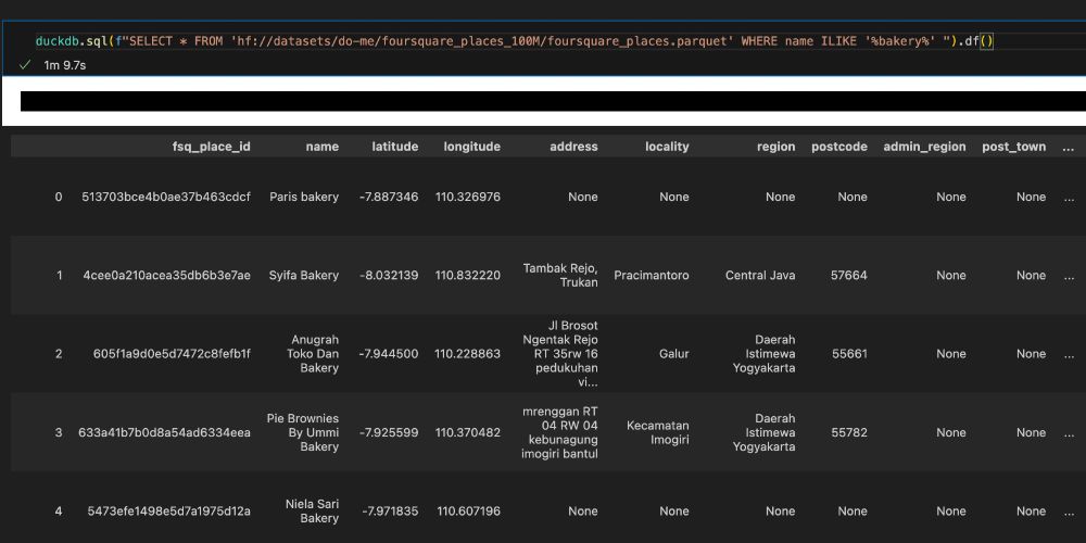 23.11.2024 16:48 — 👍 0 🔁 0 💬 0 📌 0
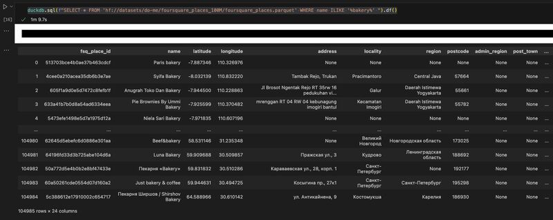
Query Foursquare's 100M OS places in a one-liner with DuckDB without downloading! huggingface.co/datasets/do-...
23.11.2024 16:45 — 👍 6 🔁 0 💬 1 📌 0