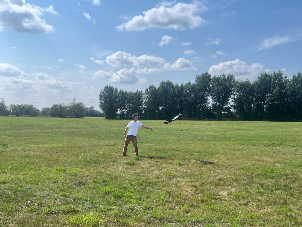
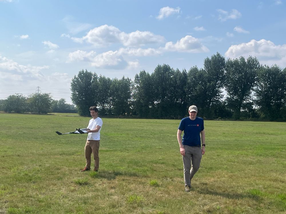
A photo of a man launching the ebee UAV in a grassy field. There are trees in the distance and white fluffy clouds in a blue sky.
A photo of 2 men, one of them holding an ebee UAV, in a grassy field. There are trees in the distance and white fluffy clouds in a blue sky.
Made primarily of polystyrene they weigh just 1.6 kg on take-off, but despite this they are capable of operating in the stronger winds we experience down in the Antarctic with a maximum continuous wind limit of 17 m/s. In fact, yesterday we clocked a top ground speed of >63 mph!
2/2
01.08.2025 15:58 — 👍 1 🔁 1 💬 0 📌 0
MAGIC was out test flying our eBee VISION platforms in advance of the upcoming Antarctic field season this week. The eBee VISION UAVs can fly for 90 minutes and operate up to 20 km from the pilot. Here's a short clip of one of them in action! 🛩️
1/2
01.08.2025 15:58 — 👍 2 🔁 1 💬 1 📌 1
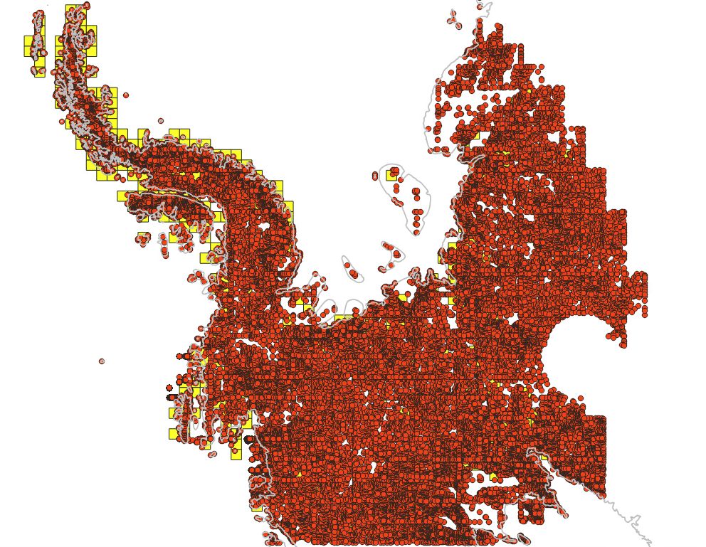
A screenshot of 59,261 spot heights in West Antarctica and the Antarctic Peninsula. This is the initial version, before reducing the density. Each point is shown as a red dot, the coastline of Antarctica is displayed as a grey line, and the yellow squares are the extent of some of the REMA tiles.
Lots of dots! These are spot heights generated for our Air Operations Planning Maps, using REMAv2 2m tiles. Next steps are to clean up the density, add existing GPS points & then add them to our maps, which are used for planning by pilots across the continent. The data will then be openly published!
30.07.2025 09:08 — 👍 2 🔁 2 💬 1 📌 0
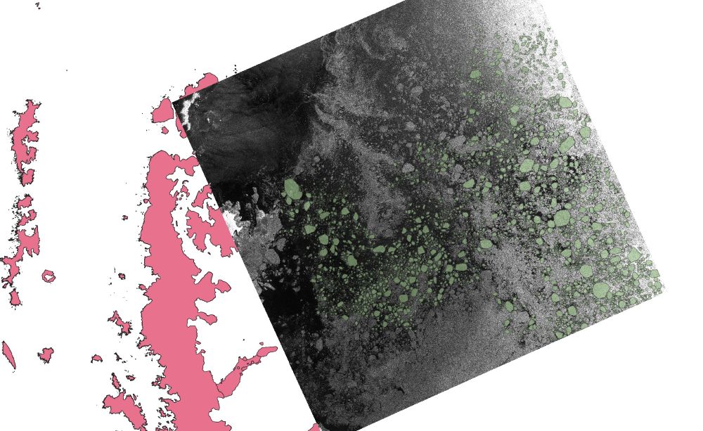
A screenshot of a SAR image at the north-east end of the Antarctic Peninsula. The digitised ice floes are highlighted in semi-transparent green. The image is from 31st Dec. 2020.
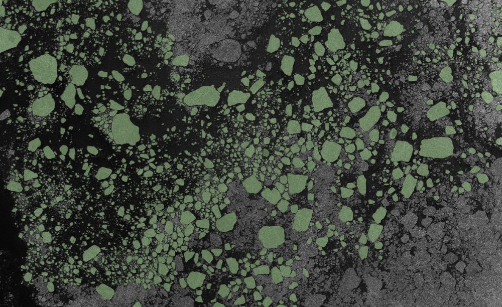
A zoomed in portion of the SAR image in the Weddell Sea. The digitised ice floes are highlighted in semi-transparent green. The image is from 31st Dec. 2020.
We are currently hosting an intern digitising ice floes from satellite radar (SAR) imagery in the Weddell Sea.
The resulting labelled data will be used in the NERC DEFIANT and QUASAR projects to assess the performance of machine learning methods and quantify errors in sea ice concentration data.
24.07.2025 14:26 — 👍 4 🔁 1 💬 0 📌 1
Just finished building a gazetteer search component on top of the ArcGIS SearchViewModel! Its running off of a set of geoserver WFS services with a custom locator layer source! Working really neatly! #ArcGIS #Maps
24.07.2025 17:05 — 👍 3 🔁 0 💬 0 📌 1
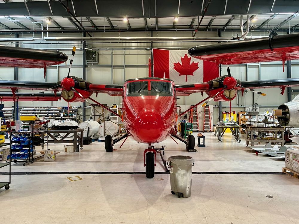
A photo of BAS's red Twin Otter plane in a hangar/workshop. A Canadian flag can be seen in the background.
We have been working along with engineers from Phase One and Rocky Mountain Aircraft over the past week to install and test our new Phase One PAS aerial camera into BAS's Twin Otter aircraft. 🛩️
1/3
14.07.2025 13:34 — 👍 7 🔁 3 💬 1 📌 0
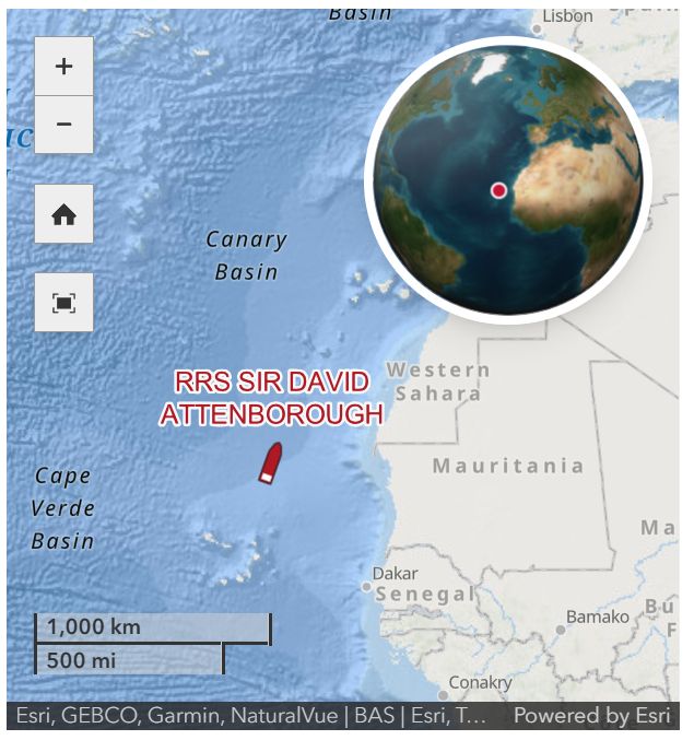
A screenshot of a map showing the location of the RRS Sir David Attenborough, travelling north off the west of Africa. A globe inset shows the location in a wider context.
Did you know that it's possible to follow the RRS Sir David Attenborough on @bas.ac.uk's website? We provide the maps and location tracking to underpin this. 🚢🗺️
See the latest position of the ship here, on its way north after a long season in Antarctica! www.bas.ac.uk/polar-operat...
09.07.2025 16:29 — 👍 9 🔁 4 💬 0 📌 0
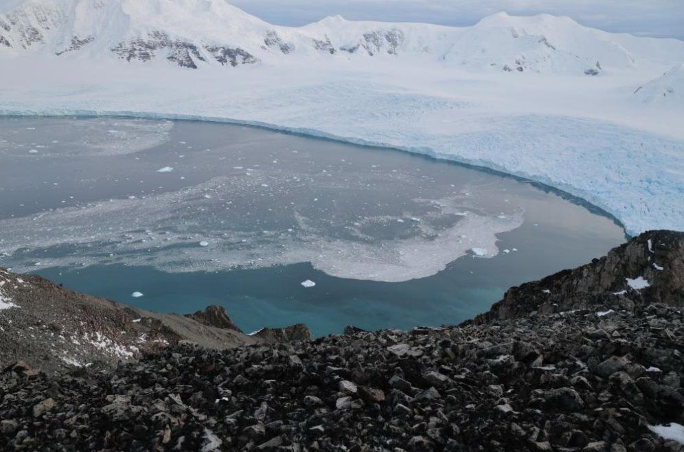
Photo looking from Stork Ridge down to Sheldon Glacier showing part of the view that our fixed cameras will capture. The image shows the view from a rocky outcrop looking down on a crevassed glacier with water in front of small icebergs are floating in the water.
This week we have been at a @polomints.bsky.social project meeting, planning details of how to use fixed stereo cameras, RPAS and our new air camera to monitor calving of the Sheldon Glacier on Adelaide Island. For more information visit polomints.ac.uk.
04.07.2025 13:50 — 👍 5 🔁 3 💬 0 📌 0
A snapshot of a map application showing the pixel difference highlighted during an automated testing run. The difference shows that some labels are no longer being rendered on the map at certain positions.
Whilst updating an app to the latest version of the ArcGIS JS API (4.33) we picked up a minor regression in labelling for a super niche situation. I would call that one epic win for our automated testing setup! Check out our setup here: github.com/antarctica/e... #Arcgis #Dev #Playwright
03.07.2025 17:11 — 👍 0 🔁 0 💬 1 📌 0
I’ve used it a lot. GitHub copilot integration has got a lot better in normal vscode, but still doesn’t feel as intuitive and seamless as cursor for me… the tab multi line complete is just so slick!
25.06.2025 22:28 — 👍 1 🔁 0 💬 0 📌 0
I always like to get in early with implementing a responsive UI - usually it means that the actual extra code is pretty minimal! #arcgis #responsive
25.06.2025 15:02 — 👍 2 🔁 0 💬 1 📌 0
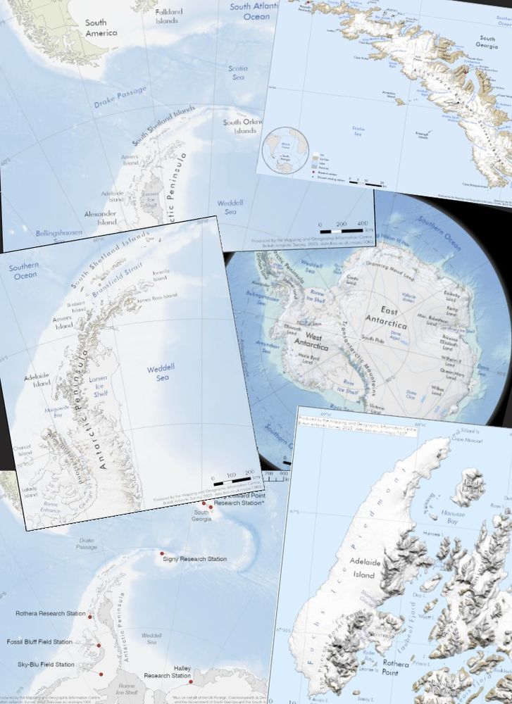
6 small maps of regions in Antarctica and South Georgia. These are examples of typical Helpdesk outputs from the job being advertised. Each map contains place names, bathymetry in shades of blue, and terrain details on land.
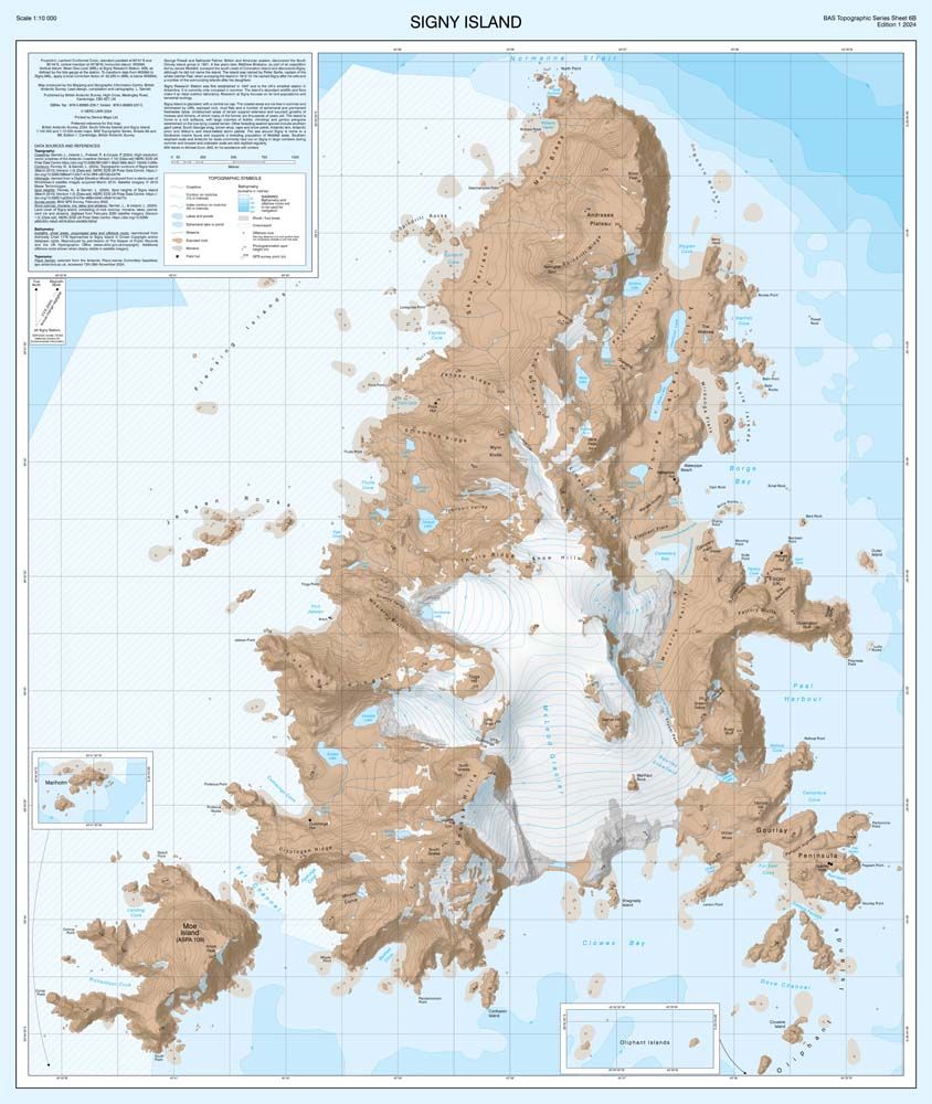
A map of Signy Island, South Orkney Islands. This map is part of our BAS Topographic Map Series. Bathymetry is shown in deepening shades of blue. Details on the land include ice and moraine extent, lakes, contours, and place names.
We're hiring a GIS and Mapping Specialist to manage our Geospatial Helpdesk and to contribute to our Topographic Map Series.
This is a really exciting opportunity at the British Antarctic Survey to support colleagues across the organisation. Details here: shorturl.at/bA4fd #GISjobs
25.06.2025 08:31 — 👍 10 🔁 10 💬 0 📌 1
We've been developing a new application with ArcGIS Maps SDK to create a simple UX for exploring our imagery archive - We pull on lots of the existing widget view models but tweak them to create out own workflow and design system. Map and workflow logic is orchestrated by XState. #arcgis #arcgisdev
24.06.2025 10:20 — 👍 5 🔁 1 💬 1 📌 0
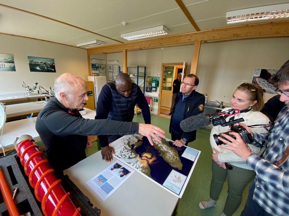
A photo of Dr Robert Mulvaney showing a map of of Ny-Ålesund and the Kongsfjorden region in Svalbard to visitors at the NERC Arctic Office. The visitors include the UK Foreign Secretary Rt Hon David Lammy and his Norwegian counterpart Espen Barth Eide. The photo shows 5 people stood around a map laid on a table, with one man filming.
Great to see our map used by UK Foreign Secretary Rt Hon David Lammy and Espen Barth Eide during their visit to the @ukarcticoffice.bsky.social in Ny-Ålesund recently. With summer/winter versions, it shows how fast the region changes and why frequent, detailed mapping in the Arctic is so important.
12.06.2025 16:05 — 👍 6 🔁 1 💬 0 📌 0
29.05.2025 19:03 — 👍 0 🔁 0 💬 0 📌 0
Sewage Map
Real-Time Sewage Discharge Monitoring | Sewage Map - Stay Updated on Sewage Pollution
Just finished a little refresh of Sewagemap.co.uk. Added a fun loader, and additional layer filtering bits and bobs! It continues to show a bleak picture of sewage overflow in the uk... 💩😔 #sewage #uk #arcgis
29.05.2025 18:58 — 👍 2 🔁 0 💬 1 📌 0
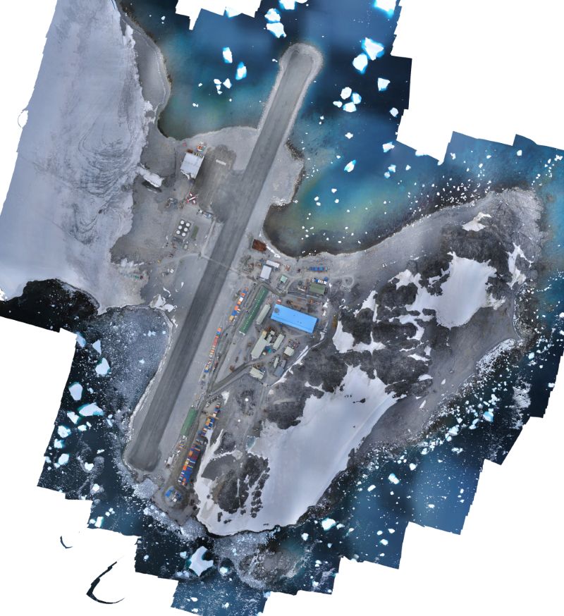
An image of Rothera Research Station, Rothera Point, on Adelaide Island. There is a bright blue building in the centre of the image which is the new Discovery Building. You can also see patches of snow on the point, and there are small icebergs floating in the surrounding water.
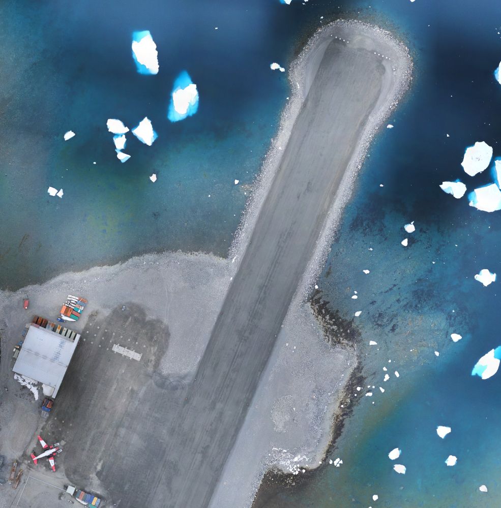
A zoomed in portion of the image, showing the northern end of the runway and the hangar. A white and red plane can also be seen, parked next to the hangar.
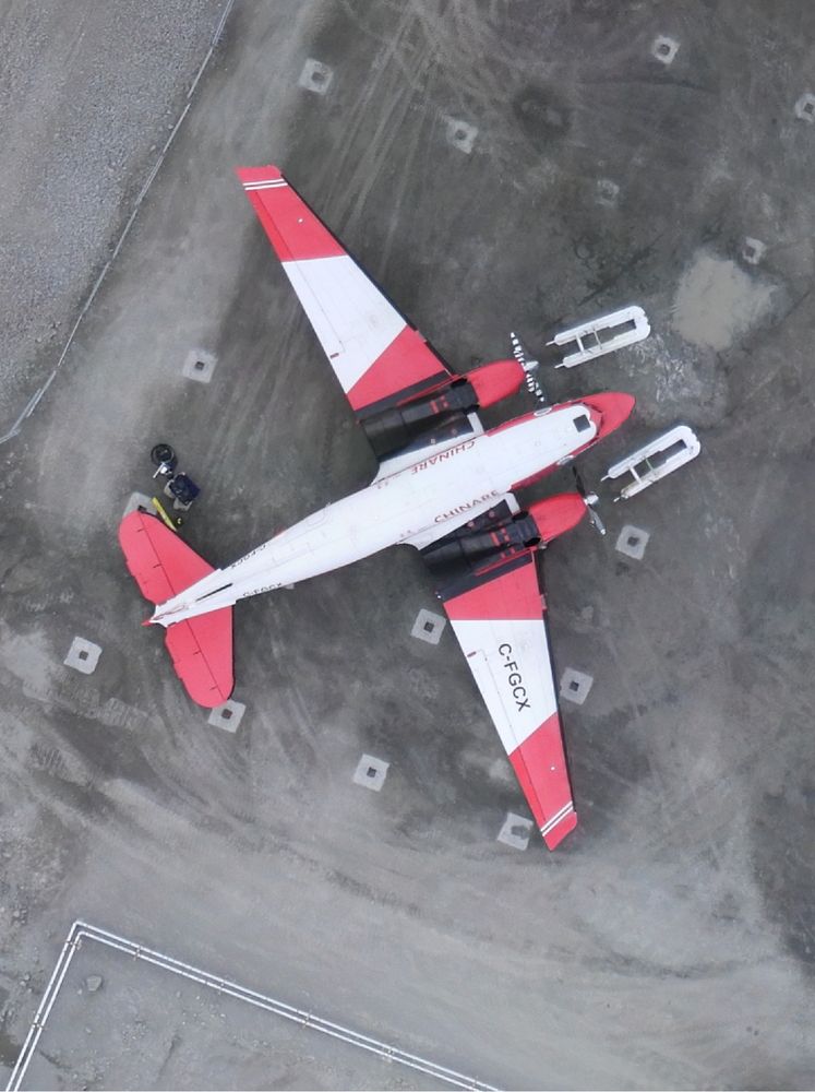
A zoomed in photo of the plane. The plane is red and white. It is possible to see skis in front of it, probably removed from the plane as it continues its journey north away from Antarctica.
A few months ago, we surveyed Rothera Point using our fixed-wing eBee-X UAV. We've now processed the data and produced this beautiful, orthorectified mosaic, as well as a Digital Elevation Model.
We carry out these surveys every year, allowing all of BAS to work with current and accurate data!
29.05.2025 09:54 — 👍 9 🔁 3 💬 0 📌 0

Text reads "eternal reminder that you may go to settings and then accessibility to enable required alt text, so you'll never forget again. it's the right thing to do."
27.05.2025 17:48 — 👍 39 🔁 15 💬 7 📌 1
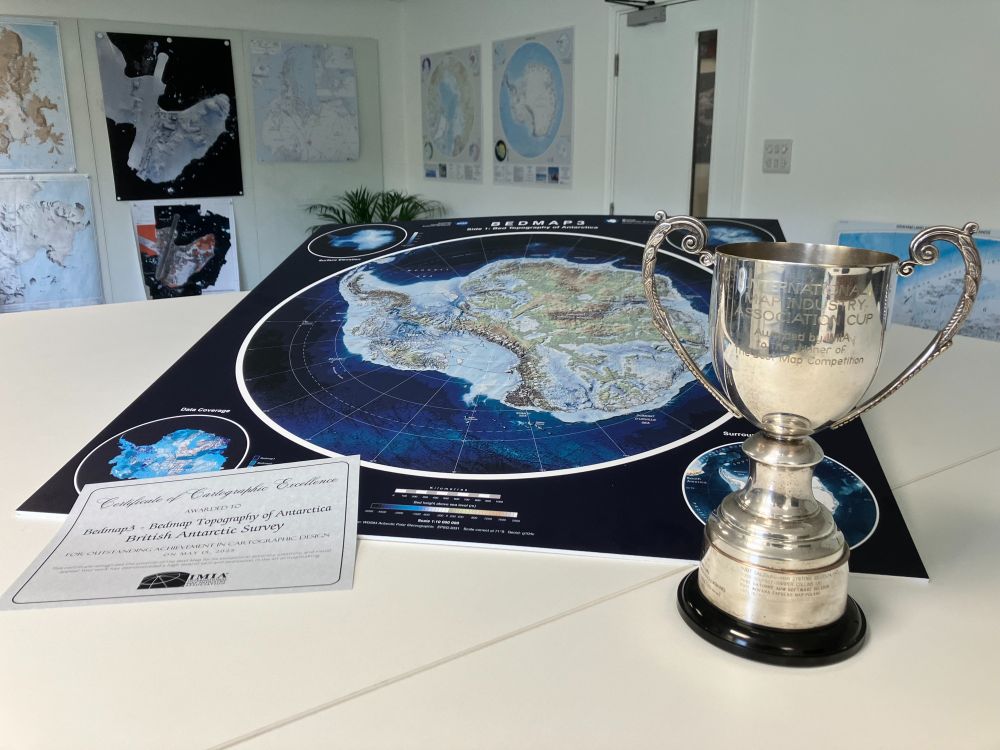
A photo of the trophy and certificate, with side A of the Bedmap 3 map shown behind. The map shows the bed topography of Antarctica underneath the ice.
We're proud to share that our Bedmap3 map won "Best Map" at the International Map Industry Association (IMIA) forum in London last week! 🏆
This international award celebrates Outstanding Cartographic Design & we’re honoured to be recognised alongside leading names in the field from previous years. 🗺️
21.05.2025 15:20 — 👍 32 🔁 8 💬 3 📌 2
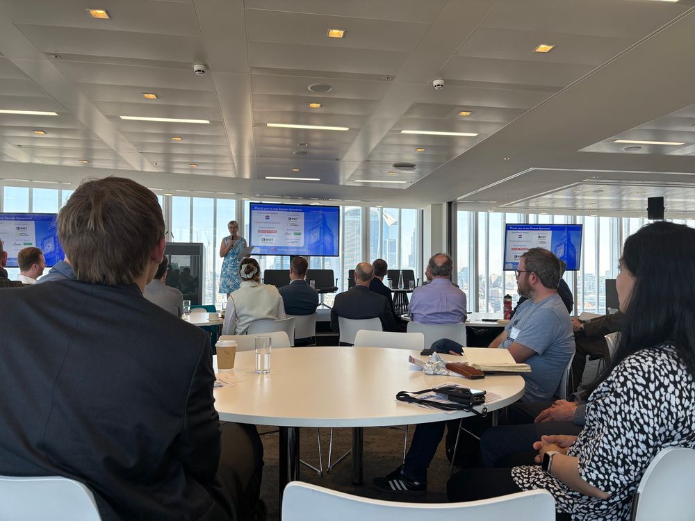
Vivien Godfrey introducing the 2 day event. There are round tables with people sitting around them, and 3 screens at the front.

Showing our map of of ‘The Shackleton Crossing’ route on South Georgia to someone.
Photo taken by David at SplashMaps.
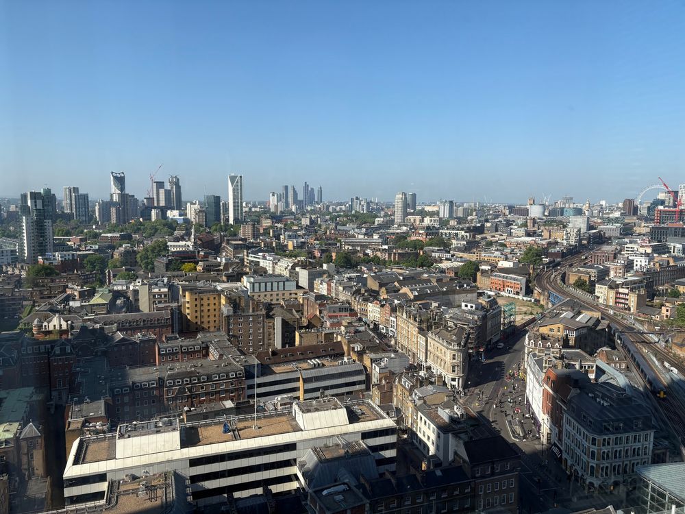
A view of London. Many tall buildings can be seen and the sky is a bright blue.
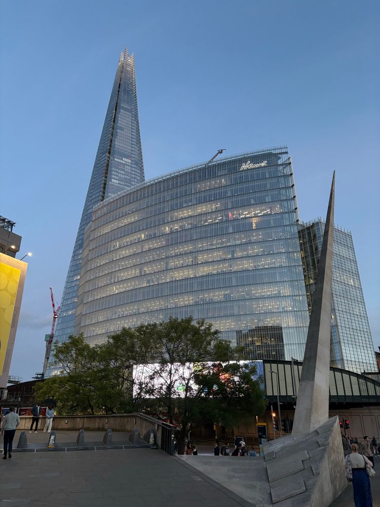
A photo of the News Building with the Shard behind it. The event is taking place at Harper Collins, inside the News Building.
It has been a busy week for conferences this week! One of our GIS Specialists presented at the IMIA Mapping Leaders Forum in London yesterday. It has been a useful few days talking to some world-leading map publishers and printers and we’ve gained lots of ideas on how we can do more with our maps!
15.05.2025 12:48 — 👍 4 🔁 2 💬 0 📌 0
Effective immediately, the PGC is no longer accepting new NSF-supported requests due to a lack of renewal funding. Current work is wrapping up. Please contact your NSF program officer if impacted. We’re grateful to have supported your polar research. Read our full statement at www.pgc.umn.edu
05.05.2025 21:33 — 👍 72 🔁 31 💬 2 📌 13
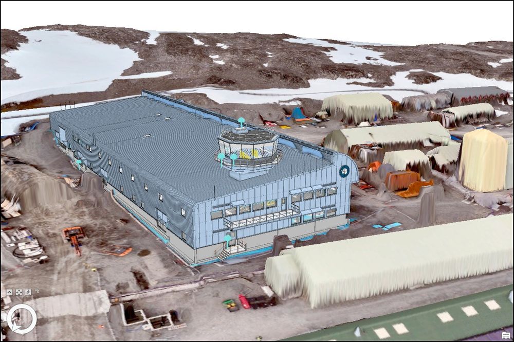
Virtual 3D scene of Rothera Station, Antarctica comprising a 3D model of Discovery Building, aerial imagery and elevation model. The Discovery Building is a pale blue and has an air traffic control tower on top. Other buildings can be seen around Rothera. The background of the image shows rocky and icy terrain.
📢 We're hiring a GIS Specialist to support the Antarctic Infrastructure Modernisation Programme.
This is a really exciting opportunity at the British Antarctic Survey for someone to help us integrate GIS and BIM for infrastructure projects in Antarctica.
Details here: shorturl.at/Mf983
29.04.2025 13:00 — 👍 5 🔁 2 💬 0 📌 0
Really swish - do you think the caret disappearing on mobile might be a bit of a usability issue? I’m always hesitant to do too much with hover events because I’m afraid I might break the mobile experience.
26.04.2025 15:36 — 👍 3 🔁 0 💬 1 📌 0
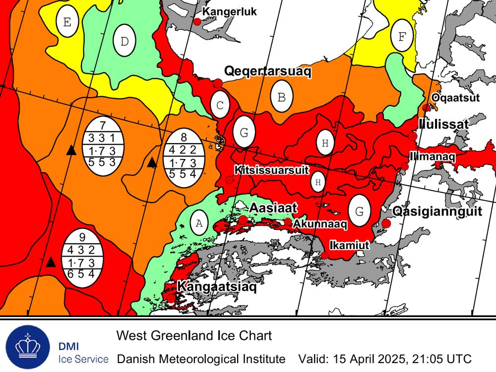
Ice chart titled “West Greenland Ice Chart” produced by the Danish Meteorological Institute (DMI), valid as of 15 April 2025 at 21:05 UTC. The map displays the ice conditions along the west coast of Greenland.
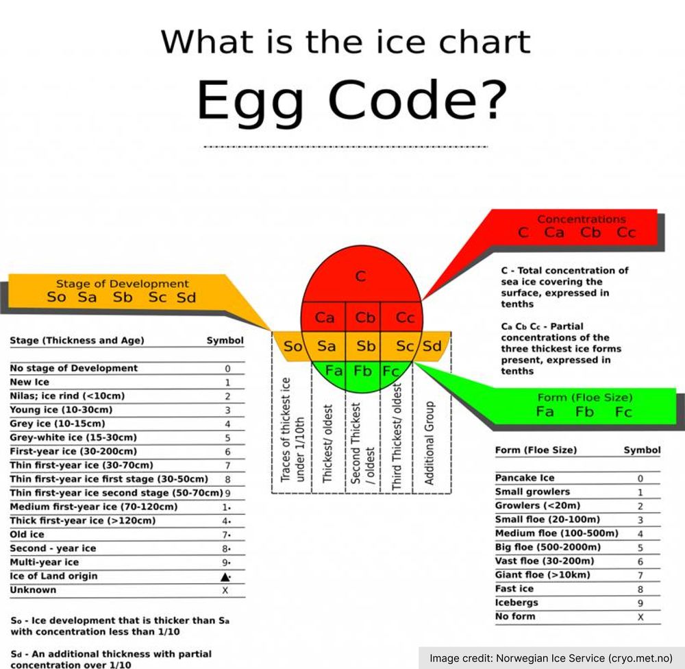
Diagram titled “What is the ice chart Egg Code?” explaining how to interpret the egg code used in sea ice charts. The central egg-shaped graphic is divided into labelled sections representing different attributes of sea ice.
You might have spotted oval symbols on sea ice charts.
They’re not Easter eggs 🐣 — but they 𝘥𝘰 contain something inside: a compact summary of ice concentration, thickness, and floe size.
18.04.2025 08:32 — 👍 7 🔁 2 💬 1 📌 1
A surveyor stood on a rocky outcrop running a GPS. The sky is grey, there is a rocky mountain in the background, and ice in the foreground.
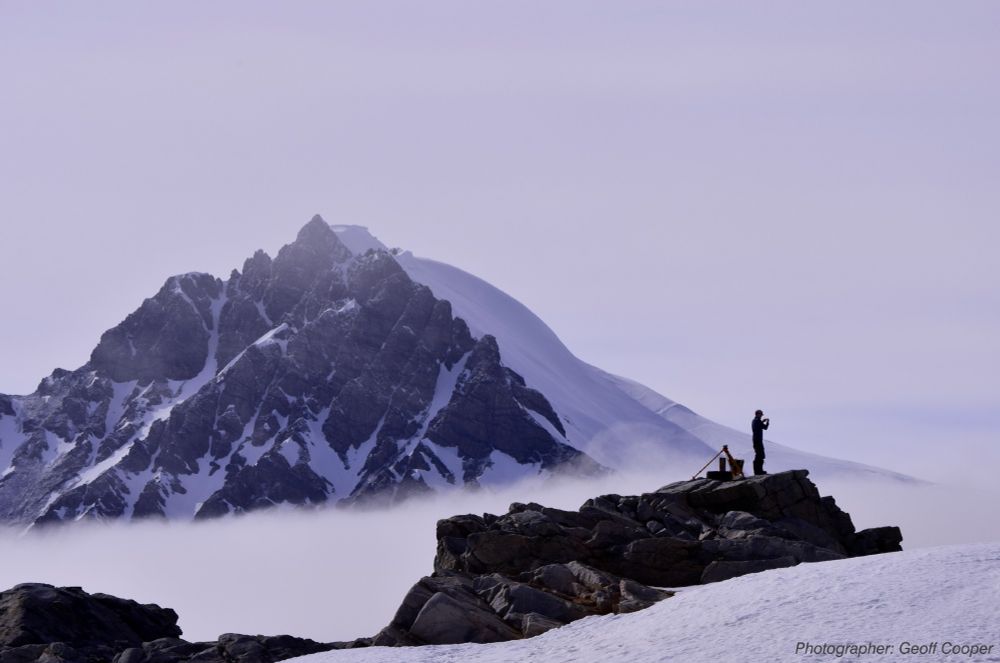
📢 We are looking for a Geomatics Surveyor to join our team at the British Antarctic Survey. 📢
Are you a surveyor with experience of collecting & managing geospatial survey data? Would you like to get the opportunity to work at Rothera Research Station? Apply today!
Details here: shorturl.at/RwAZV
10.04.2025 15:56 — 👍 7 🔁 9 💬 0 📌 3
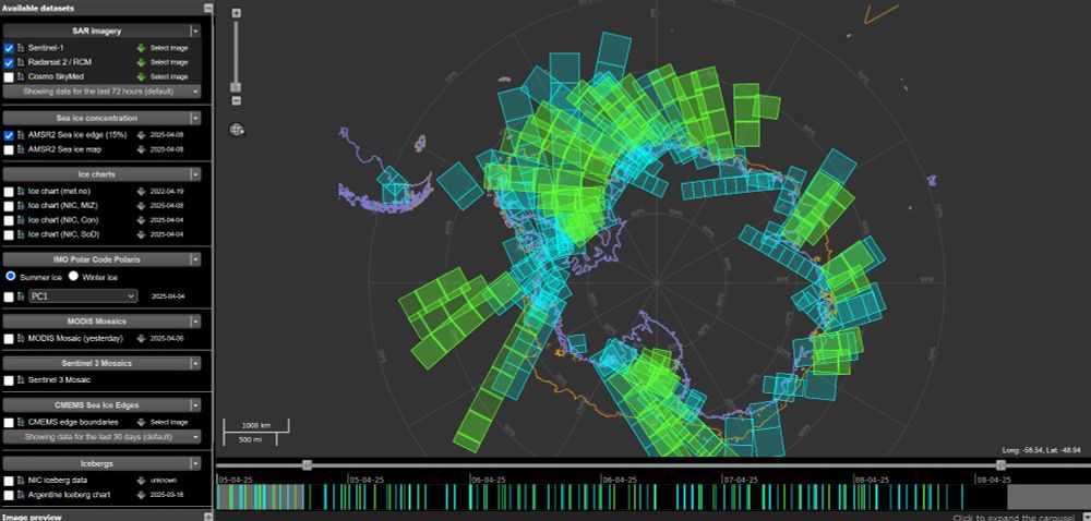
A screenshot of https://www.polarview.aq/antarctic showing the footprints of Sentinel 1 and Radarsat Constellation Mission (RCM) products in turquoise and yellow colours respectively.
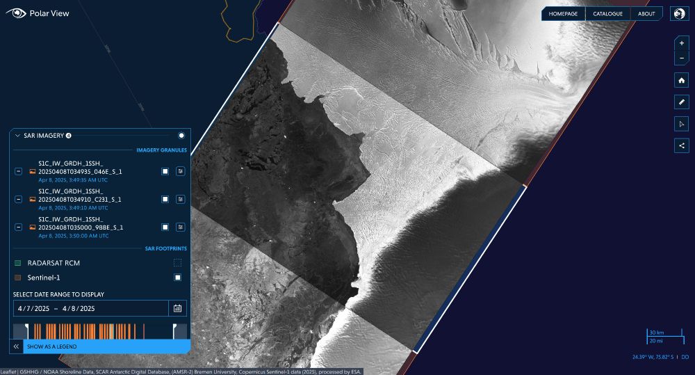
A screenshot of https://www.icelogistics.info/antarctic showing a Sentinel-1C image of the Brunt Ice Shelf displayed on the map viewer. Sea ice is dark black and hazy grey shades, and the ice shelf is brighter grey and white. Details of the images can be seen in a pop up.
🎉 Imagery from the newly launched Sentinel-1C Copernicus satellite is now accessible via Polar View www.polarview.aq and the Ice Logistics Portal www.icelogistics.info/antarctic?ce...! This addition significantly increases the repeatability of SAR observations in the Polar Regions 🛰️
08.04.2025 16:48 — 👍 27 🔁 9 💬 1 📌 2
Thanks, this is a fantastic resource! I definitely want to try this out in my next project...
It definitely is a much more holistic approach to my current workflow of breakpoints and fontsize tweaks.
01.04.2025 10:50 — 👍 1 🔁 0 💬 0 📌 0
Whats your thoughts on varying font size like this? My worry would be that there are accessibility considerations linked with font-size scaling unless some kind of minimum clamp was added...
01.04.2025 09:46 — 👍 0 🔁 0 💬 2 📌 0
#CSS ex-Google Chrome DevRel, CSSWG, co-host The CSS Podcast, host @ GUI Challenges, co-host Bad@CSS Podcast.
Creator of VisBug, open-props.style, gradient.style, transition.style & more
UI, UX, CSS, HTML, JS
https://nerdy.dev
Putting the Arctic sea ice record straight
Screw it, let's do it.
Proof it's the real me: https://www.linkedin.com/posts/rbranson_richard-branson-richardbransonbskysocial-activity-7267516793689124864--I14
Here's my blog: https://www.virgin.com/branson-
Romans, Archaeology, Museums, Typos.
We're not a villa and we don't do Latin.
Lecturer in Earth Sciences @es-ucl.bsky.social | Interested in rivers, mud, mountains, pollution, carbon cycling, quantitative methods, open science | alexlipp.github.io | www.sewagemap.co.uk | he/him | 🌍 🌱 🏔 🧗♂️ 🏕 🏃♂️
Web developer at @Octacom |
React - Laravel - Tanstack - Panda css
French 🇫🇷
Design Engineer and Educator
Building Chakra UI ⚡️, Panda CSS 🐼, and Zag.js ⚙️
🎨 Design Systems - 🚀 Statecharts - 🛠 Dev tools
Creative developer • Freelancer • Teacher • 3D lover • https://bruno-simon.com • http://threejs-journey.com
Staff Engineer @nearform.com, open source fan, hacking on geospatial in my spare time. Lives in London
I am Head of MAGIC (Mapping and Geographic Information Centre) at the British Antarctic Survey. All things spatial - especially in cold places.
No NFTs, No A.I.
linktr.ee/sarahcandersen
Executive Performance Coach. Doc of Psych. Compared to Wendy Rhoades of Billions via WSJ.
Private client work currently on waitlist only.
Newsletter -> http://drgurner.substack.com
design educator & aspiring princess 💖 building an alternative design school: designisaparty.com
Illustrator & funny comic strip maker ✍️
Get my book, calendar, prints & more 👇
www.amiiillustrates.com
🌹 Comics by Elizabeth Pich & Jonathan Kunz 🌹
Patreon: https://www.patreon.com/warandpeas
Shop: https://warandpeas.com/shop/
cyanide & happiness, explosm, that kinda stuff
We facilitate international research on the Antarctic and Southern Ocean and provide independent scientific advice.
www.scar.org
We're an academic team of Research Data Specialists enabling data-intensive and data-informed research across disciplines
@unimelb www.unimelb.edu.au/mdap
Hank of Decline
Patreon - http://patreon.com/hausofdecline
Store - https://hausofdecline.bigcartel.com/
Not the real Prime Minister. I survive on coffee:
https://ko-fi.com/:parody_pm