And again some more red sail magic from this summer…
I’m far to be done with the Greenland folders, so except more red sails & ice images 😅.

@cschammelwx.bsky.social
Weather nerd, storm chaser in ATX area Software engineer, CIRA
And again some more red sail magic from this summer…
I’m far to be done with the Greenland folders, so except more red sails & ice images 😅.
UTTERLY SURREAL LOW ANGLE GLACIER SLIDE!! 😮😱
On Saturday at 11:00 am, a 2 km-long, 25 m-high, and 150-200 m in width section detached off the Ismoil Somoni Glacier (Tajikistan) and slid down the gorge! 🧊🌊
asiaplustj.info/en/node/354309
📽️ via @volcaholic1

Seismic recording that shows horizontal lines with a slight wiggle to them.

Horizontal lines across the page that get thicker with wiggles near the bottom of the page.

The horizontal lines are very thick.

The page is almost black because of the thickness of the lines.
4 days of seismic records from a seismic station in Jamaica shows Hurricane Melissa roaring towards the island.
Hurricanes increase the amplitude of ocean waves which beat on the coast and sea floor. These produce Rayleigh waves that can be seen as increasingly thick “wiggles” in seismic records 🧪

1. Jamaica: Remain sheltered! Catastrophic flash flooding, landslides, and destructive winds will continue through today, causing widespread infrastructure damage, power and communication outages, and isolated communities. Total structural failure is possible near the path of Melissa’s center. Along the southern coast, life-threatening storm surge and damaging waves are expected through the day. Failure to act may result in serious injury or loss of life. 2. Haiti and the Dominican Republic: Catastrophic flash flooding and landslides are expected across southwestern Haiti and southern portions of the Dominican Republic through midweek. In Haiti, extensive damage and isolation of communities is likely. Tropical storm conditions are expected later today and Wednesday. 3. Eastern Cuba: Heavy rainfall, flash flooding and landslides are expected soon. Life-threatening storm surge and damaging winds are likely to begin later today. Complete all preparations now. 4. Southeastern and Central Bahamas and the Turks and Caicos: Hurricane conditions, life-threatening storm surge, and heavy rainfall are expected across portions of the southeastern and central Bahamas on Wednesday. Complete preparations by tonight and follow local official guidance. Tropical storm conditions, heavy rains, and significant storm surge are expected in the Turks and Caicos Islands on Wednesday.
A 9am EDT update from the National Hurricane Center puts Melissa's sustained winds at 180 mph and moving NNE at 7 mph towards Jamaica, where it is expected to make landfall within the next few hours. Visit hurricanes.gov for the latest.
28.10.2025 14:01 — 👍 133 🔁 39 💬 3 📌 18Simply incredible imagery of Hurricane Melissa this morning as it approaches Jamaica.
28.10.2025 13:41 — 👍 319 🔁 160 💬 10 📌 17

Keep the people of Jamaica in your thoughts today. The 9am update from NHC has the pressure down to 896mb and peak winds at 180 mph, cementing Melissa as the 5th most intense hurricane on record in the Atlantic Basin.
28.10.2025 13:11 — 👍 257 🔁 61 💬 5 📌 2This meso loop of #Melissa from CIRA is absolutely stunning at it makes its closes in on landfall in southwestern Jamaica.
rammb-data.cira.colostate.edu/tc_realtime/...
#hurricanemelissa

000WTNT33 KNHC 271733TCPAT3 BULLETINHurricane Melissa Intermediate Advisory Number 25ANWS National Hurricane Center Miami FL AL132025200 PM EDT Mon Oct 27 2025 ...CATEGORY 5 MELISSA MOVING SLOWLY WEST-NORTHWESTWARD AND EXPECTED TO TURN NORTHWARD LATER TODAY......CATASTROPHIC AND LIFE-THREATENING WINDS, FLOODING, AND STORMSURGE EXPECTED ON JAMAICA TONIGHT AND EARLY TUESDAY... SUMMARY OF 200 PM EDT...1800 UTC...INFORMATION----------------------------------------------LOCATION...16.5N 78.3WABOUT 145 MI...230 KM SW OF KINGSTON JAMAICAABOUT 325 MI...525 KM SW OF GUANTANAMO CUBAMAXIMUM SUSTAINED WINDS...175 MPH...280 KM/HPRESENT MOVEMENT...WNW OR 285 DEGREES AT 3 MPH...6 KM/HMINIMUM CENTRAL PRESSURE...906 MB...26.76 INCHES WATCHES AND WARNINGS--------------------CHANGES WITH THIS ADVISORY: None. SUMMARY OF WATCHES AND WARNINGS IN EFFECT: A Hurricane Warning is in effect for...* Jamaica* Cuban provinces of Granma, Santiago de Cuba, Guantanamo, andHolguin. A Hurricane Watch is in effect for...* Southeastern and central Bahamas* Turks and Caicos Islands A Tropical Storm Warning is in effect for...* Haiti* Cuban province of Las Tunas A Hurricane Warning means that hurricane conditions are expectedsomewhere within the warning area. A warning is typically issued36 hours before the anticipated first occurrence oftropical-storm-force winds, conditions that make outsidepreparations difficult or dangerous. Preparations to protect lifeand property should be complete in Jamaica and rushed to completionin Cuba. A Hurricane Watch means that hurricane conditions are possiblewithin the watch area. A watch is typically issued 48 hoursbefore the anticipated first occurrence of tropical-storm-forcewinds, conditions that make outside preparations difficult ordangerous. A Tropical Storm Warning means that tropical storm conditions areexpected somewhere within the warning area within 36 hours. A Hurricane Warning may be required for portions of the Bahamas andthe Turks and Caicos islands later today or tonight. Interests inBermuda should also monitor the progress of Melissa. For storm information specific to your area, please monitorproducts issued by your national meteorological service. DISCUSSION AND OUTLOOK----------------------At 200 PM EDT (1800 UTC), the eye of Hurricane Melissa waslocated near latitude 16.5 North, longitude 78.3 West. Melissa ismoving toward the west-northwest near 3 mph (6 km/h). A slow turn toward the northwest and north is expected later today, followed by a turn toward the northeast and a faster forward speed on Tuesday. A northeastward motion is expected on Wednesday and Thursday. On the forecast track, the core of Melissa is expected to move over Jamaica tonight and early Tuesday, across southeastern Cuba Tuesday night, and across the southeastern Bahamas on Wednesday. Reports from an Air force Reserve Hurricane Hunter aircraft indicate that maximum sustained winds are now near 175 mph (280 km/h) with higher gusts. Melissa is a category 5 hurricane on the Saffir-Simpson Hurricane Wind Scale. Some fluctuations in intensity are likely before Melissa makes landfall on Jamaica on Tuesday. However, Melissa is expected to reach Jamaica and southeastern Cuba as an extremely powerful major hurricane, and will still be at hurricane strength when it moves across the southeastern Bahamas. Hurricane-force winds extend outward up to 30 miles (45 km) fromthe center and tropical-storm-force winds extend outward up to 195miles (315 km). The minimum central pressure estimated from the latest Air Force Reserve Hurricane Hunter aircraft data is 906 mb (26.76 inches). HAZARDS AFFECTING LAND----------------------Key messages for Melissa can be found in the Tropical CycloneDiscussion under AWIPS header MIATCDAT3 and WMO header WTNT43 KNHC. WIND: Tropical storm conditions are occurring in Jamaica, andcatastrophic and life-threatening hurricane-force wind conditionsare expected to begin tonight and continue into early Tuesday.Within the eyewall, total structural failure is likely, especiallyin higher elevation areas where wind speeds atop and on the windwardsides of hills and mountains could be up to 30 percent stronger. Tropical storm conditions are expected to begin in eastern Cuba onTuesday, with hurricane conditions expected to begin in thehurricane warning area by Tuesday evening. Tropical storm conditionsare expected in Haiti late Tuesday and Wednesday. Tropical storm and hurricane conditions are possible in thesoutheastern and central Bahamas, as well as the Turks and CaicosIslands, on Wednesday. RAINFALL: Melissa is expected to bring rainfall of 15 to 30 inchesto portions of Jamaica and additional rainfall of 8 to 16 inches forsouthern Hispaniola through Wednesday, with storm total local maximaof 40 inches possible. Catastrophic flash flooding and numerouslandslides are likely. For eastern Cuba, storm total rainfall of 15 to 20 inches, withlocal higher amounts, is expected by Monday into Wednesday resultingin life-threatening and potentially catastrophic flash flooding withnumerous landslides. Over the Southeast Bahamas, total rainfall of 4 to 8 inches isexpected Tuesday into Wednesday resulting in areas of flashflooding. For a complete depiction of forecast rainfall associated withMelissa, please see the National Weather Service Storm TotalRainfall Graphic, available athurricanes.gov/graphics_at3.shtml?rainqpf STORM SURGE: A life-threatening storm surge is likely along the south coast of Jamaica tonight and on Tuesday. Peak storm surge heights could reach 9 to 13 feet above ground level, near and to the east of where the center of Melissa makes landfall. This storm surge will be accompanied by large and destructive waves. On the northwest coast of Jamaica, near Montego Bay, there is the possibility of 1 to 3 feet of storm surge above ground level. There is a potential for significant storm surge along the southeastcoast of Cuba late Tuesday or Wednesday. Peak storm surge heightscould reach 7 to 11 feet above normal tide levels, near and to theeast of where the center of Melissa makes landfall. This storm surgewill be accompanied by large and destructive waves. Storm surge of 4 to 6 ft above normally dry ground is possible inthe southeastern Bahamas and Turks and Caicos Islands on Wednesday. SURF: Swells generated by Melissa are expected to affect portions ofHispaniola, Jamaica, eastern Cuba, and the Cayman Islands during thenext several days, and the Bahamas, the Turks and Caicos Islands,and Bermuda later this week. These swells are likely to causelife-threatening surf and rip current conditions. Please consultproducts from your local weather office. NEXT ADVISORY-------------Next complete advisory at 500 PM EDT. $$Forecaster Beven

Hurricane Melissa 5-Day Uncertainty Track Image

Hurricane Melissa 34-Knot Wind Speed Probabilities
Atlantic Hurricane Melissa Intermediate Advisory Number 25a
...CATEGORY 5 MELISSA MOVING SLOWLY WEST-NORTHWESTWARD AND EXPECTED TO TURN NORTHWARD LATER TODAY... ...CATASTROPHIC AND LIFE-THREATENING WINDS, FLOODING, AND STORM SURGE EXPECTED ON JAMAICA TONIGHT AND EA...
Additional Details Here.
FGF issues Public Information Statement (PNS) at Oct 6, 9:30 AM CDT ...Enderlin Tornado #1 Upgraded to EF-5... via IEMbot
Additional Details Here.
Anvil crawler heaven here in the stratiform precip region of a thunderstorm cluster southeast of Champaign, IL
17.08.2025 05:04 — 👍 26 🔁 3 💬 1 📌 0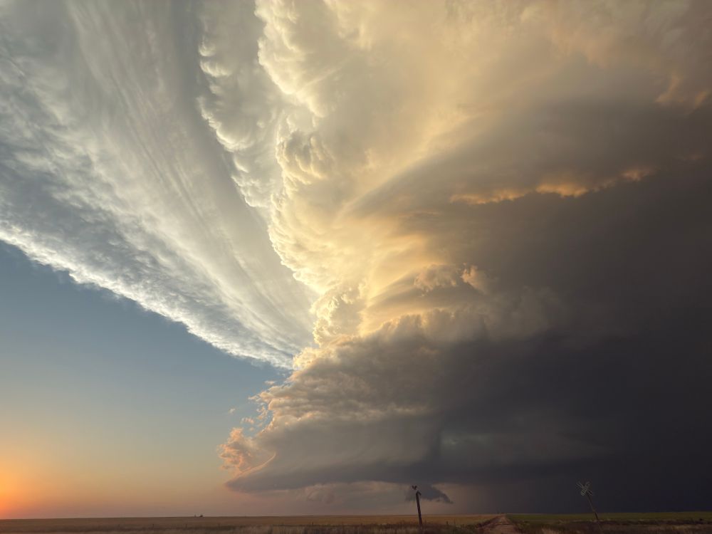
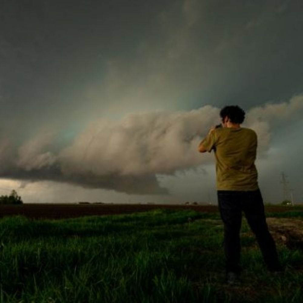
incredible north of Keyes #okwx
04.08.2025 01:43 — 👍 339 🔁 32 💬 8 📌 1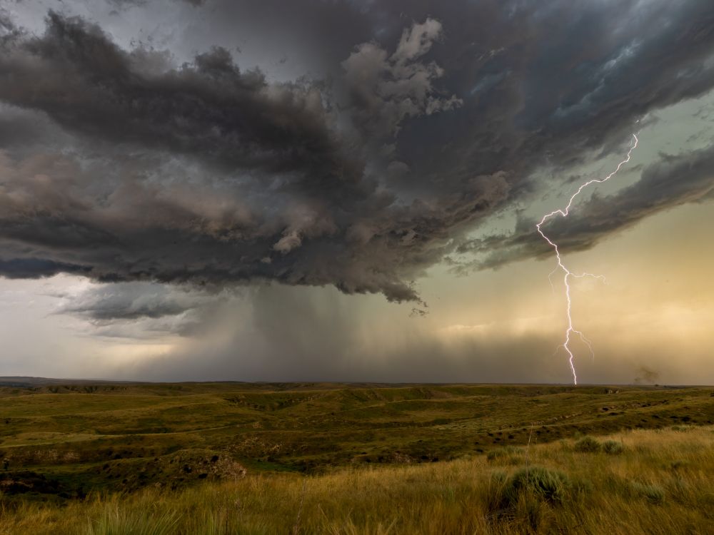
A building supercell over an area known as "Little Grand Canyon" of Nebraska; a gentle canyon with hilly grass sides.
"Little Grand Canyon" of Nebraska
04.08.2025 17:26 — 👍 77 🔁 18 💬 0 📌 0
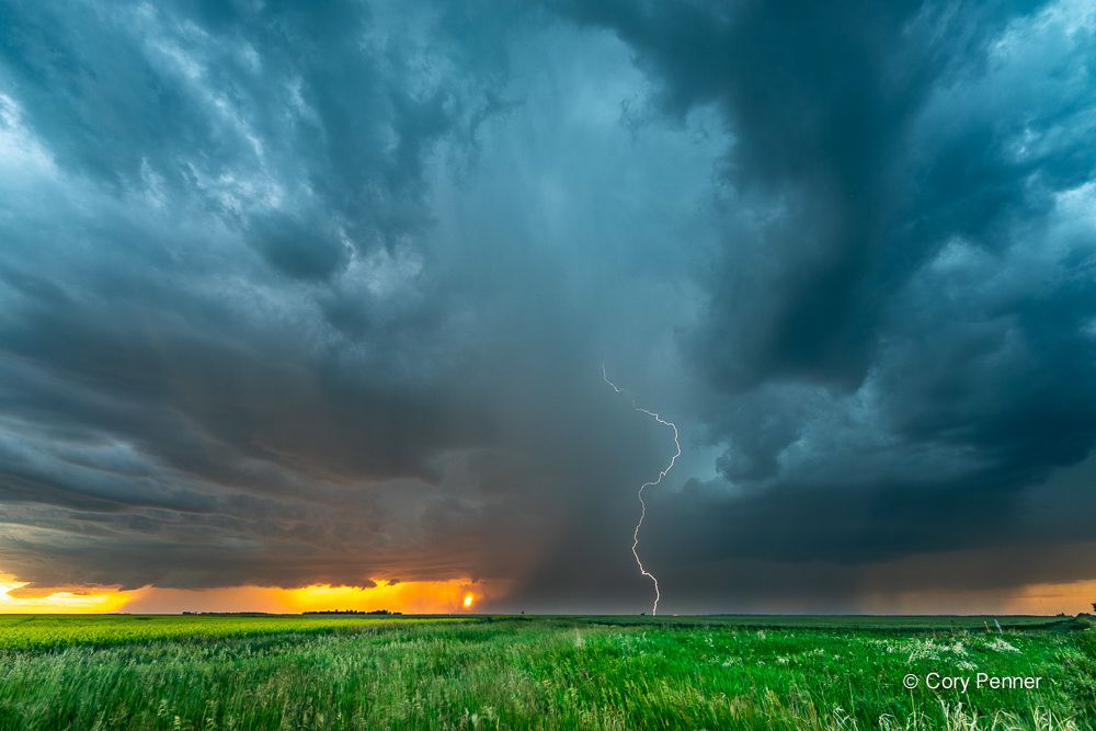
Some lightning at sunset last night near Sanford, Manitoba. #mbstorm #lightning #canadaday
02.07.2025 16:26 — 👍 14 🔁 5 💬 0 📌 0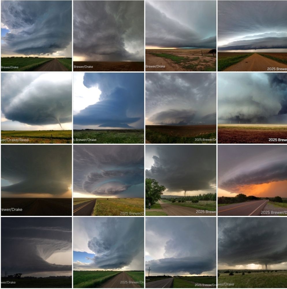
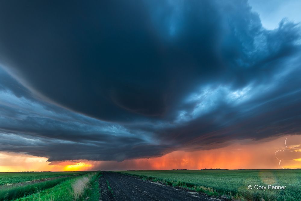
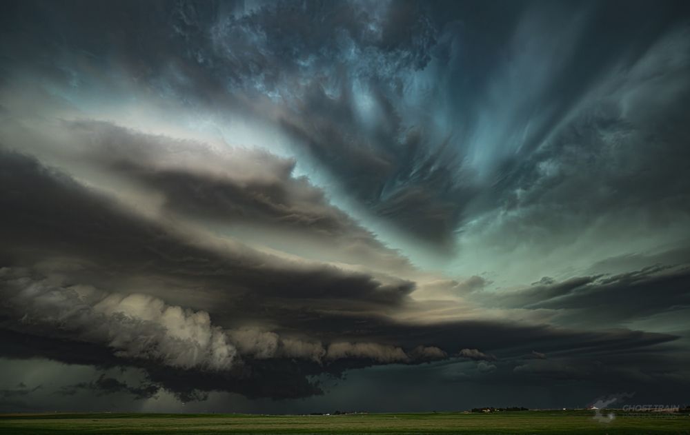
2025 didn't just have tornadoes...
It had solid supercell structure, too
w/ Juston Drake
Ideal tornado is unrated. It's not a contest to experience the most powerful storm. Higher rating means more damage means ruined lives. You'd think getting run over by a grain silo might humble a person.
02.07.2025 21:20 — 👍 5 🔁 1 💬 1 📌 0
The NOAA budget justification doc that finally was posted today didn't contain a lot of surprises - but as the first time all of the cuts were listed in their destructive detail, it is a depressing read. I tried to distill and explain the weather part, sad as it is.
substack.com/@balancedwea...
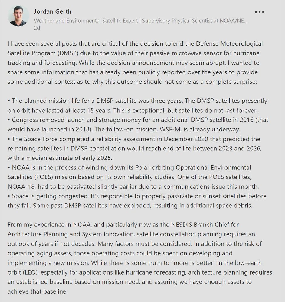
I do not remember how I came across this but there is some useful information here www.linkedin.com/posts/activi...
01.07.2025 02:00 — 👍 1 🔁 0 💬 1 📌 0If this proposed budget comes to fruition, it would be devastating for the weather and climate enterprise and a threat to the safety and security of the American public
30.06.2025 23:43 — 👍 17 🔁 8 💬 0 📌 0
Shelf cloud
Something north of town
25.06.2025 22:22 — 👍 30 🔁 5 💬 3 📌 0cloud, maybe?
25.06.2025 23:27 — 👍 1 🔁 0 💬 0 📌 0Spinny.
25.06.2025 22:49 — 👍 18 🔁 3 💬 0 📌 0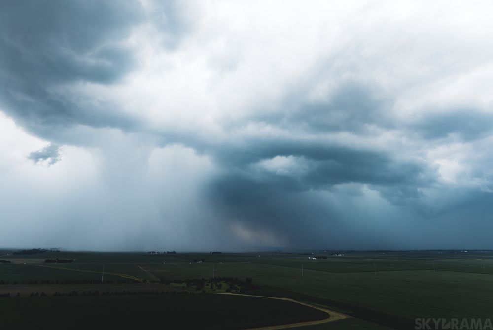
Aerial downburst peeping in southern Champaign County, #ILwx this evening. Electric little storms!
25.06.2025 23:13 — 👍 20 🔁 3 💬 0 📌 0Some slow-mo lightning from my back patio this evening in OKC.
09.06.2025 02:33 — 👍 70 🔁 11 💬 2 📌 1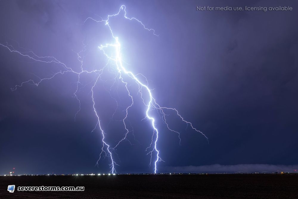
Impressive cloud to ground (CG) lightning is currently occurring near Snyder, Texas. This image captured 10 mins ago. Watch live via: www.youtube.com/@DanielShawA... @NWSLubbock #txwx
09.06.2025 03:07 — 👍 38 🔁 7 💬 0 📌 1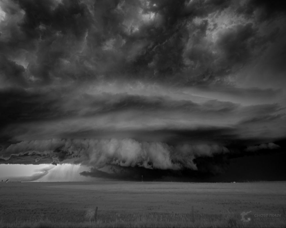

Welcome to the high plains...land of the living skies
08.06.2025 18:24 — 👍 57 🔁 6 💬 3 📌 0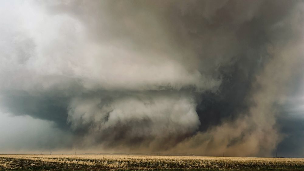
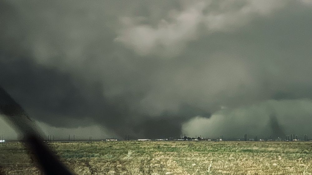
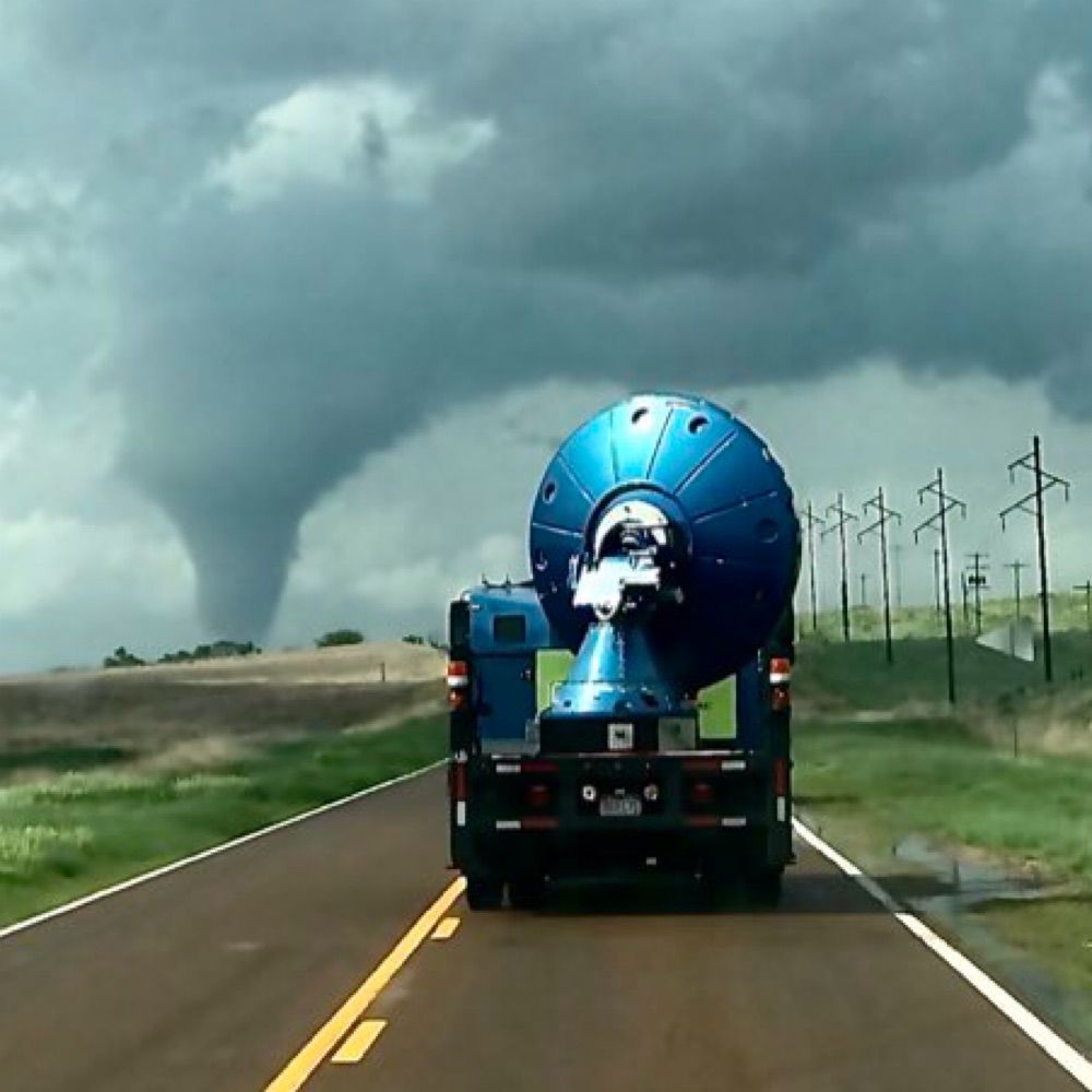
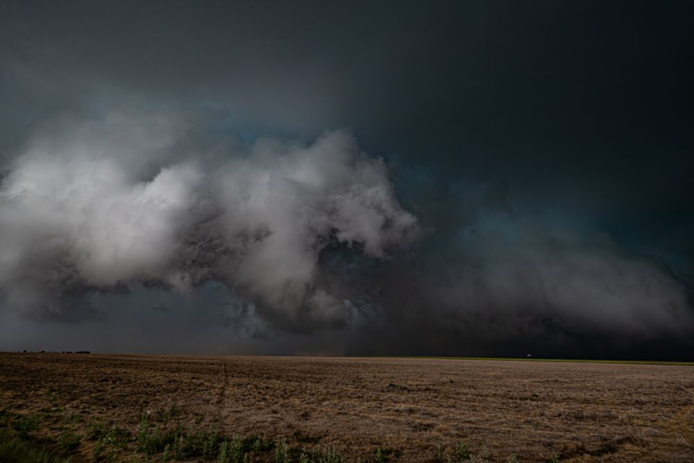
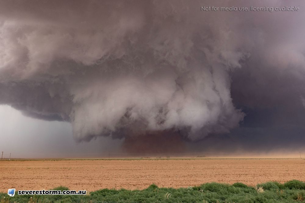
today was one of those days i’ll remember for the rest of my life. we saw no fewer than seven or eight tornadoes, including twins. morton did it again, producing a photogenic wedge at one point that looked almost identical to the morton, tx beast of 2022. a surreal experience overall.
06.06.2025 02:40 — 👍 59 🔁 6 💬 2 📌 0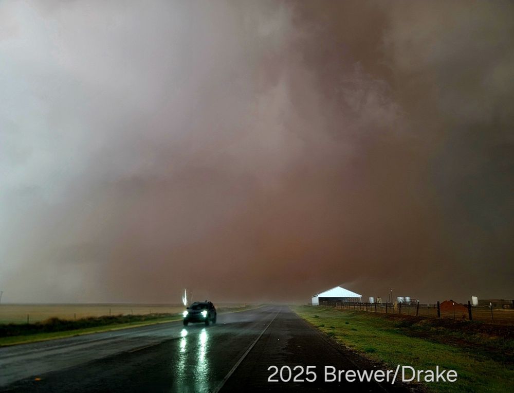
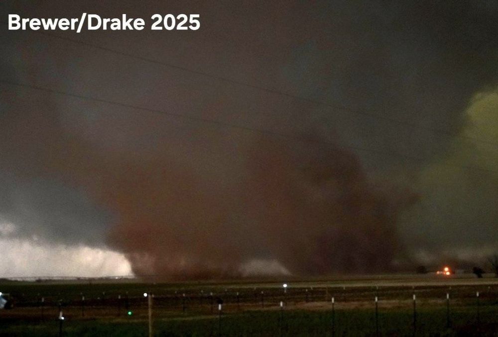
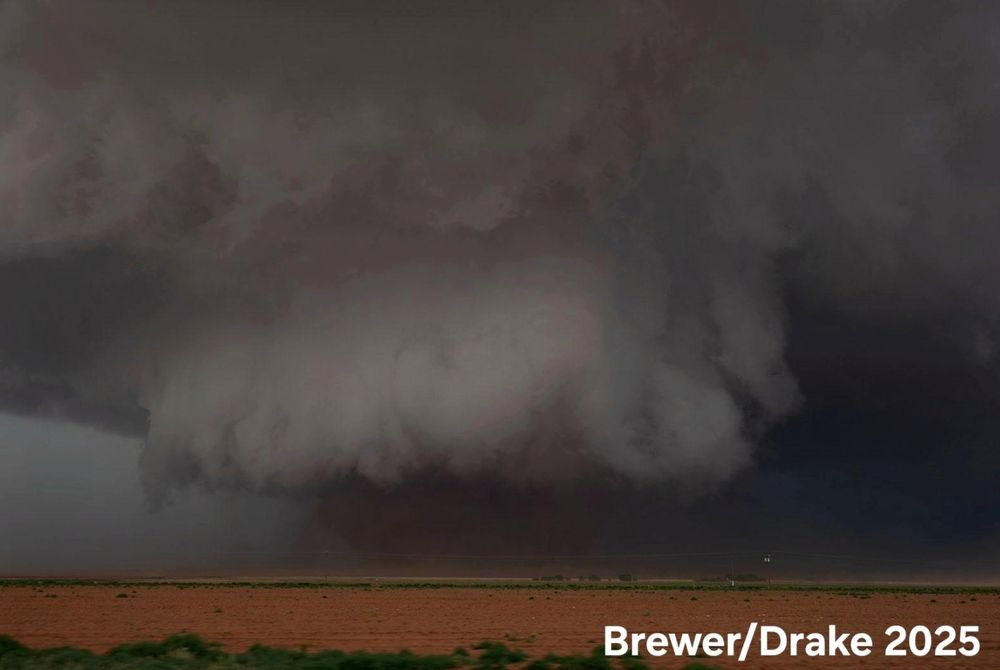
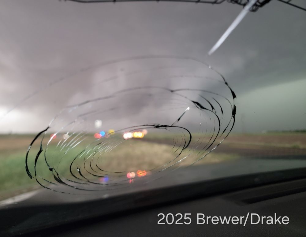
Crazy tornado event between Causey, New Mexico and Lubbock, Texas! We possibly documented 16 twisters, several anticyclonic, 3 wedges, and twins developed RIGHT NEXT TO US! Also, the windshield took a baseball hailstone.
#TXWX #NMWX
Juston Drake
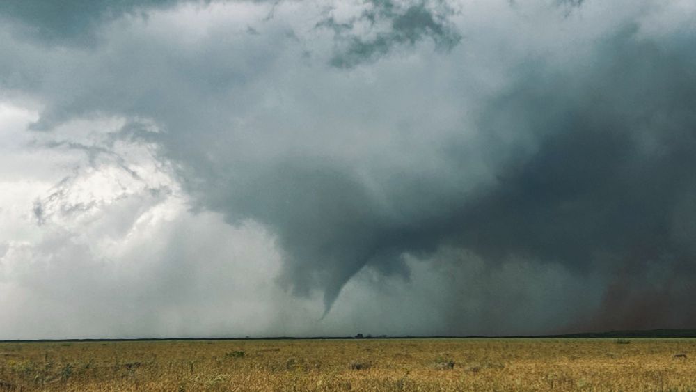
This image captured earlier as a dusty tornado moves north of Morton, Texas. Watch live via: www.youtube.com/@DanielShawA... @NWSLubbock #txwx #nmwx
05.06.2025 23:09 — 👍 125 🔁 20 💬 1 📌 2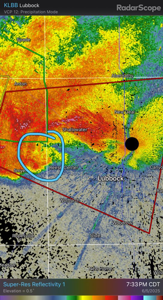
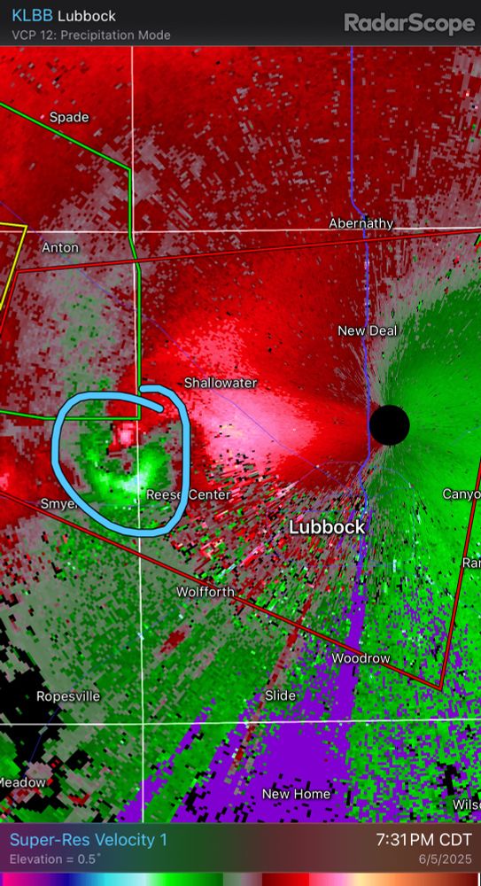
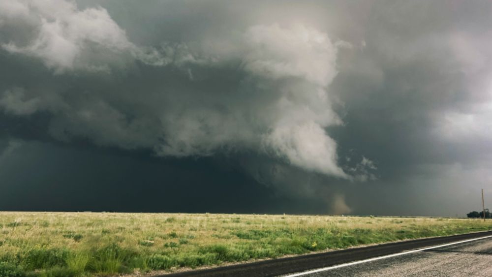
7:35 PM CDT, 6/5: A confirmed, dangerous #tornado is west of #Lubbock, #Texas and will be entering the west side soon. Seek shelter now!
06.06.2025 00:35 — 👍 9 🔁 4 💬 0 📌 0