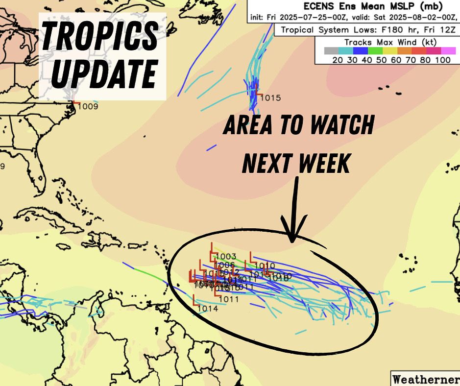
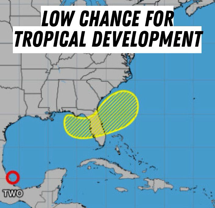
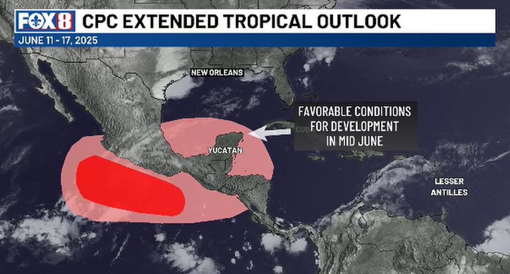
Two areas to watch.The first is located just off the East Coast, where a frontal may help organize low-pressure. It's expected to move away from land. The 2nd area is farther east in the Atlantic. A tropical wave is expected to enter favorable conditions for development by mid to late next week.
03.08.2025 00:24 — 👍 0 🔁 0 💬 0 📌 0
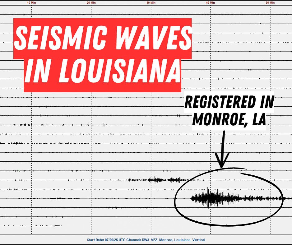
The powerful earthquake near Russia was so strong, it sent seismic waves all the way to Louisiana (and across the rest of the globe)… in just about 15 minutes. While we didn’t feel them, sensitive instruments picked up the motion. Data courtesy of Bayou State Weather. #lawx #earthquake
30.07.2025 14:20 — 👍 0 🔁 0 💬 0 📌 0
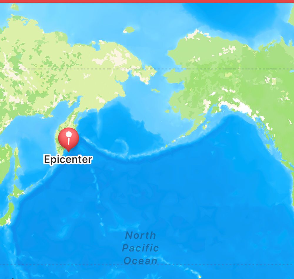
A massive 8.0 magnitude earthquake just struck off the Kamchatka Peninsula in Russia. Tsunami threat to Japan and Russia. Tsunami Advisory for the Aleutian Islands and a Tsunami Watch for Hawaii and Guam. #earthquake #tsunami
30.07.2025 00:14 — 👍 1 🔁 0 💬 0 📌 1
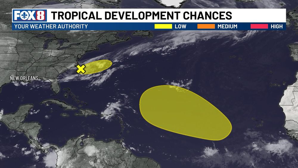
A tropical wave will move into the Atlantic. It’s packing plenty of moisture, which gives it some potential, but it still faces challenges like Saharan dust and the occasional hostile upper-level winds. Nothing is unusual about this. It's typical late July/early August.
27.07.2025 21:10 — 👍 0 🔁 0 💬 0 📌 0

Spending my Saturday night with Liz Reyes. 🙌 And I’m talking more heat on the news tonight. Happy weekend, friends. #nola
27.07.2025 03:09 — 👍 1 🔁 0 💬 0 📌 0
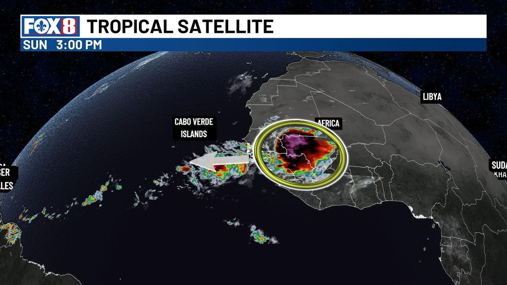
August marks the start of the typical uptick in Atlantic tropical activity, and models are taking notice. The reliable European ensemble is hinting at a strong tropical wave emerging off Africa that bears watching. #tropics
25.07.2025 19:56 — 👍 1 🔁 0 💬 0 📌 0
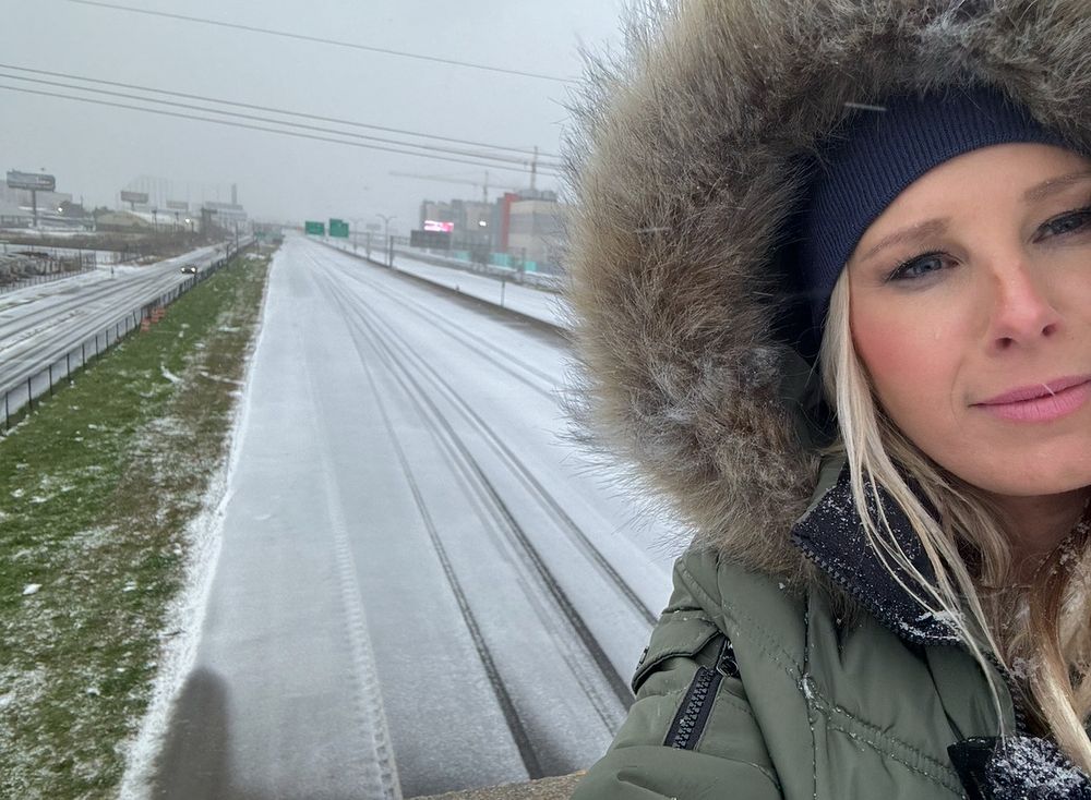
Six months ago today I was standing on an I-10 overpass during a snowstorm in New Orleans. You should be able to see the Superdome in this photo, but the heavy snow makes it impossible. I took this photo for my way later years to look back on and remember covering this historic event. #nola
21.07.2025 16:39 — 👍 1 🔁 0 💬 0 📌 0
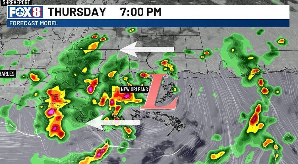
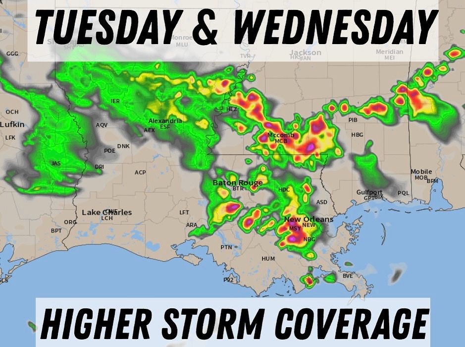
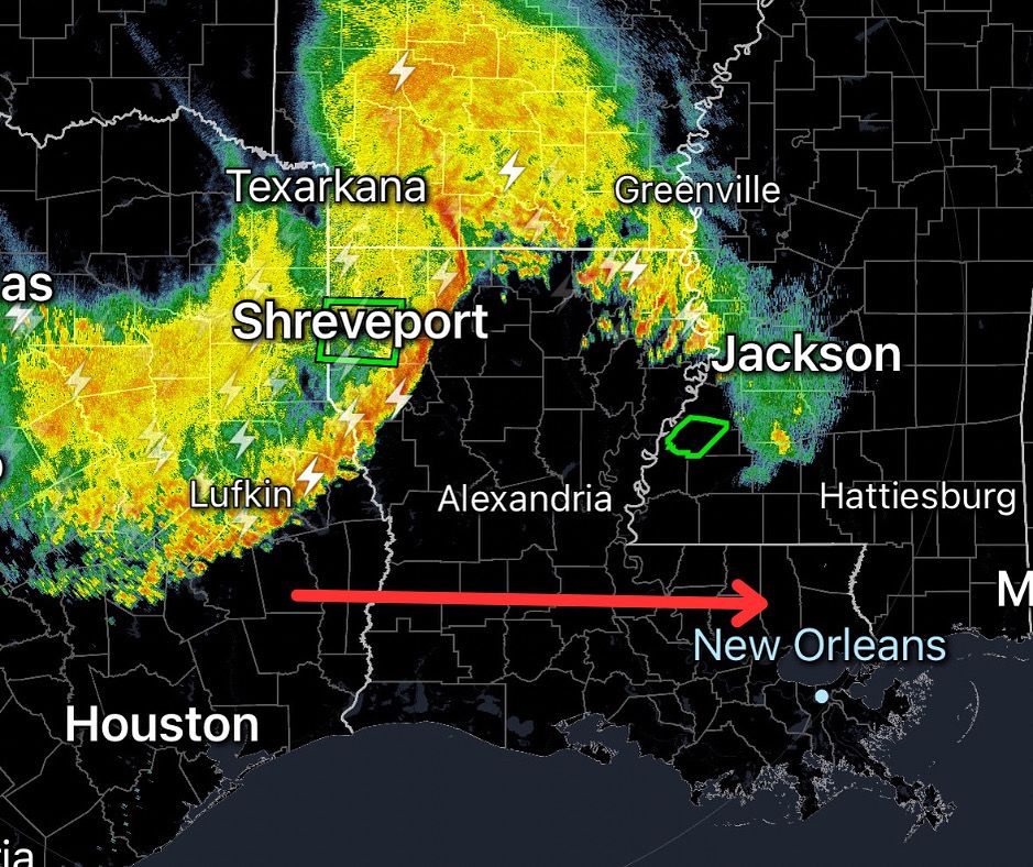
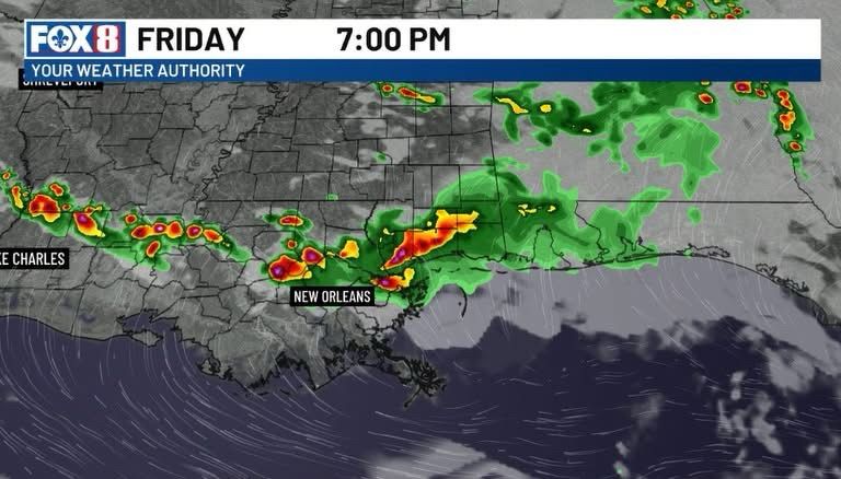
THURSDAY: Heavy downpours will flare back up later today as the surface low continues to move inland. This is not going to develop, but will continue to bring an isolated flood threat. Any storms that form will be slow-moving with torrential downpours. #nola #lawx #mswx
17.07.2025 13:33 — 👍 1 🔁 0 💬 0 📌 0
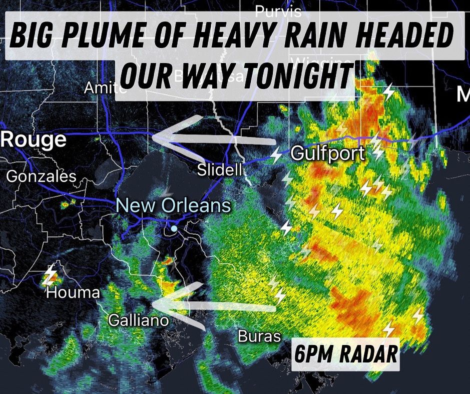
Slow, soaking tropical downpours will move in tonight. More scattered storms arrive Thursday. #nola #lawx #mswx (7-16-25)
16.07.2025 23:04 — 👍 0 🔁 0 💬 0 📌 0
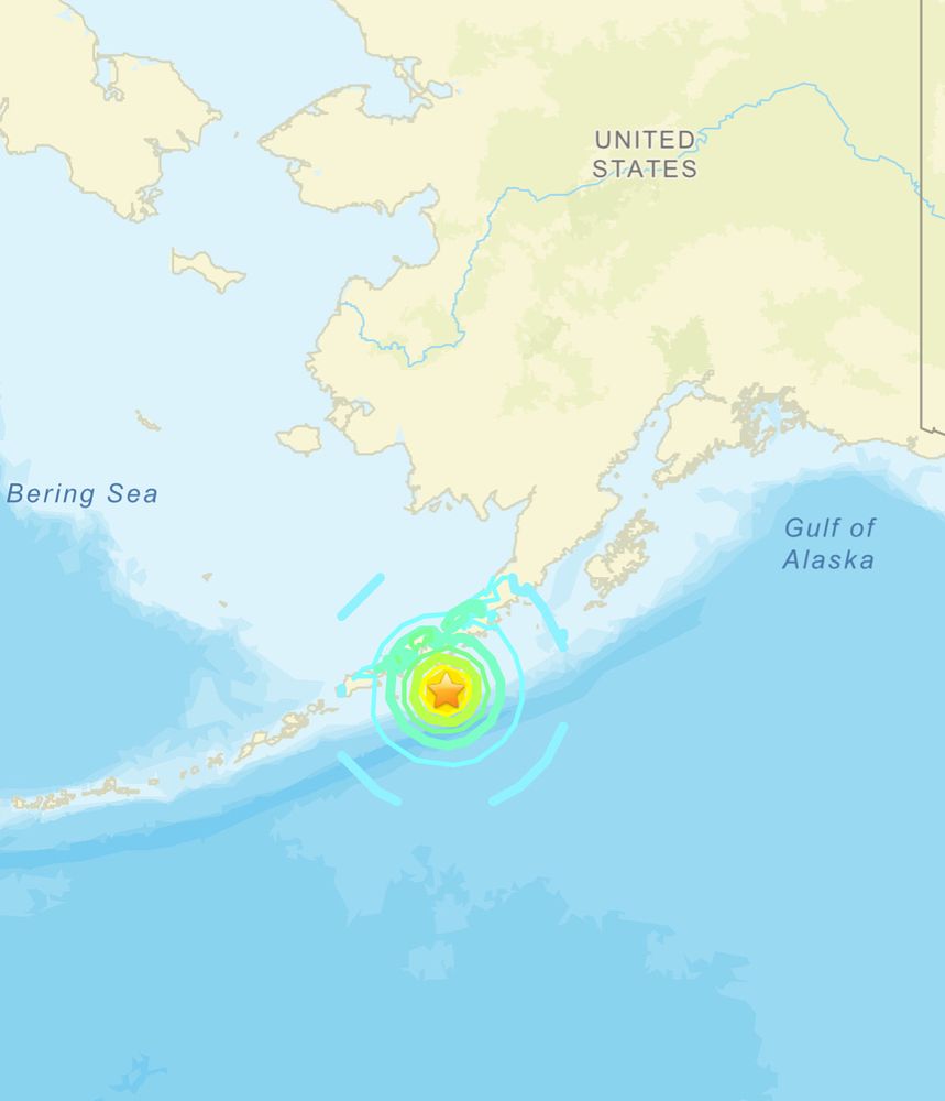
A TSUNAMI WARNING has been issued for portions of Alaska following a M7.2 earthquake registered 50 miles S of Sand Point, Alaska. Residents are urged to move farther inland. #earthquake
16.07.2025 21:42 — 👍 1 🔁 0 💬 0 📌 0
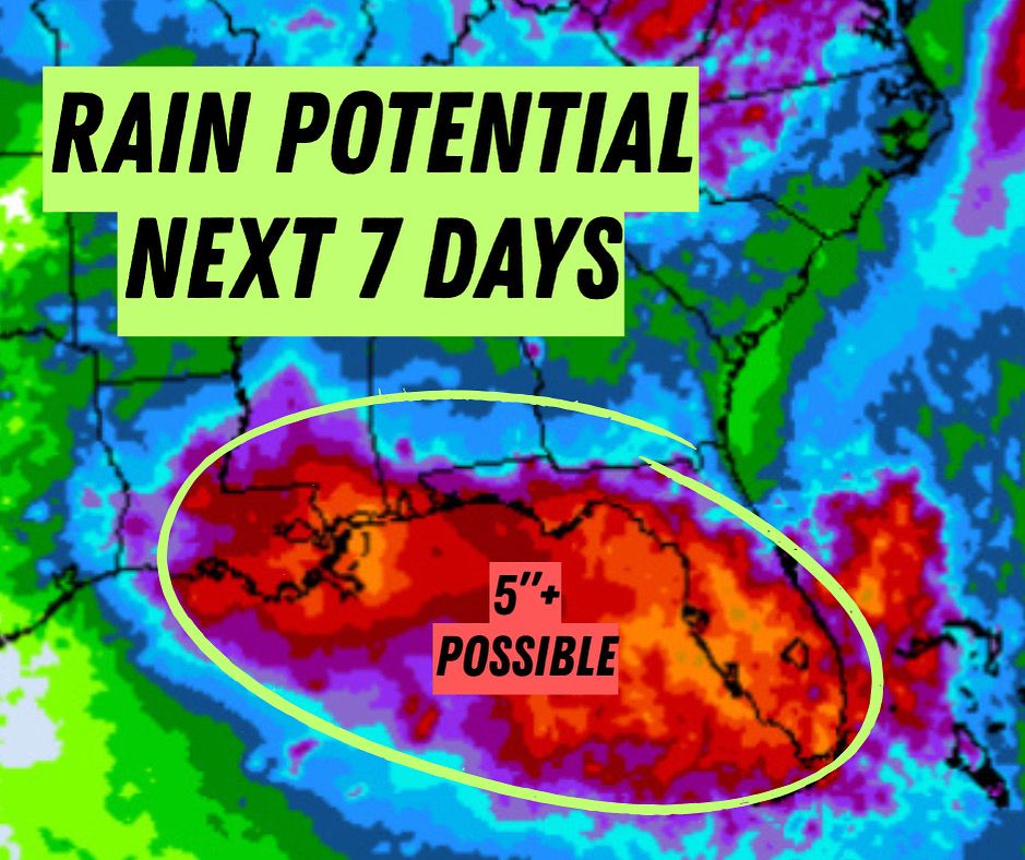
Tropical moisture will bring a flood threat to the Gulf Coast this week. Here in LA, we’re looking at the potential for a multi-day flood threat starting late Wed. Could this system develop into a tropical depression or storm? Yes, but if it does, it would be weak. The bigger concern is the rain.
14.07.2025 15:06 — 👍 1 🔁 0 💬 0 📌 0
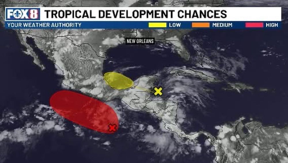
The NHC has highlighted an area in the eastern Gulf and off the SE coast. Slow development is possible this week. If it doesn’t develop, it’ll certainly dump a ton of rain. #tropics
29.06.2025 14:37 — 👍 1 🔁 0 💬 0 📌 0
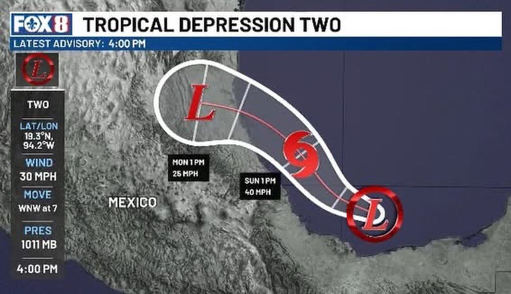
A tropical storm is expected to form by Sunday in the southern Gulf. It would take the name Barry. The storm is projected to make landfall early Monday morning in eastern Mexico
28.06.2025 21:37 — 👍 0 🔁 0 💬 0 📌 0
Invest 91L is showing signs of organizing. A Hurricane Hunter is currently flying through the storm. This could be organized into a depression by this afternoon. If that's the case, Tropical Storm watches and warnings may be issued soon for the Mexican Gulf coast. #tropics
28.06.2025 18:51 — 👍 0 🔁 0 💬 0 📌 0

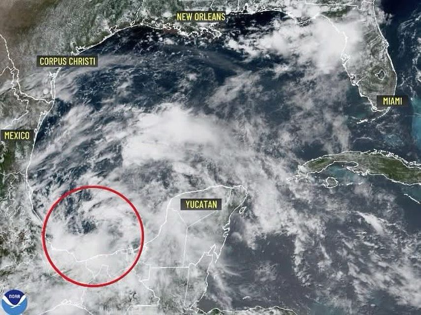
GULF STORM? Hurricane Hunters will fly into this storm Saturday. It's now called Invest 91L, which means it has not developed but is being investigated further. A tropical depression is possible this weekend. Any development is expected to move into eastern Mexico and will bring torrential rain.
28.06.2025 01:19 — 👍 0 🔁 0 💬 0 📌 0
There's a new area of interest in the Atlantic. This time in the Bay of Campeche. Conditions aren’t especially favorable right now. Cooler-than-normal water temperatures in that region will make it difficult for development to occur. Development is much more favorable on the Pacific side. #tropics
27.06.2025 01:20 — 👍 0 🔁 0 💬 0 📌 0
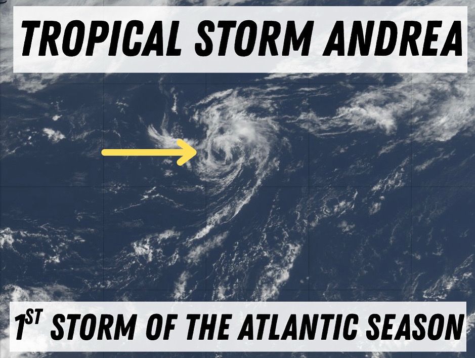
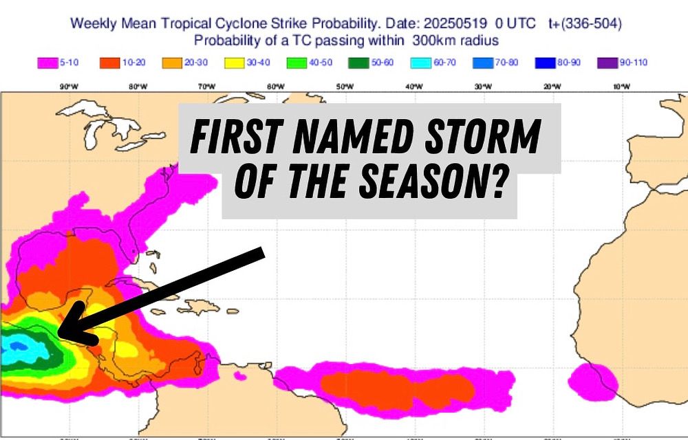
The first storm of the 2025 Atlantic hurricane season has formed. It”s located in the middle of the Atlantic and will be short lived, posing no threat to land. #tropics
24.06.2025 14:18 — 👍 0 🔁 0 💬 0 📌 0
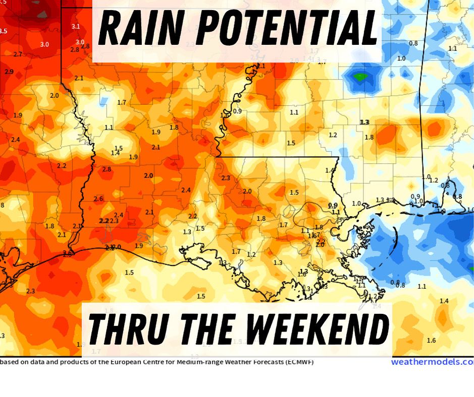
Stormy weather lasts through the weekend. It won’t be a complete washout but a few heavy downpours could lead to street flooding. Make sure to have your Plan B ready for any outdoor plans. #nola #lawx #mswx
10.06.2025 13:09 — 👍 0 🔁 0 💬 0 📌 0
Storm chances are increasing over the next two days. Expect periods of heavy downpours, which could lead to isolated street flooding. While the severe threat is low, it’s still something to keep an eye on. #nola #lawx #mswx
09.06.2025 22:10 — 👍 0 🔁 0 💬 0 📌 0
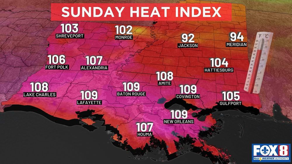
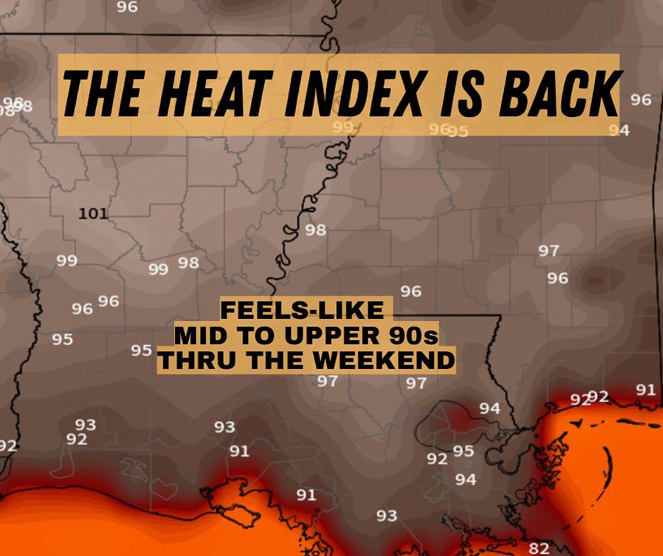
We continue with the sweltering forecast for Sunday. Near record-breaking highs and high heat index values have spurred a Heat Advisory for many around the lake and the river parishes. #nola #lawx
08.06.2025 01:28 — 👍 0 🔁 0 💬 0 📌 0
From Canada to Cocodrie, LA. You can see the haze from wildfire smoke brought in by the upper level winds. It makes the sun look muted. #lawx #wildfiresmoke
📸 Tom and Sharon McClain
03.06.2025 15:35 — 👍 1 🔁 0 💬 0 📌 0
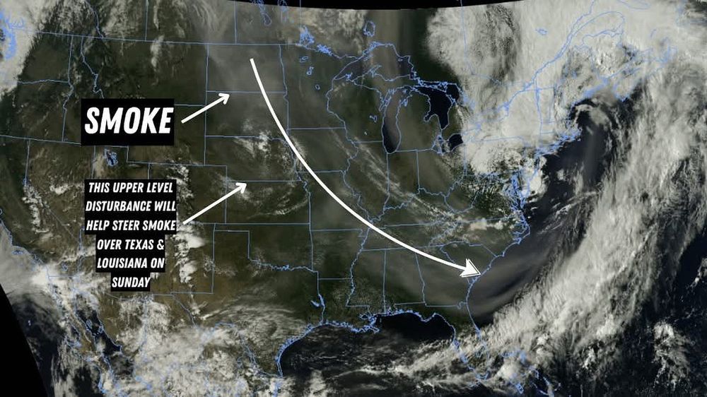
Wildfire smoke is clearly visible on sat imagery this afternoon, stretching all the way from North Dakota down to Georgia. While the smoke won't impact air quality in the South, it’s a different story in the Upper Plains. ND, in particular, is experiencing very unhealthy air quality today.
31.05.2025 21:57 — 👍 0 🔁 0 💬 0 📌 0
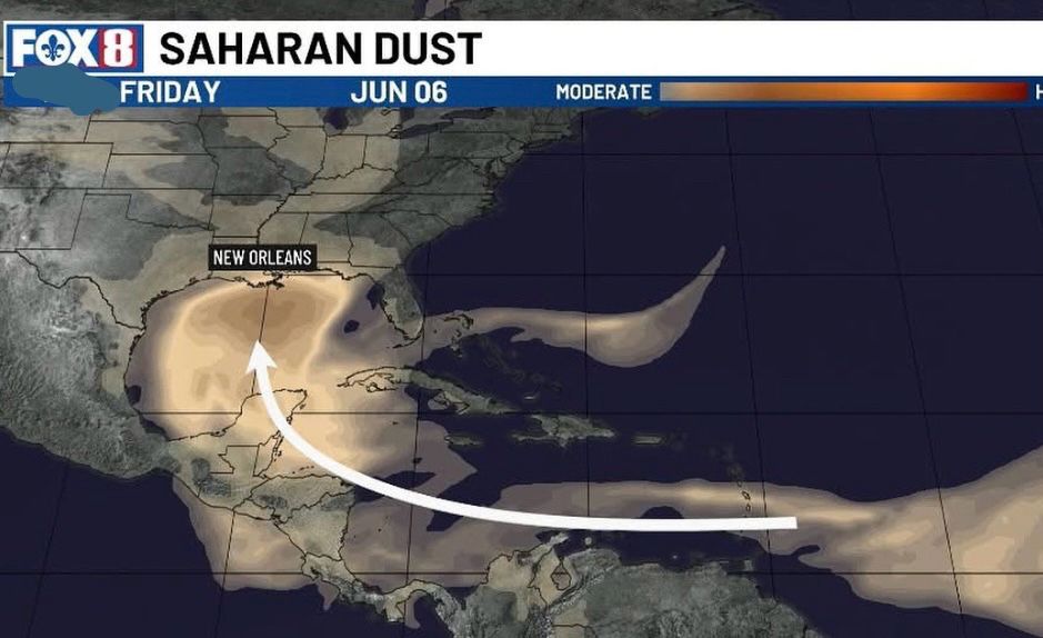
NEXT WEEK: A thick plume of Saharan dust will approach the Gulf Coast late next week.
✅ Benefits:
1. Beautiful Sunsets
2. Hurricane Suppression
3. Fertilizes the Ocean
⚠️ Cons:
1. Air Quality Issues
2. Hazy Skies
30.05.2025 22:49 — 👍 0 🔁 0 💬 0 📌 0
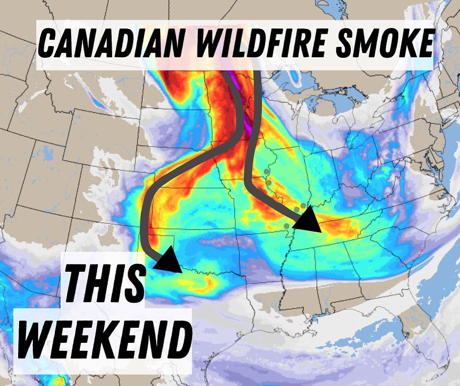
🌫️ Wildfire Smoke on the Move 🌫️
Smoke from fires Canada is expected to drift into the U.S. this weekend, bringing hazy skies to several regions. Some of that smoke could travel all the way to the Gulf States, so don’t be surprised if the skies look a bit milky or muted.
29.05.2025 20:28 — 👍 0 🔁 0 💬 0 📌 0
You’re probably starting to see some chatter about hurricanes on social media - and that’s no surprise. This time of year, conditions in the usual hotspot areas are starting to become more conducive, and the models are picking up on that. It’s still too early to know if anything will actually form.
28.05.2025 18:28 — 👍 0 🔁 0 💬 0 📌 0
MEMORIAL DAY STORMS: the tail end of this storm complex coming out of Texas will arrive in SE Louisiana by this afternoon. These storms will be hit or miss between 4pm and 7pm. Each day we will see these storm complexes coming for us this week. Some will dissipate while others hold together. #nola
26.05.2025 14:28 — 👍 1 🔁 0 💬 0 📌 0
Tropical season is waking up!
Some early signs of potential development are showing up in the eastern Pacific by late May, thanks to warm waters and a supportive atmosphere. After that, we’ll keep an eye on the western Caribbean heading into early June.
No named storms yet - just areas to watch.
20.05.2025 18:20 — 👍 0 🔁 0 💬 0 📌 0
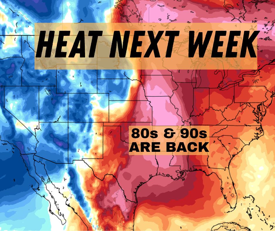
A big heat ridge will cover most of the Gulf Coast for the next week. Highs will be in the 90s - Our first of many 90 degree days to come. You’ll hear a lot about the heat index as it will soar also. #lawx #mswx
14.05.2025 19:41 — 👍 0 🔁 0 💬 0 📌 0
Enjoy the cooler Mother’s Day weekend. We’re cranking up the heat after Monday. #nola #lawx #mswx
10.05.2025 15:10 — 👍 1 🔁 0 💬 0 📌 0
Hey, heads up Jazz Fest goers. A few pop-up storms are possible today, and a line of storms will move through this evening. There is a scenario where this moves through after Jazz Fest is over. But it's best to have a poncho ready just in case. #nola #lawx
25.04.2025 15:40 — 👍 1 🔁 0 💬 0 📌 0
Advancing the power of facts, globally 🌎
CBS Philadelphia On-Air Meteorologist | AMS Certified | Emmy Award Winning | UNC Asheville Grad | Michigan Faithful.
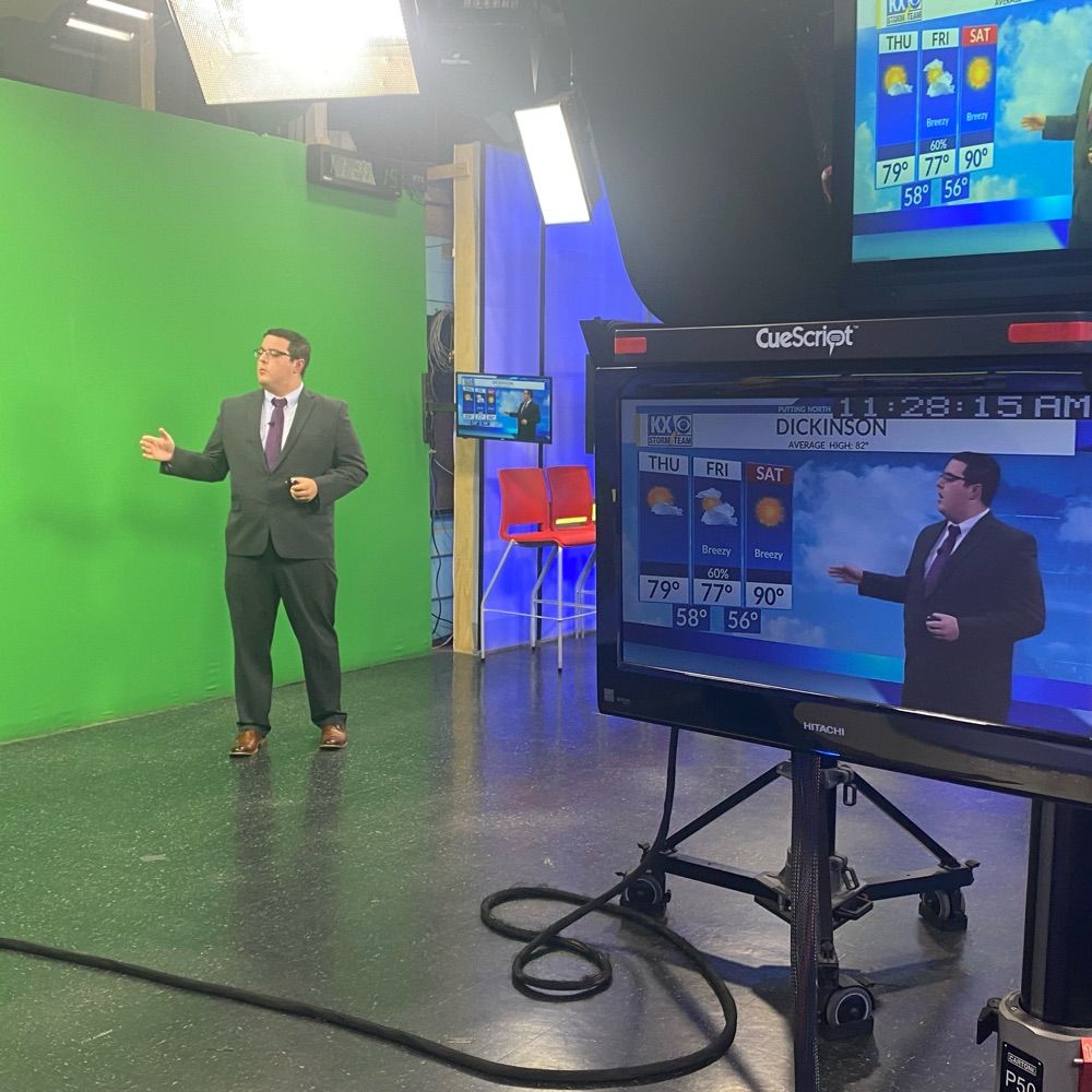
Morning Meteorologist in Bismarck ND| Central Michigan Meteorology Alumni 22’ | Weather and Sports Nerd |
Found of Find Your Tornado Shelter and map maker. Also works on consulting and products for local and national media outlets within the realm. Graduated with my Ph.D. from Mississippi State in 2023. God has got me this far...what's next?
Host of @thedavidpakmanshow.bsky.social
⛈️ ABC News Meteorologist, Weather & Climate Producer
🎓 Kean University Alum
⚾️ Mets fan
https://abcnews.go.com/
Unofficial bot sharing alerts from NWS New Orleans LA.
This account is not monitored. Contact @wandrme.paxex.aero if needed.
Artist, Scientist, Woodland Ecologist, Statistician, Historian & former Research Scholar at the RIA | Art from Dublin, Ireland 🌈 He/Him | Sé/é
Buy my work here: https://robbohan.etsy.com
Meteorologist. Author. Speaker.
Meteorologist & climate journalist. Dad. Birder. Minnesotan. Optimistic to a fault.
Science news with attitude for The Guardian. Author of The Future Earth.
Contact me securely on Signal: 3162958947
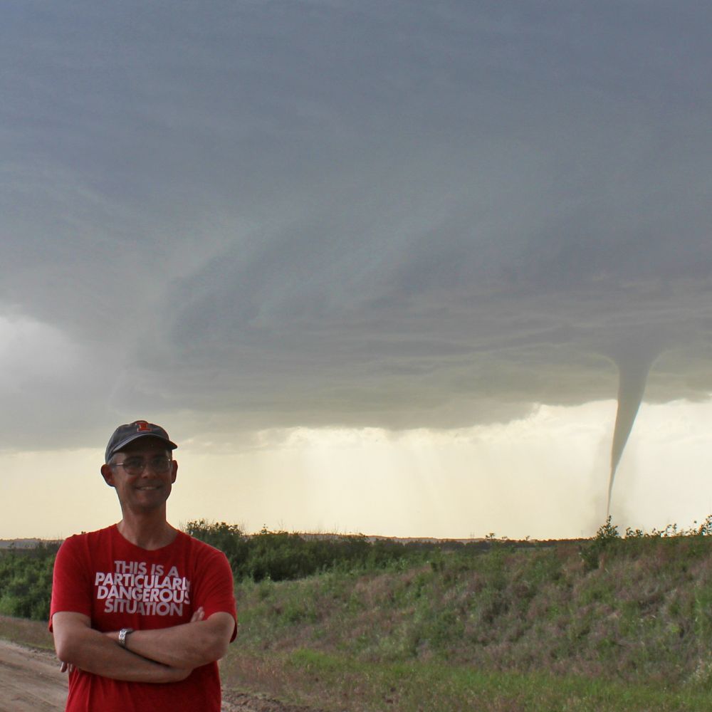
Teaching associate professor of atmospheric sciences at the University of Illinois. I teach weather. Posts are about weather and sometimes sports. Storm chaser. PhD, MS PSU; BS Michigan. All opinions mine.
https://vortexjeff.smugmug.com
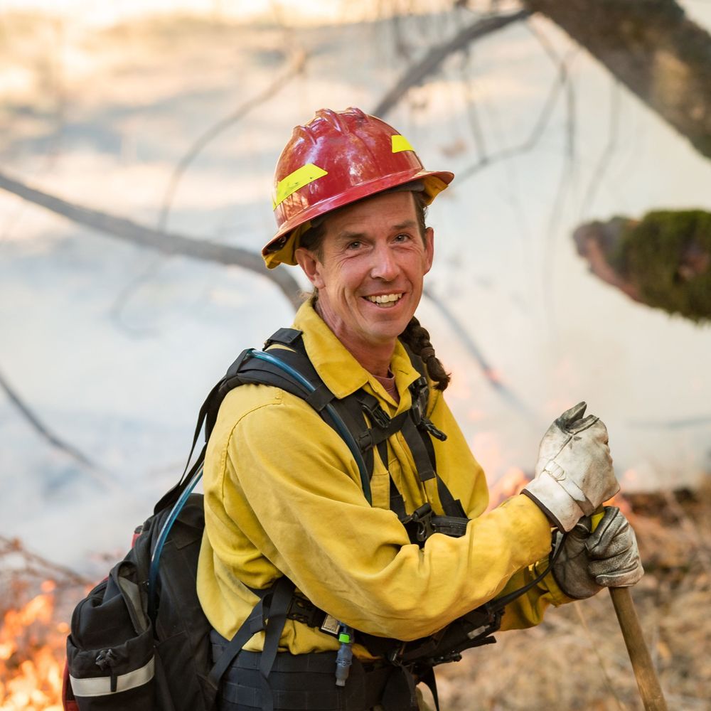
Director, UC Merced Fire Resilience Center. Pyrogeographer. I study wildfire in the era of anthropogenic climate change. Former wildland firefighter. Opinions are my own. *she/her* 🔥🔥🔥
Associate professor, Atmospheric and Environmental Sciences at UAlbany. Tropical cyclones & severe weather. Occasionally playing hockey, skiing, or paddleboarding.
🌤️#AKwx & science geek, 😍 STL gooey 🧈🍰
🐦⬛Alaska birder | Photoshop it.
Recovering broadcaster and ⚜️ Scoutmaster 🪢 now focused on Training GAC Adults who guide our Youth 🏳️🌈🏳️⚧️
Climatologist & Weather Historian.
www.mherrera.org/temp.htm
https://en.wikipedia.org/wiki/User:Maxcrc
Weather news. Climatic statistics and records. By M. Herrera
@extremetemps in all networks
I am the trick my mother played on the world.
Xennial Meteorologist in Houston. Forecasts: theeyewall.com & spacecityweather.com. Thoughts: mattlanza.substack.com
I like books, history, sports cards, baseball, Rutgers, #BHAFC.
Opinions my own.
Host of Pacific Northwest Weather Watch, Former National weather service behind the scenes guy, Alaska Airlines weather guy.
https://www.youtube.com/@PacificNorthwestWeather
Bay Area AMS Meteorologist since 2003 CSU/SJSU Lecturer. Formerly KIRO, KCRA, KSBY, KESQ, KNBC, Arizona Daily Wildcat & dad of twinados 👦🏻🌪️👦🏻🌪️
Emmy-nominated, AMS Certified Broadcast Meteorologist, formerly CNN
Proud Cornell alum, native New Yorker, & diehard Yankees fan!
NYC-ITH-SUX-SGF-CLT-ATL